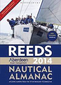
Reeds Aberdeen Asset Management Nautical Almanac (häftad)
Format
Häftad (Paperback)
Språk
Engelska
Antal sidor
1088
Utgivningsdatum
2013-08-29
Förlag
Reed's Almanac
Illustrationer
Full colour harbour charts and diagrams throughout
Dimensioner
260 x 190 x 50 mm
Vikt
2585 g
Antal komponenter
1
ISBN
9781408193273

Reeds Aberdeen Asset Management Nautical Almanac

(1 röst)
Häftad,  Engelska, 2013-08-29

Slutsåld

Reeds Nautical Almanac is the indispensable trusted annual compendium of navigational data for yachtsmen and motorboaters, and provides all the information required to navigate Atlantic coastal waters around the whole of the UK, Ireland, Channel Islands and the entire European coastline from the tip of Denmark right down to Gibraltar, Northern Morocco, the Azores - and new for 2014, Madeira. The 2014 edition continues the Almanac's tradition of year on year improvement and meticulous presentation of all the data required for safe navigation. Now with an improved layout for easier reference and with over 45,000 annual changes, it is regarded as the bible of almanacs for anyone going to sea. The 2014 edition is updated throughout, containing over 45,000 changes, and includes a free Reeds Marina Guide. The digital version includes: live weather from the Met Office for up to 72 hours ahead, a helpful route planner, a printing facility and much more. "There are some things I would not go to sea without - Reeds is one of them" Sir Chay Blyth "The big, bold, extravagantly comprehensive king of Almanacs" Yachting World "On every cruising boat you'll find one of these. Don't start your engines without it" Motor Boat and Yachting "The bible of almanacs" Classic Boat New Features for Reeds 2014 edition: Coverage which is being revised/improved:- Major revision of Cowes to reflect the proposed construction of the wave break / new marina. Revision of Thames Estuary to reflect new wind farms and the introduction of the new Sunk traffic control scheme in preparation for the Thames Gateway port development. Improved coverage of Burnham. New marina facilities at Seaham Complete revision of Menai Straits and associated passage information. Expansion of Cork to reflect its importance and inclusion of new Greystones Marina. Review of Carlingford Lough. New Atlantic Islands area to include coverage of the Madeira Archipelago for the first time and expanded coverage of the Azores. Improved coverage in northern Denmark. 6 new marinas in Netherlands; Belgium and Morocco. Amendments to Communications Safety and Weather chapters reflecting substantial changes being made to HM Coastguard operations. First Aid chapters updated. Harbour Facilities now represented by universal symbols instead of abbreviations for ease of use.
Visa hela texten

Kundrecensioner

Har du läst boken? Sätt ditt betyg »

Övrig information

...

Innehållsförteckning

The print version includes: 700 chartlets, Harbour facilities, Tide tables and streams, 7,500 waypoints, International codes and flags, Weather, Distance tables, Passage advice, Area planning charts, Rules of the road, Radio information, Communications, Safety, Mayday and distress procedures, and Documentation and Customs.