
Gillian Price – författare
Visar alla böcker från författaren Gillian Price. Handla med fri frakt och snabb leverans.
21 produkter
21 produkter
Häftad, Engelska, 2025
230 kr
Skickas
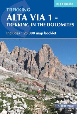
Begin your Dolomites adventure and discover the Alta Via 1 (AV1) — a classic hut-to-hut trek through northeastern Italy’s spectacular alpine scenery. Covering 115km from Lago di Braies to Belluno, this long-distance trail offers a perfect introduction to trekking in the Dolomites, suitable for both first-time and experienced trekkers, and typically completed in around two weeks. This Dolomites hiking guidebook makes planning simple, with stage-by-stage descriptions and expert advice from author Gillian Price. A dedicated map booklet, featuring Kompass 1:25,000 maps with the full route line clearly marked, allows you to navigate the trail with confidence. The trek is divided into 11 stages, each between 6 and 14km long, with detailed descriptions of the route, terrain, and key landmarks such as war tunnels from the Austro-Hungarian EmpireEach stage is paired with a 1:75,000 overview map, while the additional 1:25,000 map booklet offers detailed navigation through the heart of the Dolomites.Downloadable GPX files provide an additional digital navigation option, making it simple to use your smartphone or GPS device to track progress between alpine huts, among the immense rock formations unique to the area. The guide includes essential details on mountain huts, transport links, what to pack, and the best time to go — everything you need to plan your trip to Italy. Short on time? Alternative paths, exit routes to public transport, and optional side trips to nearby summits, such as Croda del Beco, are clearly detailed, allowing you to tailor the trek to your schedule and interests. With comprehensive route descriptions, GPX downloads, and a separate 1:25,000 map booklet, this Alta Via 1 guidebook provides a complete navigation package for hut-to-hut hiking in the Dolomites. Plan your next walking holiday with confidence and experience the breathtaking scale, beauty, and adventure of one of Italy’s most iconic long-distance trails.
Häftad, Engelska, 2025
195 kr
Skickas
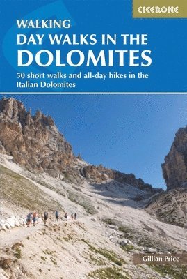
Discover Italy’s dramatic alpine playground — the iconic Dolomites, part of the spectacular Italian Alps. From soaring limestone peaks and serene glacial lakes to hidden valleys and historic mountain trails, this UNESCO World Heritage Site delivers unforgettable scenery and an outstanding walking holiday from June to September. Day Walks in the Dolomites, by renowned guidebook author Gillian Price, known for her extensive expertise in the Italian mountains, transforms walking in the Dolomites into a straightforward and rewarding experience. The guide presents 50 graded day walks, ranging from easier valley and meadow walks to more demanding high-mountain excursions, allowing you to select outings that match your fitness, experience, and available time. Every walk (3 - 21km) includes clear, step-by-step route descriptions accompanied by 1:50,000 mapping for confident navigation through dramatic limestone landscapes and alpine terrainThe 50 routes are carefully graded, making it simple to choose a walk that suits your ability, whether you prefer a gentle scenic outing or a more strenuous mountain day, so you can explore the Dolomites at your own paceWalks are based around key centres including Cortina d’Ampezzo, San Vito di Cadore, Sesto and Misurina, allowing you to plan rewarding day hikes directly from well-located accommodationPractical information is woven throughout, with helpful guidance on access, local transport and facilities so you can organise each walk efficiently and make the most of your time in Italy GPX files are available to download for use on GPS devices and smartphones, providing an additional layer of navigational support for independent hiking in the Italian Alps Each route has been carefully selected to showcase the very best of walking in the Dolomites: iconic views, hidden corners, and unforgettable viewpoints. With trusted guidance and detailed mapping, you can focus less on logistics and more on the pure enjoyment of day walks in the Italian mountains.
Häftad, Engelska, 2026
210 kr
Skickas
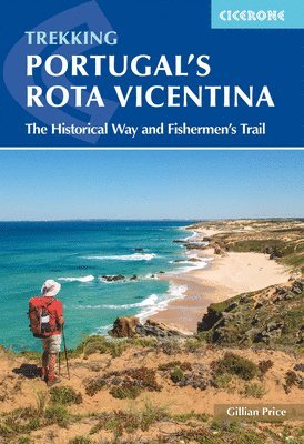
Discover the sweeping Atlantic coast, dramatic cliffs, and quiet countryside of Portugal’s Rota Vicentina, a 224 km (139 mile) trek that combines two of the region’s most rewarding routes: the Caminho Histórico (Historical Way) and the Trilho dos Pescadores (Fishermen’s Trail). The route stretches from the rural town of Santiago do Cacém in the Alentejo through the wild landscapes of the Parque Natural do Sudoeste Alentejano e Costa Vicentina to the southwestern tip of mainland Europe at Cabo de São Vicente. Suitable for most walkers with easy to moderate stages, the Rota Vicentina presents the main combined route in 12 stages of 12–24 km (7–15 miles), making it perfect for a 2-week holiday. A four-stage inland variant forms a circuit north from Odeceixe back to the main trail, giving added flexibility for planning a walking holiday or coastal adventure. 12 stage-by-stage route descriptions for the full Rota Vicentina from Santiago do Cacém to Cabo de São Vicente, including the historic Caminho Histórico and the coastal Fishermen’s TrailStep-by-step directions with detailed 1:100,000 mapping and route notes to navigate the varying terrain of inland hills, wooded valleys and Atlantic cliff topsEach stage includes distance, estimated walking time, and terrain summary to help plan daily sections and match stages to your walking paceGPX files available for the Rota Vicentina routes, compatible with GPS devices and smartphone navigation appsPractical planning advice including accommodation listings, refreshment points, public transport options and preparation tips for walking the Rota VicentinaHighlights and landmarks along the route, including Santiago do Cacém, Odeceixe, Cabo de São Vicente, Atlantic beaches, fishing villages, and olive groves Plan your Rota Vicentina adventure with confidence and enjoy the towering cliffs, Atlantic beaches, olive groves, and authentic Portuguese culture of this unforgettable long-distance walk with this comprehensive guidebook.
Häftad, Engelska, 2016
167 kr
Skickas
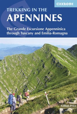
Discover Italy’s best-kept secret, the Grande Escursione Appenninica (GEA), a spectacular 400km (249 mile) long-distance trail traversing the rugged, panoramic ridges and forested valleys of the central and northern Apennines. Linking Bocca Trabaria on the Umbrian border to Passo Due Santi on the edge of Liguria, the GEA winds through the heart of Tuscany and Emilia-Romagna, crossing two National Parks and visiting ancient towns, crystal-clear lakes, and the highest peaks, including Monte Prado, the summit of Tuscany. This comprehensive Cicerone guide describes the GEA in 23 daily stages (8–25km each), with clear stage gradings, distance, elevation profiles, and estimated walking times. Thanks to excellent public transport links along the route, the GEA can be tackled as a classic three-week trek or enjoyed in shorter, flexible sections, perfect for walkers with limited time or those seeking a taste of Apennine adventure. Follow the GEA along waymarked mountain paths, forestry tracks, and quiet rural lanes through the unspoilt landscapes of the Apennines, rich with wildlife, wildflowers, and panoramic Mediterranean views, far from the crowds and deep in authentic Italian countryside.Each stage concludes in an Apennine town or village, offering comfortable guesthouses, alpine refuges, or camping, with comprehensive notes on local accommodation, food, and facilities along the GEA.Plan your journey through the Apennines for the ideal season, with guidance on trail conditions, weather, and why July–August is the best time for reliable walking and open services on the GEA.Benefit from detailed information boxes for every GEA stage, covering start and finish points, distances, elevation changes, terrain, estimated times, grade (1–3), and transport, making Apennine route planning simple.Access practical tips on preparation, packing, navigation, safety, and the unique highlights of each GEA section, plus an English–Italian glossary to support your trek across the Apennines.Delve into the history, wildlife, flora, food, and culture of the Apennines, with dedicated guidebook sections introducing the region’s rich heritage and natural wonders found along the GEA.Navigate the Apennines with confidence using clear sketch maps and elevation profiles for each GEA stage, as well as summary tables for flexible itinerary planning and suggested 1–3 day highlight walks. Set out on an unforgettable journey along the Grande Escursione Appenninica with Cicerone’s expert guidebook, and immerse yourself in the wild beauty, timeless charm, and hidden trails of Italy’s mountainous spine.
Häftad, Engelska, 2023
219 kr
Skickas
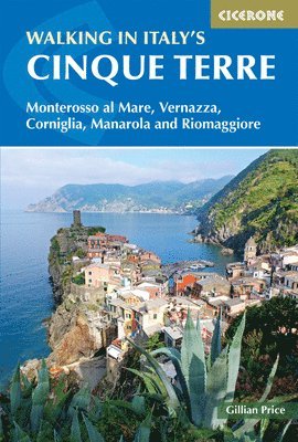
Perched above a spectacular UNESCO World Heritage coastline in the Italian Riviera, the five fishing villages of Monterosso al Mare, Vernazza, Corniglia, Manarola, and Riomaggiore are connected by a network of cliff and vineyard paths that make the Cinque Terre one of the most iconic walking destinations in Italy. Beyond the famous villages, the surrounding area extends to neighbouring Levanto, Campiglia, and Porto Venere, offering quieter routes well away from the crowds. All five Cinque Terre villages serve as starting points in this Cicerone guidebook by Gillian Price, which describes 16 graded walks ranging from 2 to 14km (1 to 8 miles) and can be completed in 2 to 5 hours, all accessible by public transport. It combines clear route descriptions with notes on local history, plants, wildlife, and cuisine to help you explore the Cinque Terre with confidence and context. The 16 walks are graded 1 to 3 and cover routes in and around all five Cinque Terre villages as well as Levanto, Campiglia, and Porto Venere, ranging from easy coastal paths to steep climbs through vineyards and cliff-edge terrainThe popular Sentiero Verde Azzurro linking Monterosso, Vernazza, Corniglia, Manarola, and Riomaggiore is described in full, alongside a superb higher traverse continuing via Campiglia to Porto VenereAll 16 routes can be combined to create a 3 to 4 day trek across the Cinque Terre, with detailed information on accommodation, refreshments, and public transport, making it straightforward to plan a multi-day itinerary by train and ferriesMaps at 1:50,000 or 1:25,000 are included for each walk alongside GPX files available to download, so you can navigate the ancient paths with confidence, whether on paper or on a GPS device or smartphone appSpring (April to June) and autumn (September and October) are the best seasons for walking, though winter offers a quieter and magical experience for those happy to find some accommodation providers and restaurants closed From the Sentiero Verde Azzurro linking all five villages to the quieter heights above Campiglia and Porto Venere, this guidebook covers the full breadth of walking in the Cinque Terre with maps, GPX downloads, and expert local knowledge for every route.
Häftad, Engelska, 2024
210 kr
Skickas
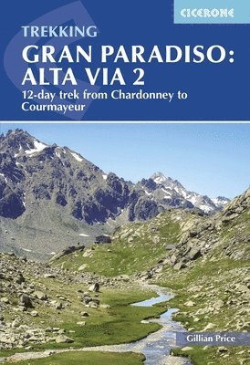
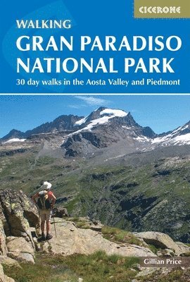
Explore the stunning high-mountain landscapes of Italy’s Gran Paradiso National Park, a protected wilderness in the Aosta Valley where towering peaks, emerald valleys and glacial tarns define one of the Alps’ most scenic trekking regions. Running east-to-west from Chardonney to Courmayeur, the Alta Via 2 is a classic long-distance trek that threads through rugged alpine terrain, past mountain huts and panoramic views of Mont Blanc and the Italian Alps. This trusted Cicerone trekking guidebook gives you everything you need to plan and walk the Alta Via 2 route, combining practical planning advice with clear, stage-by-stage descriptions of this scenic alpine trek. Featuring detailed route guidance and essential logistics information, it provides walkers with the knowledge to tackle the route’s challenging high-mountain terrain, including steep ascents, exposed ridges, and long daily distances, with confidence. Covers the full 12-day Alta Via 2 trek (148 km) between Chardonney and Courmayeur, with daily stages described in detail, including distances, ascent, and terrain notes — making it ideal for a two-week walking holiday.Practical planning chapters cover transport logistics, mountain hut network details, accommodation options and kit recommendations for trekking in the high Alps of the Aosta ValleyGPX files are available to download for use on GPS devices and smartphone apps, helping you navigate the varied alpine trails of Gran Paradiso throughout the routeTrek-specific Italian-English glossary, alpine flora and wildlife information are included to enrich your understanding of the natural and cultural environment you’ll encounterThe route is described from east to west, showcasing the beauty of Mont Blanc and rewarding trekkers with stunning views at the end of this challenging trek From soaring ridgelines to peaceful alpine valleys, this guidebook provides everything you need to get the most out of your experience on the Alta Via 2. Embark on your next long-distance trekking adventure and explore one of Italy’s most iconic high-mountain routes.
Häftad, Engelska, 2026
230 kr
Skickas
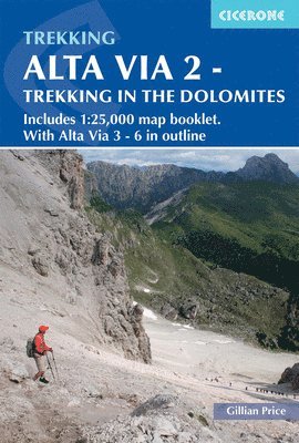
Trek the dramatic peaks, jagged ridges, and alpine valleys of the western Dolomites on the Alta Via 2 (AV2), a 174km (108 mile) long-distance trail from Bressanone to Feltre. This classic north–south route threads through some of Italy’s most stunning mountain scenery, including rocky passes, high plateaus, and scenic valleys, with opportunities to explore traditional mountain villages and alpine huts along the way. Suitable for experienced trekkers with a good level of fitness, AV2 typically takes around two weeks to complete. The route is divided into 13 stages of 8–22 km (5–14 miles), with alternative 3- or 6-day sections for those who prefer shorter excursions. A dedicated map booklet, featuring Kompass 1:25,000 maps with the full route line clearly marked, allows you to navigate the trail with confidence. 13 stage-by-stage route descriptions covering the full Alta Via 2 from Bressanone to Feltre, with distances, terrain summaries, and daily hiking timesPresented with 1:75,000 overview maps in the main book, plus a separate 1:25,000 Kompass map booklet with route line for precise navigationGPX files for the Alta Via 2 compatible with GPS devices and smartphone apps, allowing easy digital navigation on alpine terrainAlternative 3- or 6-day sections and exit routes, plus overview maps and route descriptions for Alta Via 3, 4, 5, and 6, for planning shorter hikes or extended trekking adventures in the central and eastern DolomitesDetailed information about mountain huts, refugios, and facilities along the route, with guidance on transport links and logisticsPlanning and preparation advice, including what to pack, seasonal considerations, and tips for navigating the high mountain passes of Italy's Southern Limestone AlpsKey highlights include the jagged Sella Group, scenic alpine valleys, historic villages, and panoramic Dolomite peaks along the north–south trail Plan your Alta Via 2 adventure with confidence and experience the scale, beauty, and challenge of the western Dolomites with this comprehensive guidebook.
Häftad, Engelska, 2019
167 kr
Skickas
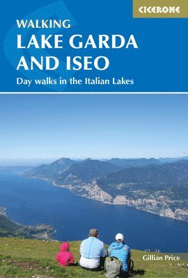
Lake Garda and Lake Iseo combine a mild year-round climate, dramatic mountain backdrops, historic villages, and well-waymarked trails that reward walkers with scenery far removed from the busy lakefronts. From easy lakeside strolls and historic military forts to panoramic peaks above Malcesine, these two lakes offer varied walking for all abilities. Covering both lakes in a single compact volume, this guidebook by Gillian Price describes 20 graded day walks ranging from 5 to 13km (3 to 8 miles) and taking 2 to 5 hours. It pairs clear route descriptions with detailed information on accommodation and public transport to help you explore with confidence. The 20 walks are split between Lago di Garda and Lago d'Iseo, graded 1 to 3, covering everything from the Valle delle Cartiere and Strada del Ponale to five routes on Monte Baldo and the island of MonteisolaHighlights include the cable car to Monte Baldo, Campione and its canyons, the Tremosine ancient stone stairway, Monte Brione's historic military forts, and Lovere on Lago d'IseoSketch maps are included for every walk alongside detailed information on accommodation and public transport, with bases in Malcesine, Riva del Garda, Limone, Gargnano, Iseo, and LovereBackground sections cover plants, flowers, wildlife, and food and drink, giving rich context for the lakeside villages, lemon orchards, and mountain landscapes on the trailSpring to autumn is best for most routes, with midsummer ideal for the Monte Baldo altitude walks and lower lakeside paths accessible in winter From the canyons of Campione and the peaks of Monte Baldo to the island of Monteisola on Lago d'Iseo, this guidebook opens up the best walking on two of Italy's most beautiful lakes. Gillian Price's expert local knowledge makes it the ideal companion for every route.
Häftad, Engelska, 2023
199 kr
Skickas
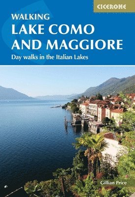
Lake Como and Lake Maggiore are two of the most celebrated destinations in northern Italy, combining a mild year-round climate, dramatic mountain backdrops, historic villas, charming lakeside villages, and well-waymarked trails that lead well away from the tourist crowds. From easy lakeside strolls and ferry-assisted walks to terraced mountainside rambles and panoramic summits, the Italian Lakes offer a remarkably varied walking landscape for all abilities. This Cicerone guidebook by expert author Gillian Price describes 28 graded day walks ranging from 3 to 20km (2 to 12 miles), completable in 1 to 5 hours, plus the full 5-stage Sentiero del Viandante trek along Lake Como's eastern shore. It pairs clear route descriptions with detailed planning information to help you explore Lakes Como and Maggiore with confidence, whether you have a long weekend or a full week to spare. The 28 day walks are split between Lago Maggiore and Lago di Como and graded 1 to 3, covering everything from the Stresa cable car to panoramic Mottarone and the Lake Como Greenway to the historic Strada Regia, with routes to suit all abilitiesThe Sentiero del Viandante, or Wayfarer's Path, is described in 5 stages covering 54km (34 miles) along the eastern shore of Lake Como between Lecco and Colico, making it an ideal multi-day addition to any visit to the Italian LakesSketch maps are included for every walk alongside detailed information on accommodation, public transport, and wildlife, with practical guidance on combining ferry trips with walks across both lakesHighlights include high-altitude sanctuaries at Sacro Monte on Maggiore and San Martino on Como, the ancient pilgrim route through Val Cannobina, the car-less village of Monteviasco, and the Como funicular to BrunateThe lakes' mild climate makes this a year-round walking destination, with lakeside walks accessible in winter, spring to autumn offering near-perfect conditions, and midsummer best for the higher routes to Mottarone and Monte San Primo From lakeside paths and ancient pilgrim routes to panoramic peaks above Lake Como and Lake Maggiore, this second edition guidebook covers every aspect of walking in the Italian Lakes. Explore with Gillian Price as your guide.
Häftad, Engelska, 2025
199 kr
Skickas
Experience the best of Italy’s alpine landscapes on 30 unforgettable day walks through Gran Paradiso National Park, set between the Aosta Valley and Piedmont in the Graian Alps. As Italy’s oldest national park, Gran Paradiso offers a spectacular setting of soaring peaks, wildflower meadows, sparkling lakes, and tranquil river valleys. These routes showcase the region’s wild beauty, where you might spot ibex, chamois, and marmots, and savour local food in mountain villages. Ideal for walkers of all experience levels, from relaxed strollers to seasoned trekkers, this comprehensive Cicerone guide describes 30 graded walks (2.5–24km/1.5–15 miles), each taking between 1.5 and 8 hours. Walks start from traditional villages and peaceful valleys, all accessible by public transport, with flexible itineraries to fit your plans. Choose from 30 inspiring day walks across Gran Paradiso National Park, following well-marked trails, old mule tracks, and alpine paths linking traditional hamlets, lakes, and mountain viewpoints, with opportunities to encounter wildlife along the way.Plan your Gran Paradiso walking holiday for the ideal season, with guidance on local weather and trail conditions showing why June to October is best for wildflowers, wildlife sightings, and open mountain huts.Benefit from clear grading and route descriptions, reliable waymarking, and daily information boxes covering distance, walking time, elevation gain, terrain, and facilities for every walk in Gran Paradiso National Park.Find practical holiday planning advice and recommendations for accommodation in the Aosta Valley and Piedmont, from village hotels and guesthouses to mountain rifugi, plus comprehensive notes on services, places to eat and sample local cuisine, water sources, and bus connections between valleys.Navigate Gran Paradiso’s trails with confidence using clear 1:50,000 mapping, downloadable GPX files, and step-by-step directions for every route.Expand your knowledge of Gran Paradiso with sections on geology, natural history, flora and fauna, travel, language, regional food and drink, and the vibrant culture of the area. Plan your Italian mountain adventure with confidence using this trusted Cicerone guidebook. Immerse yourself in the wild beauty, history, culinary delights, and cultural richness of Gran Paradiso National Park, one of Europe’s most spectacular protected landscapes.
Häftad, Engelska, 2025
210 kr
Skickas
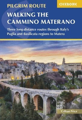
Experience the Cammino Materano, a remarkable pilgrim-style walking network through southern Italy that offers a wonderful alternative to more popular European routes, showcasing an underrated region rich in culture, history and varied landscapes. Stretching across the Puglia and Basilicata regions, the Cammino Materano encompasses three principal long-distance routes all converging on the ancient cave city of Matera, with its dramatic ravines and UNESCO-recognised Sassi dwellings. The three main routes of the Cammino Materano vary in distance and duration: the Via Peuceta stretches roughly 167 km (104 miles) from Bari to Matera and typically takes 7 - 10 days to complete; the Via Ellenica, running about 287 km (178 miles) from Brindisi to Matera, usually requires 14 days; and the Via Lucana, which begins in Tricarico and covers around 114 km (71 miles), can be walked in 6 days.This Cicerone guidebook transforms planning the Cammino Materano into a straightforward process, drawing together the practical information, route detail and cultural insight you need to walk one or all three routes confidently. With clear stage breakdowns, mapping and planning tools tailored to walkers of most abilities, it’s a vital resource for anyone seeking a memorable long-distance walk that blends scenic beauty with Italian heritage. Each of the three routes — Via Peuceta, Via Ellenica and Via Lucana — is described in clear stages with detailed route notes, 1:100,000 mapping and elevation profiles, helping you understand terrain, distances, and daily walking challenges in advanceA route summary table and stage facilities planners bring key information together in one place, including distances, likely walking times, accommodation options, and refreshment stops for every day’s stage, including in towns and villages like Santeramo in Colle, Carovigno and Ostuni Practical advice is provided on planning and preparation, from timing your walk (spring and autumn being the best seasons) to what to pack and how to manage logistics supporting safe and enjoyable long-distance walking in southern ItalyDetails on how to get your Cammino accreditation are also provided for the full pilgrim trail experience GPX files are available to download for use with mobile devices and GPS apps, offering a flexible digital navigation option for all three of these Italian long-distance trails With clear stage breakdowns, mapping, cultural insight and practical guidance, this guidebook ensures you can walk the Cammino Materano with confidence, experiencing quiet villages, rolling countryside and the historic streets of Matera along the way. It combines useful guidance with context and insight, making it an ideal companion for a rewarding and memorable walking journey.
Häftad, Engelska, 2026
199 kr
Skickas
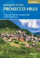
Discover the vineyard-covered hills of northern Italy with this guide to walking in the Prosecco Hills, a UNESCO-listed landscape between Conegliano and Valdobbiadene in the Veneto region. Terraced vineyards, wooded slopes and historic villages create a distinctive patchwork of scenery, with quiet paths linking churches, castles and wine-producing communities in one of Italy’s most celebrated rural landscapes. The routes are suitable for walkers of all abilities, with a mix of short vineyard walks and a longer multi-day trail through the region. Day walks range from gentle strolls to rewarding hill walks, while the 4-day Cammino delle Colline del Prosecco links valleys and hilltop villages between Vidor and Vittorio Veneto. The guidebook is ideal for travellers who want to combine scenic walking with local culture, food and wine. 15 varied day walks ranging from 2–13km (1–8 miles), plus the 4-day Cammino delle Colline del Prosecco covering 51km (32 miles) across the heart of the regionRoutes explore the UNESCO-listed Prosecco Hills north of Venice, following paths through terraced vineyards, wooded hillsides and quiet rural lanesWalks connect historic villages and wine towns including Valdobbiadene, Pieve di Soligo, Follina, Conegliano and Vittorio VenetoClear step-by-step route descriptions with 1:50,000 map extracts for every walk to make navigation straightforwardGPX files available to download, allowing you to follow each route easily using a GPS device or smartphone navigation appDetailed practical information on planning, facilities, public transport, accommodation and local wineries, helping you combine walking with food and wine experiences From peaceful vineyard paths to historic hilltop villages, these routes offer a relaxed way to experience the landscapes, traditions and flavours of Italy’s Prosecco country. This guidebook provides everything you need to plan memorable walks in one of northern Italy’s most distinctive regions.

Häftad, Engelska, 2026
210 kr
Kommande
Discover the sweeping Atlantic coast, dramatic cliffs, and quiet countryside of Portugal’s Rota Vicentina, a 224 km (139 mile) trek that combines two of the region’s most rewarding routes: the Caminho Histórico (Historical Way) and the Trilho dos Pescadores (Fishermen’s Trail). The route stretches from the rural town of Santiago do Cacém in the Alentejo through the wild landscapes of the Parque Natural do Sudoeste Alentejano e Costa Vicentina to the southwestern tip of mainland Europe at Cabo de São Vicente. Suitable for most walkers with easy to moderate stages, the Rota Vicentina presents the main combined route in 12 stages of 12–24 km (7–15 miles), making it perfect for a 2-week holiday. A four-stage inland variant forms a circuit north from Odeceixe back to the main trail, giving added flexibility for planning a walking holiday or coastal adventure. 12 stage-by-stage route descriptions for the full Rota Vicentina from Santiago do Cacém to Cabo de São Vicente, including the historic Caminho Histórico and the coastal Fishermen’s TrailStep-by-step directions with detailed 1:100,000 mapping and route notes to navigate the varying terrain of inland hills, wooded valleys and Atlantic cliff topsEach stage includes distance, estimated walking time, and terrain summary to help plan daily sections and match stages to your walking paceGPX files available for the Rota Vicentina routes, compatible with GPS devices and smartphone navigation appsPractical planning advice including accommodation listings, refreshment points, public transport options and preparation tips for walking the Rota VicentinaHighlights and landmarks along the route, including Santiago do Cacém, Odeceixe, Cabo de São Vicente, Atlantic beaches, fishing villages, and olive groves Plan your Rota Vicentina adventure with confidence and enjoy the towering cliffs, Atlantic beaches, olive groves, and authentic Portuguese culture of this unforgettable long-distance walk with this comprehensive guidebook.
Häftad, Engelska, 2019
144 kr
Skickas
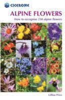
The Alps are home to some of the most remarkable wildflowers on earth, and knowing what you are looking at transforms any mountain day. This compact pocket field guide from alpine expert Gillian Price covers the most commonly found alpine flower species, designed to slip into a pack pocket and be pulled out on the hillside when something catches your eye. Gillian Price's trusted Cicerone field guide covers 230 alpine flowers with clear photographs, identification notes and fascinating background on the plants themselves. Arranged by colour for quick reference, it is designed for the non-specialist walker with a curiosity about the natural world around them. Flowers are organised by colour (red, yellow, blue, purple and white) for rapid identification in the field, so you can look up what you are seeing without needing prior botanical knowledgeEach entry includes a clear photograph and concise description of the flower's key identifying features, alongside its name in English, Latin, German, French and ItalianFascinating notes on the origins of flower names and curious historical facts add depth to each entry, making this as enjoyable to read as it is useful in the fieldAn introduction by Gillian Price explores the remarkable survival strategies of alpine flowers, from the Alpine Snowbell's natural antifreeze to the extraordinary adaptations that allow tiny plants to endure months beneath snow and temperatures as low as minus 25°CA glossary of flower parts, a full flower index by English and Latin name, and a directory of botanical gardens across the Alps complete the guide A beautiful and practical companion for any mountain walker with an eye for the natural world. Never again wonder what that flower is.
Häftad, Engelska, 2013
189 kr
Skickas
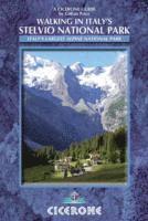
Walk in Italy's Stelvio National Park and discover the country's largest alpine national park, a vast and spectacular wilderness of glaciers, high passes, thundering waterfalls, and soaring peaks in the Italian Rhaetian Alps. Bordering the Dolomites to the east and Switzerland to the west, the Stelvio is a haven for wildlife including ibex, chamois, lammergeiers, and eagles, and one of the great walking destinations of the Alps. Suitable for beginner and experienced walkers alike, this comprehensive Cicerone guidebook by prolific alpine author Gillian Price describes 38 day walks across the Stelvio National Park. Routes range from 5 to 18km (3–11 miles) and can be enjoyed in 2–7 hours, graded from 1 to 3 to cater for a range of abilities, with walks easily extended into multi-day experiences with overnight stays in alpine refuges. Choose from 38 graded day walks across the Stelvio National Park, following well-maintained and waymarked paths through dramatic glacial valleys, past mountain lakes and cascading waterfalls, and up to high ridges with views across the Rhaetian Alps to the Dolomites and Switzerland.Discover the highlights of the Stelvio National Park, including the thrilling Stelvio Pass, the Forno glacier and the Forni Sentiero Glaciologico Alto, the Ortler and Cevedale mountains, ibex and chamois in Val Zebrù and Valle di Rabbi, and the traditional culture of the Ultental valley.Navigate with confidence using sketch maps included for each walk, with detailed guidance on the park's numbered and waymarked path network and recommendations for the best commercial maps covering the Stelvio.Extend your walking into multi-day adventures by combining routes with overnight stays in the park's network of hospitable alpine refuges, with a full accommodation appendix covering rifugi and guesthouses throughout the Stelvio.Plan your Stelvio National Park walking holiday with detailed practical information on getting there, local transport, accommodation, food and drink, and key bases including Bormio, Santa Caterina Valfurva, Sulden, Martell, Peio, and Rabbi.Deepen your experience of the park with introductory sections on the geography and history of the Stelvio, its plants and flowers, and the remarkable wildlife that makes this national park one of the best places in the Alps to see ibex, chamois, lammergeiers, and golden eagles. Explore the glaciers, valleys, and high peaks of Italy's largest alpine national park with confidence using this trusted Cicerone guidebook. From the Stelvio Pass to the wildlife-rich valleys of Val Zebrù and Valle di Rabbi, this is the essential companion for walking in one of the Alps' most spectacular and rewarding protected landscapes.
Häftad, Engelska, 2023
219 kr
Skickas
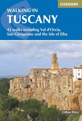
Few regions on earth combine natural beauty and cultural richness quite like Tuscany, a landscape of rolling hills, medieval hill towns, cypress-lined lanes, Etruscan ruins, and UNESCO World Heritage sites. From the environs of Florence and the Chianti vineyards to the wild Alpi Apuane, the Val d'Orcia, and the island of Elba, the region offers an extraordinary variety of walking landscapes across its nine distinct areas. This trusted Cicerone guidebook by expert author Gillian Price describes 43 mostly easy day walks ranging from 3 to 18km (2 to 11 miles), completable in 2 to 7 hours and graded 1 to 3. It pairs clear route descriptions with detailed planning information to help you explore Tuscany's most beautiful corners at a pace that lets you savour every view, village, and glass of local wine. The 43 walks are graded and organised across nine areas, from the hills around Florence and Fiesole and the high Apennines to the Chianti vineyards, the UNESCO World Heritage scenery of the Val d'Orcia and San Gimignano, the island of Elba, and the Maremma coast, giving a comprehensive picture of walking in TuscanyMany routes follow historical pathways once used by traders, pilgrims, and armies, threading through medieval hamlets, past Medici villas, and Renaissance towns, adding rich cultural depth to every walkEvery route is illustrated with 1:50,000 maps and supported by detailed information on planning, accommodation, and public transport, making this a fully self-contained guide for independent explorers and those using Tuscany's excellent rail and bus connectionsRich background sections cover Tuscany's plants, flowers, and wildlife alongside notes on food and wine, local history, and what to take, giving you the full context to understand and appreciate everything you encounter on the trailTuscany's mild climate makes it a genuine year-round walking destination, with spring and autumn particularly rewarding at lower altitudes and the higher Apennine and Alpi Apuane routes coming into their own in summer Now in its fourth edition, this guidebook's route descriptions, 1:50,000 maps, and expert local knowledge cover Tuscany's full breadth, from Etruscan coastline and Chianti vineyards to the UNESCO hilltowns of Val d'Orcia and San Gimignano. Explore one of Europe's greatest walking destinations with confidence.
Häftad, Engelska, 2024
199 kr
Skickas
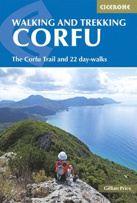
Explore Corfu’s finest walking and trekking routes, from its celebrated long-distance Corfu Trail to a diverse selection of 22 day walks spanning the island’s lush interior and stunning coastline. The greenest and most accessible of the Greek islands, Corfu offers a laidback atmosphere, traditional villages, and mile upon mile of well-waymarked paths through olive groves, wooded hills, golden beaches and wildflower meadows. This comprehensive Cicerone guidebook is perfect for walkers of all abilities, featuring the 150km Corfu Trail in 10 graded stages from the southern tip to the far north, plus 22 day walks exploring Corfu’s diverse landscapes. The 150km Corfu Trail is described in 10 stages, crossing the island from south to north and ending each day in a Corfiot village or at a beach with local accommodation and taverna dining.22 day walks (3.5–18km/2–5 hours) explore Corfu’s scenic coastal paths, olive groves, lush wooded hills, and tranquil mountain villages.Flexible itineraries allow you to enjoy rest days on Corfu’s golden beaches or in charming inland towns, with easy access via the island’s bus and taxi network.Clear route descriptions, sketch maps, and information boxes provide essential details for every Corfu walk, including distance, elevation, grade, and walking time.Practical advice covers Corfu’s local transport options, village walking bases, accommodation listings, cafés, and an English–Greek glossary for smooth travel.Suggested routes help you make the most of your time on Corfu, whether you have a weekend or a full-length trekking holiday.Local insights introduce Corfu’s ancient ruins, Greek cuisine, wildflowers, wildlife, and the island’s famously warm hospitality.The best time for walking in Corfu is between May and October, when the weather is ideal, and the island is alive with colour and culture. Plan your walking holiday on Corfu with this definitive Cicerone guidebook, and experience the island’s enchanting landscapes, welcoming villages, and timeless Mediterranean charm on foot.
Häftad, Engelska, 2025
199 kr
Skickas
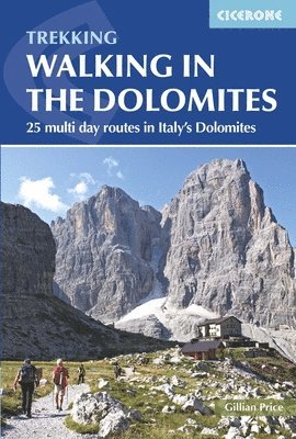
The Dolomites are one of the world's great mountain walking destinations. These extraordinary pale limestone towers, rising from the valleys of northeast Italy, form a UNESCO World Heritage Site of exceptional natural beauty, and the network of hut-to-hut routes threading between them offers some of the finest multi-day walking in Europe. Ranging from 11 to 41km (7 to 25 miles) and taking 2 to 4 days to complete, the 25 mostly circular routes in this third edition Cicerone guidebook by Gillian Price span the full breadth of the Dolomites. Suitable for experienced hikers with a head for heights, routes range from moderate to challenging, with some traverses involving scrambling and exposure. 25 multi-day hut-to-hut routes covering the full breadth of the Dolomites, from the Tre Cime di Lavaredo and Cortina Dolomites to the Marmolada, Sella, Civetta, Pale di San Martino and Dolomiti di BrentaIconic highlights include the Tre Cime tour, the Sella traverse, the Catinaccio loop, the Civetta tour and the Tofane-Lagazuoi circuit above Cortina d'Ampezzo, some of the most celebrated mountain walks in ItalyRoutes across UNESCO-listed mountain groups are also described, including the Puez-Odle altopiano, Sassolungo, Latemar and the remote Dolomiti Friulane, covering the full range of landscapes within the World Heritage Site1:100,000 mapping provided for every route alongside detailed information on hut accommodation, public transport connections, access points and route difficultyComprehensive practical guidance covering the best season to walk (mid-June to late September), accommodation in mountain rifugi, food and drink, equipment, waymarking and an Italian-English glossary The Dolomites are at their most spectacular when explored over multiple days, moving from hut to hut through the high passes and rocky cols that connect each mountain group. Gillian Price, Cicerone's foremost Italy author, has crafted the definitive multi-day walking guidebook to one of Europe's most breathtaking mountain landscapes.
Häftad, Engelska, 2024
199 kr
Skickas
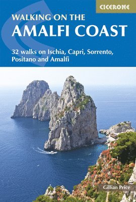
One of the world's most celebrated coastlines, the Amalfi Coast is a UNESCO World Heritage Site where dramatic limestone cliffs plunge to turquoise water, ancient villages cling to terraced hillsides, and a network of centuries-old mule tracks and pilgrim paths weave between lemon groves and hidden coves. Walking here is an experience unlike anywhere else in Italy. Criss-crossing this extraordinary landscape, this comprehensive guidebook by Gillian Price covers 32 walks from 3 to 11km (2 to 7 miles), taking between 1 and 5 hours and suited to family strollers and experienced trekkers alike. Walks are graded 1 to 3, can be combined to create longer days out and are easily accessible from Naples, Sorrento, Positano and Amalfi, with detailed public transport, accommodation and refreshment information throughout. 32 graded walks across five areas, covering Ischia, Capri, Sorrento, Positano and Amalfi, with routes along ancient mule tracks, pilgrim paths, coastal cliff trails and mountain ridges above the Gulf of NaplesThe Sentiero degli Dei, the Path of the Gods above Positano, is described in full — one of the most celebrated and photographed walks in Italy, with views across the Amalfi Coast that few other trails in Europe can matchThe islands of Capri and Ischia each have dedicated sections, with walks including Monte Solaro on Capri, the Sentiero dei Fortini coastal path and multiple routes across Ischia's volcanic interiorSketch maps for every walk are provided alongside detailed route descriptions, with walks designed to be linked together to create longer itineraries and plenty of shorter options for first-time visitorsPractical information on public transport, accommodation and local food and drink throughout, including ferry connections between the coast and the islands, making this the ideal planning companion for any Amalfi Coast visit Few places in the world combine natural beauty, cultural heritage and walking opportunities as effortlessly as the Amalfi Coast. Gillian Price, Cicerone's foremost Italy author, has captured every step of it in this guidebook.
Häftad, Engelska, 2024
199 kr
Skickas
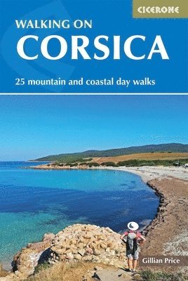
Corsica is one of the Mediterranean's most dramatic and varied walking destinations, combining rugged granite peaks, ancient forests, river gorges, fragrant maquis shrubland, and a spectacular coastline of cliffs, coves, and sandy beaches all within a single island. With 25 graded day walks exploring both the mountainous interior and the coast, this guidebook opens up the very best of the île de Beauté to walkers of every ability. This trusted Cicerone guidebook by expert author Gillian Price describes 25 day walks ranging from 4 to 19km (2 to 12 miles), completable in 2 to 7 hours, and graded 1 to 3 to suit beginners and experienced walkers alike. It pairs clear, walk-by-walk route descriptions with practical planning information to help you explore Corsica's landscapes with confidence, from the iconic white cliffs of Bonifacio to the glacial lakes of the Restonica valley. The 25 walks are graded for difficulty and organised from north to south, covering Cap Corse, the northwest coast, the mountainous centre around Corte, the southwest, and the far south around Bonifacio, so you can focus on a single area or combine walks across the island during a longer stayClear, step-by-step route descriptions are supported by 1:50,000 maps for every walk, with detailed information on facilities, public transport, and accommodation to help you plan and navigate with easeDownloadable GPX files enable easy digital navigation on GPS devices or smartphone apps, as you walk the Calanche sea cliffs, wander through the Aïtone forest, or gaze out from the headland at Capu RossuRich background notes cover Corsica's plant life, wildlife, and history alongside practical advice on when to go, getting to the island, local transport, food and drink, and what to take, giving you the full picture before you set foot on the trailA glossary of French and Corsican terms, a full accommodation appendix, and a route summary table round out the guide, making it a comprehensive and self-contained companion for any visit to the island Whether you're following clifftop paths above the Mediterranean or pushing into the wild mountain interior, the graded route descriptions, 1:50,000 maps, GPX downloads, and rich island knowledge provide everything you need. Tackle the best of Corsica's walks with confidence.
Häftad, Engelska, 2019
189 kr
Skickas
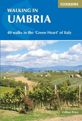
Sandwiched between Rome and Florence yet remarkably unspoilt, Umbria is Italy's only landlocked region and one of its most rewarding walking destinations. Known as the Green Heart of Italy, it combines rolling hills rising to the Apennines and Sibillini mountains with ancient villages, Roman and Etruscan ruins, UNESCO World Heritage towns, dense woodland, and nature reserves across six distinct walking areas. 40 day walks ranging from 3 to 19km (2 to 12 miles) and taking 1 to 5 hours are described in this second edition guidebook by expert author Gillian Price. It pairs clear route descriptions with detailed information on accommodation, public transport, and facilities to help you explore the Green Heart of Italy with confidence. The 40 walks are graded 1 to 3 and organised across six areas covering Alta Val Tiberina and Gubbio, Lago Trasimeno and its islands, Orvieto and Todi, Assisi and Monte Subasio, Spoleto and the Valnerina, and Norcia and the SibilliniSketch maps are included for every walk alongside detailed information on accommodation, public transport, and facilities, with notes on culinary delights helping you make the most of Umbrian food and drinkHighlights include Assisi, glorious Orvieto and its medieval aqueduct, Lago Trasimeno and the islands of Isola Maggiore and Isola Polvese, the Piano Grande di Castelluccio, Monte Cucco, and the wonderful ValnerinaBackground sections cover Umbria's history, plants, flowers, and wildlife, giving rich context for the Roman and Etruscan ruins, medieval hilltowns, and dense woodland you encounter on the trailBases include Perugia, Assisi, Gubbio, Norcia, Spoleto, Orvieto, and Passignano sul Trasimeno, with the region sitting conveniently between Rome and Florence for easy access With walks spanning UNESCO hilltowns, crater lakes, Roman ruins, and the high Sibillini peaks, this second edition guidebook captures the full variety of walking in Umbria in a single volume. Discover the very best of the region from hiking expert Gillian Price.