
Terry Marsh – författare
Visar alla böcker från författaren Terry Marsh. Handla med fri frakt och snabb leverans.
24 produkter
24 produkter
Häftad, Engelska, 2025
219 kr
Skickas
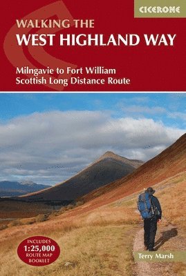
Walk the West Highland Way, Scotland’s most iconic long-distance hiking trail, and experience 156km (96 miles) of ever-changing landscapes — from the gentle paths north of Glasgow to the dramatic mountains of the Scottish Highlands. Running from Milngavie to Fort William, this legendary route is the first of Scotland’s Great Trails and is achievable for most walkers, typically completed in around one week. Whether you’re planning your first multi-day walk or returning to tackle a classic route, this trusted Cicerone guidebook gives you everything you need to walk the West Highland Way with confidence. It combines clear, stage-by-stage route descriptions with practical planning advice, helping you prepare thoroughly and enjoy the journey once you’re on the trail. The West Highland Way is described south to north in 7 stages, allowing you to follow the trail through increasingly dramatic Highland scenery while managing daily distances to suit your fitness and scheduleEach stage features clear, step-by-step route descriptions, supported by 1:100,000 OS mapping, helping you stay on track along the lochs and glens of Scotland's Great Trail Downloadable GPX files enable easy digital navigation on GPS devices or smartphone apps, so you can enjoy the sights of Loch Lomond and Bridge of Ochry without any stress A handy trek planner highlights facilities, public transport links and services along the route, alongside a comprehensive accommodation table for key destinations like Kinlochleven to help organise every aspect of your journeyAdditional insights from experienced guidebook author, Terry Marsh, cover the history of the trail as well as important factors to consider, like Scotland's famous midges and deer stalking season diversions Together, the detailed route descriptions, GPX downloads, and OS map booklet provide a trustworthy, all-in-one navigation package for Scotland’s most famous long-distance walk. Tackle the iconic West Highland Way with confidence.
- Nyhet
Häftad, Engelska, 2026
125 kr
Skickas
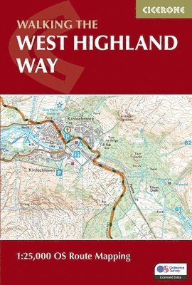
Stretching 155km (97 miles) across Scotland from Milngavie to Fort William, the West Highland Way is one of Scotland's Great Trails and one of the most celebrated long-distance walks in the British Isles. Passing through the stunning landscapes of Loch Lomond, Rannoch Moor and Glencoe, it is suitable for walkers of most abilities and typically completed in around a week. The West Highland Way Map Booklet is a compact, lightweight walking map and navigation companion featuring the entire route on detailed OS mapping. Designed for use on the move, it provides clear, reliable mapping in a convenient pocket-sized format. Full West Highland Way route shown on Ordnance Survey 1:25,000 mapping for precise navigation whilst walking from Milngavie to Fort WilliamClearly marked trail line through Loch Lomond and The Trossachs National Park and across the open moorland of Rannoch Moor, past Buachaille Etive Mor and through Glencoe, with key highlights including the Devil's Staircase and Lairig MorContinuous mapping format in a compact, pocket-sized booklet, eliminating the need for multiple separate map sheetsThe booklet can be used in either direction, with the relevant OS Explorer map legend included for easy referenceFor step-by-step route descriptions and planning advice, the accompanying Cicerone guidebook, Walking the West Highland Way, is also available and includes a copy of this map booklet Compact enough to slip into a jacket pocket and clear enough to use on the move, the West Highland Way Map Booklet is the essential navigation companion for one of Scotland's greatest walks.
Häftad, Engelska, 2016
157 kr
Skickas
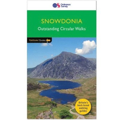
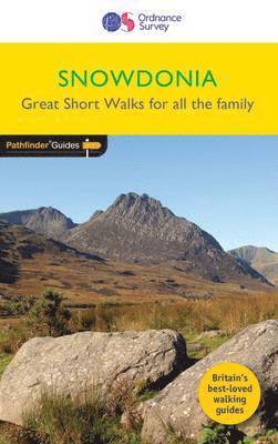
Pathfinder(R) Snowdonia covering Bont Newydd, Aber and Tal-y-lln. This selection offers interest, regional variety and balance of routes in Snowdonia providing the best walks in the area. From an easy stroll along in Aber Falls to the much more challenging walk up the summit of Cnicht, this volume contains something for everyone. Covering walks through the whole of Snowdonia both popular and little know scenic routes including Tryfan, Beddgelert and Barmouth Bay. -See walk locations by Looking Inside Inside: -28 great walks in Snowdonia from 2 to 10 miles -Clear, large scale Ordnance Survey route maps -GPS reference for all Snowdonia waypoints -Where to park, good pubs and places of interest en route -All routes have been fully researched and written by expert outdoor writers -Beautiful photography of scenes from the walks Pathfinder(R) Guides are Britain's best loved walking guides. Made with durable covers, they are the perfect companion for countryside walks throughout Britain. Each title features circular walks with easy-to-follow route descriptions, large-scale Ordnance Survey route maps and GPS waypoints.With over 70 titles in the series, they offer essential information for walkers throughout the country.Contents* Aber Falls* Cwm Pennant* Precipice Walk* Ceunant Cynfal* Tal-y-Llyn Lake* Capel Curig* Penmaenpool and the Mawddach Trail* Llyn y Gader and Beddgelert Forest* Lledr Valley* Gwydyr Forest and Trefriw* Coed-y-brenin* Vale of Ffestiniog* Cregennen Lakes* Tanygrisiau and Rhosydd* Tryfan* Moel Hebog* Drum and Llyn Anafon* Pont Scethin* Cnicht* Carnedd Llywelyn* Gwydyr Forest and the Swallow Falls* Nanmor Valley and Aberglaslyn* Aran Benllyn* Moel Eilio* Snowdon (Yr Wyddfa)* Cadair Idris* Glyder Fach and Glyder Fawr* Y Llethr and Moelfre
Häftad, Engelska, 2016
159 kr
Skickas
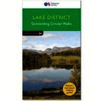
Pathfinder(R) Lake District covering Coniston, Kewswick and Devoke Water. This selection offers interest, regional variety and balance of routes in the Lake District providing the best walks in the area. From an easy stroll through Buttermere to the much more challenging walks in Rosthwaite and Stonethwaite this volume contains something for everyone. Covering walks through the whole of the Lake District both popular and little know scenic routes including Bowfell, Wetherlan and the Langdale Valleys. -See walk locations by Looking Inside Inside: -28 great walks in the Lake District from 2 to 10 miles -Clear, large scale Ordnance Survey route maps -GPS reference for all Lake District waypoints -Where to park, good pubs and places of interest en route -All routes have been fully researched and written by expert outdoor writers -Beautiful photography of scenes from the walks Pathfinder(R) Guides are Britain's best loved walking guides. Made with durable covers, they are the perfect companion for countryside walks throughout Britain. Each title features circular walks with easy-to-follow route descriptions, large-scale Ordnance Survey route maps and GPS waypoints.With over 70 titles in the series, they offer essential information for walkers throughout the country.
Häftad, Engelska, 2016
100 kr
Skickas
Short Walks Snowdonia covering parts of Abergynolwyn, Conwy and Snowdon. This selection offers interest and regional variety in Snowdonia, providing the best short walks in the area. Covering walks through the whole of the Snowdonia, both popular and little know scenic routes including the Eastern Moors and the River Lathkill. - See walk locations by Looking Inside Inside: -20 circular walks up to 5 miles - Clear, large scale Ordnance Survey route maps - GPS reference for all Snowdonia waypoints - Where to park, good pubs and places of interest en route - All routes have been fully researched and written by expert outdoor writers - Beautiful photography of scenes from the walks Ideal for families, or for those who prefer shorter distances, Short Walks guides contain 20 walks graded by distance, duration and difficulty. Each route includes points of interest as well as fun observation questions for children.
Häftad, Engelska, 2017
155 kr
Skickas
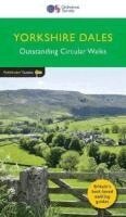
Pathfinder Yorkshire Dales covering parts of the National Park, Ribblesdale and Swaledale. This selection offers interest, regional variety and balance of routes in the Yorkshire Dales providing the best walks in the area. From an easy stroll through Ingleton Waterfalls to the much more challenging walks in Gunnerside, this volume contains something for everyone. Covering walks through the whole of the Yorkshire Dales both popular and little know scenic routes including Wharfedale, Wendleydale, and Burnsall. -See walk locations by Looking Inside Inside: 28 great Yorkshire Dales walks from 2 to 10 miles -Clear, large scale Ordnance Survey route maps -GPS reference for all Yorkshire Dales waypoints -Where to park, good pubs and places of interest en route -All routes have been fully researched and written by expert outdoor writers -Beautiful photography of scenes from the walks Pathfinder Guides are Britain's best loved walking guides. Made with durable covers, they are the perfect companion for countryside walks throughout Britain. Each title features circular walks with easy-to-follow route descriptions, large-scale Ordnance Survey route maps and GPS waypoints.With over 70 titles in the series, they offer essential information for walkers throughout the country.
Häftad, Engelska, 2023
170 kr
Skickas
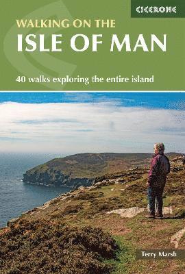
Discover the rugged beauty and remarkable variety of the Isle of Man on foot, with 40 inspiring walks that traverse its mountains, coastline, and enchanting National Glens. Explore open moorland, wooded valleys, sandy beaches, and bare mountain tops, where every path offers sweeping sea views and a taste of the island’s unique character. Encounter waterfalls, historical sites, and captivating wildlife, all within a landscape shaped by volcanic outcrops and limestone pavements. Perfect for both casual strollers and adventurous walkers, this comprehensive Cicerone guide presents 40 routes ranging from 2 to 23km (1 to 14 miles), with clear options to combine shorter walks for longer, more demanding days out. For those seeking a greater challenge, the guide includes summaries of five longer routes, including the epic 153km (95 mile) Raad ny Foillan (Isle of Man Coast Path), as well as a taste of the Millennium Way and the island’s highest peaks, Snaefell and North and South Barrule. Experience the very best of the Isle of Man, from the windswept drama of Point of Ayre and the wild slopes of Slieau Freoaghane, to the enchanting wooded glens of Ballaglass and Dhoon, the ancient monuments and mining heritage near Laxey, and the sweeping summit views atop Snaefell and South Barrule.Enjoy walking on the Isle of Man year-round, benefiting from its mild maritime climate and an extensive network of routes suitable for families, half-day outings, or ambitious hillwalkers. Many walks begin close to public transport hubs, while detailed notes on local geology, history, and Manx culture, along with practical tips on parking and refreshments, make exploring the island easy and rewarding.Choose from 40 carefully crafted routes that criss-cross the Isle of Man, each featuring a 1:40,000 OS map extract, clear information on route highlights, parking, refreshments, and a handy glossary to help you navigate Manx place names and terms.Discover the rich heritage and unique identity of the Isle of Man on every walk, as you encounter ancient Celtic crosses, mining relics, vibrant coastal wildflowers, and abundant birdlife woven into the fabric of the island’s varied landscapes.Combine shorter routes for more ambitious days on the Isle of Man’s trails, exploring both the north and south of the island and enjoying the ever-present proximity of the Irish Sea, visible from almost every path due to the island’s compact size.Marvel at the Isle of Man’s contrasting scenery, from wild uplands and thickly wooded glens to tranquil sandy beaches, volcanic basalt towers, rolling farmland, and limestone outcrops, all packed into an island just 52km by 22km (32 by 14 miles). Plan your Isle of Man walking adventure with confidence and see this enigmatic island from a fresh perspective. With the definitive Cicerone guidebook in hand, discover why the Isle of Man is truly a walker’s paradise, where every route offers a new vista, a glimpse of the sea, and the promise of adventure on every path.
Häftad, Engelska, 2024
189 kr
Skickas
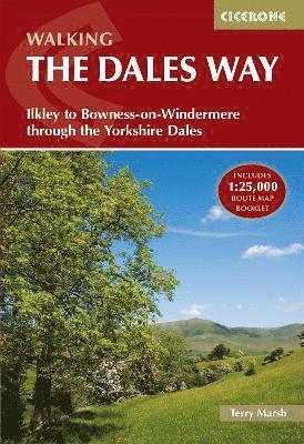
Discover the Dales Way, one of Britain's gentlest long-distance walks, a picturesque 128km (79-mile) trail from Ilkley through the Yorkshire Dales National Park to Bowness-on-Windermere in the Lake District. This beginner-friendly route follows riverside paths through Wharfedale, Dentdale and Lakeland fringes, passing Bolton Abbey, Grassington, Hawes, Sedbergh and classic Dales scenery over 6 stages (11-31km), perfect for a 6-8 day introduction to multi-day hiking. This expertly written Cicerone guidebook provides everything you need to plan and complete the Dales Way with confidence. Authored by experienced long-distance walker Terry Marsh, it combines clear route descriptions, reliable mapping, practical planning tools, and background insights that bring the landscapes and communities of northern England to life. All 6 stages are supported by detailed route descriptions alongside elevation profiles, allowing you to anticipate ascents, descents, and terrain before setting out each dayA separate OS 1:25,000 map booklet is included, showing the full route with a clear route line to provide reliable, easy-to-follow navigation throughout the Dales WayThe guidebook includes a Watershed alternative, offering an optional higher-level route of rewarding views that utilises the Pennine Bridleway for walkers looking to add variety or challenge to their journeyA comprehensive trek planner details accommodation, refreshment stops, and facilities at key centres along the route, including Ilkley, Grassington, Hawes, Dent, and Sedbergh, helping you plan each stage with confidenceAdditional historical and cultural background brings the route to life, with highlights such as the dramatic gorge of Strid Wood, the historic church at Hubberholme, and other landmarks along the way Designed to support walkers from start to finish, this guidebook allows you to enjoy the gentle rhythm of the Dales Way, from riverside paths and limestone villages to the dramatic views of Lake Windermere on the approach to Bowness. Walk with confidence, knowing each stage has been carefully described, while taking time to appreciate the scenery, history, and character that make the Dales Way such a rewarding long-distance route.

Häftad, Engelska, 2023
99 kr
Skickas
Enjoy the tranquil beauty of the Dales Way, a picturesque long-distance trail stretching 130 km (81 miles) from Ilkley in West Yorkshire to Bowness-on-Windermere in the Lake District, passing through some of northern England’s most stunning countryside. Follow gentle riverside paths and rolling green valleys, traversing the heart of the Yorkshire Dales and the foothills of the Lake District, with highlights including Bolton Abbey, Dentdale, and the breathtaking views of Windermere.This map book provides all the detailed mapping you need to walk the Dales Way: Features 1:25,000 Ordnance Survey (OS) mapsCovers the entire trail from Ilkley to Bowness-on-WindermereSuitable for walking the trail in either directionCompact and easy to carry, perfect for your jacket pocket or backpackFor step-by-step route descriptions, an accompanying Cicerone guidebook, ‘Walking the Dales Way,’ is also availablePart of a comprehensive series for long-distance walkers Plan your journey along the Dales Way with confidence and experience the peaceful charm of England’s iconic landscapes.
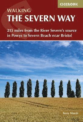
Walking the Severn Way
215 miles from the River Severn's source in Powys to Severn Beach near Bristol
Häftad, Engelska, 2023
189 kr
Skickas
Discover the Severn Way, a 215-mile (344km) journey that follows the course of the UK’s longest river from the wild heights of Plynlimon plateau in mid-Wales, through the superb landscapes of Powys, Shropshire, Worcestershire and Gloucestershire, including the tranquil Hafren Forest, before reaching the Bristol Channel at Severn Beach. Ideal for walkers with long-distance walking experience, the Severn Way’s official route is divided into 22 manageable daily stages, with options to tailor the walk to your ability and timeframe. The comprehensive Cicerone guidebook allows for flexible itineraries, whether you wish to complete the route over three weeks, walk shorter sections, or explore day walks and route variants, including a scenic variant start over Plynlimon and an onward ‘Bristol Link’ into the city centre. Explore a rich tapestry of history and geography as you follow the River Severn’s path, visiting lively market towns and villages such as Llanidloes, Welshpool, Shrewsbury, Ironbridge, Worcester, and Gloucester. The route weaves together threads of trade, commerce, civil war, and the lives of ordinary folk, finishing at Severn Beach or continuing onward on the Bristol Link to the heart of Bristol.Enjoy the River Severn’s unspoilt scenery and abundant historic interest, from ancient river crossings and industrial heritage to peaceful woodlands and meadows. Along the way, you’ll find welcoming pubs and tea rooms, as well as opportunities to discover the region’s unique hospitality and character.The Severn Way can be walked throughout the year, but the best time is between May and September, when the landscapes are at their most vibrant. Each stage includes detailed guidance, with advice on tackling longer stretches, riverside walking, and hilly terrain.Each section features a detailed route summary table with start and finish points, distances, ascent and descent, and practical advice on accommodation, public transport, and facilities at key locations including Llanidloes, Newtown, Shrewsbury, Ironbridge, Worcester, Tewkesbury, Gloucester Docks, and Severn Beach.Navigate the Severn Way confidently with Ordnance Survey 1:50,000 maps, featuring clear overlays that show each stage of the route.Discover the varied wildlife and habitats of the Severn Valley and surrounding countryside, from woodland birds in the upper reaches to a wealth of wetland and riverbank species further south. Points of interest are highlighted in each section to help you make the most of your visits along the way. Plan your Severn Way adventure with confidence and immerse yourself in the history and landscapes along Britain’s longest river, with the comprehensive support of the Cicerone guidebook.
Häftad, Engelska, 2025
189 kr
Skickas
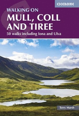
Wild, rugged and rich in wildlife, the Isle of Mull is one of Scotland's most rewarding Inner Hebridean islands for walking, with dramatic coastlines, sweeping glens and the only Munro in the Hebrides outside Skye in Ben More. Neighbouring Coll, Tiree, Iona, Ulva, Gometra and Erraid each bring their own distinct character, from Iona's ancient pilgrimage routes to Tiree's wide Atlantic beaches and flower-rich machair. This third edition Cicerone guidebook by expert author Terry Marsh covers 50 walks across seven islands, ranging from 2 to 19km (1 to 12 miles) and suited to walkers of all abilities. Clear route descriptions are paired with 1:50,000 OS mapping and downloadable GPX files, with detailed practical information on ferry connections, accommodation and getting around each island throughout. 50 walks across seven islands are included, spanning Mull, Coll, Tiree, Iona, Ulva, Gometra and Erraid, from short coastal circuits and glen walks to demanding mountain traverses, all without technical difficulties1:50,000 OS mapping and downloadable GPX files for every walk, providing reliable navigation across rough, trackless terrain where map and compass skills are essentialSpectacular highlights throughout, including Ben More (the only Hebridean Munro outside of Skye), the Carsaig Arches, Lochbuie, the Fossil Tree and the sacred isle of Iona, one of Scotland's most historically significant and visited destinationsExceptional wildlife across all islands, with Mull renowned as one of the best places in Britain to spot white-tailed eagles, red deer, otters and dolphins from the shoreComprehensive practical information is provided on ferry transport from Tobermory and Craignure, inter-island connections, accommodation and access, covering everything needed to plan a walking trip to the Inner Hebrides What makes the Inner Hebrides so special is that no two islands feel the same. This guidebook captures that variety across all seven islands, giving every walker the tools to explore Mull, Coll and Tiree at their own pace.
Häftad, Engelska, 2024
122 kr
Skickas
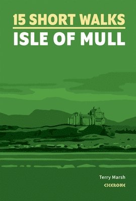
Discover the wild beauty, white-sand beaches and wildlife-rich coastlines of Scotland’s Inner Hebrides with 15 short walks exploring the Isle of Mull and its surrounding Hebridean landscapes on Ulva and Iona. From colourful harbour views in Tobermory and peaceful woodland trails in Aros Park to dramatic cliffs, historic castles and remote Atlantic beaches, these routes reveal the island’s remarkable variety of landscapes – perfect for relaxed half-day walks, nature watching and memorable island adventures with family. Each walk includes a clear Ordnance Survey® map alongside a detailed step-by-step route description, with numbered waypoints linking map and text to help make navigation on Mull simple and reliable for walkers of all experience levelsPractical details are provided for every route, including parking, public transport access, refreshment stops and local facilities at towns and villages like Craignure and Tobermory, making it easy to plan a short walk, whether you are staying on Mull or visiting for the dayDiscover some of the island’s most memorable locations, including Tobermory’s colourful waterfront, the lighthouse at Rubha nan Gall, the historic grounds of Glengorm Castle, and beautiful beaches such as Langamull, Kilvickeon and TireraganRoutes range from 1.5 to 10.5km and typically take under three hours, making them ideal short walks on Mull for beginners, families and relaxed half-day outings Additional notes highlight wildlife, viewpoints and places of interest along the way from sea cliffs on the Treshnish Peninsula to peaceful island trails on Iona Part of Cicerone’s trusted Short Walks series, this compact guidebook is the ideal companion for exploringone of Scotland’s most captivating west coast islands. Whether you’re wandering through coastal machair, following quiet woodland paths or standing on a remote Hebridean beach watching the Atlantic roll in, 15 Short Walks on the Isle of Mull provides everything you need to enjoy the island’s landscapes at a relaxed and rewarding pace.
Häftad, Engelska, 2026
210 kr
Kommande
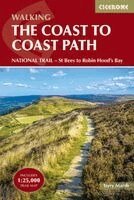
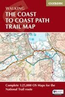
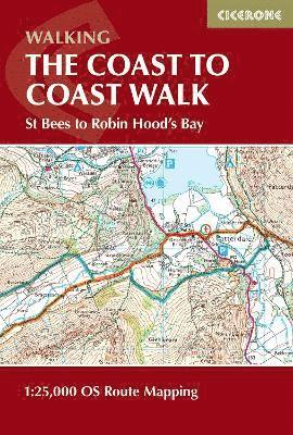
Walk one of the UK’s most iconic long-distance trails on the Coast to Coast Path National Trail, crossing northern England from St Bees on the Irish Sea to Robin Hood’s Bay on the North Sea. Covering 182 miles (293km), this classic route links three of England’s finest national parks – the Lake District, Yorkshire Dales and North York Moors – offering a spectacular journey through mountains, valleys, moorland and historic countryside. The Coast to Coast Path is widely regarded as one of Britain’s best long-distance walks. Avoiding towns wherever possible and favouring high ground, the trail reveals the changing landscapes, geology and cultural history of northern England. Beginning with a dramatic clifftop walk at St Bees Head, the route soon heads inland into the western Lake District, exploring remote valleys and high passes beneath famous fells before leaving Lakeland by the shores of Haweswater. Beyond the Lake District, the route crosses the limestone uplands around Shap and enters the Yorkshire Dales, where historic mining landscapes and sweeping moorland lead to the high crossing of Nine Standards Rigg. The trail then continues through Swaledale and Richmond before traversing the quiet farmland of the Vale of Mowbray. The final section crosses the wide open heather moorland of the North York Moors and finishes with a memorable clifftop walk down to the North Sea at Robin Hood’s Bay. 13 stage-by-stage route descriptions covering the full Coast to Coast Path from St Bees to Robin Hood’s BayAlternative itineraries of 15 and 19 days allowing a more relaxed pace across the 182-mile (293km) routeClear route guidance supported by 1:100,000 mapping and a detailed 1:25,000 OS map bookletDownloadable GPX files for easy navigation using GPS devices or smartphone appsPractical planning advice covering fitness preparation, accommodation, transport and daily logisticsStage summaries outlining distances, ascent, facilities and accommodation along the routeBackground information on the landscapes, geology and cultural history of northern England encountered along the trail Whether you are tackling your first ever long-distance walk or planning your next multi-day National Trail, the Coast to Coast Path offers a rewarding end-to-end adventure. With clear mapping, practical planning advice and reliable route guidance, this guidebook makes it easier to organise your journey and enjoy every mile of this classic walk across England.
Häftad, Engelska, 2026
157 kr
Kommande
Walk one of the UK’s most iconic long-distance trails on the Coast to Coast Path National Trail, crossing northern England from St Bees on the Irish Sea to Robin Hood’s Bay on the North Sea. Covering 182 miles (293km), this classic route links three of England’s finest national parks – the Lake District, Yorkshire Dales and North York Moors – offering a spectacular journey through mountains, valleys, moorland and historic countryside. The Coast to Coast Path is widely regarded as one of Britain’s best long-distance walks. Avoiding towns wherever possible and favouring high ground, the trail reveals the changing landscapes, geology and cultural history of northern England. Beginning with a dramatic clifftop walk at St Bees Head, the route soon heads inland into the western Lake District, exploring remote valleys and high passes beneath famous fells before leaving Lakeland by the shores of Haweswater. Beyond the Lake District, the route crosses the limestone uplands around Shap and enters the Yorkshire Dales, where historic mining landscapes and sweeping moorland lead to the high crossing of Nine Standards Rigg. The trail then continues through Swaledale and Richmond before traversing the quiet farmland of the Vale of Mowbray. The final section crosses the wide open heather moorland of the North York Moors and finishes with a memorable clifftop walk down to the North Sea at Robin Hood’s Bay. 1:25,000 OS trail map with Ordnance Survey Explorer map legendShows the full 182-mile (293km) route of the Coast to Coast PathRoute divided into 13 daily stages, with route stats for walking the trail in either directionDownloadable GPX files for easy navigation using GPS devices or smartphone appsAvailable with the Cicerone guidebook Walking the Coast to Coast Path or as a separate, standalone purchase Whether you are tackling your first ever long-distance walk or planning your next multi-day National Trail, the Coast to Coast Path offers a rewarding end-to-end adventure. With clear mapping and practical route information, this trail map makes it easier to organise your journey and enjoy every mile of this classic walk across England.
Häftad, Engelska, 2025
122 kr
Skickas
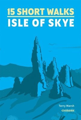
Discover the wild spirit and legendary landscapes of the Isle of Skye with this collection of 15 carefully chosen short walks, each designed to showcase the island’s most iconic scenery, from the dramatic pinnacles of the Old Man of Storr and the surreal landslip of the Quiraing to shimmering sea lochs, hidden beaches, and the enchanting Fairy Pools. With every route taking less than three hours, this guidebook is your essential companion to explore the magic of Skye, perfect for families, first-time visitors, or anyone eager to experience the rugged beauty and rich history of Scotland’s celebrated ‘Winged Isle’. Each of the 15 walks features clear, easy-to-follow maps and step-by-step route descriptions, with numbered points that link directly to OS mapping for simple, reliable navigation.Practical details are provided for every walk, including information on parking, public transport, facilities, and route highlights, ensuring your Skye adventures are enjoyable, accessible, and well-planned, whether you’re seeking towering rock spires, Neolithic sites, or sweeping views towards the Outer Hebrides.Explore Skye’s most memorable sights: the Old Man of Storr, Quiraing, Rubha Hunish, the Fairy Pools, and the atmospheric ruins of Boreraig, alongside lesser-known gems such as Dùn Borrafiach, Armadale woodland, and the raised beach at Scorrybreac.Routes begin at key Skye locations, including Portree, Broadford, and Armadale, with suggestions for car, bike, or public transport, making it easy to reach even the island's remote corners.Encounter Skye’s unique wildlife and flora along the way, from golden and white-tailed eagles soaring overhead, to puffins, seals, wildflowers, and ancient woodlands, set against the island’s ever-changing weather and legendary light.Part of Cicerone’s trusted Short Walks series, this guide to the Isle of Skye brings together everything you need for a memorable day out in Scotland’s most evocative landscape. Whether you’re a local, a day-tripper, or planning an extended island escape, this guide is your key to discovering the best of Skye at an easy, enjoyable pace, letting the island’s history, wildlife, and scenery inspire every step.
Häftad, Engelska, 2024
226 kr
Skickas
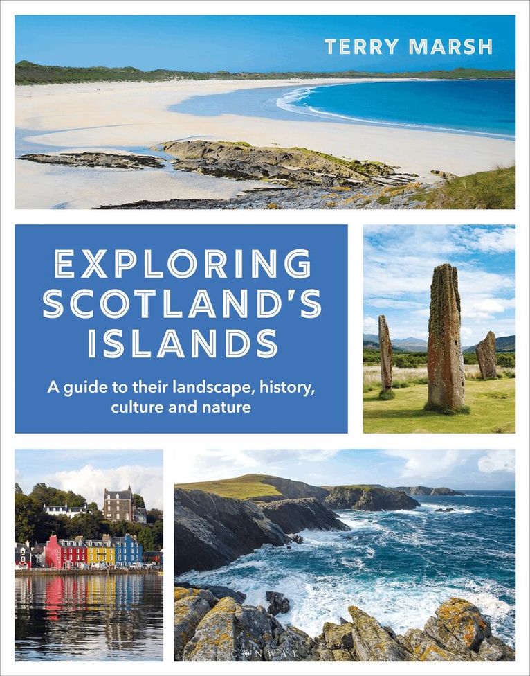
Explore the enchanting islands of Scotland with this absorbing and beautiful guide.Around the coast of Scotland there are hundreds of islands, from bare, rugged skerries to lush dominions of history and deep-rooted culture. Each offers a unique haven to explore, whether you enjoy sparkling-white sandy beaches, miles of untouched land beneath your feet, nature-spotting among otters, puffins, seals and more, sampling the finest whisky and cheeses, or learning more about Scotland’s history. Exploring Scotland’s Islands describes the main island groups in all their moods, and focuses on what gives these islands such magical and lasting appeal. This book is a glorious celebration in words, maps, illustrations and photographs of some of the most superb scenery in Scotland. Discover why these unique isles draw those lucky enough to find them back to visit whenever they can. Among captivating descriptive text and beautiful photography, Exploring Scotland’s Islands also provides the reader with essential visitor information such as transport links, the most inspiring visitor attractions and sights to see, cafés and restaurants not to be missed, and where you can stay to make your visits all the more special.
Häftad, Engelska, 2025
217 kr
Skickas
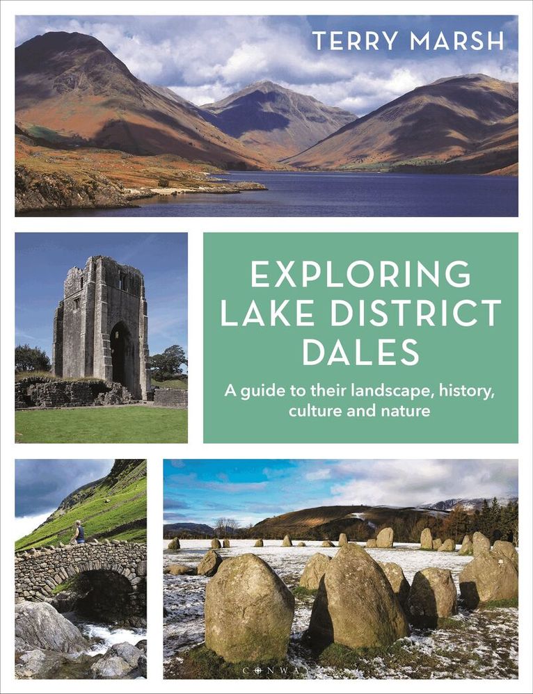
SHORTLISTED FOR LAKELAND BOOK OF THE YEAR 2026Explore the beauty of the Lake District dales with this enchanting and absorbing guide.Crisp and sharp, fascinating throughout, [this book] is an outstanding journey through the Lake District. - Bill Birkett, Author, Mountaineer and PhotographerThe Lake District has over 100 dales, many of them tranquil enclaves far from the hectic comings and goings of daily Lakeland life. Yet beyond the main river arteries, most dales remain little-known; some see more sheep and deer than humans. Even locals would be hard pressed to pinpoint some with certainty.Ticking your way through a list of Lake District summits is easy; they stick up and are easily accounted for. Less so the dales. Where, for example, is Blengdale, or Miterdale, seldom-visited Woundale, Fusedale, Moasdale and Pasture Bottom?In Exploring Lake District Dales, Terry Marsh champions the cause of the dales. Diving into their geology, geography, history, culture, folklore and matters of curious and touristic interest, this book reveals the beauty and appeal of dales, great and small.Among captivating text and stunning photography, Exploring Lake District Dales also provides you with essential visitor information such as transport links, the most inspiring visitor attractions and sights, unmissable restaurants and great places to stay, making this book the complete package for all Lake District admirers.
Häftad, Engelska, 2022
145 kr
Skickas
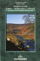
Explore the quiet moorlands, hidden valleys and historic villages of the Forest of Bowland National Landscape and the surrounding countryside of Pendle, one of north-west England’s most rewarding yet often overlooked walking destinations. From the open fells and upland scenery to the peaceful Lune, Hodder and Ribble river valleys, this landscape offers a rich mix of remote moorland, rural farmland and classic Lancashire hill country. Walking in the Forest of Bowland and Pendle is a comprehensive Cicerone guidebook featuring 40 circular walks that explore the best of this beautiful area of Lancashire. Written by experienced outdoor author Terry Marsh, the routes range from 5 to 20km (3–13 miles) and are suitable for all abilities, from shorter, low-level walks to longer, more strenuous outings across the Bowland fells and surrounding countryside. 40 circular walks are included across the Forest of Bowland National Landscape and around Pendle Hill, ranging from 5–20km (3–13 miles), exploring landscapes from open moorland to the scenic Lune, Hodder and Ribble valleysRoutes are accessible from key centres including Lancaster, Clitheroe and Slaidburn, making it easy to plan rewarding day walks across the Bowland hills and surrounding countryside1:50,000 Ordnance Survey mapping (reproduced at 1:60,000) accompanies every walk, helping you navigate confidently across the moorland paths and rural landscapes of LancashireA route summary table and overview information make it easy to choose a walk that suits your time and preferred level of challenge, including routes to Fair Snape Fell, Ward’s Stone, and Clougha PikeCompact and practical, the guidebook is sized to fit easily in a jacket pocket and includes local points of interest such as the famous Pendle Hill and its association with the Pendle witches From the sweeping uplands of the Forest of Bowland National Landscape to the distinctive profile of Pendle Hill, this beautiful part of Lancashire rewards walkers with wide-ranging views, peaceful countryside and a strong sense of place. With carefully selected routes, clear mapping and practical guidance, Walking in the Forest of Bowland and Pendle provides everything you need to discover the best walks in this tranquil corner of northern England.
Häftad, Engelska, 2022
155 kr
Skickas
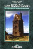
Experience the wild, open landscapes of the West Pennine Moors, a rugged and atmospheric region of rolling hills, heather-clad moorland, deep reservoirs, and peaceful valleys nestled between Manchester and the Ribble Valley. This distinctive area offers walkers a blend of remote upland terrain and accessible countryside, with dramatic views and a wealth of natural and industrial heritage to discover. Walking on the West Pennine Moors is a detailed Cicerone guidebook presenting 30 day walks that explore the diverse landscapes of this beautiful moorland region. Written by experienced outdoor author Terry Marsh, the guide features routes ranging from 5 to 15 km (3 to 9 miles), suitable for a wide range of abilities—from gentle valley strolls to more challenging upland adventures. 40 circular walks across the West Pennine Moors are included, covering locations from Bolton to Chorley and Blackburn, offering a mix of moorland summits, wooded valleys, and reservoirsExplore notable landscapes, including the rugged moorland tops of Rivington Pike and Winter Hill, the tranquil waters of Belmont and Anglezarke Reservoirs, and historic industrial sites, including the ruins of mills and reservoirsEach route is supported by 1:50,000 Ordnance Survey mapping, alongside clear step-by-step directions and downloadable GPX files to ensure confident navigation across moorland trails and country lanes of LancashirePractical information, including distance, ascent, parking, public transport options, and nearby pubs or cafés in towns and villages such as Rivington and Darwen, is provided, making planning easy and accessibleThe guidebook offers insights into the area's natural environment and industrial history, highlighting features such as the remnants of early water supply schemes and the rich wildlife of the West Pennine Moors From expansive moorland panoramas to quiet wooded valleys, the West Pennine Moors provide a captivating setting for walkers seeking varied terrain within easy reach of urban centres like Preston, Blackburn, and Manchester. With comprehensive route descriptions, detailed mapping, and practical advice, Walking on the West Pennine Moors equips you to explore the wild beauty and heritage of this iconic Lancashire landscape.
Häftad, Engelska, 2017
210 kr
Skickas
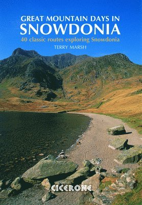
Take on 40 of Snowdonia's greatest mountain days, from the classic Snowdon Horseshoe and the dramatic ridges of the Glyderau and Carneddau to the remote Rhinogydd, the wild Arans, and the magnificent sweep of Cadair Idris above the Mawddach Estuary. Spanning eight distinct mountain regions across the Snowdonia National Park, this is a handpicked collection of classic routes and lesser-known gems across some of the finest mountain terrain in Wales. Designed for experienced walkers and scramblers ready to push beyond the well-trodden paths, this large-format Cicerone guidebook describes 40 graded mountain routes across Snowdonia, illustrated throughout with Harvey map extracts and topo diagrams by Lakeland artist Mark Richards. Routes are graded from moderate to arduous, with some involving mild scrambling or long days on rugged and complex terrain. Choose from 40 classic and lesser-known mountain routes across eight regions of Snowdonia, covering Snowdon and Moel Eilio, the Glyderau, the Carneddau, Eifionydd, Siabod and the Moelwynion, the Rhinogydd, Migneint and the Arans, and Cadair Idris and the Tarrens, with a mix of horseshoe circuits, ridge traverses, and summit days.Discover highlights including the Snowdon Horseshoe and the Watkin Path, Tryfan and the Bristly Ridge, the Nantlle Ridge, the Cwm Eigiau Horseshoe, the Carneddau end-to-end, Cnicht and Cwm Croesor, Rhinog Fawr and Fach, Aran Fawddwy, and three routes on Cadair Idris.Navigate with confidence using Harvey map extracts and topo diagrams by Mark Richards included for every route, with guidance on the recommended Harvey Superwalker and OS Explorer sheets covering all eight mountain regions of Snowdonia.Select routes suited to your ability using clear grading from moderate to arduous, with notes on terrain complexity, scrambling, and seasonal conditions to help you plan safe and rewarding mountain days throughout the year.Prepare thoroughly with introductory sections on weather, mountain environment, map and compass skills, and practical advice on getting the most from Snowdonia's mountain landscape in every season, including winter.Extend your exploration with the companion Cicerone title Great Mountain Days in Scotland, which together with this guide offers a collection of the finest mountain days across two of Britain's greatest mountain national parks. Explore the mountains of Snowdonia with confidence using this trusted Cicerone guidebook. Whether you are new to the national park or returning to discover routes beyond the familiar classics, this is the essential companion for anyone who wants to experience Snowdonia's mountain landscape at its very best.
Häftad, Engelska, 2024
190 kr
Skickas
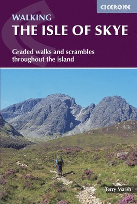
Rugged, dramatic and endlessly atmospheric, the Isle of Skye is one of Scotland’s most spectacular walking destinations. From the jagged Black Cuillin to the wild coastal cliffs and surreal rock formations of Trotternish, this Inner Hebridean island offers some of the most varied and inspiring hiking landscapes in the UK. This comprehensive Cicerone guidebook helps you explore the Isle of Skye on foot with confidence, featuring 87 walks and scrambles across the island. Covering everything from shorter coastal routes to demanding mountain days in the Cuillin, it combines detailed route descriptions with practical planning advice and expert local insight. These 87 walks and scrambles across the Isle of Skye explore diverse regions including Sleat, Strath, Minginish, Duirinish, Waternish and Trotternish, from quiet coastal paths to rugged Highland mountain routesRoutes range from 2–23km (1–15 miles), making the guidebook suitable for relaxed day walks and full mountain adventures across Skye’s wild landscapes, for both beginners and experienced hikersHighlights along the way include the iconic Cuillin mountains, as well as classic viewpoints, dramatic sea cliffs and remote glens that define hillwalking in the Scottish HighlandsEach walking route is supported by 1:50,000 Ordnance Survey mapping, helping you navigate confidently through Skye’s rugged terrain and remote mountain environmentsPractical information is provided to help you plan your walking holiday, including access points from key centres such as Portree and Broadford, plus advice on facilities, accommodation, and travel around the island Whether you’re planning your first walking trip to the Isle of Skye or returning to explore deeper into its mountains and coastlines, this guidebook provides everything you need to plan memorable adventures. Discover hidden glens, climb iconic peaks and experience the raw beauty of Skye — one of the most unforgettable walking destinations in Scotland.
Häftad, Engelska, 2026
157 kr
Skickas
Experience the legendary Coast to Coast Walk, a celebrated long-distance trail stretching 192 miles (309 km) from St Bees on the Irish Sea to Robin Hood’s Bay on the North Sea, traversing the diverse landscapes of northern England. Journey through three National Parks, the Lake District, Yorkshire Dales, and North York Moors, passing dramatic mountains, rolling fells, and charming English villages along the way.This map book provides all the detailed mapping you need to walk the Coast to Coast trail: Features 1:25,000 Ordnance Survey (OS) mapsCovers the entire trail from St Bees to Robin Hood’s BaySuitable for walking the trail in either directionCompact and easy to carry, ideal for your jacket pocket or backpackFor step-by-step route descriptions, an accompanying Cicerone guidebook, ‘The Coast to Coast Path,’ is also availablePart of a comprehensive series for long-distance walkers Set out with confidence and embrace the adventure of crossing England from coast to coast, discovering its most iconic landscapes along the way.
42 kr
Skickas
Häftad, Engelska, 2013
196 kr
Tillfälligt slut
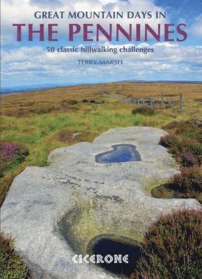
Take on 50 of the Pennines' greatest walking routes, from the high summit of Cross Fell and the spectacular High Cup Nick in the North Pennines to the Three Peaks of the Yorkshire Dales, the heather moorlands of the South Pennines, and the dramatic Kinder Downfall in the Dark Peak. Spanning the full length of England's backbone, this is a handpicked collection of classic routes and lesser-known gems across one of Britain's most characterful upland landscapes. Designed for experienced walkers and fell runners ready to push into the wilder corners of the Pennines, this large-format Cicerone guidebook describes 50 graded routes across five distinct areas. Routes range from 10 to 21km (6–13 miles) and can be enjoyed in 3–7 hours, graded from moderate to strenuous, with many also well suited to fell running. Choose from 50 classic and lesser-known routes across five areas of the Pennines, covering the North Pennines, the Howgills and Eden Valley, the Yorkshire Dales, the South Pennines, and the Dark Peak, with a mix of summit days, moorland traverses, and valley circuits offering something for every kind of Pennine walker.Discover highlights including Cross Fell and High Cup Nick, Nine Standards Rigg, Wild Boar Fell, the Three Peaks of Ingleborough, Whernside, and Pen-y-Ghent, Gordale Scar and Malham Cove, Pendle Hill, Stoodley Pike, Kinder Downfall, and the gritstone edges of Stanage and Derwent.Navigate every route with confidence using 1:25,000 OS mapping reproduced at 1:40,000 for greater clarity, with key landmarks shown in bold in the route text to help you plot your way across the often featureless Pennine terrain.Select routes suited to your ability and experience using clear grading from moderate to strenuous, with advice on the deceptive nature of the Pennine landscape and the importance of strong navigational skills and self-sufficiency on remote moorland.Prepare thoroughly for walking in the Pennines with introductory sections on weather, safety, equipment, navigation, and the particular challenges of remote Pennine terrain, which can feel remarkably wild despite its relative proximity to towns and cities.Run, walk, or explore the routes at your own pace, with many routes well suited to fell runners as well as experienced hillwalkers looking for a long and rewarding day on the moors. Explore the summits, moors, and valleys of the Pennines with confidence using this trusted Cicerone guidebook. Whether you are discovering the Pennines for the first time or returning to find new routes beyond the familiar classics, this is the essential companion for walking in England's longest upland chain.