
Visar resultat för..."Rucksack Readers"
43 produkter
43 produkter
Häftad, Engelska, 2013
145 kr
Skickas inom 11-20 vardagar
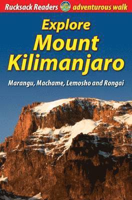
At 5895 metres (nearly 4 miles) above sea level, the summit of Mount Kilimanjaro is the highest point on earth that a walker can reach. Success is not guaranteed, because each person's response to rapid altitude gain is different. But you can improve your chances by a wise choice of route and itinerary, by thorough preparation and by taking care of yourself on the mountain. The author provides information and advice about how to choose your route; how to prepare and what to pack; how to prevent and manage altitude sickness; first-hand detailed descriptions of Marangu, Machame, Lemosho and Rongai routes; background on Tanzania, its wildlife and economy; a special feature on climbing Mount Meru to pre-acclimatise; and a map flap showing all ascent routes. The book has over 60 colour photographs, opens flat and is printed on rainproof paper.
Häftad, Engelska, 2017
168 kr
Skickas
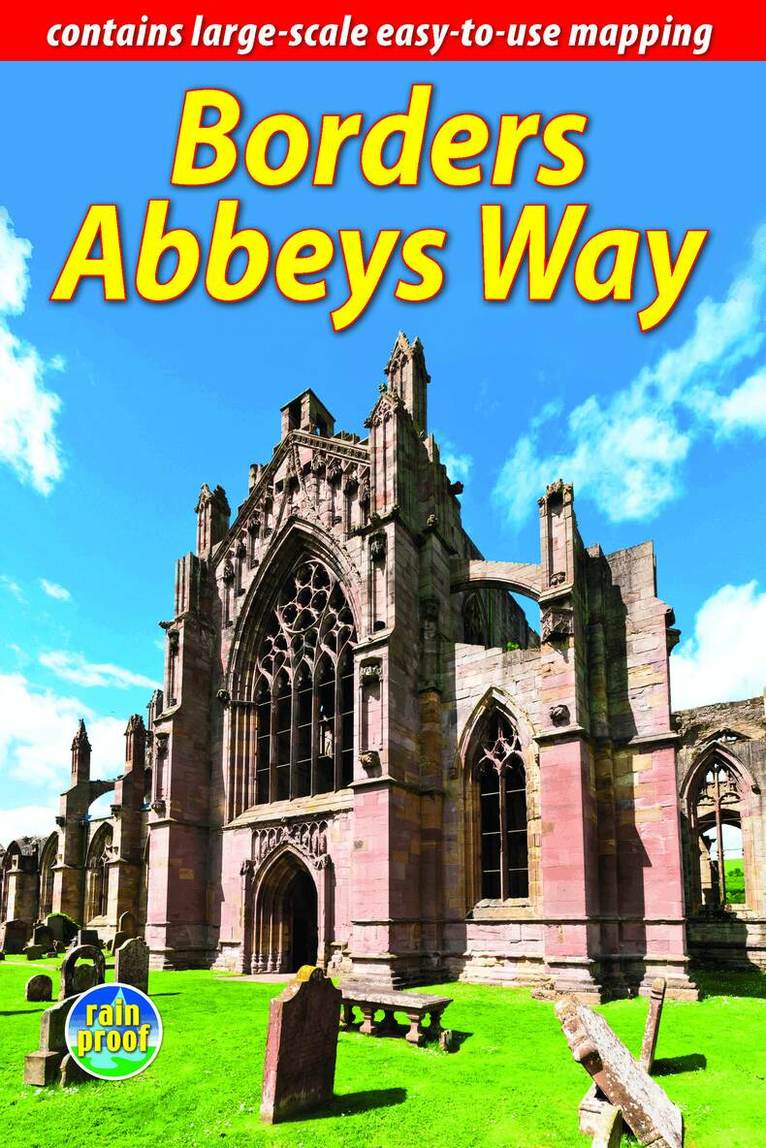
The Borders Abbeys Way is one of Scotland’s Great Trails, a fascinating circuit that takes in the historic ruined abbeys of Melrose, Dryburgh, Kelso and Jedburgh. Within its 68 miles (109 km) it includes also the charming towns of Hawick and Selkirk, and passes Abbotsford House, the historic home of Sir Walter Scott. Much of the terrain is easy-going, beside the Rivers Tweed and Teviot, and the hilly sections offer splendid views. The route is most easily reached by rail from Edinburgh to Tweedbank, near Melrose.This guidebook contains all you need to plan and enjoy your trip:• ten pages of detailed mapping of the route at 1:50,000• detailed route description, plus summaries with distance, terrain and food/drink stops• coverage of the history and architecture of the Borders abbeys• planning information for transport and accommodation• a section about habitats and wildlife, with superb images• lavishly illustrated, with over 70 colour photographs• rucksack-friendly format, printed on rainproof paper.
Häftad, Engelska, 2018
193 kr
Skickas inom 11-20 vardagar
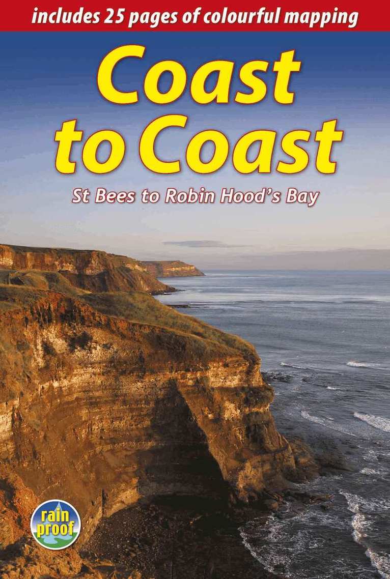
England's most popular walk runs for 184 miles (296 km) across the north of England from St Bees on the Irish Sea to Robin Hood's Bay on the North Sea. It passes through three National Parks - the Lake District, Yorkshire Dales and North York Moors - with fine scenery, welcoming pubs and plenty of accommodation. Devised by the legendary Wainwright, the Coast to Coast attracts walkers worldwide.The new edition is richly illustrated with 150 photographs, many by professional landscape photographer Karen Frenkel. There are 25 pages of colourful new mapping (scale 1:55,000) with cumulative distances, a 25-metre contour interval and points of interest marked. Each section has its own altitude profile, with details of where refreshments are available. Much detail has been added to route descriptions, in many places clarified by extra photographs with custom overlays to clarify route detail. Major route options have been added and mapped, and many updates made. The format is lightweight, robust and rainproof.
Häftad, Engelska, 2019
199 kr
Skickas inom 11-20 vardagar
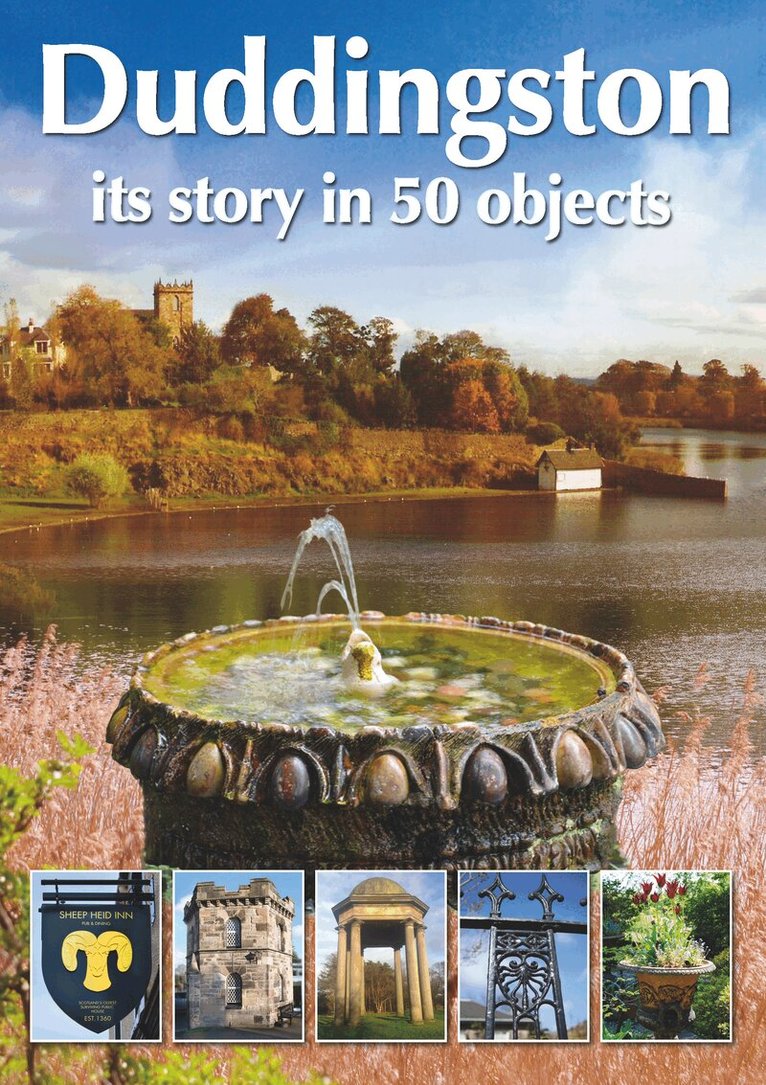
Duddingston is less than two miles from central Edinburgh, the capital of Scotland. Yet it has its own identity, and in 2019 it celebrates 60 years of its own conservation society. It has several outstanding grade-A Listed Buildings, including 12th century Duddingston Kirk and 18th century Duddingston House, and a raft of human stories about its residents. Duddingston is also home to Scotland’s oldest pub the Sheep Heid, Dr Neils 'secret garden' and Edinburgh’s oldest railway, the Innocent. Visitors can enjoy the wildlife of Duddingston Loch and its backdrop Arthur’s Seat, an extinct volcano. This book shows you how easily it can be explored on foot and by public transport.With over 180 photographs, a self-guided walking tour map and concise, readable text, this short book will reveal hidden secrets of a part of Edinburgh known to few.
Häftad, Engelska, 2020
168 kr
Skickas inom 11-20 vardagar
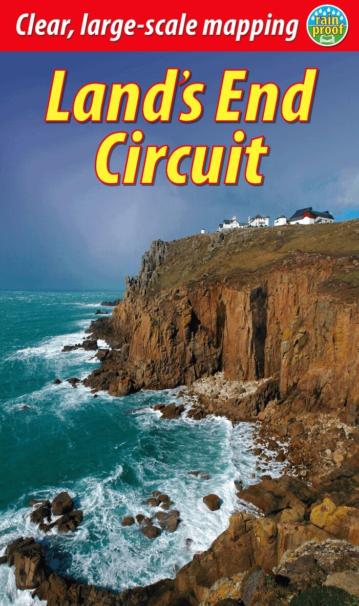
The South West Coast Path is the longest National Trail in the UK, and its full 630 miles is off-putting to most recreational walkers. This carefully selected section from St Ives to Penzance provides a superb taster experience that readily fits inside one week. Enjoy some of the UK’s finest coastal scenery including around Land’s End, its wild south-western extreme. This part of Cornwall is surprisingly accessible by mainline railway, and it offers plenty of charming places to stay and eat. The book includes an option to complete the circuit inland by St Michael’s Way, and also a side-trip by tidal causeway to St Michael’s Mount. The detailed route description is enhanced by background on Cornwall’s geology, history and culture.Lavishly illustrated, the book has 100 colour photos and 15 pages carrying detailed route mapping (1:35,000). It is in a slim pocket-friendly format and, like all Rucksack Reader guidebooks, printed on rainproof paper.

Häftad, Engelska, 2020
156 kr
Skickas
This inspiring 70-mile pilgrim route starts from North Berwick on the Firth of Forth near Edinburgh, and continues via Whitekirk’s 12th century church to Dunbar. It follows the North Sea coastline to the stunning scenery of St Abb’s Head and visits Coldingham Priory, perhaps Scotland’s most important Benedictine monastery. Enjoy impressive cliffs and dramatic sea stacks between visits to historic fishing villages. Cross the border and enter Berwick with its ramparts, walls and bridges across the River Tweed. The route culminates with a barefoot crossing of the Holy Island sands to Lindisfarne, where St Aidan founded a monastery in AD 635.Most people will complete the route within 5 to 8 days, staying in friendly B&Bs along the route, but it can also be done in several shorter expeditions using train and bus. This 72-page guidebook contains all you need to plan and enjoy the Forth to Farne Way:route detail in sections, with distance, terrain and refreshmentswhere to find food and accommodationbackground on the spiritual dimension, geology and wildlifeplanning information for travel by train, bus, car or plane16 pages with detailed route mapping at 1:30,000in full colour, with 80 photographsrucksack-friendly and on rainproof paper.
Häftad, Engelska, 2021
168 kr
Skickas
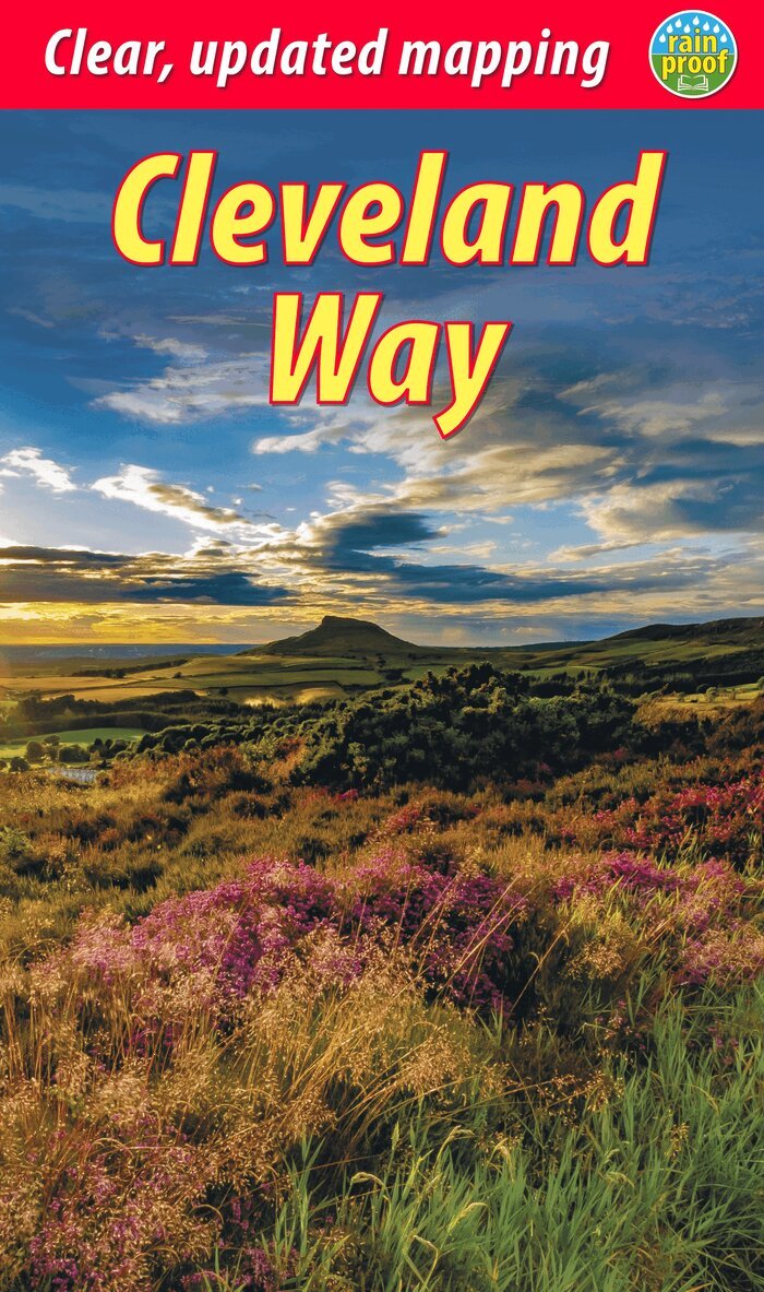
The Cleveland Way is one of England's oldest and best-loved National Trails. It runs for 108 miles (174 km) around the North York Moors National Park, starting inland at Helmsley, offering panoramic views over the vales of York and Mowbray and from the Cleveland Hills. After reaching the coast at Saltburn, it heads south along the dramatic sea cliffs, with their tales of shipwrecks and smugglers, to end at Filey.The route features prehistoric burial mounds, ancient castles, abbeys and Roman remains, with more recent traces of industrial history. Vast areas of heather moorland are host to intriguing wildlife. The Cleveland Way is easily accessible by public transport and is divided into easy stages by villages of character with friendly pubs and accommodation. Above all, the walker is welcomed with warm Yorkshire hospitality.The third edition of this guidebook contains all you need to plan and enjoy your Cleveland Way walk: updated route descriptions, background on geology, pre-history and history, illustrated information about wildlife, mapping of the entire route on 20 pages at 1:40,000, information about public transport and travel. The book is lavishly illustrated, with 100 colour photos and is printed on rain-resistant paper.
Häftad, Engelska, 2021
194 kr
Skickas
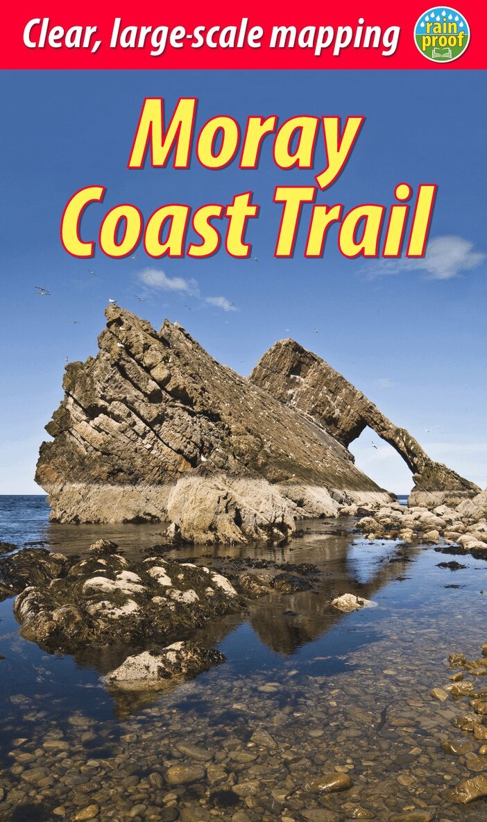
This guidebook describes two contrasting routes in north-east Scotland: the Moray Coast Trail from Forres to Cullen, and the Dava Way, an inland route from Grantown to Forres. The Moray Coast Trail consists of 44 miles of beach walking, coastal paths, quiet roads and old railway. The Dava Way extends for 23 miles inland with vistas of mountain, moorland and farmland. We also introduce the Moray Way, a concept combining most of the above two routes with part of the Speyside Way to form a 95-mile circuit of considerable beauty and historical interest.Here is all you need to plan and enjoy your holiday on and around the Moray Firth:detailed description of the Moray Coast Trail from west to east, and Dava Way from south to northsummaries of distance, terrain and refreshments for each sectiondetails of visitor attractions and side-tripsrichly illustrated habitats and wildlifeplanning information for travel by car, bus and planecontacts for accommodationmaps showing both routes at 1:40,000in full colour, with 75 photographsrucksack-friendly and on rainproof paper.
Häftad, Engelska, 2021
195 kr
Skickas
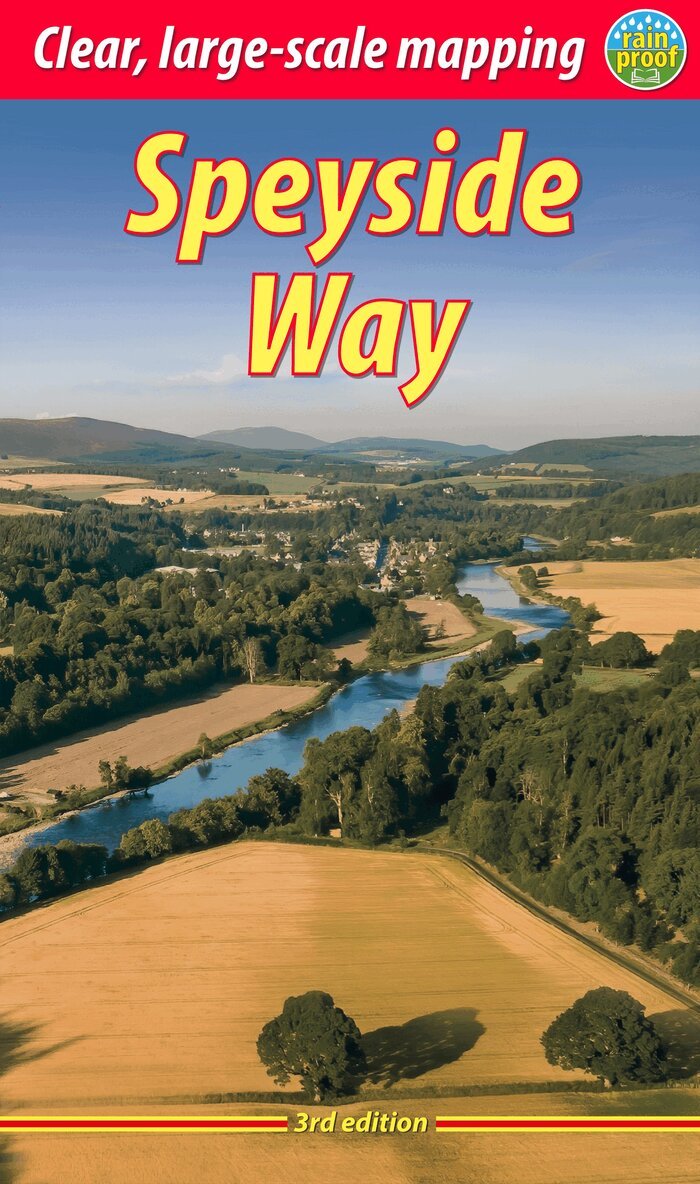
The Speyside Way runs for 85 miles (136 km) from the fishing port of Buckie to Newtonmore in the Cairngorms National Park, with an optional 16-mile spur to Tomintoul via Glenlivet. Following the lovely valley of the River Spey, you walk through countryside rich in malt whisky and wildlife, along riverside paths, railway trackbed and forest and moorland tracks. This fully revised edition of the essential trail guide is based on several field trips in 2021 to research the newly extended route. It has custom mapping at 1:42,500 and plans of villages and towns along the Way. The book contains all you need to plan and enjoy your holiday: detailed mapping of the whole route; the Way step-by-step, with summaries of distance, terrain and refreshment stops; habitats and wildlife, including ospreys, dolphins and wildcats; explanation of whisky-making and distilleries; planning information for travel by car, train, bus or plane; printed on rainproof paper throughout.
Häftad, Engelska, 2022
205 kr
Skickas
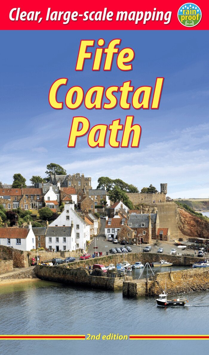
The Fife Coastal Path runs around the coastline of eastern Scotland for 117 miles (187 km) from Kincardine on the Forth to Newburgh on the Tay. Starting west of the famous Forth bridges, the route heads through former mining towns towards the villages of Fife's East Neuk (corner), with their rich tradition of smuggling and fishing. After rounding Fife Ness, the route follows the coastline through St Andrews, golf capital of the world and former religious centre of Scotland.Fife has long played an important part in Scottish history and the route passes many castles, towers and churches. There are splendid views along the coast and over the Firths of Forth and Tay, with great chances to sight seabirds, seals and dolphins. The villages have welcoming pubs, famous fish-and-chip shops and good B&Bs. Transport by train and bus makes for easy access throughout.The guidebook contains everything you need to plan and enjoy your holiday on foot, or on a bike where cycling is appropriate - details of each section showing distance, side-trips and food/drink stops; background on history, landscapes and wildlife; planning information for travel by bus, train, car and plane; lavishly illustrated, with 100 colour photographs; and detailed mapping of the entire route at 1:45,000.This second edition contains many route updates and is in an even lighter, more pocketable format. The book is rugged and printed on rainproof paper.
Häftad, Engelska, 2021
205 kr
Skickas
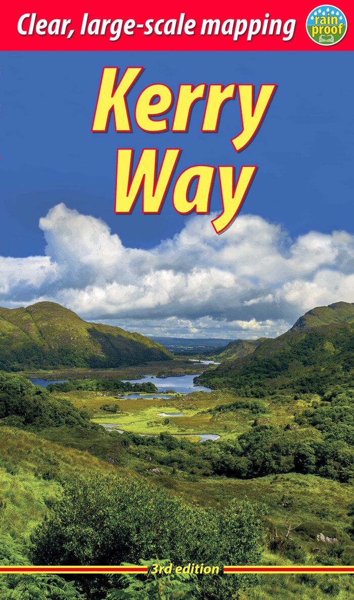
The Kerry Way runs around Ireland's most beautiful peninsula for 130 miles (210 km), starting from Killarney. It features mountain scenery and coastal panoramas, and is rich in geology and wildlife. The book contains large-scale mapping, 100 colour photographs and is robust and rainproof. It has a special feature on the ascent of Carrauntoohil, Ireland's highest peak. This third edition has been fully revised and updated following a comprehensive route check in 2021.
Häftad, Engelska, 2021
205 kr
Skickas
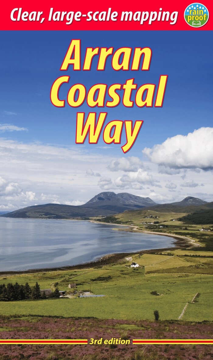
The Arran Coastal Way is perhaps Scotland's finest circular long-distance trail, running 65 miles (105 km) around the Isle of Arran in a memorable week-long hike from Brodick. It's accessible from near Glasgow by the Ardrossan ferry. Famous as`Scotland in miniature', Arran is rich in scenery, castles, caves and standing stones. The walking is varied, from mountain paths to deserted beaches, from minor road-walking to boulder-hopping, and in places it is refreshingly rugged. Arran's wildlife is uniquely approachable, and its residents welcoming. Both text and photos have been thoroughly updated after route changes and extra options created by the Coastal Communities Fund project. This third edition has mapping at 1:55,000 and 125 colour photos. Its predecessor was Highly Commended by the Outdoor Writers and Photographers Guild in 2018. This edition has more pages but is lighter and more rainproof than before.This guidebook contains all you need to plan and enjoy your Arran Coastal Way walk, including a Foreword by wilderness walker Cameron McNeish:detailed description of the route, updated for 2021background on geology, pre-history and historywhisky-making, wildlife and habitatsboat trip to the Holy Islerevised mapping of the entire route (1:55,000)information about public transport and travellavishly illustrated, with 125 colour photographson rainproof paper.
Häftad, Engelska, 2022
180 kr
Skickas
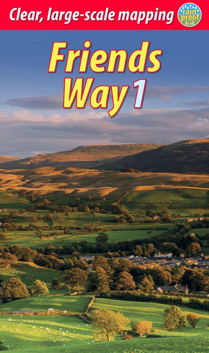
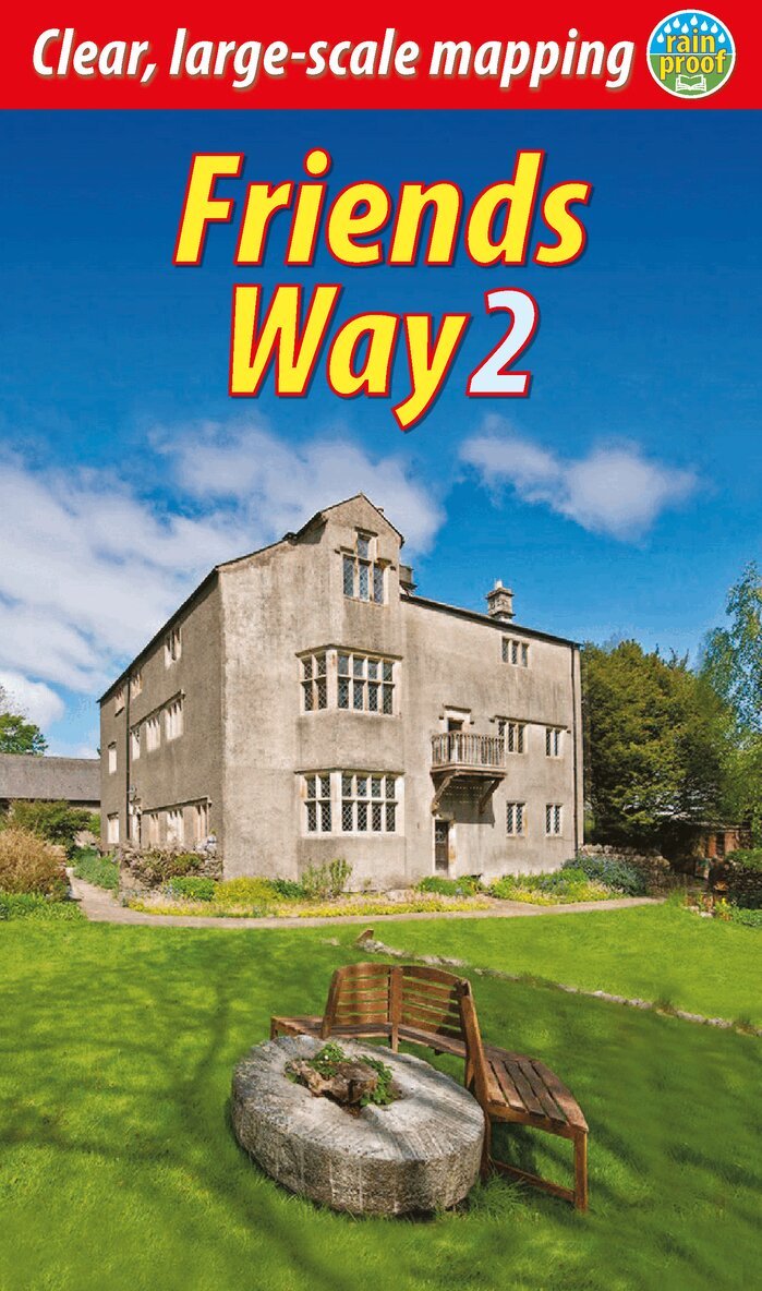
The Friends Way is a grand walk that starts in Barley, Lancashire, passing over the summit of Pendle Hill to and through some of the finest parts of the Yorkshire Dales to end at Sedbergh. It combines glorious scenery with superb wildlife and striking geology, and it also visits many places that were crucial in George Fox’s journey of 1652. He preferred to deliver his sermons outdoors, dismissing churches as ‘steeple-houses’. His long walk and discussions with Seekers and other dissidents were the catalyst for the creation of the Society of Friends, first known as Quakers.From Pendle Hill, where Fox had his vision, to Fox’s Pulpit, where he gave his ‘Sermon on the Fell’ to a crowd of over 1000, the route is steeped in Fox’s personal journey. This 62-mile Way ends at Sedbergh, a town rich in Quaker heritage, to be followed by two day-walks, one a circuit that takes in Fox’s Pulpit. The whole route can be completed comfortably inside one week. It will appeal not only to all Quakers who enjoy walking, but also to those walkers who don’t yet know the remarkable story of Fox’s 1652 journey and life.The guidebook is richly visual, with mapping at 1:35,000 on 17 of its pages and nearly 140 colour photos. It is robustly bound and printed on rainproof paper.
Häftad, Engelska, 2023
181 kr
Skickas
The Friends Way route will appeal not only to all Quakers who enjoy walking, but also to those walkers who don’t yet know about Margaret Fell's remarkable story. This volume, a sequel to Friends Way 2, continues the route from Sedbergh to Swarthmoor Hall near Ulverston. After George Fox reached Swarthmoor Hall, he deeply impressed Margaret Fell (1614-1702) with his radical ideas. She later became a committed Quaker who was imprisoned for her beliefs, and also his wife. She worked tirelessly to organise the movement, to lobby for releasing prisoners of conscience and to spread the Quaker word by publishing letters.This book covers her journey from mistress of Swarthmoor to mother of Quakerism, as well as devoting a section to Swarthmoor Hall which was and is the most important centre of Quakerism in northern England. The route takes in major Quaker sites in Sedbergh and Kendal en route to Swarthmoor Hall, and it can comfortably be completed inside one week.
Häftad, Engelska, 2024
192 kr
Skickas
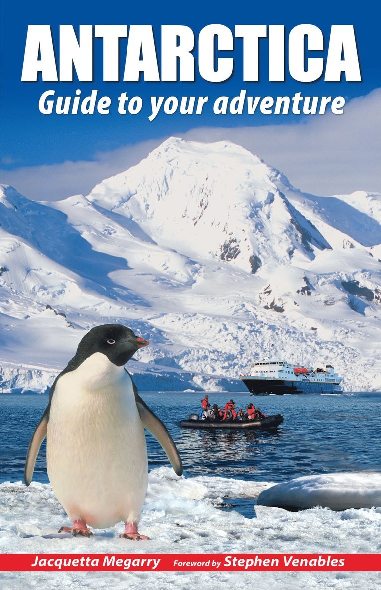
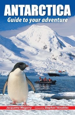
To people who haven’t been there, Antarctica seems remote, extreme and perhaps even forbidding. Yet everybody who has visited comes back full of enthusiasm, with amazing memories and stunning photos. The author inspires interest in this amazing place while encouraging responsible, informed and sustainable tourism.She helps you to decide where and when to go, whether to include South Georgia and/or the Falklands, how to read between the lines of an itinerary, which operator to book with and what size of ship will suit you best. She provides practical information about weather, clothing and photography, and gives links to useful websites and further reading. She covers various specialist options from sea kayaking to camping on the ice.The wildlife section is lavishly illustrated with photos of creatures ranging from tiny krill through seabirds and penguins to seals, dolphins and whales with their amazing adaptations. Understanding their breeding cycles helps you to anticipate what you will see at different times of year. Specially commissioned mapping lets you understand the trade-offs between different itineraries. Graphics and over 100 colour photos support the concise text which is informed by the author’s personal experiences.Antarctica’s ice cap stores 90% of the world’s freshwater ice, and it is a crucial place for climate monitoring and other scientific research. The author explains the 1959 Antarctic Treaty, and the Madrid and Montreal Protocols, and their implications both for the continent and for visitors on cruise ships. She interprets the formation of icebergs and glaciers, how the climate varies over different parts of Antarctica and how Antarctic ice affects sea levels.The guide covers the history of Antarctica’s discovery and exploration, not only the Scott/Amundsen famous race to the South Pole and Shackleton’s extraordinary rescue, but also the less-known achievements of Douglas Mawson. The story is updated with the Jarvis recreations of Mawson’s and Shackleton’s famous journeys, and the discovery of the Endurance shipwreck, 107 years after the ship was crushed and sank.Use this book to plan your adventure of a lifetime, but be warned: many who visit Antarctica end up trying to return.
Häftad, Engelska, 2022
193 kr
Skickas
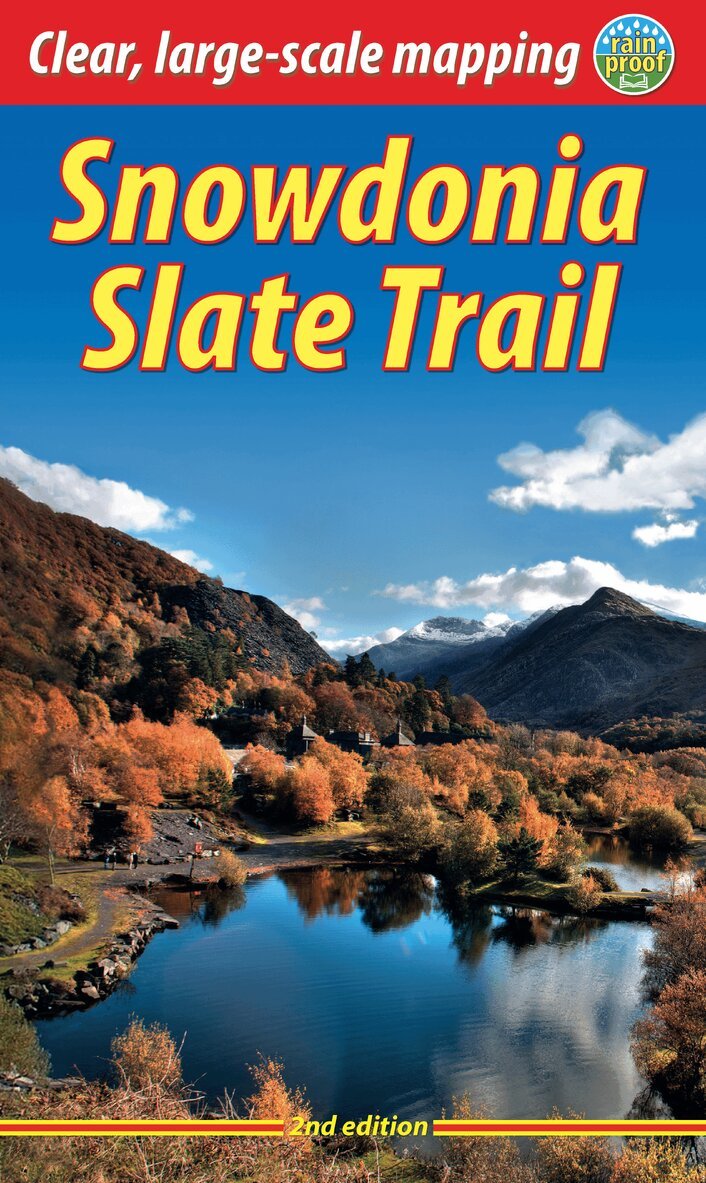
The Snowdonia Slate Trail is a waymarked trail that runs for 83 miles from Bangor on the North Wales coast, making a circuit through the heart of Snowdonia to end at Bethesda. The trail joins up villages with a choice of welcoming accommodation. The walking is varied, ranging from easy valleys to mountain passes, from wild moorland to river gorges.Highlights include the National Slate Museum of Wales, stunning views of Snowdon and nearby mountains, and abandoned slate villages high in the hills. The trail also passes the Penrhyn quarry with its impressive galleries of slate crossed by the longest, fastest zip-wire in Europe.This guidebook is in rucksack-friendly format and printed on rainproof paper. Lavishly illustrated with 95 colour photos, it contains large-scale mapping and all you need to plan and enjoy your holiday:14 pages with clear mapping of the route at 1: 40,000practical information about public transport and travelsection with inside knowledge on how best to climb Snowdondetailed route descriptions including where to find refreshments and accommodationbackground on the slate industry heritage, the ‘Great Little Trains of Wales’ and wildlife.
Häftad, Engelska, 2023
192 kr
Skickas
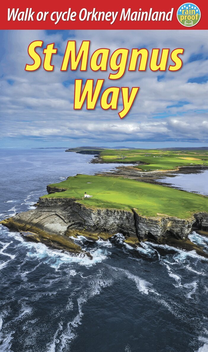
Orkney is Scotland’s best-kept secret: a supreme outdoor destination that is more accessible than you expect, by ferry or plane. It offers world-class prehistory, approachable wildlife and welcoming Orcadian hospitality.This pilgrimage walk celebrates Orkney’s patron saint, Magnus, some 900 years after his martyrdom. The 60-mile St Magnus Way has it all: manageable daily distances, stunning coastal vistas, unique wildlife, tidal islands, historic interest and great variety of terrain. It starts from the site of Magnus’ martyrdom on Egilsay and culminates at his cathedral in Orkney’s capital Kirkwall.For cyclists, the 67-mile (108 km) St Magnus Cycleway visits the same places as the Way. However it runs almost wholly on tarmac and is readily split into two circuits of 27 and 40 miles respectively (44 km and 64 km respectively).This essential trail guide contains all you need to plan your visit on foot or bike:Foreword by Magnus Linklaterbiography of St Magnus and his cathedralplanning info for travel by car, ferry and planerichly illustrated sections on history, geology and wildlifevisit info for museums, distilleries and the World Heritage Siteconcise step-by-step directions14 pages with route mapping at 1:30,000in full colour, with 101 photos.
Häftad, Engelska, 2023
224 kr
Skickas
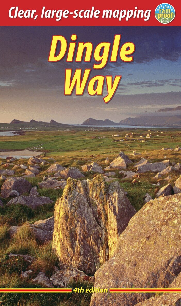
The Dingle Way runs for 114 miles (183 km) around the beautiful Dingle Peninsula. It starts and finishes in Tralee, accessible by train or bus from Dublin and from Kerry Airport. The complete walk takes eight days, but it can easily be shortened. The Dingle Way follows country lanes, quiet roads and cliff-top paths, punctuated by long stretches of glorious beach walking. It offers spectacular seascapes and mountain views. The peninsula is rich in wildlife, archaeology and charming Irish pubs.This guidebook was fully revised for 2023 with route updates, improved mapping and additional Gaelic place names. It contains all you need to plan and enjoy your holiday on the Dingle Way: the Way in sections, with summaries of distance, terrain and where to find food and drink; concise background on prehistory, heritage and wildlife; information about climbing Mount Eagle and Mount Brandon; a special feature on the Blasket Islands; planning information for travel by car, train, bus or plane; detailed mapping of the Dingle Way on 16 pages (scale 1:55,000); in full colour, with 75 photographs; and printed on rainproof paper throughout.
Häftad, Engelska, 2023
205 kr
Skickas
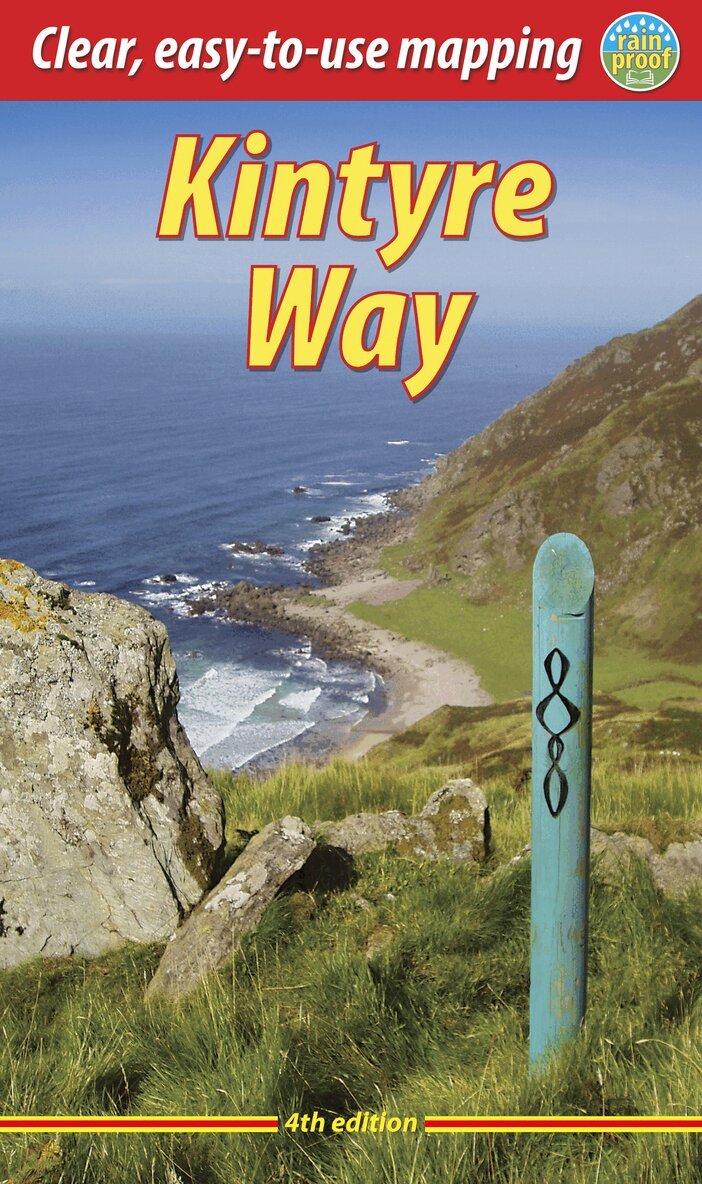
This fully waymarked trail runs for 101 miles/162 km southward from the beautiful natural harbour of Tarbert to Macrihanish, near the Mull of Kintyre. Criss-crossing the entire peninsula, you pass castles, abbeys and prehistoric remains, sometimes walking along rugged coastline, sometimes high on forestry tracks with glorious views over Arran, the Firth of Clyde and towards Ireland. You will enjoy many wildlife sightings in this peaceful area, famous as Scotland only "mainland island". Since it opened (2006) the route has changed in places. The 2023 edition of this essential guidebook contains all you need to plan and enjoy your holiday: 11 pages with mapping showing the whole route (1:70,000); the Way step-by-step, with summaries of distance, terrain and refreshment stops; habitats and wildlife; whisky-making in Kintyre; side-trip to the island of Gigha; and planning information for travel by car, ferry, bus and plane. The book is printed on rainproof paper throughout, and has over 90 colour photographs.
Häftad, Engelska, 2023
190 kr
Skickas
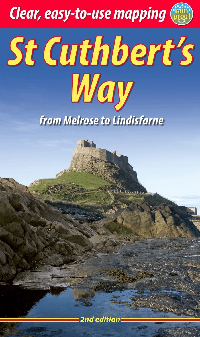
Follow the footsteps of St Cuthbert in this easy-going walk of 63 miles (101 km) from Melrose Abbey in the Scottish Borders to the Holy Island of Lindisfarne in Northumberland. St Cuthbert’s Way is one of Scotland’s Great Trails, and it is also one of England’s great trails. Starting from the ruins of Melrose Abbey, it winds alongside the River Tweed, and after about 31 miles you walk across the border into England on high ground. The Way includes a section of Roman road and passes castles, hill forts and historic ruins along the way. Most people will complete it comfortably within 5 or 6 days.Its summit is Wideopen Hill (369m/1210ft), and its barefoot finale is the Pilgrim Way to Lindisfarne with its priory and castle. The route is fully waymarked, the gradients are modest and it has welcoming B&Bs and pubs at strategic intervals. This second edition was thoroughly revised in 2023 and it contains custom mapping at 1:40,000 and many post-Covid updates. It is bound in our lighter, pocket-friendly format and printed on rainproof paper.
Häftad, Engelska, 2023
217 kr
Skickas
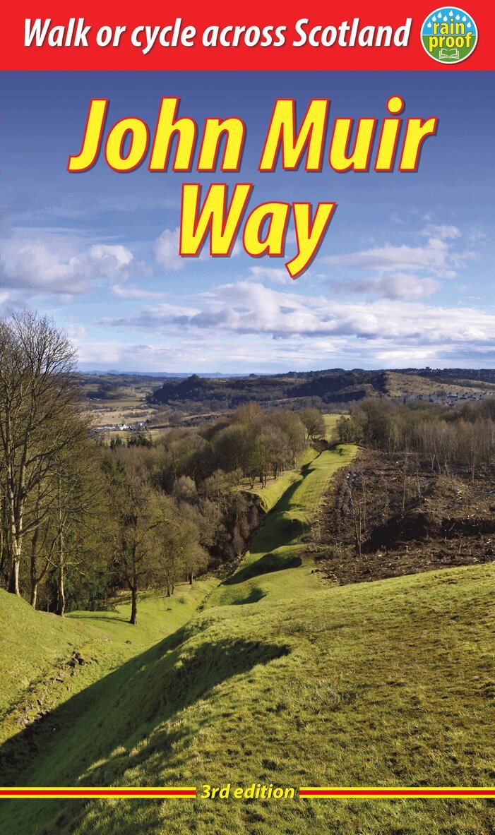
The John Muir Way is one of Scotland’s Great Trails. It runs for 134 miles (215 km) coast-to-coast across central Scotland, from Helensburgh on the Clyde to Dunbar on the North Sea. The route is as suitable for cyclists as for walkers, and it can be tackled as a coast-to-coast expedition or in sections – typically ten for walkers or five for cyclists.Our all-new 2023 third edition includes the latest route updates and features improved mapping with mileage markers along the route and a km grid. The mapping is at 1:75,000 and appears on 20 of its pages. It contains new material and despite having more pages is lighter and more pocketable than the previous edition thanks to perfect binding. It has many fresh photos and the new cover features the Antonine Wall from Bar Hill Fort.The John Muir Way’s appeal ranges from the Charles Rennie Mackintosh architecture of Helensburgh through the scenic grandeur of Loch Lomond, along two famous canals and past the amazing Falkirk Wheel, beside the Roman Antonine Wall, passing Linlithgow Palace, Blackness Castle and the Forth Bridges to the capital glories of Edinburgh. It goes beside the Firth of Forth to reach North Berwick, then heads inland to finish at Dunbar with its ruined castle and the John Muir birthplace.
Häftad, Engelska, 2023
205 kr
Skickas
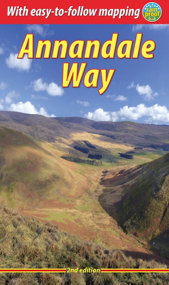
The Annandale Way is a charming long walk in a little-known, but very accessible, part of southern Scotland. Walked southward from source to the sea, it starts in the sheep town of Moffat, and runs for 56 miles (90 km) via Lochmaben, with superb views from the top of Almagill Hill. A slightly shorter branch of the route goes via Lockerbie and Eskrigg Nature Reserve. The two branches rejoin north of Annan to reach the Solway Firth at Newbiebarns.The second edition contains several important route updates, four extra pages and many fresh photos, yet it is 20 grams lighter and more pocketable than the first.This guidebook contains everything you need to plan and enjoy your trip:detailed route description for walking from north to southconcise instructions for those wishing to walk south to northsummary of each section showing distance, terrain and food/drink stopsbackground on the history and economy of Annandaleseven pages of habitats and wildlife with superb imagesplanning information for transport and accommodationnine pages of detailed mapping of the route at 1:44,000lavishly illustrated, with over 110 colour photosrucksack-friendly format, printed on rainproof paper.
Häftad, Engelska, 2024
205 kr
Skickas
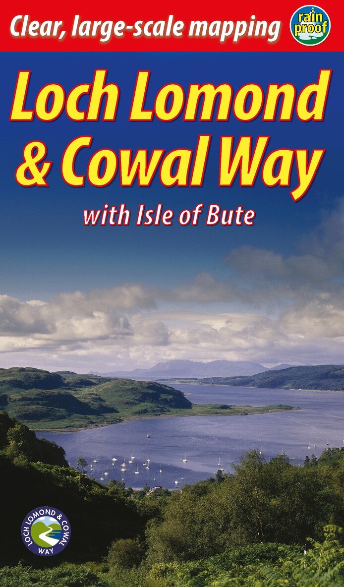
"Lavishly illustrated guidebook with route map plus practical information" - Scots MagazineThe Loch Lomond & Cowal Way is one of Scotland's Great Trails. It runs for 57 miles (91 km) across the Cowal peninsula, which lies west of Glasgow and is easily reached by public transport, road and ferry. The route starts at Portavadie on Loch Fyne and ends at Inveruglas on Loch Lomond.The trail is waymarked and undulating, with rugged terrain and glorious views over the Isle of Bute and the Firth of Clyde. The area is rich in history and heritage, with wildlife sightings including red squirrel, red deer and golden eagle.Cowal has ferries to Bute, to Kintyre and (in season) across Loch Lomond to join the West Highland Way. It’s the missing link that enables Scotland’s ultimate long-distance walk, from Kintyre all the way to Inverness.In 2018 the route’s name was extended to Loch Lomond & Cowal Way to reflect the fact that over 50% of it runs within the Loch Lomond & Trossachs National Park. This new edition updates the guidebook of that name and contains many new photographs.
Häftad, Engelska, 2024
190 kr
Skickas
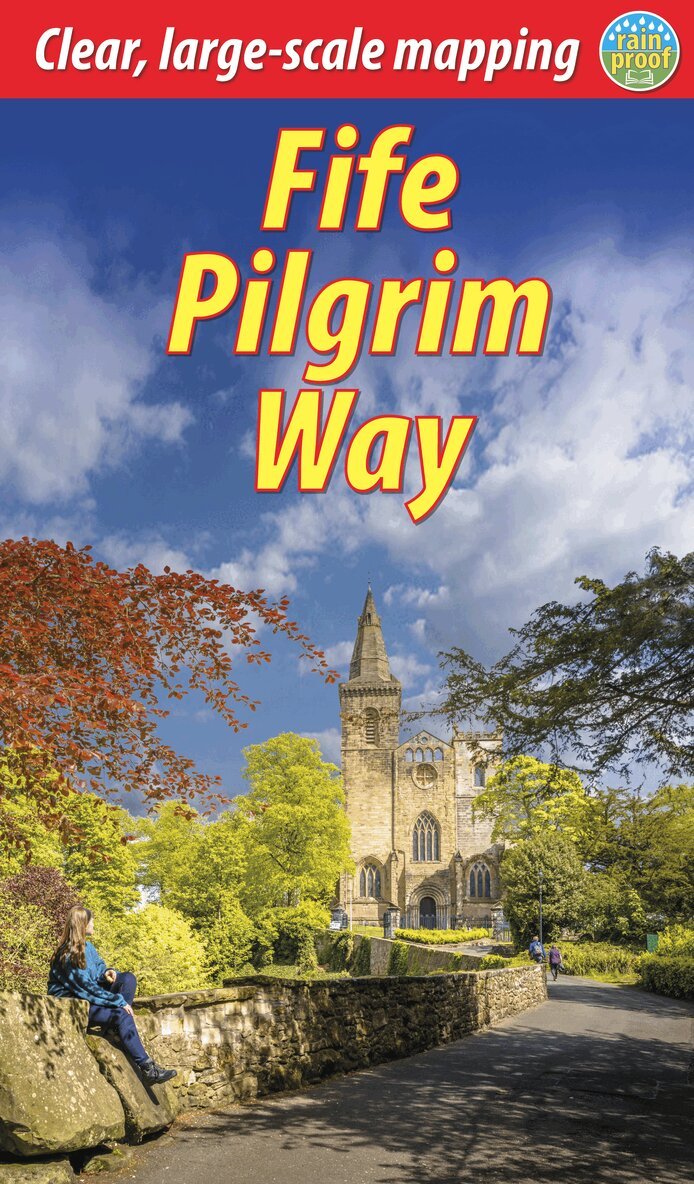
This pilgrimage walk runs for 56 miles (91 km) from the Firth of Forth via Dunfermline Abbey to the famous pilgrim destination of St Andrews. It is rich in industrial heritage, passing through mining communities, along disused railways and passing castles. Above all, it celebrates Fife’s pilgrim kingdom and history through many churches and religious sites.Start from either the historic village of Culross or the pilgrim landing at North Queensferry, and make your way across the heartlands of Fife. The route has fine scenery and passes through country parks, native woodlands and river valleys rich in wildlife. Most walkers will need 5-6 days to complete the journey.Cyclists with mountain or gravel bikes can enjoy most of the route in most conditions, but in some circumstances – where the ground is very wet or the path too narrow – they may need to dismount. Most cyclists will want 2-3 days to complete the route.The guidebook features step-by-step directions with detailed mapping, and illustrated sections on history, heritage and wildlife. It directs readers to side-trips, refreshments and accommodation along the way. Lavishly illustrated, the book features custom mapping at 1:40,000 on 16 of its pages and has 108 colour photos.
Häftad, Engelska, 2024
205 kr
Skickas
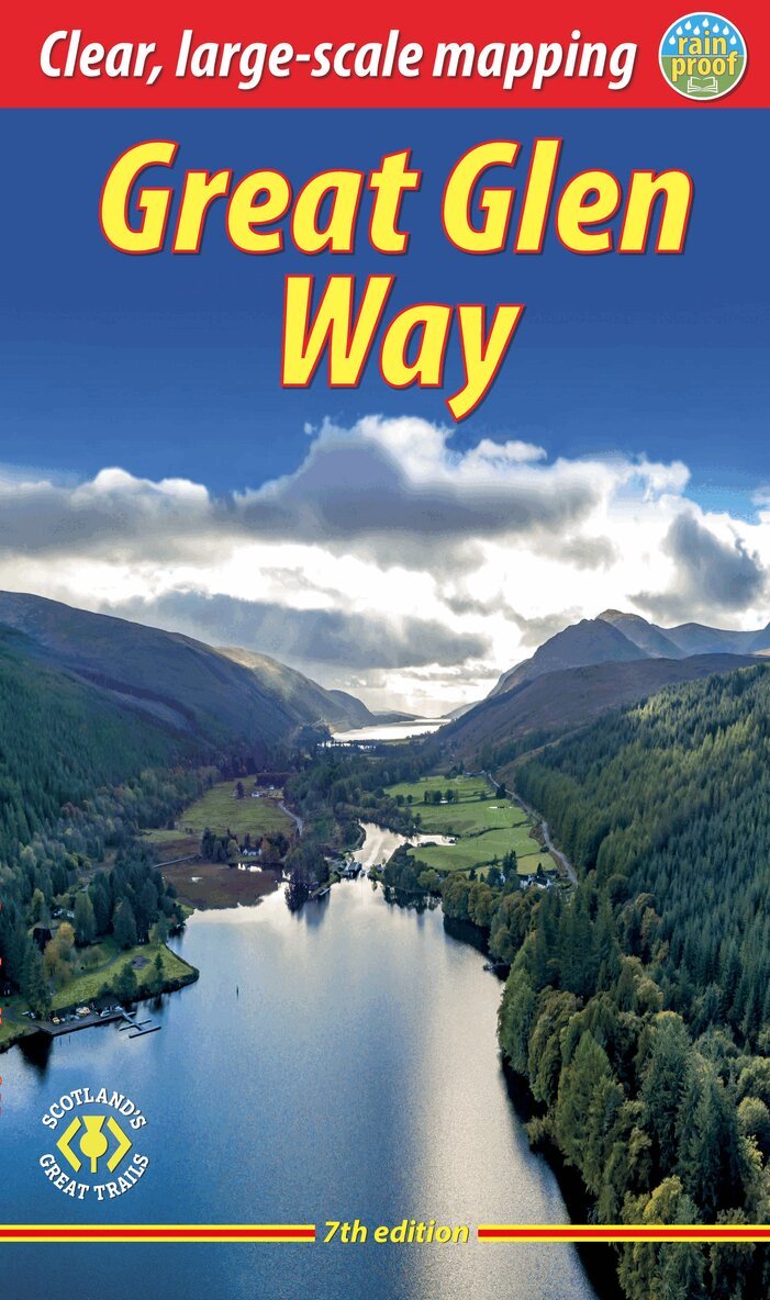
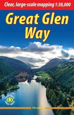
This guidebook (fully updated in 2024) contains all you need to plan and enjoy a holiday walking or cycling along Scotland's historic Great Glen (77 miles/124 km). The Way runs between Fort William and Inverness, passing beside Scotland's highest mountain, along its historic Caledonian Canal and alongside beautiful lochs, including Loch Ness with its famous monster legend and Urquhart Castle.This seventh edition covers all route options including the newly opened Abriachan section of High Route as well as details of the route changes that apply during 2024 and 2025 because of the closure of Loch Oichside and the High Route beyond Fort Augustus.Here is all you need to plan and enjoy the Great Glen Way – on foot or on a bike:detailed mapping on 13 pages at 1:38,000 with relief contours and colouringhill and mountain side-trips including Ben Nevisbackground on canal heritage, clan history and wildlifedetailed description for each section with points of interest and mileage referencessummaries showing distance, terrain, food/drink stops and altitude profileplanning information for walkers and cyclists, with travel to/from the routetown plans of Fort William and Invernessin full colour, with 100+ photosrucksack-friendly and on rainproof paper throughout.
Häftad, Engelska, 2024
205 kr
Skickas
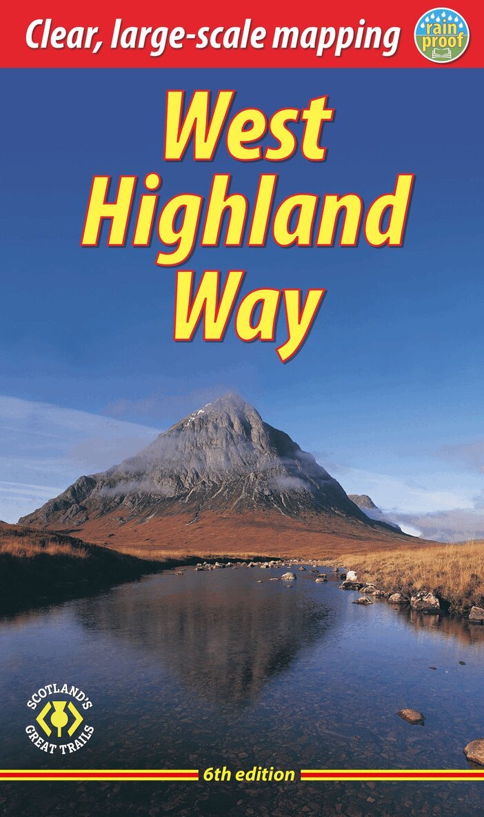
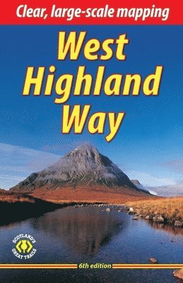
The West Highland Way is Scotland's most popular long-distance walk, running 96 miles (155 km) from Glasgow, Scotland's largest city, through its first National Park, across the western Highlands to the foot of its highest mountain, Ben Nevis. This sixth edition of the popular rucksack-friendly guidebook has been revised for 2024 with various updates. It contains all you need to plan and enjoy one of the world's finest walks. It includes detailed route descriptions with altitude profiles; background on Loch Lomond, history and wildlife; detailed mapping of the entire route at 1:42,500; practical information about transport and travel; lavishly illustrated with 120 colour photos; and printed on rainproof paper.
Häftad, Engelska, 2024
332 kr
Skickas inom 3-6 vardagar
Häftad, Engelska, 2024
208 kr
Skickas
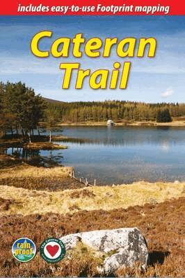
The Cateran Trail is one of Scotland’s Great Trails – a circuit of 64 miles (104 km) starting in Blairgowrie, near Perth, following in the footsteps of cattle-rustlers (caterans). This waymarked Trail follows ancient paths through glens, mountains and farmland of Highland Perthshire, with fine scenery, heritage and wildlife. The nearest village is never more than 7 miles (11 km) away, and gradients are easy to moderate. The Trail can be completed comfortably within 4-5 days, and several route variants are described, including the option for a weekend Minitrail.Our updated third edition includes 35 fine images from professional photographer Mike Bell. Its detailed mapping is at 1:50,000 and has been updated for 2024, as have all route descriptions and other information.
Häftad, Engelska, 2024
327 kr
Skickas inom 3-6 vardagar
Häftad, Engelska, 2024
326 kr
Skickas inom 3-6 vardagar
Letar du efter digitala böcker?
E-böcker och ljudböcker handlar du än så länge på vår tidigare sajt.