
Visar resultat för..."Trailblazer Publications"
41 produkter
41 produkter
Häftad, Engelska, 2023
191 kr
Skickas
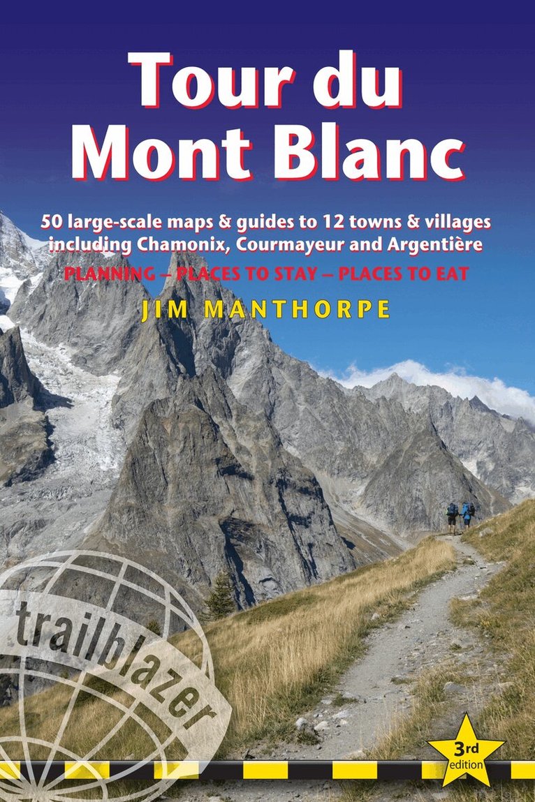
All the information you need to enjoy your mountain trail adventure At 4810m (15,781ft), Mont Blanc is the highest mountain in western Europe, and one of the most famous mountains in the world. The trail (105 miles, 168km) that circumnavigates the massif, passing through France, Italy and Switzerland, is the most popular long distance walk in Europe. The Trailblazer Tour du Mont Blanc guide Includes:60 maps - 12 town and village plans and 50 large-scale walking maps - at 1:20,000 - showing route times, gradients, where to stay, interesting features. Walking directions, tricky junctions, places to stay and eat, points of interest and walking times are all written onto the maps themselves in the places to which they apply. With their uncluttered clarity, these are not general-purpose maps but fully-edited maps drawn by walkers for walkersItineraries for all walkers - whether walking the 105 mile (168km) route in its entirety, or sampling the highlights on day walks and short breaksPractical information for all budgets - where to stay (campsites, gites, hostels, B&Bs, lodges and hotels), where to eat, what to seeComprehensive background information - the Alps, flora and fauna, the history of mountaineering and trekking in the region and the conquest of Mont Blanc in 1786 by Bourrit and BalmatFull public transport information - for all access pointsClimbing Mont Blanc - practical information, guides, the route to the top
Häftad, Engelska, 2022
174 kr
Skickas
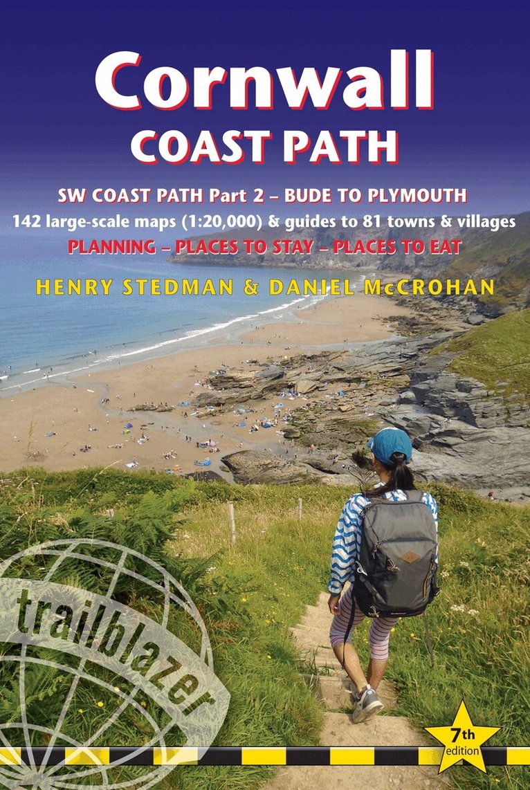
All the information you need to enjoy your hiking adventure along the South West Coast Path in this fully revised and updated 7th edition.Trailblazer's Cornwall Coast Path Walking Guide is a practical, complete hiking route guide, with maps and accommodation for the 288-mile footpath that runs around the entire coastline of Cornwall from Bude to Plymouth. The Cornwall Coast Path is part 2 of the South-West-Coast Path, a 630-mile National Trail from Minehead to Poole.The Trailblazer guide to the Cornwall Coast Path includes:142 large-scale walking maps in two-colour style (3 1/8inches to 1 mile), 15 town plans, guides to 81 towns and villages, 24 stage maps and overview mapItineraries for all walkers - whether walking the route in its entirety over a week to 10 days or sampling the highlights on day walks and short breaksGPS waypointsPractical information for all budgets - camping, bunkhouses, hostels, B&Bs, pubs and hotels; where to stay, where to eat, what to seeComprehensive public transport information - for all access points on the coast pathFlora and fauna - 6 page full colour, flower, butterfly, bird guideGreen hiking - understanding the local environment and minimizing our impact on itPlus extra colour sections: 16pp colour introduction and 21pp of colour mapping for stage sections (one stage per page) with trail profiles, and colour overview mapAlso includes the route across the North Devon border, Hartland Quay to Bude
Häftad, Engelska, 2025
299 kr
Skickas
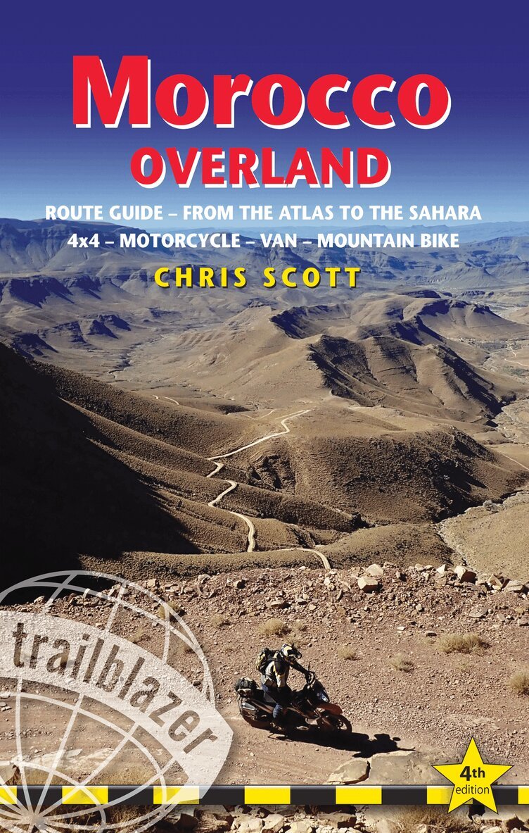
Fully updated and including new routes, this full-colour 4th edition of Morocco Overland is a route guide to exploring southern Morocco’s spectacular landscapes – from the snow-clad Atlas Mountains to the dunes of the Saharan fringe. This is a major update: the route guide has now been divided into eight regions. All the routes have been verified, loads of new ones have been discovered and logged, and there are over 20 new maps outlining scores of exciting trails (nearly double the previous edition) spanning 250,000 km² across southern Morocco’s fabulous mountains and deserts.With easy-to-follow routes ranging from sub-alpine trails to arid canyons winding past hidden Berber villages, and from the Atlantic surf to former Dakar Rally pistes, this comprehensive route and planning guide will appeal to both first timers and the seasoned adventurer.68 detailed routes and dozens more tracks covering over 20,000kmOff-road routes for 4x4s, motorcycles and mountain/gravel bikesScenic byways suitable for all vehicles including campervansOver 40 pages of colour mappingExpert guidance on the choice and preparation of 4x4s, 2WDs, motorcycles and MTBsOff-roading techniquesAdvice on getting to Morocco including cross-country routes, ferries, immigration procedures, fly-drive for 4x4 and bike rentalsRoute guide with downloadable GPS waypoints and each route is graded for suitability for big motorcycles and mountain bikesIncludes fuel stations and selected restaurants and places to stayAfter three years and 25,000 kilometres in five 4x4s and seven bikes, here is the 4th edition of Morocco Overland. Whether in your own van, 4x4, 2 wheel-drive, on a motorcycle or a gravel bike, or are flying in to rent locally, Morocco Overland covers everything the regular travel guidebooks miss out to help make the most of your adventure in southern Morocco.
Häftad, Engelska, 2022
144 kr
Skickas
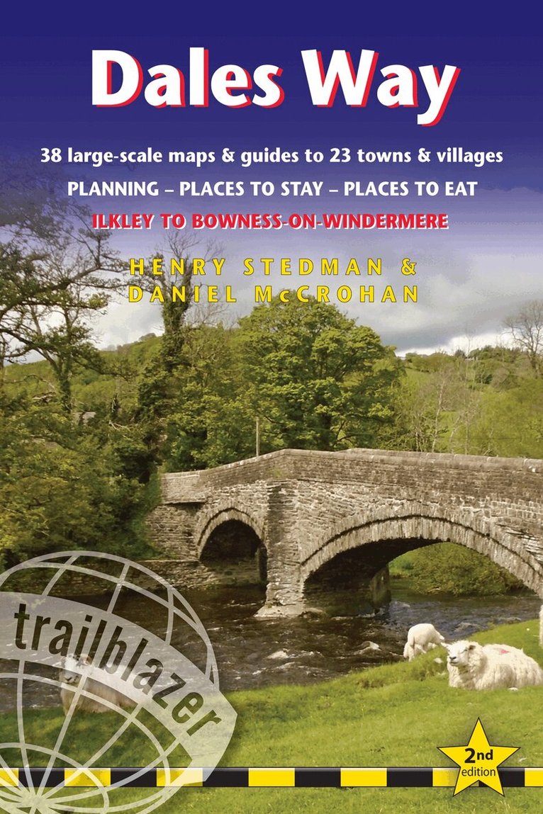
All the information you need to enjoy your hiking adventure along the Dales Way in this fully revised and updated 2nd edition. Enjoy the Dales Way with this all-in-one guide to walking the long distance footpath from Ilkley, West Yorkshire, through the Yorkshire Dales National Park, for 84 miles (135km) to end in the Lake District, in Bowness-on-Windermere.New edition re-researched and rewritten, with maps redrawn in new two-colour styleIncludes 38 detailed walking maps, the largest-scale maps available - At just under 1:20,000 (8cm or 3 1/8 inches to 1 mile) these are bigger than even the most detailed walking maps currently available in the shopsUnique mapping features - walking times, directions, tricky junctions, places to stay, places to eat, points of interest. These are not general-purpose maps but fully edited maps drawn by walkers for walkersItineraries for all walkers - whether hiking the entire route or sampling highlights on day walks or short breaksDetailed public transport information - for all access pointsPractical information for all budgets. What to see, where to eat (cafes, pubs and restaurants); where to stay (B&Bs, hotels, bunkhouses, hostels & campsites)
Häftad, Engelska, 2026
180 kr
Skickas
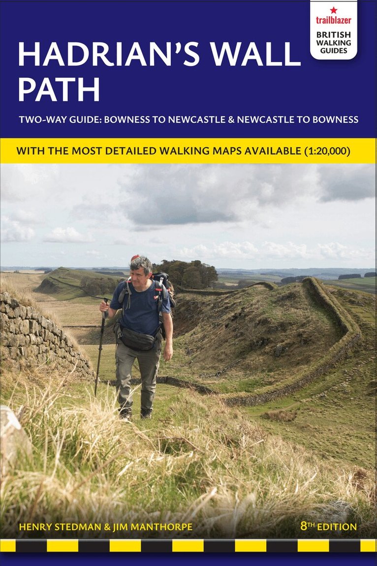
All-in-one guide to walking Hadrian's Wall Path National Trail now in its 8th edition, re-walked and fully updated. Two-way edition with routes re-walked from Bowness-on-Solway to Wallsend (Newcastle) and Wallsend (Newcastle) to Bowness-on-Solway. Hadrian's Wall Path, 84 miles from end to end, follows the course of northern Europe's largest surviving Roman monument, a 2nd-century fortification built - in the border country between England and Scotland - on the orders of the Emperor Hadrian in AD122. Opened in 2003, the path crosses the beautiful border country between England and Scotland. It is the first National Trail to follow the course of a UNESCO World Heritage Site. This week-long walk is regarded as one of the least challenging National Trails. This 8th edition has been re-walked and fully updated.Printed in two-colours - follow east to west or west to east directions8 town plans and 59 large-scale walking maps - at just under 1:20,000 - showing route times, places to stay, points of interest and much moreIncludes 8 stage maps and 2 overview mapsItineraries for all walkers - whether walking the route in its entirety over seven to eight days or sampling the highlights on day walks and short breaksPractical information for all budgetsWhere to stay with reviews - camping, bunkhouses, hostels, B&Bs, pubs and hotelsWhere to eat with reviews - cafes, pubs, tea-shops, restaurants, takeaways and shops/supermarketsWhat to see - historical, cultural, geographical informationDetailed street plansComprehensive public transport information - for all access points on the Hadrian's Wall PathFlora and fauna - four page full colour flower guide, plus an illustrated section on local wildlifeGreen hiking - understanding the local environment and minimising our impact on itNewcastle city guideGPS waypoints and what3words references - also downloadable from the Trailblazer website16 pages of colour mapping for stage sections (one stage per page) with trail profiles
Häftad, Engelska, 2025
168 kr
Skickas
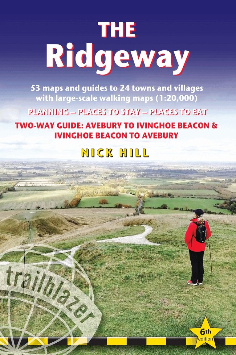
The go-to, all-in-one guide to walking The Ridgeway path.Running from Wiltshire to Buckinghamshire, in southern England, this ancient trackway is Britain's oldest road. In this fully revised and updated, two-way edition all routes have been completely rewalked in both directions from Avebury to Ivinghoe Beacon near Aylesbury and Ivinghoe Beacon to Avebury.Coverage includes: Marlborough, Avebury, West Overton, Avebury Stone Circle, Kennett and East Kennett, Foxhill, Liddington, Wantage, Bishopstone, Ashbury, Woolstone, Uffington, Goring, Streatley, Wallingford, Crowmarsh Gifford, Watlington, Princes Risborough, Tring, Ivinghoe BeaconIn this guide you will find:53 detailed walking maps - the largest scale maps available - at just under 1:20,000 (8cm or 31/8 inches to one mile) these are bigger than even the most detailed walking maps currently available in the shopsUnique mapping features – walking times, directions, tricky junctions, places to stay, places to eat, points of interest. These are not general-purpose maps but fully edited maps drawn by walkers for walkersItineraries for all walkers – whether hiking the entire route or sampling highlights on day walks or short breaksDetailed public transport information for all access pointsPractical information for all budgets – what to see; where to eat (cafés, pubs and restaurants); where to stay (B&Bs, hotels, hostels, bunkhouses and campsites)Downloadable GPS waypoints
Häftad, Engelska, 2015
178 kr
Skickas
Fully revised and updated 3rd edition of the indispensable guide for anyone planning (or dreaming) about taking their bicycle on a long-distance adventure. This comprehensive guide will make that dream a reality whether it's cycling from Alaska to Tierra del Fuego, across Asia, around Australia or the length of Africa.Contents includes:Part 1 Planning and preparation: What kind of ride? Seasons Budget and time Companions Researching information Documentation Visas Insurance Money HealthPart 2 Bikes, Clothing & Camping Gear: Narrowing down your bike choices - Frame material and component options - Top touring bikes Comfort zone Tools and spares - Carrying luggage How much stuff? Bikepacking setup; Clothing Footwear; Camping Tents Sleeping bags and mats Stoves Treating water Kitchen essentials Electronic devicesPart 3 On the road: Transporting your bike Navigating Staying in touch Health Hygiene Staying Safe Dirt-road ridingPart 4 Route Outlines Europe to Asia & Australasia Practical information and touring tips for: Europe Southern route through Turkey, Iran and Pakistan Indian subcontinent Caucasus Central Asia Northern route through Russia & Mongolia East Asia South East Asia Australasia.Part 5 Route Outlines Africa Practical information and touring tips for: the Nile Route East and Southern Africa the Sahara West and Central Africa.Part 6 Route Outlines the Americas Practical information and touring tips for: Pan-American Highway - Alaska to the Lower 48 Pacific Coast Route Great Divide Mountain Bike Route Mexico and Central America Negotiating the Darien Gap Riding the Andes from Colombia to Patagonia .Part 7 Tales from the Saddle Seven first-hand accounts of spoke-bending biking adventures worldwide.Bicycle Maintenance AppendixThe Handbook contains 32 pages of colour including 28 photos and a 2-page world map showing Highlights of the Adventure Cycle-Touring World; over 250 black and white photos and 7 regional route outline maps.
Häftad, Engelska, 2018
180 kr
Skickas
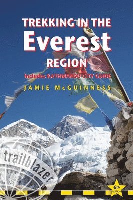
Trekking in the Everest Region with Kathmandu city guide: a trekking and trekking peak guide. Planning, Places to stay, Places to eat, includes 96 maps.Sixth edition of the most comprehensive trekking guide to the Everest region of Nepal's Himalaya. Ranging from lush terraced fields to the highest mountain on earth, the scenery is breathtaking. Arranging a trek is not difficult and there are trekking possibilities to suit all budgets.This practical guide includes detailed route maps covering not only the classic treks but also the wild routes:Everest expedition route - Rolwaling, Trekking from Lukla, Salpa-Arun, The Gokyo trek, High passesTrekking peaks - including Mera and Island Peak27 detailed route maps and 63 village plansGetting to NepalKathmandu - trek preparations and what to seeWhere to stay and eatHealth and safetyEmploying a guide or porter in Nepal
Häftad, Engelska, 2019
291 kr
Skickas inom 3-6 vardagar
The world's most scenic rail ride. A journey on Canada's transcontinental railroad ranks as one of the greatest rail experiences in the world. Stretching from the Atlantic to the Pacific, the lines span 3974 miles, taking in not only several of North America's finest cities but also some of the most dramatic scenery on earth, including the spectacular Rocky Mountains.Fully revised 6th edition - entirely re-researched.Mile-by-mile route guide - what to see along the route, with 32 rail route maps.Rail travel for all budgets - information from the cheapest rail tickets with shoestring accommodation in the cities along the route to the most luxurious guided tours.City guides and maps - the best sights, recommended hotels and restaurants in 10 major stops along the lines: Halifax, Quebec City, Montreal, Toronto, Winnipeg, Edmonton, Jasper, Calgary, Churchill and Vancouver.Railway history - the rail link that created modern Canada.
Häftad, Engelska, 2019
189 kr
Skickas
New 10th edition - all routes have been retravelled and fully updated. This 10th edition features extra colour sections and even more maps.A trip across Siberia on the longest continuous railway track in the world is undoubtedly the journey of a lifetime. It's also a convenient way to reach China, Mongolia or Japan. Tickets are not expensive or difficult to arrange. This acclaimed guide shows you how to organise a trip, where to get tickets, where to stay and what to see.Practical information - planning your trip; what to take; getting to Russia from Europe, North America and AustralasiaKilometre-by-kilometre route guides covering the entire routes of the Trans-Siberian, Trans-Manchurian, Trans-Mongolian and Siberian BAM railways with 49 strip maps in English, Russian and Chinese: see where you are as you travel.City guides and maps - the best sights, places to stay and restaurants for all budgets: Moscow, St Petersburg, Ulaan Baatar, Beijing and 32 towns in Siberia; plus Lake Baikal guideSiberia and the railway - the detailed history of Siberia, the construction and the running of the railway today are of great interest not only to visitors but also to armchair travellers.With 92 maps - plus timetables, fares, Russian & Chinese phrasesNew 10th edition - a new 16pp colour introduction and trip planner.
Häftad, Engelska, 2021
146 kr
Skickas
All-in-one, practical guide to walking the Great Glen Way long-distance footpath.The trail begins where the West Highland Way ends - at Fort William - and follows the Great Glen faultline to finish at Inverness after 79 miles (127km). The trail passes Loch Lochy, Loch Oich and Loch Ness and also follows the towpath of the Caledonian Canal.It's a relatively easy week-long walk amongst beautiful Highland scenery but there's a high level option between Fort Augustus and Drumnadrochit that gives even better mountain views.This 2nd edition has been re-walked and fully updated.Includes 38 detailed walking maps in two-colour style: the largest-scale maps available - at just under 1:20,000 (8cm or 31/8 inches to 1 mile) these are bigger than even the most detailed walking maps currently available in the shops.Unique mapping features - walking times, directions, tricky junctions, places to stay, places to eat, points of interest. These are not general-purpose maps but fully edited maps drawn by walkers for walkers.With accommodation, pubs and restaurants in detailed guides to 15 towns and villages including Fort William and Inverness.Itineraries for all walkers - whether hiking the entire route or sampling highlights on day walks or short breaks.Detailed public transport information - Buses and trains for all access points.Practical information for all budgets.What to see; where to eat with reviews (cafes, teashops, pubs, restaurants, takeaways); where to stay with reviews (hostels, campsites, bunkhouses, B&Bs, hotels).Downloadable GPS waypoints also included.Written by Scottish hillwalker Jim Manthorpe.

Häftad, Engelska, 2022
221 kr
Skickas
The go-to Japan guide for anyone planning to travel by train.Japan is steeped in legend and myth, perhaps the greatest of which is the popular misconception that the country is simply too expensive to visit. The truth is that flights to Japan are cheaper than they've ever been, accommodation can be great value, while the warm hospitality which awaits every visitor costs nothing at all. The real secret to travelling around the country on a budget, however, is the Japan Rail Pass. Use this comprehensive guide in conjunction with a rail pass to get the most out of a trip to Japan.Practical information - planning your trip; when to go; suggested itineraries; what to take; festivals and events.City guides and maps - where to stay, where to eat, what to see in 30 towns and cities; historical and cultural background.Kilometre-by-kilometre route guides - covering train journeys from the coast into the mountains, from temple retreat to sprawling metropolis and from sulphurous volcano to windswept desert; 33 route maps.Japan Rail service schedules - Bullet trains and main routes in this guide.Customs, etiquette, Japanese words and phrases - with kanji/hiragana/katakana for all place name text - readers can point to the text when asking Japanese speakers for directions.Extended Highlights - extra colour sections make this book even more user-friendly and attractive.What's new in this fully-updated 5th edition?New style Trailblazer guide with twin-colour layout and restyled mapsGreater coverage of Tokyo with additional mapping following post-Olympic interest for the capitalMore hot-spring resorts added (including Kinosaki, Kinugawa and Nyuto)More information about areas off the beaten track including the wood-carving town of Inami, Yanagawa where you can ride in a 'gondola' along its canals, Tomioka Silk Mill (where silk production was first mechanised), Okunoshima island (notorious for its WWII poison gas factory)Expanded colour section with 'Best' lists to help plan a tripFully updated post Covid outbreak
Häftad, Engelska, 2021
178 kr
Skickas
Iceland offers a world of hiking opportunities like no other place on earth. The famous 55km Laugavegur Trek takes you past glaciers, volcanoes, steaming fumaroles and hot springs all set in a landscape of yellow rhyolite and black ash. This new guide gives you plenty of other options from hiking in the shadow of the largest ice-cap in Europe at Skaftafell to easier day hikes around the vibrant capital city of Reykjavik.41 detailed walking maps in two-colour in the classic Trailblazer style - showing route times, gradients, where to stayDetailed Reykjavik city guide - and mapsItineraries for all walkers on 11 specially selected hikes - from day hikes around Reykjavik to more challenging 6-day treks including the 55km Laugavegur TrekPractical information for all budgets - where to stay (campsites, hostels and huts, B&Bs, lodges and hotels), where to eat, what to seeComprehensive background information - geology and vulcanology, flora and fauna, history, peopleFull public transport information - for all access points.
Häftad, Engelska, 2020
178 kr
Skickas
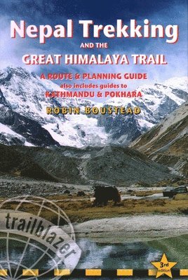
With extensive sections to help choose a trekking region, this is a route and planning guide for anyone organising a trekking holiday in Nepal. It includes the most popular routes as well as the newest trekking areas plus the most extreme route of all, the 160-day Great Himalaya Trail. There are route guides to the following regions: Kanchenjunga, Makalu, Rolwaling, Solu-Khumbu (Everest Region), Helambu & Langtang, Ganesh & Manaslu, Annapurna, Naar & Phu, Mustang, Dolpo, The Far West.Choosing a trek - independent tea-house trekking or guided treks arranged through trekking agencies; choosing a guide and crew; when to go; trekking grades and durationPractical information - visas, permits, fees and equipment, planning your trip and getting to NepalNepal background - people, religions, festivals and etiquetteKathmandu & Pokhara city guides - hotels, restaurants, what to seeGreen hiking - responsible tourism and how to minimise your impact on a fragile regionHealth and safety - how to stay healthy on your trek and avoid altitude sicknessColour mapping - showing the main trekking routes in Nepal.
Häftad, Engelska, 2023
202 kr
Skickas
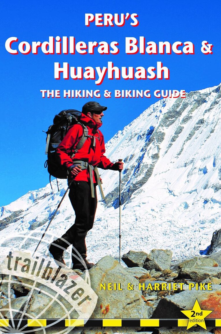
All the information you need to hike or bike your way through Perus's Cordilleras Blanca and Huayhuash, the 2nd most popular tourist region after the Inca Trail. This spectacular region boasts some of the most beautiful scenery in the Andes, and offers the most accessible high mountain trekking and biking in the world. Perfect pyramidal peaks, gargantuan ice falls and turquoise alpine lakes are all easily reached from Huaraz, the region's capital and centre of tourist comforts. This practical guide contains 50 detailed route maps and descriptions covering 20 hiking trails and more than 30 days of paved and dirt road cycling. Trekking – includes the classic treks: Huayhuash Circuit, Santa Cruz and Alpamayo Base Camp, as well as lesser known, wild walks in valleys which see few visitors. Ranging from easy day hikes to challenging routes of 10 days or more, all can be trekked independently or inguided groups.Cycling – includes a loop of Peru’s highest mountain - the Huascaran Circuit - as well as four other multi-day rides and five day-cycles from Huaraz. Covers all the information cyclists need to pedal past glaciers on 6000m peaks or fly down 2500m descents from high passes.Mountain-biking – includes 2 detailed downhill routes and information on organising guides to lead you through the labyrinth of exciting singletrack to be found in the area.Lima, Huarez and gateway towns – hotels, restaurants, what to see, street plans
Häftad, Engelska, 2020
221 kr
Skickas
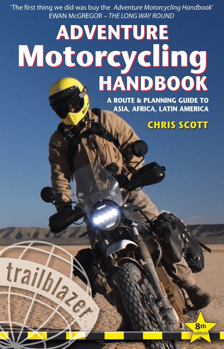
In print since 1991 and now in full colour, the eighth edition of the Adventure Motorcycling Handbook (AMH8) remains the legendary travel bible for two-wheeled adventurers.Dreaming of taking on the Big Trip? From Kathmandu to Machu Picchu or Mongolia to Patagonia (via Tanzania), AMH8 tells you everything you need to know on how to ride Africa, Asia and Latin America, aka: the Adventure Motorcycling Zone (AMZ).With 440-fact-filled pages including contributions from a team of earth roaming, overlanding experts.When, where and how, essential documentation, two dozen travel bikes rated, pages and pages on adapting and equipping your bike plus Life on theRoad: borders, visas, money changing, air freight or shipping, comms and trackers, police trouble, mapping and navigation, off-road riding, troubleshooting and repairs, medical emergencies, wild camping and gear.Trans-Continental Route Outlines give you an idea of the best way to traverse the AMZ; which borders, fuel costs, where to get visas and catch ferries and where not to go.
Häftad, Engelska, 2021
148 kr
Skickas
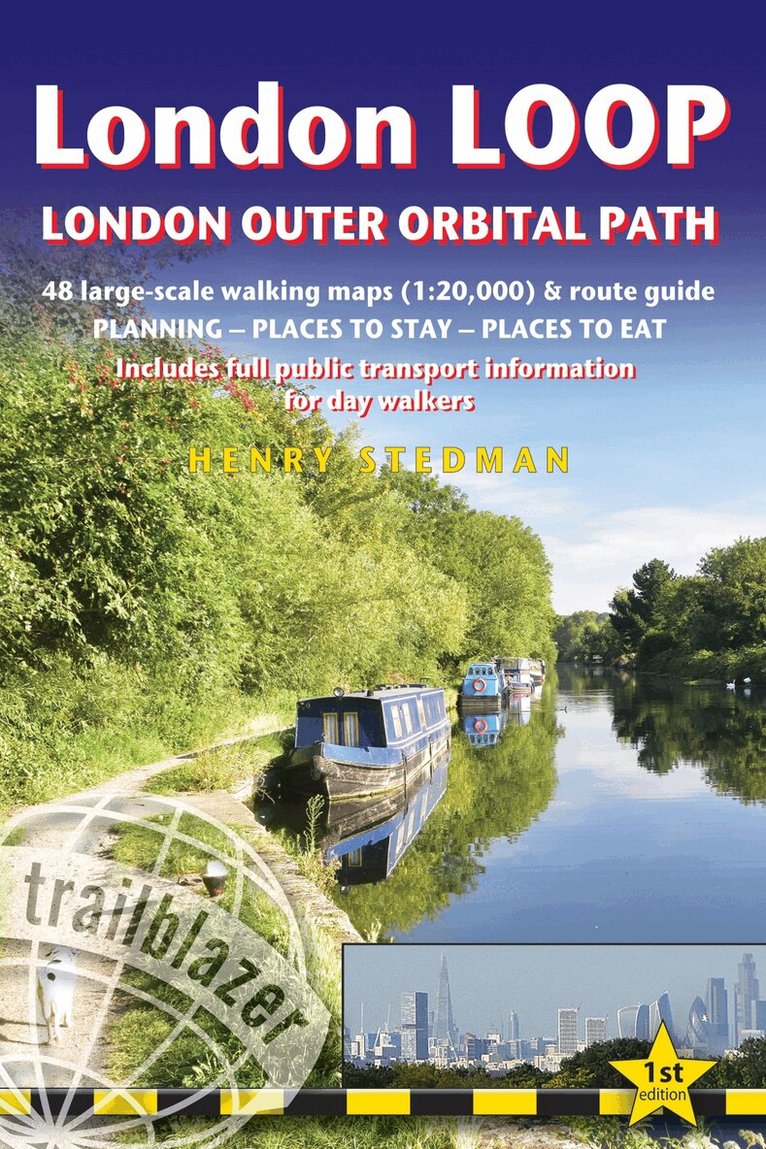
All-in-one guide to walking the complete London LOOP - London Outer Orbital Path, including trail maps, places to stay, where to eat and what to see, public transport information.The London LOOP - London Outer Orbital Path is a 150 mile circuit of the country s capital, starting at Erith and finishing at Purfleet-on-Thames. It stays within the M25 and sticks by-and-large to the Metropolitan Green Belt - that buffer zone of green largely undeveloped land that encircles the city.The guide includes:48 Trail maps (at just under 1:20,000) in two-colour style, 16pp colour stage maps and 2 overview maps40 colour photos, including colour flower and butterfly guidePlaces to stay and eat with reviewsAttractions along the wayDetailed public transport information showing all access points on the path, for day walkersCovers the complete circuit but also ideal for London-based day walks
Häftad, Engelska, 2022
146 kr
Skickas
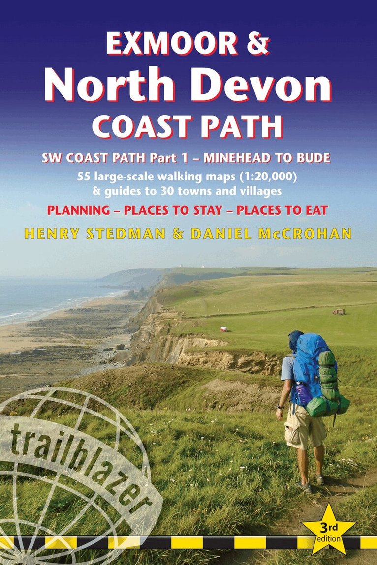
Practical, complete guide to walking Exmoor & North Devon Coast Path, the first section of the South West Coast Path, from Minehead to Bude (124.5 miles).This spectacular route passes through the Exmoor National Park following the highest coastline in England (over 800ft), through numerous idyllic villages such as Lynton and Clovelly, around Barnstaple Bay and Hartland Point to the seaside resort of Bude just over the border with Cornwall.The Trailblazer Exmoor and North Devon Coast Path Guide includes:55 large-scale walking maps in two-colour style, 13 town plans, 8 stage maps and 2 overview mapsPlaces to stay with reviews - bunkhouses, campsites, B&Bs, hostels, pubs, hotelsPlaces to eat with reviews - cafes, teashops, pubs, restaurants, takeawaysGPS Waypoints - downloadable from Trailblazer websiteNew edition includes extra colour mapping for each stage of the walkAlso includes 60 colour photosItineraries for all walkers - whether walking the route in its entirety over a week to 10 days or sampling the highlights on day walks and short breaksWhat to see - attractions, history, cultureComprehensive public transport information - for all access points on the coastFlora and fauna - four page full colour flower guide, plus an illustrated section on local wildlifeFull information on the Exmoor National ParkGreen hiking - understanding the local environment and minimising our impact on it
Häftad, Engelska, 2023
157 kr
Skickas
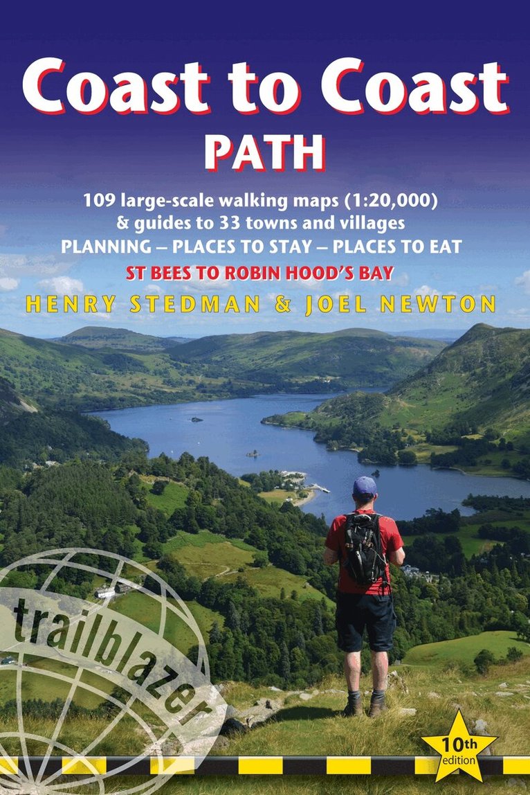
All the information you need to enjoy your hiking adventure from Coast to Coast in this updated 10th edition. Fully re-walked and revised 10th edition of this classic 191-mile walk from the Irish Sea to the North Sea. Crossing three national parks - the Lake District, the Yorkshire Dales, and the North York Moors - it samples the very best of the English countryside - rugged mountains and lakes, gentle dales and stone-built villages; wild moorland; sea cliffs and fishing villages.The guide includes:109 large-scale walking maps - at just under 1:20,000 - showing route times, places to stay, places to eat, points of interest, and 9 town plans14 colour stage maps to help plan your walk, including hills and descentsPlaces to stay with reviews - campsites, bunkhouses, hostels, B&Bs, pubs and hotelsPlaces to eat with reviews - cafes, teashops, pubs, takeaways, restaurantsWhat to see from the path - history, culture, natural historyComprehensive public transport information - for all access points on the pathFlora and fauna - four page full colour flower guide, plus an illustrated section on local wildlifeItineraries for all walkers - whether walking the route in its entirety over two weeks or sampling the highlights on day walks and short breaksGreen hiking - understanding the local environment and minimizing our impact on itGPS waypoints - also downloadable from the Trailblazer website page
Häftad, Engelska, 2022
146 kr
Skickas
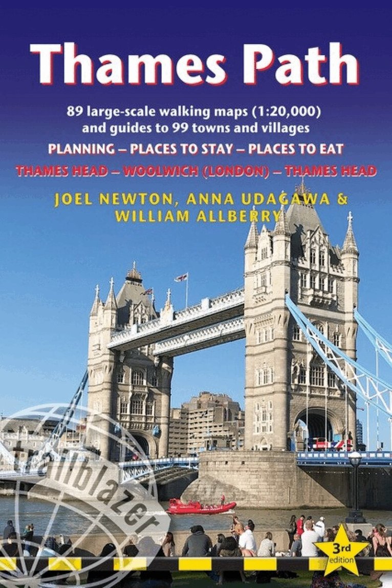
Follow the path of Britain's best-known river from London to the Cotswolds or from the Cotswolds to London. Here is all the information you need to walk the Thames Path. The Trailblazer Thames Path Guide is a practical, all-in-one, two-way guide to walking the Thames Path National Trail. The guide shows the route in both directions, from the Thames Head (the Cotswolds) to Woolwich (London) & London to Thames Head, including large-scale trail maps printed in two colours, places to stay, places to eat and public transport information. It is the first guide to the Thames Path that includes the Trail's extension in London to the Woolwich Foot Tunnel, where it links with the England Coast Path National Trail.89 large-scale walking maps (1:20,000)Guides to 99 towns and villagesPlanning, places to stay and places to eat are all includedItineraries for all walkersDetailed public transport information *Practical information for all budgetsDownloadable GPS waypoints
Häftad, Engelska, 2022
186 kr
Skickas
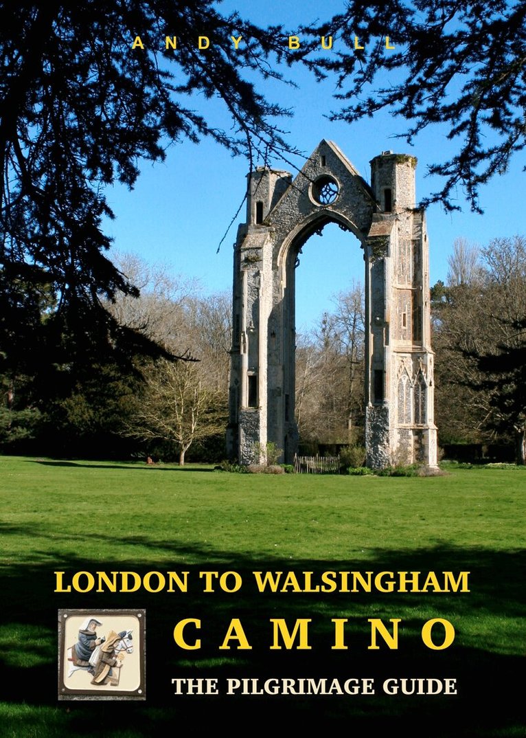
A pilgrim path that offers a wonderful long-distance route, on footpaths and quiet lanes, across the glorious east of England.London to Walsingham Camino guidebook is a full colour guide to walking the re-established pilgrimage route from the Church of St Magnus the Martyr, with its shrine to Our Lady of Walsingham to the Anglican and Catholic shrines at Walsingham in Norfolk. The experience of walking the route is described in this illustrated book with the step by step walking directions and gpx files being downloaded from the Trailblazer website.The whole 177.8 mile pilgrimage could be accomplished by a fit walker in a fortnight or less. But maybe you want to walk for fewer miles each day, or just at weekends, or on odd days when you have the time and energy. This guide caters for multiple approaches.Walsingham was England’s Nazareth. A fantastical tale brought pilgrims – kings, queens, and commoners alike – to Walsingham in the Middle Ages. In 1061 a Walsingham noblewoman, Lady Richeldis de Faverches, had a vision in which the Virgin Mary transported her soul to Nazareth and showed her the house where the Holy Family once lived, and in which the Annunciation of Archangel Gabriel, foretelling Jesus’s birth, occurred. She was told to build a replica of the house in Walsingham, and did so. The Holy House, initially a simple wooden structure, later richly decorated with gold and precious jewels, became a shrine and attracted pilgrims to Walsingham from all over Europe. Numerous kings travelled as pilgrims to Walsingham.Walsingham was by far the most important pilgrim shrine in England until Henry VIII outlawed pilgrimage and the veneration of saints in 1538. It was much more popular than Canterbury. Not only that: in the whole of the Christian world it was eclipsed by just three other places: Jerusalem, Rome, and Santiago de Compostela. Those places have enjoyed an unbroken tradition of pilgrimage and veneration stretching back a millennium or more. Not Walsingham. It reverted to being just a village in Norfolk once the pilgrims stopped coming. The road from London ceased to be the most important route in England, and faded into obscurity.For 400 years, no pilgrims walked to Walsingham. Since the 1930s, when both Catholic and Anglican shrines were re-established here, Walsingham has undergone a revival. It draws around 300,000 pilgrims each year, but hardly any of them walk much more than the final Holy Mile, and only a few church and other groups trace the full route from London.The London to Walsingham Camino guidebook is part of an attempt to change that: to re-establish a walking route which, while being as true to the original way as possible, takes account of the modern realities on the ground. A pilgrim path that offers a wonderful long-distance route, on footpaths and quiet lanes, across the glorious east of England. A truly pleasurable and uplifting walking experience.
Häftad, Engelska, 2024
168 kr
Skickas
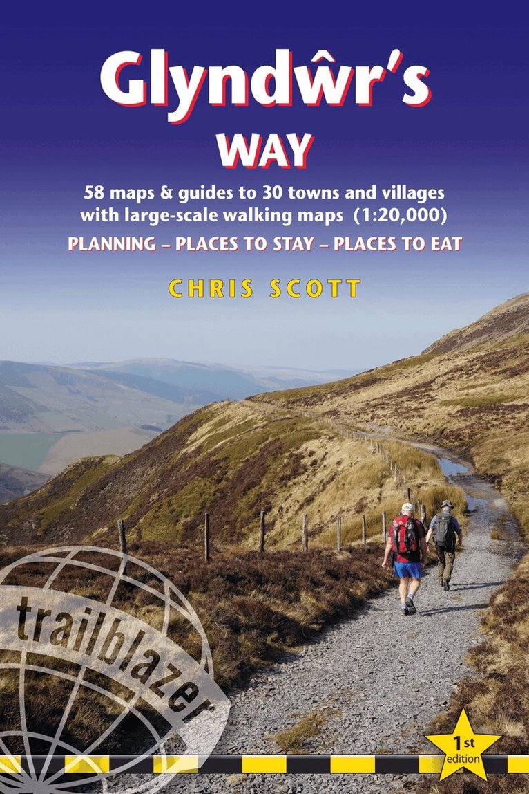
All the information you need to enjoy your hiking adventure along Glyndwr's Way. Brand new title in the Trailblazer British Walking Guide series covering the 135-mile National Trail in Wales. Follow in the footsteps of Owain Glyndwr, the Welsh prince who led a rebellion against the English in 1400. Traversing a range of open farmland and forest, it links with another National Trail, Offa's Dyke Path, at its start in Knighton and end in Welshpool. The guide includes:58 large-scale walking maps - at just under 1:20,000 - showing route times, places to stay, places to eat, points of interest, and 10 town plansPlaces to stay with reviews - campsites, bunkhouses, hostels, B&Bs, pubs and hotelsPlaces to eat with reviews - cafes, teashops, pubs, takeaways, restaurantsWhat to see from the path - history, culture, natural historyComprehensive public transport information - for all access points on the pathFlora and fauna - four page full colour flower guide, plus an illustrated section on local wildlifeItineraries for all walkers - whether walking the route in its entirety over two weeks or sampling the highlights on day walks and short breaksGreen hiking - understanding the local environment and minimizing our impact on itGPS waypoints - also downloadable from the Trailblazer website page
Häftad, Engelska, 2023
168 kr
Skickas
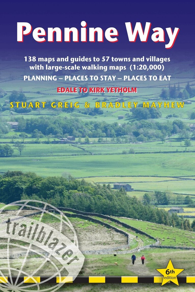
Trailblazer British Walking Guide to the Pennine Way, Britain's best-known National Trail that winds for 256 miles through three National Parks - the Peak District, Yorkshire Dales and Northumberland.This superb footpath showcases Britain's finest upland scenery, while touching the literary landscape of the Bronte family and Roman history along Hadrian's Wall.138 large-scale walking maps - at just under 1:20,000 - showing route times, gradients, where to stay, interesting features.Guides to 57 towns and villages - along the way.Itineraries for all walkers - whether walking the route in its entirety or sampling the highlights on day walks and short breaks.Practical information for all budgets - Edale to Kirk Yetholm.Where to stay with reviews - B&Bs, hostels, campsites, pubs and hotels.Where to eat with reviews.What to see, plus detailed town plans.Public transport information - for all access points on the path.GPS waypoints - also downloadable from the Trailblazer website.Extra colour sections: 16pp colour introduction and 16pp of colour mapping for stage sections (one stage per page) with trail profiles.
Häftad, Engelska, 2023
158 kr
Skickas
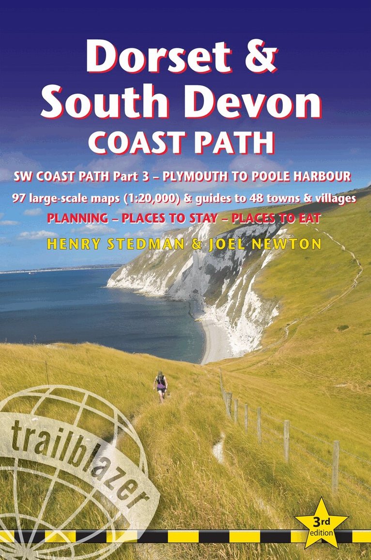
Trailblazer British Walking Guide: Dorset & South Devon Coast Path, South-West Coast Path Part 3, Plymouth to Poole HarbourComprehensive, all-in-one guide to walking the Dorset & South Devon Coast Path, the third and last section of the South West Coast Path National Trail. The walking guide includes:88 large-scale walking maps at just under 1:20,000 - showing route times, places to stay, places to eat, points of interest and much more.29 town plans, 14 colour stage maps showing hills and descents, and 2 colour overview maps.Places to stay with reviews - pubs, hotels, B&Bs, hostels, bunkhouses, campsites.Places to eat with reviews - teashops, cafes, takeaways, pubs, restaurants.What to see along the way - historical, cultural and geographical background information.Itineraries for all walkers - whether walking the route in its entirety over a week to 10 days or sampling the highlights on day walks and short breaks.Comprehensive public transport information - for all access points on the path.Flora and fauna - four page full colour flower guide, plus an illustrated section on local wildlife.Green hiking - understanding the local environment and minimizing our impact on it.Downloadable GPS waypoints.The information is written onto the maps, so walking directions, tricky junctions, places to stay and eat, points of interest and walking times are all written onto the maps themselves in the places to which they apply. The maps are not general-purpose ones but fully-edited maps drawn by walkers for walkers.
Häftad, Engelska, 2023
168 kr
Skickas
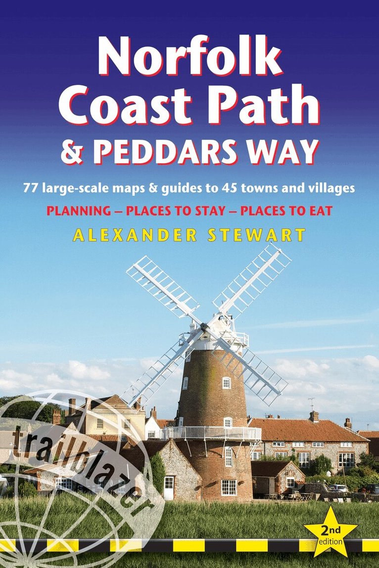
All the information you need to enjoy your hiking adventure along the Norfolk Coast Path and Peddars Way. The Norfolk Coast Path & Peddars Way cover 130-miles of walking trails. The Peddars Way runs through East Anglia from Knettishall Heath on the Norfolk/Suffolk border and follows a Roman road to Holme-next-the-Sea. From here it becomes the Norfolk Coast Path, hugging the beautiful Norfolk coastline through Holkham, Wells, Blakeney and Cley to Cromer before it rounds the shoulder of the county and continues along the superb beaches and crumbling cliffs to Mundesley, Sea Palling and Great Yarmouth, finishing just before the Suffolk border.Includes:75 large-scale walking maps - at just under 1: 20,000 (8cm or 3 and one eighth inches to 1 mile) our maps are bigger than even the most detailed walking maps currently available, with walking directions, tricky junctions, places to stay and eat, points of interest and walking times written onto the mapsAll standards of accommodation with reviews: campsites, B&Bs, hostels, hotels, bunkhousesWhere to eat with reviews: cafes, teashops, pubs, takeaways and restaurantsDetailed public transport information for all villages and towns along the pathsItineraries for all walkers including one day Peddars Way and Norfolk Coast Path walksIncludes 40 mile extension of the National Trail from Cromer to Hopton-on-SeaDownloadable GPS waypointsColour pictures including a 6 page colour bird and flower guideHistorical, cultural and geographical background information
Häftad, Engelska, 2024
168 kr
Skickas
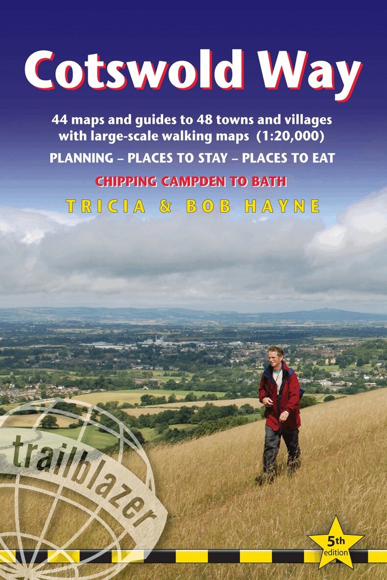
All the information you need to walk the Cotswold Way. Trailblazer Cotswold Way guide is an all-in-one hiking route guide with the most detailed maps for the Cotswold Way, a 102-mile National Trail that runs from Chipping Campden to Bath, following the beautiful Cotswold escarpment for most of its course.This is the fully revised and updated 5th edition. The trail leads through quintessentially English countryside with little villages of honey-coloured stone to the well-known town of Bath. The guideIncludes:44 large-scale maps at just under 1:20,000 (3 1/8 inches to 1 mile) - showing route times, places to stay, points of interest and much more and trail profiles8 town plans - Chipping Campden, Broadway, Winchcombe, Cheltenham, Painswick, Dursley, Wotton-under-Edge, and the city of Bath and 8 overview mapsFull details of all accommodations and campsites, restaurants and pubsItineraries for all walkers - whether walking the route in its entirety over seven to eight days or sampling the highlights on day walks and short breaksPractical information for all budgets: where to eat, what to seeComprehensive public transport information - for all access points on the Cotswold WayFlora and fauna - four page full colour flower guide, plus an illustrated section on local wildlifeGreen hiking - understanding the local environment and minimizing our impact on itBath city guideIncludes downloadable gps waypoints
Häftad, Engelska, 2025
178 kr
Skickas
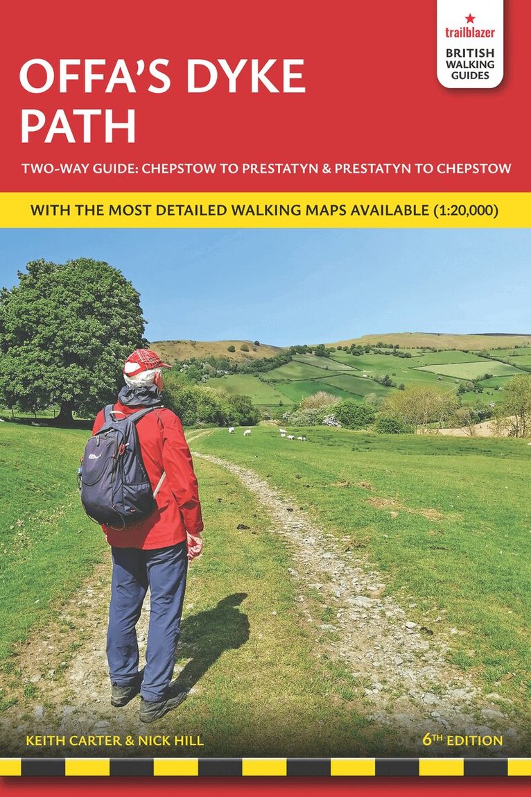
All the information you need to walk Offa's Dyke Path in this two-way edition, with routes re-walked in both directions - from Chepstow to Prestatyn and from Prestatyn to Chepstow and reformatted for use by walkers hiking south to north and north to south.The Offa's Dyke Path is a magnificent National Trail that runs from the North Wales coast to the Severn Estuary following the line of Offa's Dyke, an impressive 8th century earthwork along the English/Welsh border. The ever-changing landscape - the Wye Valley, the Black Mountains, the Shropshire Hills and the Clwydian Hills - is steeped in history and legend providing 177 miles of fascinating walking.This sixth edition has been re-walked and fully updated and includes:98 walking maps - 1:20,000 (3 and 1/8 inches to 1 mile) - the largest-scale maps availableUnique mapping features - walking times, directions, tricky junctions, places to stay, places to eat, points of interestItineraries for all walkers - whether walking the route in its entirety or sampling the highlights on day walks and short breaksPractical information for all budgets - what to see, where to stay, where to eat: pubs, B&Bs, hotels, campsites, hostels, with reviewsGuides to 52 towns and villages - along the wayPublic transport information - for all access points on the pathGPS waypoints - also downloadable from the Trailblazer websiteIncludes extra colour sections: 16pp colour introduction and 16pp of colour mapping for stage sections (one stage per page) with trail profiles
Häftad, Engelska, 2024
168 kr
Skickas
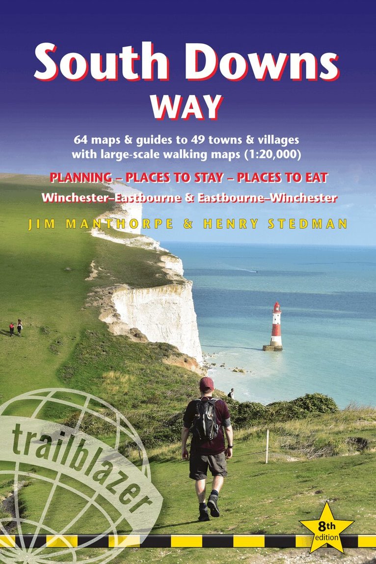
All the information you need to walk the South Downs Way. Trailblazer's guide to South Downs Way shows the route in both directions from Winchester to Eastbourne and from Eastbourne to Winchester. This handy, pocket size South Downs Way guide includes: 82 Maps in two-colour style - 60 large-scale walking maps - 1:20,000 (3-1/8 inches to 1 mile), 11 town plans, 10 stage maps with trail profiles showing hills and descents, and 2 overview mapsDetailed accommodation with reviews - B&Bs, campsites, pubs, hotels, bunkhousesWhere to eat with reviews - cafes, teashops, pubs, takeaways and restaurantsComprehensive public transport information - with frequency of services for all access points on the PathDownloadable GPS waypointsItineraries for all walkers - whether hiking the entire route or sampling highlights on day walks, weekends or short breaksUnique mapping features - walking times, directions, tricky junctions, places to stay, places to eat, points of interest written onto the mapsFlora and fauna - four page full colour flower guide, plus an illustrated section on local wildlifeGreen hiking - understanding the local environment and minimizing our impact on it
Häftad, Engelska, 2024
203 kr
Skickas
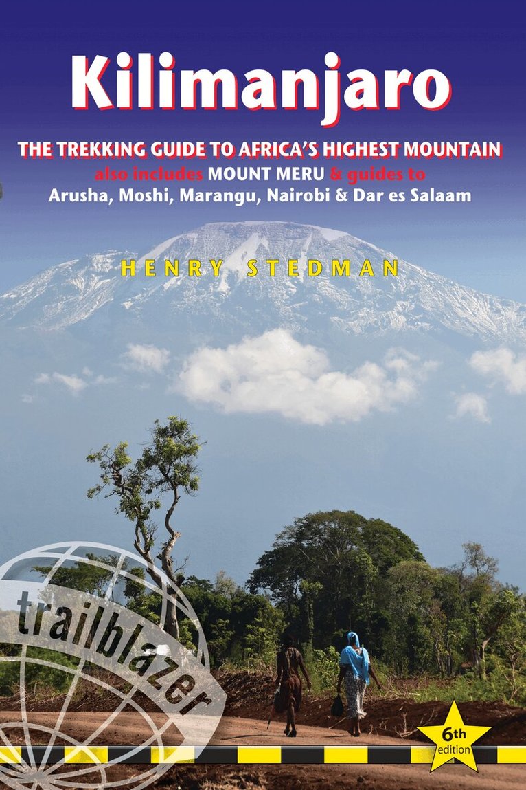
Practical, best-selling guide to climbing Mount Kilimanjaro, Africa's highest mountain and most popular trek. At 5895m (19,341ft) Kilimanjaro is Africa's highest mountain. Yet with no mountaineering skills necessary to reach the summit, even non-climbers can experience the thrill of climbing one of the world's greatest peaks. Taking you from the dusty plains of East Africa through jungle and moorland to the glacier-clad summit, this is one of the most beautiful and challenging treks there is. Trailblazer's Kilimanjaro guide includes:Comprehensive trail guide and maps (with GPS waypoints also downloadable from the Trailblazer website) to the six major routes: Machame, Marangu, Rongai (Loitokitok), Lemosho, Shira and Umbwe by an author who's climbed them all numerous timesCity guides - Where to stay, eat and what to see en route to Kili in: Dar es Salaam, Nairobi and gateway towns of Arusha, Moshi and MaranguPlanning your trip and booking a trek with full reviews of trekking agencies - when to go, how to bookMount Meru - a popular pre-Kilimanjaro trekBackground information - comprehensive history, geology, climate, flora and fauna - including a detailed bird spotter's guide and a flora identification section - plus cultural information on the Chagga peoplePorters' rights - how to helpHealth and safetyFully updated 6th edition of this best-selling guidebook to Africa's most popular trek. Kilimanjaro is the world's tallest freestanding peak. It's the most popular trek in Africa, both for independent trekkers and for charity organisationsRoutes covered on 35 detailed walking maps in the proven Trailblazer style; all walking times are indicated along with points of interest and gradientsExtra colour sections plus a 16pp colour introduction to Kilimanjaro and the climb
Häftad, Engelska, 2024
168 kr
Skickas
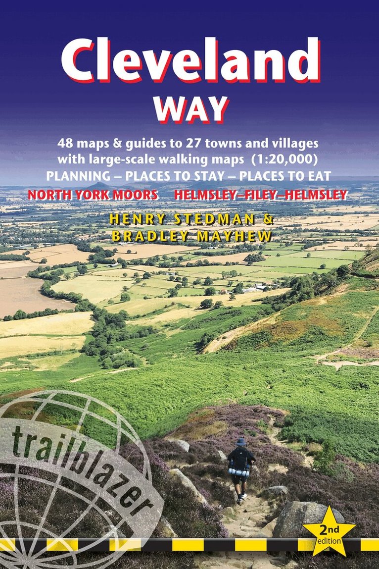
All the information you need to enjoy your hiking adventure along the Cleveland Way in this fully revised and updated 2nd edition. In the beautiful, wild countryside of the North York Moors National Park in northern England lies this fabulous trail, the Cleveland Way. The 110-mile route runs from Helmsley near Thirsk around the western edge of the park to reach the coast at Saltburn-by-the-Sea. It then continues along the eastern edge of the park south down the coast through Whitby, Robin Hood's Bay and Scarborough to finish in Filey. Combining moorland and coast there's wonderful scenic variety to this walk, with crumbling castles and idyllic fishing villages to explore. The guide includes:48 large-scale walking maps - at just under 1:20,000 - showing route times, places to stay, places to eat, points of interest, and 8 town plans10 colour stage maps to help plan your walk, including hills and descents, and two colour overview mapsPlaces to stay with reviews - campsites, bunkhouses, hostels, B&Bs, pubs and hotelsPlaces to eat with reviews - cafes, teashops, pubs, takeaways, restaurantsWhat to see from the path - history, culture, natural historyComprehensive public transport information - for all access points on the WayFlora and fauna - four page full colour flower guide, plus an illustrated section on local wildlifeItineraries for all walkers - whether walking the route in its entirety over two weeks or sampling the highlights on day walks and short breaksGreen hiking - understanding the local environment and minimizing our impact on itGPS waypoints - also downloadable from the Trailblazer website page.
Letar du efter digitala böcker?
E-böcker och ljudböcker handlar du än så länge på vår tidigare sajt.