
Philip's Red Books – serie
Visar alla böcker i serien Philip's Red Books. Handla med fri frakt och snabb leverans.
8 produkter
8 produkter
Engelska, 2025
87 kr
Skickas inom 5-8 vardagar
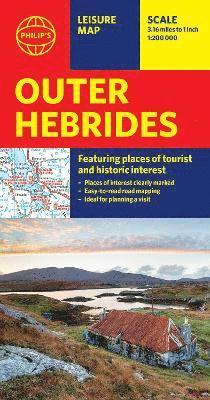
Brand new edition of this easy-to-use Philip's sheet map of the Outer Hebrides, giving detailed coverage of the area's road network, and featuring all the major places of tourist and historic interest.The latest edition of this information-packed Philip's leisure map of the Outer Hebrides (or Western Isles) gives clear and detailed coverage of the archipelago's road networks at a scale of 3.16 miles to 1 inch. From the bustle of Stornoway to the flora and fauna of the remotest spots, this is the only companion you will need.The easy-to-use map shows all the major places of tourist and historic interest, including ancient sites, beaches, castles, camping sites, country parks, galleries, gardens, golf courses, museums, nature trails and walks, standing stones, sports and entertainment venues. Whether bracing sea walks, learning Scottish Gaelic or savouring distilleries is your plan, a handy index makes them all easy to find and enjoy.Local or a visitor, the convenient, single-sided sheet map is ideally suited for leisure and business use.
98 kr
Skickas inom 5-8 vardagar
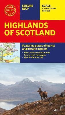
A folded map specially created for touring the glories of the Scottish Highlands, with a wealth of places of interest clearly marked. It includes detailed coverage of the area's road network with easy-to-read road mapping perfect for route-planning. This leisure and tourist map of the Highlands of Scotland gives detailed coverage of the area's road network at a scale of 4.34 miles to 1 inch. The map shows an abundance of places of tourist and historic interest, including castles, camping sites, country parks, galleries, gardens, golf courses, marinas, museums, nature trails, historic sites, sports venues, theatres, theme parks, wildlife parks and zoos. A specially-created index to principal places of interest is also featured. In a convenient folded format, this single-sided sheet map is ideally suited for both leisure and business use - and it's great value for money too!
Engelska, 2020
87 kr
Skickas inom 5-8 vardagar
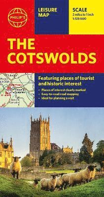
A new edition of this double-sided map of the Cotswolds clearly featuring places of tourist and historic interest in an easy-to-read style of mapping, alongside six handy town centre plans. This leisure and tourist map of the Cotswolds gives detailed coverage of the area's road network at a scale of approximately 2 miles to 1 inch (1:125,000). The coverage stretches from Abingdon in the east to Gloucester in the west, and from Swindon in the south to Great Malvern in the north.The map shows places of tourist and historic interest, including castles, camping and caravanning sites, country parks, galleries, gardens, golf courses, museums, nature trails, historic sites, sports venues, theatres and wildlife parks. An index to principal places of interest is also featured.With some of the most enchanting towns and cities in England in the area - all with extraordinary history and notable natural beauty - use the Philip's Leisure Map to explore and delight in the Cotswold magic. Included in the mapping are indexed town-centre street maps for Bourton-on-the-Water, Cheltenham, Cirencester, Gloucester, Tewkesbury and Winchcombe for easy navigation and enjoyment.In a convenient folded format, this double-sided sheet map is ideally suited for both leisure and business use, whether by locals or visitors.
87 kr
Skickas inom 5-8 vardagar
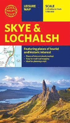
Brand new edition from Philip's of this information-packed sheet map of Skye and Lochalsh, giving detailed coverage of the road network, and featuring all the major places of tourist, cultural and historic interest.From the colourful town of Portree to the best water sport locations, the map shows all the major places of tourist and historic interest, including beaches, castles, camping sites, gardens, golf courses, museums, nature and pony trails, ancient historic sites, sports and entertainment venues, wildlife spots and most of all where to enjoy the extraordinarily dramatic landscape. A clear and handy index to principal places of interest - from Flora MacDonald's grave to the Skye Museum of Island Life - is also included.Whether local or a visiting Prince, the conveniently folded single-sided sheet map is ideally suited for both leisure and business.
Häftad, Engelska, 2022
87 kr
Skickas inom 5-8 vardagar
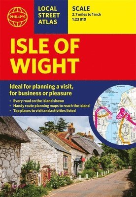
This pocket-sized street atlas of the Isle of Wight gives detailed coverage of the whole of the island.This local street atlas of the Isle of Wight gives detailed coverage of the whole of the island at a scale of 2 2/3 inches to 1 mile. Important for ferry links to the Isle of Wight, the mainland towns of Southampton, Gosport, Lymington and Portsmouth are included at the same scale. Central Portsmouth is also shown at the enlarged scale of 5 1/3 inches to 1 mile.Full of useful tourist information and all the sights and activities available on the Isle of Wight, the maps also show hospitals, car parks, post offices, leisure facilities, schools, industrial areas and retail areas, while the index lists street names and postcodes. Extra contents include an 8-page route-planner, marking all major and minor roads on the island together with an area on the mainland taking in the New Forest to the west and Emsworth to the east, plus a 4-page guide to the top visitor attractions.Pocket sized, the atlas is ideally suited for both business and leisure use, whether by locals or visitors.
75 kr
Skickas inom 5-8 vardagar
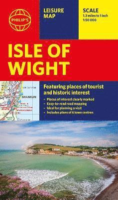
A newly updated edition of this single-sided folded sheet map of the Isle of Wight, giving everything you need for a holiday or day trip.Whether you want to enjoy the extraordinary coastal walks or be regal at Osbourne House, the map features all the key camping and caravan sites, castles, craft centres, historic houses, marinas and slipways, museums, gardens, sports venues, theme parks, walking and cycling routes, and wildlife parks.With wineries and ancient churches, amazing sailing and exceptional landscapes, the Isle of Wight has much to offer. Charles I was imprisoned on the island during the Civil War at Carisbrooke Castle and there are botanical gardens to wander at your leisure. The famous Needles are must-visit and welcoming seaside towns are clearly marked for easy navigation.There are six clear town centre street maps: Cowes, Newport, Ryde, Sandown, Shanklin and Ventnor to ensure you never get lost.With a clear, user-friendly mapping style, this map provides all the information that visitors and locals need to find their way around the island.
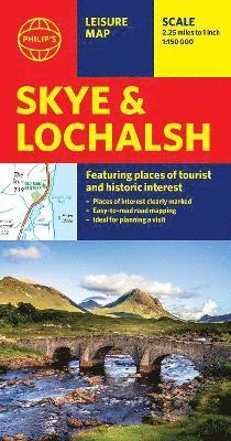
Philip's Skye and Lochalsh: Leisure and Tourist Map
Featuring Places of tourist and historic interest
Engelska, 2025
87 kr
Skickas inom 5-8 vardagar
Brand new edition from Philip's of this information-packed sheet map of Skye and Lochalsh, giving detailed coverage of the road network, and featuring all the major places of tourist, cultural and historic interest.From the colourful town of Portree to the best water sport locations, the map shows all the major places of tourist and historic interest, including beaches, castles, camping sites, gardens, golf courses, museums, nature and pony trails, ancient historic sites, sports and entertainment venues, wildlife spots and most of all where to enjoy the extraordinarily dramatic landscape. A clear and handy index to principal places of interest - from Flora MacDonald's grave to the Skye Museum of Island Life - is also included.Whether local or a visiting Prince, the conveniently folded single-sided sheet map is ideally suited for both leisure and business.
Engelska, 2025
87 kr
Skickas inom 5-8 vardagar
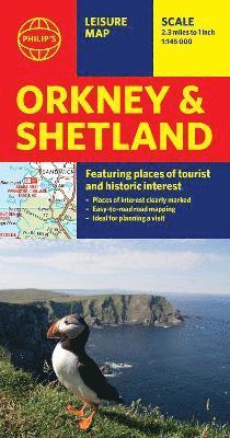
Whether it's the outstanding natural beauty, ancient sites or an activity-packed break calling you, the Philip's leisure and tourist map of Orkney and Shetland is all you need. Places of interest are clearly marked on the easy-to-read mapping - ideal for planning that all-important route.This double-sided Philip's leisure and tourist map of Orkney and Shetland gives detailed coverage of the islands' road networks at an easy-to-read scale of approximately 2.5 miles to 1 inch. The Orkney Islands are featured on side one of the map, with the Shetland Islands shown on the reverse. The maps show places of tourist and historic interest, including beaches, castles, camping sites, distilleries, galleries, gardens, golf courses, museums, nature trails, historic sites, sports and entertainment venues. From the ancient settlement of Orkney's Skara Brae and Scapa Flow to the Shetland Museum and Bobby's Bus Shelter, all the top places of interest are featured on each side of the map for Orkney and Shetland respectively. Easily folded (and unfolded), this double-sided sheet map is ideally suited for both leisure and business use, whether by locals or visitors to the islands.