
Benchmark Maps – författare
Visar alla böcker från författaren Benchmark Maps. Handla med fri frakt och snabb leverans.
10 produkter
10 produkter
Engelska, 2017
145 kr
Skickas inom 3-6 vardagar
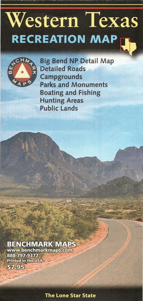
The Western Texas Recreation Map is the first map product to show the real richness of recreation potential in The Lone Star State. One side provides a Western Texas map that features land cover (forest, grassland, cropland, & wetland), extensive highway detail, point-to-point mileages, recreation sites, Roadside America attractions, campgrounds, parks & wildlife areas, boating & fishing access points, and public hunting areas. This side also includes an area map of Big Bend National Park. The reverse side features categorized recreation listings with helpful descriptions, current contact information, and map grid references.
171 kr
Skickas inom 3-6 vardagar
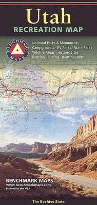
The Utah Recreation Map is a folded map version of the Recreation Guide pages within Benchmark's Utah Road & Recreation Atlas. The Utah Recreation Map is the ideal planning tool for everything outdoors, from a nearby day-hike to a vacation adventure in one of Utah's rugged parks and wilderness areas. It's the only Utah map that benefits from Benchmark's field-checked accuracy and cartographic excellence. The state map features Public Lands, extensive highway detail, point-to-point mileages, recreation attractions, campgrounds, parks & wildlife areas, boating & fishing access points, and hunting units (GMU). The reverse side features a regional map of Salt Lake City and the Wasatch Front, and includes statewide categorized POI listings with helpful descriptions, current contact information, and map grid references.
Häftad, Engelska, 2019
308 kr
Skickas inom 3-6 vardagar
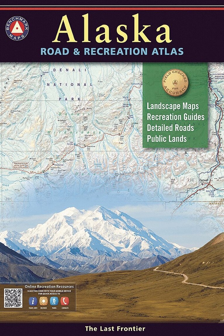
Alaska truly is the Last Frontier. No other publication can display this rugged scenery and recreation potential with more precision than Benchmark’s Alaska Road & Recreation Atlas. The Landscape Maps reveal landforms with amazing realism and detail, clearly showing how the state’s vast network of roads, waterways, and recreation landmarks fit into the landscape. A complete Recreation Guide lists a myriad of outdoor activities. Arranged by category and boasting unequalled insight and detail, it is the ideal planning tool from a simple scouting trip to an extended exploration. Benchmark field-checkers drove several thousand miles to make sure the Alaska Road & Recreation Atlas is the most accurate, comprehensive, and reliable map product ever published for the 49th State.
Häftad, Engelska, 2019
326 kr
Skickas inom 3-6 vardagar
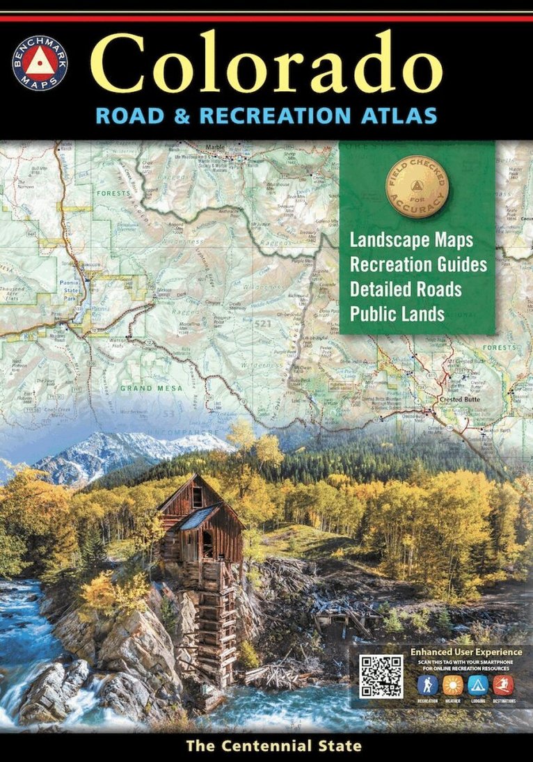
Benchmark’s Colorado Road & Recreation Atlas is designed to help residents and visitors make the most of Colorado’s endless recreation opportunities. The recreation guide includes lists of attractions, trailheads, fishing spots, historic sites, and much more throughout the state. The Landscape Maps show all drivable roads, classed by surface and purpose. Large-scale metro maps of Denver, Boulder, and Colorado Springs are also included.
Häftad, Engelska, 2024
379 kr
Skickas
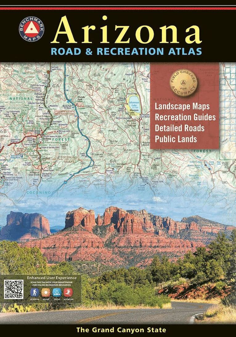
The Grand Canyon State abounds in natural beauty and outdoor recreation possibilities. Completely reworked with new Landscape Maps and a comprehensive Recreation Guide, our Arizona Road and Recreation Atlas is an invaluable resource for adventure planning and exploration. All New Landscape MapsTM -National Forest land ownership (private in-holdings) are shown in addition to forest boundaries -Updated road conditions compiled from annual Motor-Vehicle Use (MVU) data by US Forest Service -BLM/State land ownership -Page to page map overlap, clear legibility Recreation Guide -Public Lands maps are completely updated with recreation access and point-to-point mileages -Recreation listings are current and fact-checked -Categorized listings include: -Parks, Monuments, Natural Wonders -Campgrounds & RV Parks -Boating & Fishing Access -Forest & Wildlife Areas -Hunting Unit Map with Info Resources Map Scales: Recreation Maps 1:1,000,000 Landscape Maps 1:285,000 Metro Maps 1:125,000
Häftad, Engelska, 2025
455 kr
Skickas
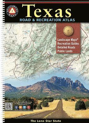
Everything is bigger in Texas, and our atlas is no exception! The Texas Road & Recreation Atlas is our largest title, featuring 200 pages of maps and guides covering the vastness of the Lone Star State from its most-populous cities to its remote desert mountains. The field-checked Landscape Maps reveal back roads & landforms with amazing realism and detail, illustrating how the state's network of roads and local recreation landmarks fit into its topography. The 20-page Recreation Guide provides regional maps alongside categorized recreation listings and detailed information resources to help you map out your trip. This atlas is the ideal tool for planning and navigating your next Texas adventure, whether it?s a simple day trip or an extended exploration of the Lone Star State. Landscape Maps Detailed and updated shaded relief illustrating current land use & vegetation land cover Exceptional and updated highway & back road detail Historical markers Public land boundaries and access points Page to page map overlap Recreation Guide Regional maps with public land detail, recreation points of interest, point-to-point mileages, public hunting areas, and more Categorized listings include National & State Parks, Trails & Natural Wonders, Campgrounds, Fishing & Boating, Museums & Historic Sites, and more 200 Pages. 3rd Edition, 2025. Spiral-bound. ISBN 9798986387956 Map Scales: Landscape Maps 1:253,400 (1'=4 miles) Recreation Maps 1:1,267,200 (1'=20 miles)
Häftad, Engelska, 2026
378 kr
Kommande
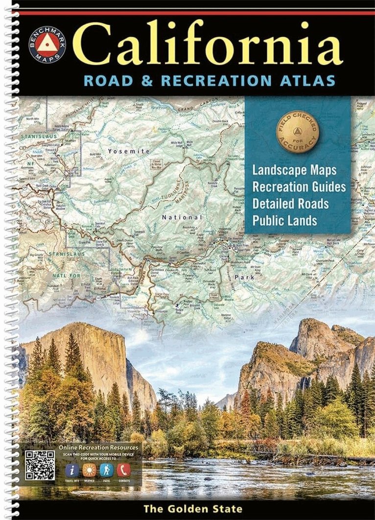
California is rich in geographical diversity and natural beauty, from its verdant mountains and vast deserts to the seemingly endless Pacific coastline. Get to know the best of California with this recently updated and improved atlas, now featuring 48 more pages than the previous editions, with durable spiral-binding. The comprehensive Recreation Guide and accompanying California Recreation Map are the perfect resources to plan your Golden State adventure. Our maps of California are field checked for accuracy, and feature all of the important outdoor recreation categories and cultural interests. Highways of the Western U.S. and California (Hwy 101, I10, I5, I15, I505, I80) Recreation and Public Lands Detail Highly Detailed Landscape Maps Index of counties, cities, parks, mountains, lakes & rivers. Detailed Sacramento, San Francisco, San Jose, Los Angeles, and San Diego Metro Maps GPS Grid 13th Edition, 2026. Spiral-bound; ISBN 9798986387994 Map Scales: Recreation Maps 1:863,000 1'=13.6 miles. Landscape Maps 1:215,000 1'=3.4 miles. Metro Maps 1:158:000 1'=2.5 miles
Engelska, 2023
154 kr
Tillfälligt slut
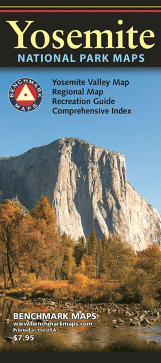
Domes and spires soar thousands of feet above the floor of Yosemite Valley while some of the world's highest waterfalls plunge over its cliffs. Make the most of your trip to Yosemite with this 3-in-1 map that features a regional map of the central Sierras, an enlarged map of Yosemite Park, and a magnified view of Yosemite Valley. Updates include new map styles and recent place name updates within Yosemite National Park. Includes thoroughly researched Recreation Guides and Index.
Häftad, Engelska, 2014
250 kr
Tillfälligt slut
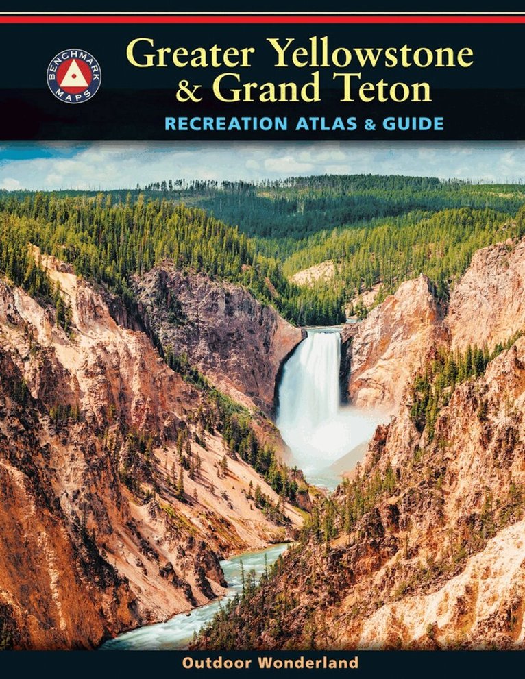
Yellowstone is our first national park and combined with Grand Teton National Park, the region is unrivaled in geologic wonder, dramatic landscapes, and unique wildlife. Benchmark Maps partnered with the University of Oregon's Department of Geography's InfoGraphics Lab to develop a new recreation atlas that complements their successful academic title Atlas of Yellowstone. The result was this specialty recreation atlas and guide for Greater Yellowstone and Grand Teton. We hope you enjoy the features of this atlas of these national parks, the cornerstones of western park lands.
Häftad, Engelska, 2021
339 kr
Tillfälligt slut
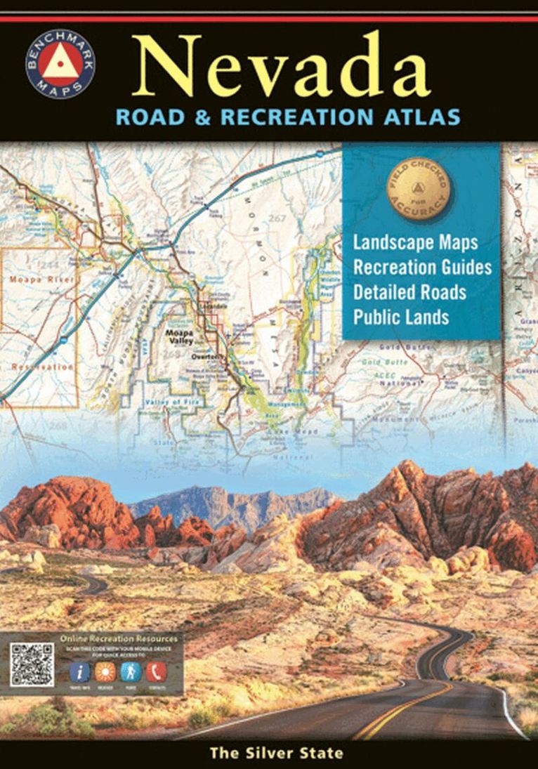
Nevada has long been known as the wildest adventure state in the lower 48, and this atlas is the first atlas to fully corral all of its marvels and outdoor potential. Careful and thorough field checking and local research assure users the best Nevada outdoor experience possible. Recreation maps show hunting units and public lands, emphasizing historic trails and points of interest. Special metro maps of Las Vegas and Reno, and a dazzling view of Lake Tahoe make this a complete atlas for the home or car.