
Dennis Kelsall – författare
163 kr
Skickas
157 kr
Skickas

157 kr
Skickas
163 kr
Skickas
163 kr
Skickas
Pathfinder More Peak District
157 kr
Skickas
171 kr
Skickas

168 kr
Läs direkt efter köp
180 kr
Läs direkt efter köp
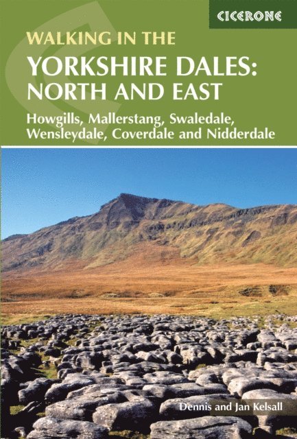
A guidebook to 43 walks in the north and east of the Yorkshire Dales, covering the Howgills, Mallerstang, Swaledale, Wensleydale and Nidderdale. Most routes are easy or moderate, although there are a handful of more demanding outings crossing rugged upland terrain.
The walks, all easily accessible from Kirkby Stephen, Sedburgh, Pateley Bridge and Aysgarth, range from 5 to 19km (3–12 miles) and can be enjoyed in 2–5 hours. Several walks can be combined with another to create a longer route.
1:50,000 OS maps included for each walk Sized to easily fit in a jacket pocketNotes on refreshments and parkingInformation on the region’s rich geology, history, plantlife and wildlifePart of a 2-volume set – an accompanying Cicerone guidebook Walking in the Yorkshire Dales: South and West is also available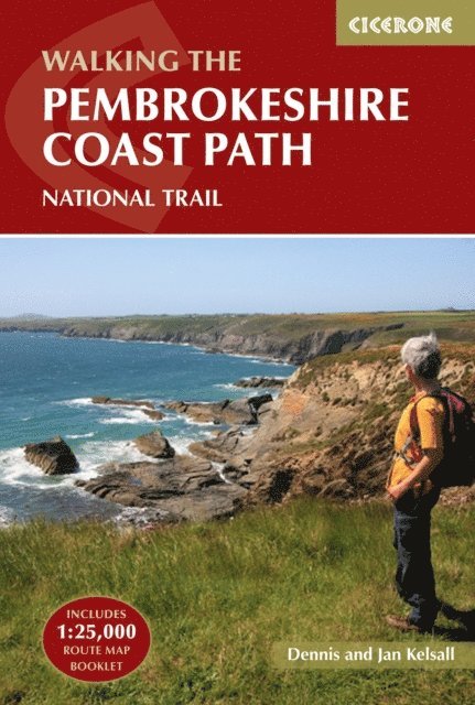
228 kr
Läs direkt efter köp
208 kr
Läs direkt efter köp
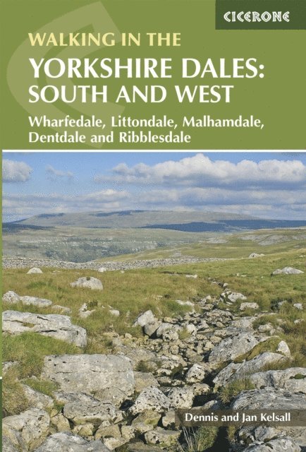
A guidebook to 43 walks in the south and west of the Yorkshire Dales, covering Wharfedale, Littondale, Malham, Dentdale and Ribblesdale. Most routes are easy or moderate, although there are a handful of more demanding outings crossing rugged upland terrain.
The walks, all easily accessible from Kirkby Lonsdale, Settle, Skipton and Grassington, range from 6 to 21km (4–13 miles) and can be enjoyed in 2–5 hours. Also included is the Yorkshire Three Peaks: a 37km (23 mile) challenge route visiting Pen-y-ghent, Whernside and Ingleborough.
1:50,000 OS maps included for each walk Sized to easily fit in a jacket pocket Notes on refreshments and parking Information on the region’s rich geology, history, plantlife and wildlife Part of a 2-volume set – an accompanying Cicerone guidebook Walking in the Yorkshire Dales: North and East is also available
175 kr
Läs direkt efter köp
180 kr
Läs direkt efter köp
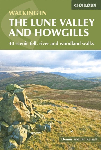
This guidebook offers a wide range of walks from the source of the river Lune in the Howgill Fells to Glasson Dock, just below Lancaster. The 40 day walks range between 3 and 11 miles in length and are all illustrated with extracts of 1:50,000 OS mapping.The walks start in the north of the region and follow the River Lune southwards to the sea, with bases including Orton, Sedbergh, Kirkby Lonsdale and Lancaster. They explore the infinitely varied landscape as the river Lune flows between the Lake District and Yorkshire Dales national parks and the Forest of Bowland and Arnside and Silverdale Areas of Outstanding Natural Beauty.Also included is an outline of a 60-mile, 6-day route walking the River Lune from end to end, with lots of background information about the area''s history, geology and also all the local facilities to help you plan your trip. There are magnificent views from the empty hilltops, delightful natural woodlands full of wildlife, stunning secluded side valleys and open moorland vistas to be explored in Yorkshire, Cumbria and Lancashire.

200 kr
Läs direkt efter köp
208 kr
Läs direkt efter köp
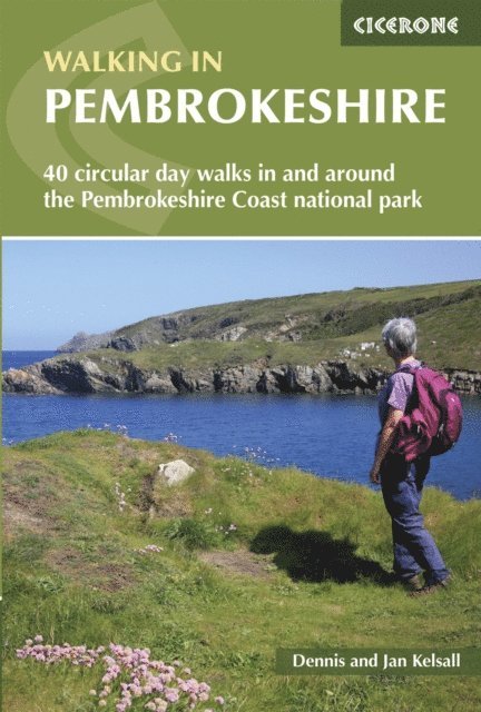
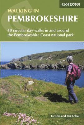
A guidebook to 40 circular day walks in Pembrokeshire. Exploring the dramatic scenery of the Pembrokeshire Coast National Park, Preseli Hills and Daugleddau the walks are suitable for all abilities, from gentle strolls to more strenuous and demanding walks.
The walks range in length from 3–20km (2–12 miles) and take between 1–7 hours to complete, perfect for either a short stroll or a full day out.
1:50,000 OS maps included for each walk Detailed information on refreshments, public transport and toilets is given for each walk Easy access from Cardigan, Haverfordwest and Tenby Local points of interest are featured including Carew Castle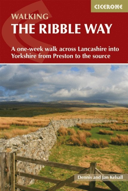
235 kr
Läs direkt efter köp
A guidebook to walking the Ribble Way between the estuary mouth near Preston and the Ribble river''s source on Cam Fell in the Yorkshire Dales. Covering 116km (72 miles), this long-distance trail across Lancashire and Yorkshire takes 1 week to hike and is suitable for walkers of most abilities.
The route is described from south to north in 7 stages, each between 13 and 27km (8–17 miles) in length. Notes for day walkers are also provided including public transport access for all route stages.
1:50,000 OS maps included for each stage GPX files available to download Detailed information on facilities on the route Advice on planning and preparation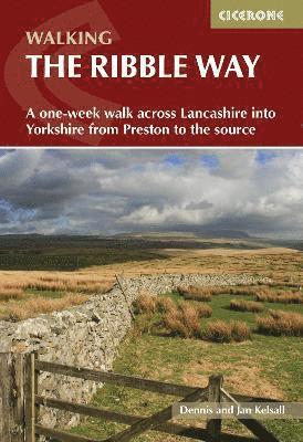
195 kr
Skickas
127 kr
Skickas

206 kr
Skickas
138 kr
Läs direkt efter köp
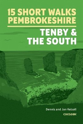
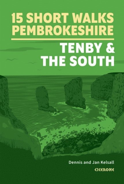
Would you like to explore the best of southern Pembrokeshire? This guidebook covers 15 of the best short walks in the area (between 2 and 11km), including Tenby, Saundersfoot, Amroth, Manorbier, Angle and Bosherton.
Why choose this guidebook?
Walks under three hours, plus one challenge route Easy to follow with clear route descriptions Facilities, parking and highlights for every route No specialist gear needed, walk all year round Ordnance Survey mappingCicerone’s Short Walks guidebooks contain everything you need to get outdoors and discover the best of an area. The routes are perfect if you’re new to walking or looking for something you can enjoy with the whole family. Let the adventures begin!
249 kr
Läs direkt efter köp
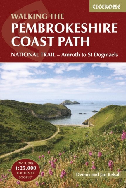
A guidebook to walking the Pembrokeshire Coast Path National Trail between Amroth near Tenby and St Dogmaels by Cardigan. Covering 290km (180 miles) and over 10,500m of ascent, this trail takes around 2 weeks to hike.
The route is described from south to north in 14 stages between 15 and 27km (9-17 miles) in length. An abbreviated route description is also given for those walking the route north to south, as well as alternate routes to avoid high tide and military range closures.
Contains step-by-step description of the route alongside 1:100,000 OS maps Includes a separate map booklet containing OS 1:25,000 mapping and route line The book features a handy trek planner that highlights information about accommodation, facilities and public transport along the route Sized to easily fit in a jacket pocket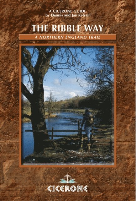
167 kr
Läs direkt efter köp

162 kr
Skickas
- Nyhet

173 kr
Skickas
173 kr
Skickas

162 kr
Skickas
93 kr
Skickas
95 kr
Skickas
95 kr
Skickas
92 kr
Skickas