Gary L Prost – författare
Visar alla böcker från författaren Gary L Prost. Handla med fri frakt och snabb leverans.
5 produkter
5 produkter
917 kr
Skickas inom 10-15 vardagar
Western Europe’s Natural Wonders is part of a series of books that provides a geologic guideto some of the most iconic, interesting, and geologically significant features of the Earth’s surface. This volume takes readers across three classic locations in Western Europe including the Mid-Atlantic Ridge in Iceland and classic locations in the development of geology in the Alps and Pyrenees. It examines plate tectonics from spreading centers to convergent margins and discusses the deformation of mountain ranges and sedimentary basins, reviews the importance of geology in a historical context, explains the role of geology in agriculture, mining, and energy development, and highlights mineral and fossil locations. Sections describe volcanism, glacial features, and the concepts of ice ages, thrust faulting, mountain building, and plate tectonics. Written in a conversational style, this is a lavishly illustrated set of self-guided tours for students and teachers, professionals, and amateur Earth scientists to understand the key geologic aspects of local landscapes.FeaturesExplains the geology of regions with emphasis on landscape and scenery along a series of road transects.Includes numerous colorful maps and breathtaking photos of geological landscapes to illustrate various geological features.Provides background and insights that enhance the experience of the reader far beyond simple sightseeing.Easy to read and understood by the lay person and written by a career geologist with decades of experience in the field.This book is for a variety of readers, from those with a deep knowledge and understanding of geology and earth sciences to those with a desire to learn more about how their natural surroundings and scenic parks came to be and what the scenery tells us about Earth's history. It is also an invaluable source of knowledge for professional Earth scientists who want to better understand their local geology, as well as tourism professionals, tourism boards, and agencies who wish to promote their scenic areas and parks.
2 317 kr
Skickas inom 10-15 vardagar
Western Europe’s Natural Wonders is part of a series of books that provides a geologic guideto some of the most iconic, interesting, and geologically significant features of the Earth’s surface. This volume takes readers across three classic locations in Western Europe including the Mid-Atlantic Ridge in Iceland and classic locations in the development of geology in the Alps and Pyrenees. It examines plate tectonics from spreading centers to convergent margins and discusses the deformation of mountain ranges and sedimentary basins, reviews the importance of geology in a historical context, explains the role of geology in agriculture, mining, and energy development, and highlights mineral and fossil locations. Sections describe volcanism, glacial features, and the concepts of ice ages, thrust faulting, mountain building, and plate tectonics. Written in a conversational style, this is a lavishly illustrated set of self-guided tours for students and teachers, professionals, and amateur Earth scientists to understand the key geologic aspects of local landscapes.FeaturesExplains the geology of regions with emphasis on landscape and scenery along a series of road transects.Includes numerous colorful maps and breathtaking photos of geological landscapes to illustrate various geological features.Provides background and insights that enhance the experience of the reader far beyond simple sightseeing.Easy to read and understood by the lay person and written by a career geologist with decades of experience in the field.This book is for a variety of readers, from those with a deep knowledge and understanding of geology and earth sciences to those with a desire to learn more about how their natural surroundings and scenic parks came to be and what the scenery tells us about Earth's history. It is also an invaluable source of knowledge for professional Earth scientists who want to better understand their local geology, as well as tourism professionals, tourism boards, and agencies who wish to promote their scenic areas and parks.
2 521 kr
Skickas inom 10-15 vardagar
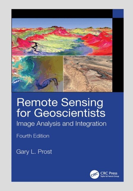
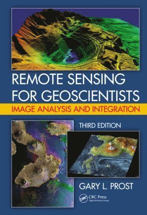
The fourth edition of the bestselling Remote Sensing for Geoscientists: Image Analysis and Integration expands the scope of remote sensing to cover image systems that did not exist 11 years ago when the third edition was published. It is thoroughly updated to meet the needs of readers today and provides examples of new capabilities using Google Earth© and various apps. It describes the latest remote sensing systems and sensors, provides examples of imagery, and explains how to analyze and integrate remote sensing images in projects that require superior results. Lavishly illustrated, it serves as a how-to guide for those using remote sensing in Earth Sciences for mapping and monitoring.New in the Fourth Edition:Thoroughly revised to address remote sensing technological advances achieved in recent years.Includes new examples of using remote sensing for successful projects in water, oil, gas, and mineral exploration and exploitation, forensic remote sensing, and environmental monitoring.Reviews the latest instrumentation, processing, and integrated analysis of imagery.Includes two new chapters, including one on clandestine geologic remote sensing and a new chapter on free Google Earth software to remotely sense anywhere on Earth and process imagery to highlight geologic features.Maintains a clear style and simple language understandable by the average person.This is a terrific, all-encompassing text for professionals in industry and governmental agencies, academics, and students who are part of the remote sensing and geospatial community and working in the fields of geology, geosciences, energy and mining industry, groundwater, and environmental engineering and for those who are involved in monitoring natural resources, the environment, and natural disasters.
Remote Sensing for Geoscientists
Image Analysis and Integration, Third Edition
Inbunden, Engelska, 2013
1 855 kr
Tillfälligt slut
This third edition of the bestselling Remote Sensing for Geologists: A Guide to Image Interpretation is now titled Remote Sensing for Geoscientists: Image Analysis and Integration. The title change reflects that this edition applies to a broad spectrum of geosciences, not just geology; stresses that remote sensing has become more than photointerpretation; and emphasizes integration of multiple remote sensing technologies to solve Earth science problems. The text reviews systems and applications, explains what to look for when analyzing imagery, and provides abundant case histories to illustrate the integration and application of these tools.See What’s New in the Second Edition: Broader coverage to include integration of multiple remote sensing technologiesExpanded with significant new illustrations in color and reviews of new satellites and sensors Analysis of imagery for geobotanical remote sensing, remote geochemistry, modern analogs to ancient environments, and astrogeologyThe book covers how to initiate a project, including determining the objective, choosingthe right tools, and selecting imagery. It describes techniques used in geologic mapping and mineral and hydrocarbon exploration, image analysis used in mine development and petroleum exploitation, site evaluation, groundwaterdevelopment, surface water monitoring, geothermal resource exploitation, and logistics. It also demonstrates how imageryis used to establish environmental baselines; monitor land, air, and water quality; maphazards; and determine the effects of global warming.The many examples of geologic mapping on other planets and the moon highlight how to analyze planetary surface processes, map stratigraphy, and locate resources. The book then examines remote sensing and the public, geographic information systems and Google Earth, and how imagery is used by the media, in the legal system, in public relations, and by individuals. Readers should come away with a good understanding of what is involved in image analysis and interpretation and should be ableto recognize and identify geologic features of interest. Having read this book, they should be able to effectively use imagery in petroleum, mining, groundwater, surface water, engineering, and environmental projects.
1 705 kr
Skickas inom 10-15 vardagar
This glossary provides a ready reference to those in the geosciences with the need to translate from English to Spanish or vice versa. It also provides clear communication, a better understanding, and closer working relationships among geoscientists, engineers, and businessmen.