
George L. Heritage – författare
924 kr
Skickas inom 5-8 vardagar
1 060 kr
Läs direkt efter köp
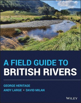
Temperate rivers are influenced by many factors including geology, climate, soils, sediment type, flow, as well as human activity. The complex interactions of the non-anthropogenic controlling factors have led to a wonderful diversity of river type throughout the British Isles. Sadly, almost all rivers in the UK have suffered significant and long-lasting modification by unsympathetic management, that has all but destroyed this variety, creating watercourses that are simplified conduits for water and sediment, designed primarily to drain the land and reduce flood risk. This volume aims to help reverse this, illustrating using over 200 images and descriptions, this variety of rivers in Britain, highlighting the many forms that temperate river systems take and providing an accessible summary of the underlying river science knowledge base.
A Field Guide to British Rivers covers the full range of upland and lowland channel types and describes the full variety of substrate conditions from bedrock through boulder, cobble and gravel, to silt dominated systems. The authors describe examples gathered from their extensive research and practical experience working with rivers throughout mainland Britain and set those examples in their wider landscape context to exemplify the natural functioning of temperate river types. This book offers a practical and contextualised guide to contribute to efforts towards the sympathetic and sustainable restoration and re-naturalisation of degraded channels in the UK. Offering a unique viewpoint of both the underpinning science and the practicalities of river management, A Field Guide to British Rivers is an essential a stand-alone guide for anyone involved in river restoration and management as well as for those simply interested in rivers in general.
Written as a field guide to demonstrate practical examples of river types, and to highlight the pressures they experience and their often-parlous condition, this book is intended to better inform both river management approaches and the policy necessary to achieve this. Fundamentally, the authors seek to demonstrate how the hydrological, geomorphological, and ecological functions of rivers and their catchments are inexorably intertwined, and together how they generate and maintain rivers as dynamic entities.

1 060 kr
Läs direkt efter köp
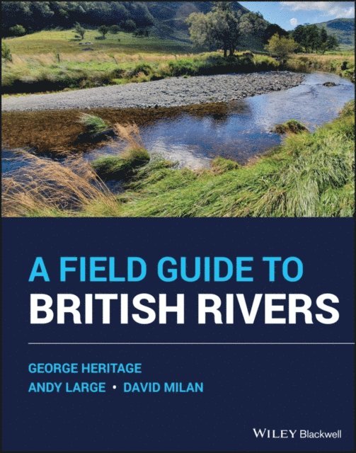
Temperate rivers are influenced by many factors including geology, climate, soils, sediment type, flow, as well as human activity. The complex interactions of the non-anthropogenic controlling factors have led to a wonderful diversity of river type throughout the British Isles. Sadly, almost all rivers in the UK have suffered significant and long-lasting modification by unsympathetic management, that has all but destroyed this variety, creating watercourses that are simplified conduits for water and sediment, designed primarily to drain the land and reduce flood risk. This volume aims to help reverse this, illustrating using over 200 images and descriptions, this variety of rivers in Britain, highlighting the many forms that temperate river systems take and providing an accessible summary of the underlying river science knowledge base.
A Field Guide to British Rivers covers the full range of upland and lowland channel types and describes the full variety of substrate conditions from bedrock through boulder, cobble and gravel, to silt dominated systems. The authors describe examples gathered from their extensive research and practical experience working with rivers throughout mainland Britain and set those examples in their wider landscape context to exemplify the natural functioning of temperate river types. This book offers a practical and contextualised guide to contribute to efforts towards the sympathetic and sustainable restoration and re-naturalisation of degraded channels in the UK. Offering a unique viewpoint of both the underpinning science and the practicalities of river management, A Field Guide to British Rivers is an essential a stand-alone guide for anyone involved in river restoration and management as well as for those simply interested in rivers in general.
Written as a field guide to demonstrate practical examples of river types, and to highlight the pressures they experience and their often-parlous condition, this book is intended to better inform both river management approaches and the policy necessary to achieve this. Fundamentally, the authors seek to demonstrate how the hydrological, geomorphological, and ecological functions of rivers and their catchments are inexorably intertwined, and together how they generate and maintain rivers as dynamic entities.
1 460 kr
Skickas inom 11-20 vardagar
1 661 kr
Läs direkt efter köp
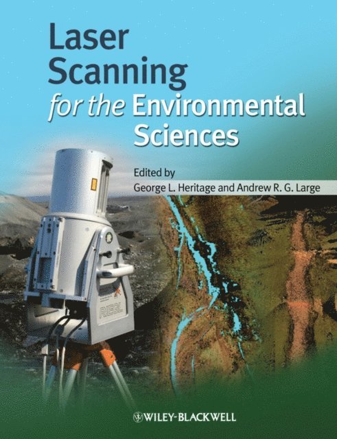
The proposed book collates a series of invited peer revieved papers presented at the a conference on geoinformatics and LIDAR to be held at the National Centre for Geocomputation based in the National University of Ireland, Maynooth. Current constraints in field survey and DEM construction are reviewed together with technical and applied issues around the new technology. The utility of the data in process modelling is also covered. The book will be of great value to researchers in the field of geomorphology, geostatistics, remote sensing and GIS and will prove extremely useful to students and practitioners concerned with terrain analysis. The proposed work will:
Highlight major technological breakthrough in 3D data collection. Feature examples of application across a wide range of environmental areas. Critically evaluate the role of laser based techniques in the environment. Detail theory and application of laser techniques in the natural environment.