
Janette Norton – författare

188 kr
Skickas
208 kr
Läs direkt efter köp

208 kr
Läs direkt efter köp
A guidebook to 30 circular day walks in the west of France’s Provence. Exploring the dramatic scenery of Drome Provencale, the Vaucluse and the Var regions of Provence, the walks are suitable for beginner and experienced walkers alike and are perfect for walking year-round.
The routes range from 4-16km (2-10 miles) and can be enjoyed in 2-7 hours. Walks span from the Baronnies in the north to the Ste-Baume ridge in the south and can be tackled from charming bases such as Nyons, Apt and Aix-en-Provence.
Sketch maps are included for each route Highlights include Baronnies, Ste-Baume ridge, Vaucluse, Sainte-Baume massif Information on local history and wildlife GPX files available to download Part of a 2-volume Cicerone series on Provence
208 kr
Läs direkt efter köp

208 kr
Läs direkt efter köp
A guidebook to 30 circular day walks in the east of France’s Provence. Exploring the dramatic scenery of the Alpes Maritimes, Alpes de Haute-Provence and Mercantour regions of Provence, the walks are suitable for beginner and experienced walkers alike and are perfect for walking year-round.
The routes range from 4-21km (2-13 miles) and can be enjoyed in 2-8 hours. They go from key areas including Vence, Grasse and Digne-les-Bains.
Sketch maps are included for each route Local highlights include Mont Mounier, Verdon Gorge and Estérel Information on local history and wildlife GPX files available to download Part of a 2-volume Cicerone series on Walking in Provence
245 kr
Läs direkt efter köp
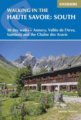
A guidebook to 30 walks in southern Haute Savoie. Exploring the dramatic scenery of the French Alps between Chamonix and Annecy, the walks are suitable for beginner and experienced walkers alike.
Routes range from 7 to 20km (4–12 miles) and can be enjoyed in 3–8 hours. Walks have been graded from easy to difficult allowing you to choose routes suitable for your ability.
1:50,000 maps are included for each route GPX files available to download Detailed information on planning, accommodation and transport Part of a 2-volume set, an accompanying Cicerone guidebook Walking in the Haute Savoie: North is also available
Walking in the Haute Savoie: North
30 day walks - Salève, Vallée Verte, Abondance, Bellevaux, Morzine
201 kr
Läs direkt efter köp
204 kr
Läs direkt efter köp
A guidebook to 30 walks in the northern Haute Savoie. Exploring the dramatic scenery of the French Alps south of Lake Geneva, the walks are suitable for beginner and experienced walkers alike.
Routes range from 7 to 14km (4–9 miles) and can be enjoyed in 2–7 hours. Walks have been graded from easy to difficult allowing you to choose routes suitable for your ability.
1:50,000 maps are included for each route GPX files available to download Detailed information on planning, accommodation and transport Part of a 2-volume set, an accompanying Cicerone guidebook Walking in the Haute Savoie: South is also available
241 kr
Läs direkt efter köp
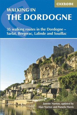
A guidebook to 35 day walks in France’s Dordogne region. Exploring the beautiful scenery of this historic area, the walks are suitable for beginner and experienced walkers alike.
Walks range from 6 to 19km (4–12 miles) and can be enjoyed in 2–6 hours. Each route is easily accessible from either Bergerac, Lalinde, Sarlat or Souillac (Lot) and has been graded to allow you to choose routes suitable for you.
1:50,000 maps are included for each route GPX files available to download Detailed information on accommodation, equipment to take, local plants and wildlife Highlights include medieval towns, châteaux and caves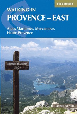
173 kr
Skickas
206 kr
Skickas
206 kr
Skickas