
Jim Manthorpe – författare
Visar alla böcker från författaren . Handla med fri frakt och snabb leverans.
6 produkter
6 produkter
Häftad, Engelska, 2021
151 kr
Skickas
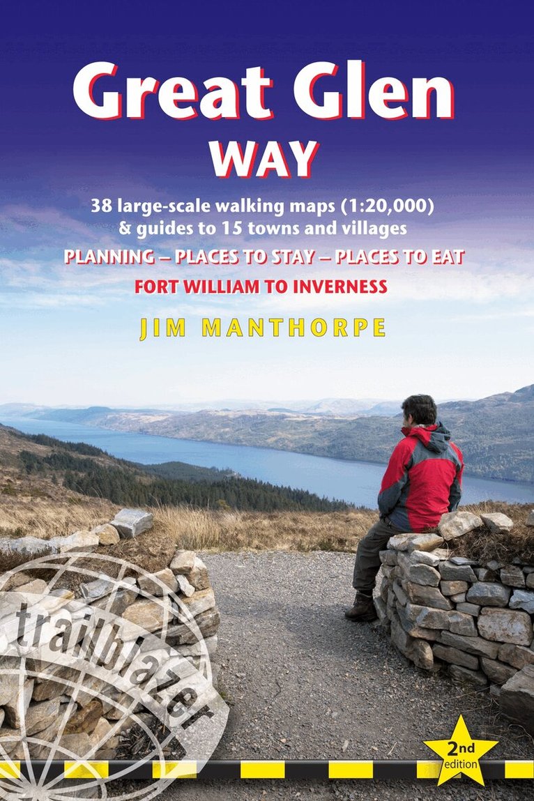
All-in-one, practical guide to walking the Great Glen Way long-distance footpath.The trail begins where the West Highland Way ends - at Fort William - and follows the Great Glen faultline to finish at Inverness after 79 miles (127km). The trail passes Loch Lochy, Loch Oich and Loch Ness and also follows the towpath of the Caledonian Canal.It's a relatively easy week-long walk amongst beautiful Highland scenery but there's a high level option between Fort Augustus and Drumnadrochit that gives even better mountain views.This 2nd edition has been re-walked and fully updated.Includes 38 detailed walking maps in two-colour style: the largest-scale maps available - at just under 1:20,000 (8cm or 31/8 inches to 1 mile) these are bigger than even the most detailed walking maps currently available in the shops.Unique mapping features - walking times, directions, tricky junctions, places to stay, places to eat, points of interest. These are not general-purpose maps but fully edited maps drawn by walkers for walkers.With accommodation, pubs and restaurants in detailed guides to 15 towns and villages including Fort William and Inverness.Itineraries for all walkers - whether hiking the entire route or sampling highlights on day walks or short breaks.Detailed public transport information - Buses and trains for all access points.Practical information for all budgets.What to see; where to eat with reviews (cafes, teashops, pubs, restaurants, takeaways); where to stay with reviews (hostels, campsites, bunkhouses, B&Bs, hotels).Downloadable GPS waypoints also included.Written by Scottish hillwalker Jim Manthorpe.
Häftad, Engelska, 2023
261 kr
Skickas
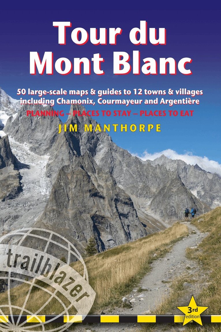
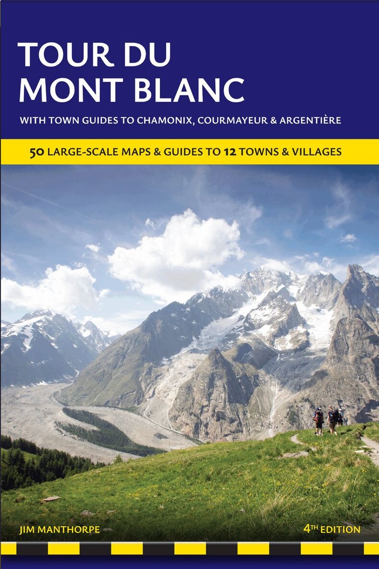
All the information you need to enjoy your mountain trail adventure At 4810m (15,781ft), Mont Blanc is the highest mountain in western Europe, and one of the most famous mountains in the world. The trail (105 miles, 168km) that circumnavigates the massif, passing through France, Italy and Switzerland, is the most popular long distance walk in Europe. The Trailblazer Tour du Mont Blanc guide Includes:60 maps - 12 town and village plans and 50 large-scale walking maps - at 1:20,000 - showing route times, gradients, where to stay, interesting features. Walking directions, tricky junctions, places to stay and eat, points of interest and walking times are all written onto the maps themselves in the places to which they apply. With their uncluttered clarity, these are not general-purpose maps but fully-edited maps drawn by walkers for walkersItineraries for all walkers - whether walking the 105 mile (168km) route in its entirety, or sampling the highlights on day walks and short breaksPractical information for all budgets - where to stay (campsites, gites, hostels, B&Bs, lodges and hotels), where to eat, what to seeComprehensive background information - the Alps, flora and fauna, the history of mountaineering and trekking in the region and the conquest of Mont Blanc in 1786 by Bourrit and BalmatFull public transport information - for all access pointsClimbing Mont Blanc - practical information, guides, the route to the top
Häftad, Engelska, 2021
185 kr
Skickas
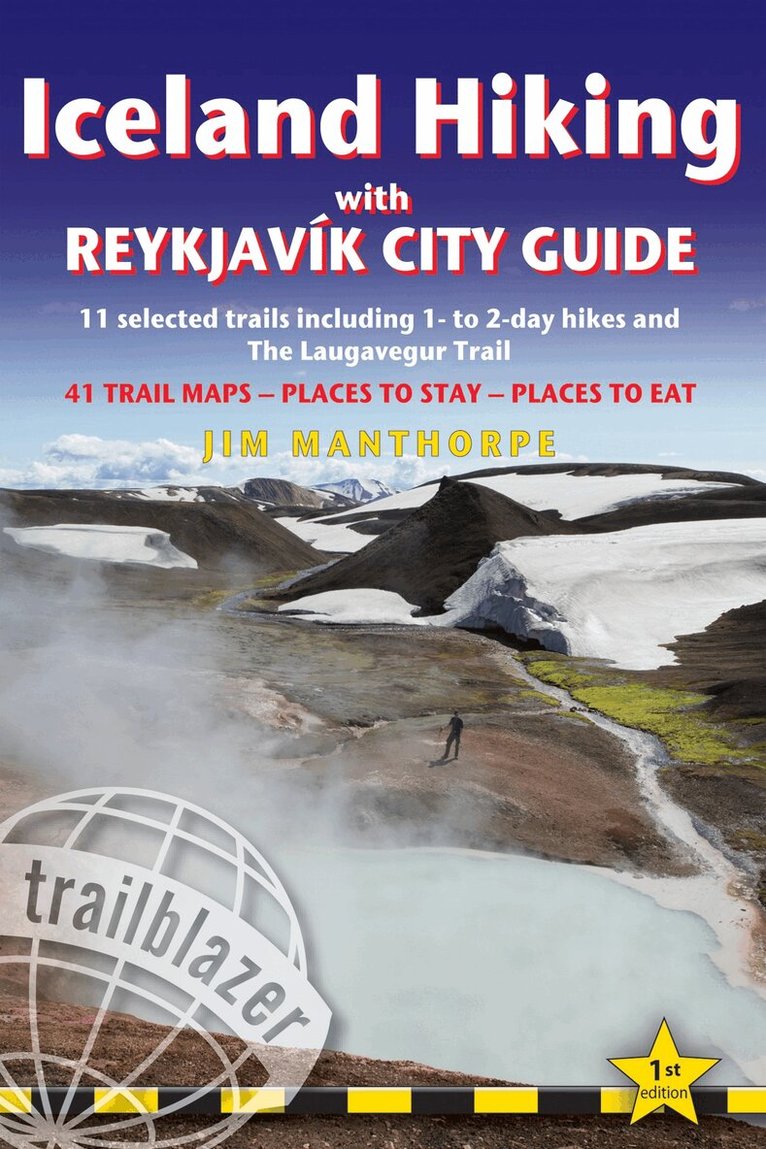
Iceland offers a world of hiking opportunities like no other place on earth. The famous 55km Laugavegur Trek takes you past glaciers, volcanoes, steaming fumaroles and hot springs all set in a landscape of yellow rhyolite and black ash. This new guide gives you plenty of other options from hiking in the shadow of the largest ice-cap in Europe at Skaftafell to easier day hikes around the vibrant capital city of Reykjavik.41 detailed walking maps in two-colour in the classic Trailblazer style - showing route times, gradients, where to stayDetailed Reykjavik city guide - and mapsItineraries for all walkers on 11 specially selected hikes - from day hikes around Reykjavik to more challenging 6-day treks including the 55km Laugavegur TrekPractical information for all budgets - where to stay (campsites, hostels and huts, B&Bs, lodges and hotels), where to eat, what to seeComprehensive background information - geology and vulcanology, flora and fauna, history, peopleFull public transport information - for all access points.
Häftad, Engelska, 2024
174 kr
Skickas
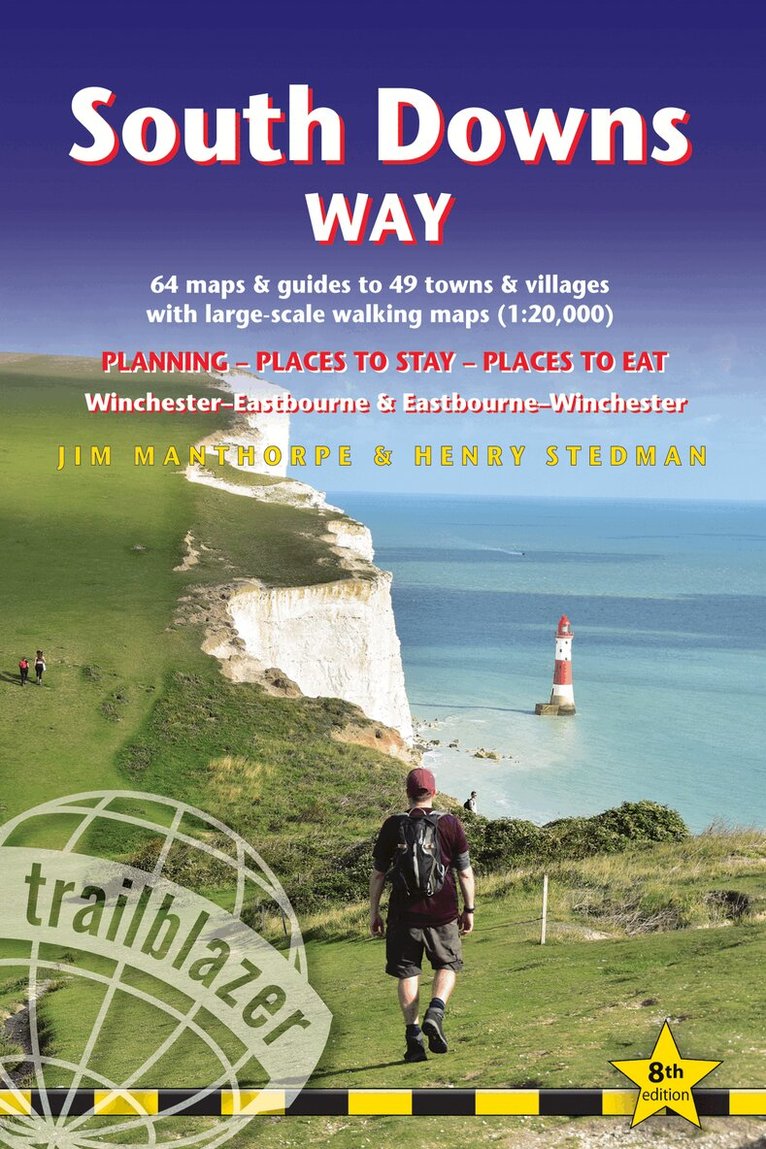
All the information you need to walk the South Downs Way. Trailblazer's guide to South Downs Way shows the route in both directions from Winchester to Eastbourne and from Eastbourne to Winchester. This handy, pocket size South Downs Way guide includes: 82 Maps in two-colour style - 60 large-scale walking maps - 1:20,000 (3-1/8 inches to 1 mile), 11 town plans, 10 stage maps with trail profiles showing hills and descents, and 2 overview mapsDetailed accommodation with reviews - B&Bs, campsites, pubs, hotels, bunkhousesWhere to eat with reviews - cafes, teashops, pubs, takeaways and restaurantsComprehensive public transport information - with frequency of services for all access points on the PathDownloadable GPS waypointsItineraries for all walkers - whether hiking the entire route or sampling highlights on day walks, weekends or short breaksUnique mapping features - walking times, directions, tricky junctions, places to stay, places to eat, points of interest written onto the mapsFlora and fauna - four page full colour flower guide, plus an illustrated section on local wildlifeGreen hiking - understanding the local environment and minimizing our impact on it
Häftad, Engelska, 2026
207 kr
Kommande
All the information you need to plan your mountain trail adventure on this iconic route. At 4810m (15,781ft), Mont Blanc is western Europe’s highest mountain, and one of the most famous mountains in the world. The trail (105 miles,168km) that circumnavigates the massif, passing through France, Italy and Switzerland, is the most popular long distance walk in Europe. This rewalked and updated Trailblazer Tour du Mont Blanc guide includes:60 maps -12 town and village plans and 50 large-scale walking maps at 1:20,000 showing route times, gradients, where to stay, interesting featuresWalking directions, tricky junctions, places to stay and eat, points of interest and walking times are all written onto the maps themselves in the places to which they apply. With their uncluttered clarity, these are not general-purpose maps but fully-edited maps drawn by walkers for walkersItineraries for all walkers - whether walking the 105 mile (168km) route in its entirety, or sampling the highlights on day walks and short breaksInformation for walkers doing the route in both directions - clockwise or anticlockwisePractical information for all budgets - where to stay (campsites, gites, hostels, B&Bs, lodges and hotels), where to eat, what to seeComprehensive background information - the Alps, flora and fauna, the history of mountaineering and trekking in the region and the conquest of Mont Blanc in 1786 by Bourrit and BalmatFull public transport information - for all access pointsClimbing Mont Blanc - practical information, guides, the route to the top, waypoints and what3words references
Häftad, Engelska, 2021
273 kr
Tillfälligt slut
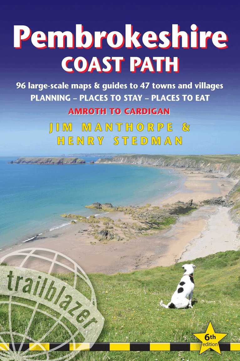
The Pembrokeshire Coast Path follows a National Trail for 186 miles (299km) around the magnificent coastline of the Pembrokeshire Coast National Park in south-west Wales. Renowned for its unspoilt sandy beaches, secluded coves, tiny fishing villages and off-shore islands rich in bird and marine life, this National Trail provides some of the best coastal walking in Britain.This practical, comprehensive guide to walking the Pembrokeshire Coast Path provides 96 trail maps and 15 town plans, including planning, places to stay, places to eat, what to see.The Trailblazer Pembrokeshire Coast Path Guide includes:96 large-scale trail maps and 15 town plans in two-colour style, 14 stage maps and 2 overview mapsDetailed accommodation with reviews: B&Bs, campsites, pubs, hotels, bunkhousesWhere to eat with reviews: cafes, teashops, takeaways, pubs and restaurantsDetailed public transport information with frequency of servicesUnique mapping features - In many walking guides the reader has to read a route description then try to relate it to the map. Our guides are easier to use because walking directions, tricky junctions, places to stay and eat, points of interest and walking times are all written onto the maps themselves in the places to which they apply. With their uncluttered clarity, these are not general-purpose maps but fully- edited maps drawn by walkers for walkers.Downloadable GPS waypoints also included.Includes EXTRA COLOUR OVERVIEW MAPPINGThe largest scale walking maps available - At just under 1:20,000 (8cm or 31/8 inches to 1 mile) our maps are bigger than even the most detailed walking maps currently available in the shops.An all-in-one guide - Trailblazer guides include practical information not usually found in walking guides to the UK: reviews of places to stay, places to eat, attractions along the way and detailed public transport information showing all access points on the path, for weekend and day walkers.Itineraries for all walkers, whether hiking the entire route or sampling highlights on day walks, weekends or short breaksFlora and fauna - four page full colour flower guide, plus an illustrated section on local wildlifeGreen hiking - understanding the local environment and minimizing our impact on it