
John Hayes – författare

762 kr
Skickas inom 5-8 vardagar
- Nyhet
181 kr
Skickas
- Nyhet
186 kr
Skickas

488 kr
Skickas inom 5-8 vardagar

460 kr
Skickas inom 5-8 vardagar

855 kr
Skickas inom 10-15 vardagar

2 113 kr
Skickas inom 5-8 vardagar

630 kr
Läs direkt efter köp

1 013 kr
Läs direkt efter köp

1 013 kr
Läs direkt efter köp

510 kr
Skickas inom 10-15 vardagar

2 466 kr
Skickas inom 10-15 vardagar

888 kr
Läs direkt efter köp

888 kr
Läs direkt efter köp

904 kr
Läs direkt efter köp

340 kr
Skickas inom 5-8 vardagar

628 kr
Skickas inom 5-8 vardagar

1 180 kr
Skickas inom 10-15 vardagar

384 kr
Skickas inom 10-15 vardagar

404 kr
Läs direkt efter köp

1 765 kr
Läs direkt efter köp

66 kr
Läs direkt efter köp

2 660 kr
Skickas inom 10-15 vardagar

545 kr
Läs direkt efter köp

545 kr
Läs direkt efter köp

986 kr
Läs direkt efter köp
242 kr
Läs direkt efter köp

249 kr
Läs direkt efter köp
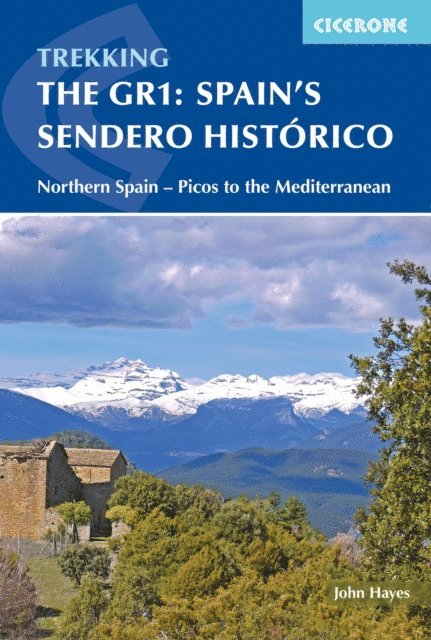
A guidebook to trekking the GR1 Sendero Histórico through northern Spain. Suitable for fit experienced trekkers, this quiet 1247km (775 mile) route stretches from Puerto de Tarna on the edge of the Pico de Europa National Park, across the southern flank of the Cantabrian Mountains, through the Basque Country and Catalunya, to Sant Martí d’Empúries on the Mediterranean coast, and can be completed in around two months.
The GR1 is divided into 53 stages of 11 to 36km (7–21 miles). These are presented in 7 sections, with start and end points that are easily accessed by public transport, for the benefit of those who wish to walk only part of the route. An extension to Finisterre and the Atlantic using GR routes is also included.
Route description illustrated with 1:100,000 mapping GPX file available for download Handy route summary and facilities tables help you plan your itinerary Information on accommodation and facilities Notes on the regions’ fascinating history
235 kr
Läs direkt efter köp
259 kr
Läs direkt efter köp
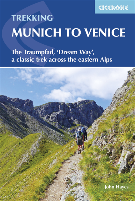
A guidebook to trekking the Traumpfad or ''Dream Way'' from Munich''s Mariënplatz to the Piazza San Marco in Venice. Covering 570km (354 miles), this long-distance trek through Germany, Austria and Italy takes around 1 month to hike and is suitable for most able walkers with a head for heights.
The route is described from north to south in 30 stages, each between 10 and 34km (6–21 miles) in length. Five alternate stages and a day spent traversing via ferrata in the Dolomites are also described.
1:100,000 mapping plus larger-scale urban maps for key locations GPX files available to download Handy route planner helps you plan your itinerary Refreshment, transport and accommodation information given for each trek stage Highlights include the Karwendel, Tux and Zillertal Alps and the Dolomites