
Kendall Carter – författare
Visar alla böcker från författaren . Handla med fri frakt och snabb leverans.
8 produkter
8 produkter
Häftad, Engelska, 2025
446 kr
Skickas inom 5-8 vardagar
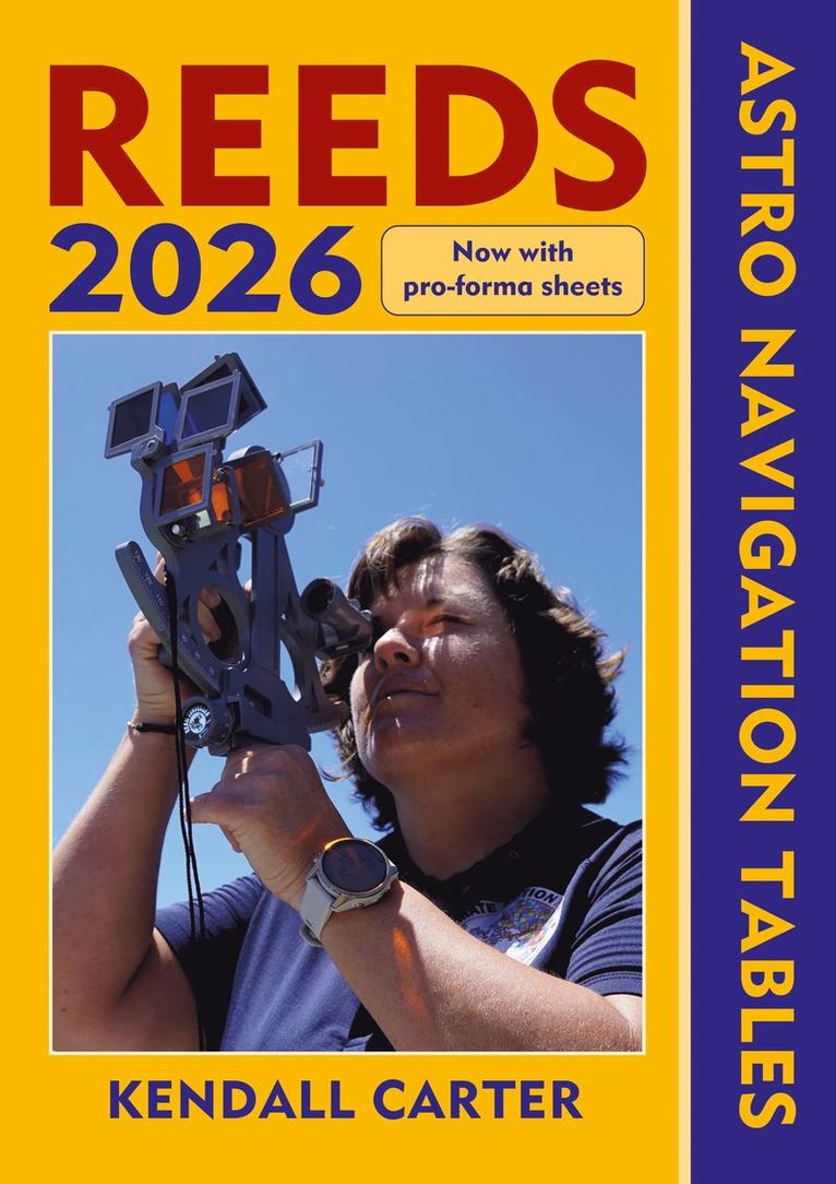
The established book of annual astro-navigation tables compiled specifically for the needs of boaters.This superbly compact almanac and sight reduction tables contains information the ocean-going sailor needs in order to navigate by the sun, moon, stars and planets, using tables devised by practical ocean navigators. This book, together with a sextant, will help sailors to navigate confidently and safely when out of the sight of land.This 2026 edition is completely up to date and continues to feature the well-received additions of the past few years, including forms to help determine True Altitude (for the sun, stars and planets), Calculated Altitude (using the versine formula) and Azimuth (using the ABC Tables), as well as a pro forma for calculating Intercept. These tables, along with clear and easy to use star ID charts, mean you can resolve any calculation you're ever going to need. There is also an introductory section on practising ashore, with helpful worked examples as an aide memoire, and plenty of space for making notes and calculations.While they should not be relied upon as anyone’s sole means of navigation, being so easy to use, Reeds tables encourage active navigation and a better understanding by sailors of where they have been and where to go next – rewarding in itself and essential in the event of GPS failure.
E-bok
PDF, Engelska, 2024511 kr
Läs direkt efter köp
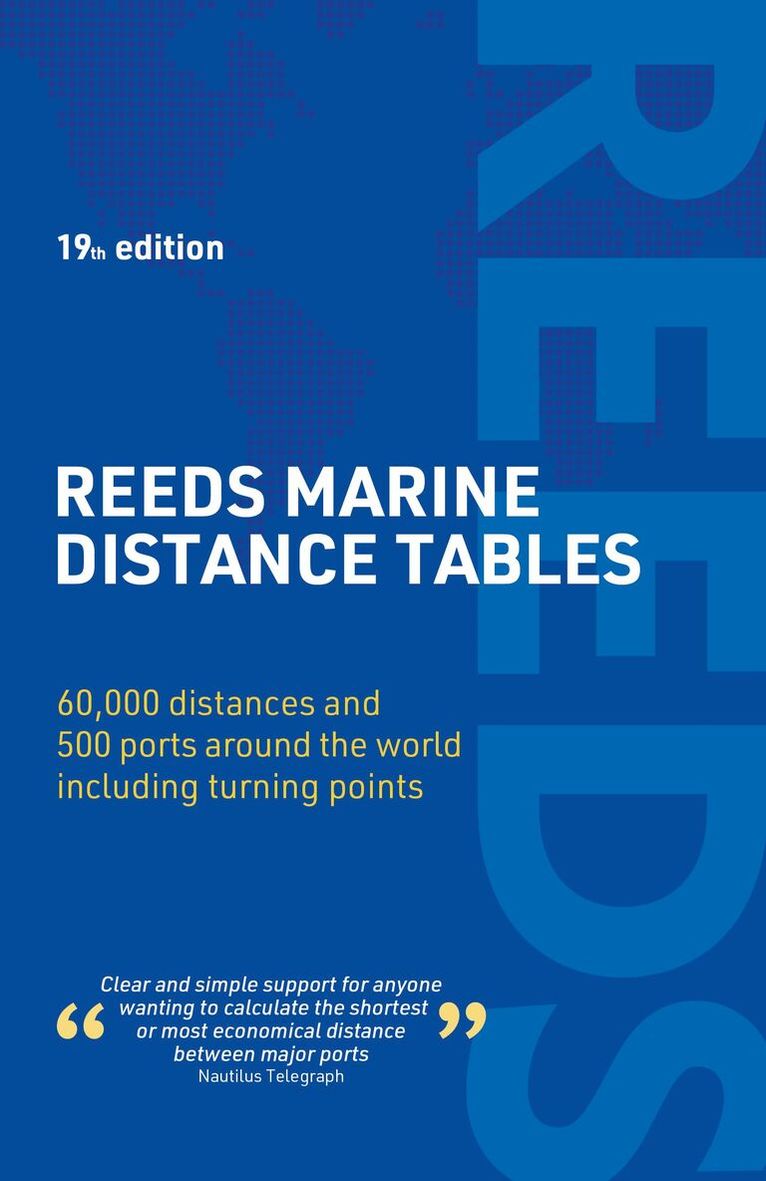
Reeds Marine Distance Tables are the perfect ready-reckoner for captains, navigators and owners of merchant and cruise ships large and small wanting a quick and accurate distance reference between all the regularly used commercial ports around the world. They are also of increasing value to the superyacht fleet.The book is divided into key ''market areas'', and includes a pull-out map for area identification and easy see-at-a-glance port reference. Traffic Separation Schemes are calculated into the tables whilst the distance to any port not included can easily be determined by making an approximation from the next closest port. Useful tables of major ''turning points'' around the world (such as Cape Finisterre, Cape Horn and the Dover Straits), Transatlantic distances, world time zones, and time and speed conversion tables are also included.As well as incorporating general updates and improvements, this edition has been expanded to include more Indian Ocean ports, routes reflecting the increasing role of China in international shipping, as well as inter-distance tables for the Adriatic and Aegean. Freighter movements, cargo tonnage and cruise ship destinations have all been factored into considering details on the top ten busiest ports worldwide.Reeds Marine Distance Tables are an invaluable reference for ship owners, operators, brokers, navigators and superyacht skippers. Using this one reference, anyone can calculate the shortest or most economical distances between all the major ports in the world.
Häftad, Engelska, 2024
492 kr
Skickas
Reeds Marine Distance Tables are the perfect ready-reckoner for captains, navigators and owners of merchant and cruise ships large and small wanting a quick and accurate distance reference between all the regularly used commercial ports around the world. They are also of increasing value to the superyacht fleet.The book is divided into key 'market areas', and includes a pull-out map for area identification and easy see-at-a-glance port reference. Traffic Separation Schemes are calculated into the tables whilst the distance to any port not included can easily be determined by making an approximation from the next closest port. Useful tables of major 'turning points' around the world (such as Cape Finisterre, Cape Horn and the Dover Straits), Transatlantic distances, world time zones, and time and speed conversion tables are also included.As well as incorporating general updates and improvements, this edition has been expanded to include more Indian Ocean ports, routes reflecting the increasing role of China in international shipping, as well as inter-distance tables for the Adriatic and Aegean. Freighter movements, cargo tonnage and cruise ship destinations have all been factored into considering details on the top ten busiest ports worldwide.Reeds Marine Distance Tables are an invaluable reference for ship owners, operators, brokers, navigators and superyacht skippers. Using this one reference, anyone can calculate the shortest or most economical distances between all the major ports in the world.
E-bok
PDF, Engelska, 2026530 kr
Läs direkt efter köp
Reeds Marine Distance Tables is the perfect ready reckoner for captains, navigators and ship owners wanting a quick and accurate distance reference between all the regularly used commercial ports around the world.Divided into key 'market areas', Reeds Marine Distance Tables includes a pull-out map for area identification and an easy see-at-a-glance port reference. Traffic Separation Schemes are calculated into the tables already, for ease of use. Useful tables of major 'turning points' around the world (including Cape Finisterre, Cape Horn and the Dover Straits), transatlantic distances, world time zones, and time and speed conversion tables are also included. Comprehensively revised for its 19th edition, Reeds Marine Distance Tables is an invaluable resource for ship owners, operators, brokers, navigators and superyacht skippers. Using this one reference, anyone can calculate the shortest or most economical distances between all the major ports in the world.
Häftad, Engelska, 2026
487 kr
Skickas inom 5-8 vardagar
Reeds Marine Distance Tables is the perfect ready reckoner for captains, navigators and ship owners wanting a quick and accurate distance reference between all the regularly used commercial ports around the world.Divided into key 'market areas', Reeds Marine Distance Tables includes a pull-out map for area identification and an easy see-at-a-glance port reference. Traffic Separation Schemes are calculated into the tables already, for ease of use. Useful tables of major 'turning points' around the world (including Cape Finisterre, Cape Horn and the Dover Straits), transatlantic distances, world time zones, and time and speed conversion tables are also included.Comprehensively revised for its 19th edition, Reeds Marine Distance Tables is an invaluable resource for ship owners, operators, brokers, navigators and superyacht skippers. Using this one reference, anyone can calculate the shortest or most economical distances between all the major ports in the world.
E-bok
PDF, Engelska, 2025428 kr
Läs direkt efter köp
The established book of annual astro-navigation tables compiled specifically for the needs of boaters.This superbly compact almanac and sight reduction tables contains information the ocean-going sailor needs in order to navigate by the sun, moon, stars and planets, using tables devised by practical ocean navigators. This book, together with a sextant, will help sailors to navigate confidently and safely when out of the sight of land.This 2026 edition is completely up to date and continues to feature the well-received additions of the past few years, including forms to help determine True Altitude (for the sun, stars and planets), Calculated Altitude (using the versine formula) and Azimuth (using the ABC Tables), as well as a pro forma for calculating Intercept. These tables, along with clear and easy to use star ID charts, mean you can resolve any calculation you're ever going to need. There is also an introductory section on practising ashore, with helpful worked examples as an aide memoire, and plenty of space for making notes and calculations.While they should not be relied upon as anyone's sole means of navigation, being so easy to use, Reeds tables encourage active navigation and a better understanding by sailors of where they have been and where to go next rewarding in itself and essential in the event of GPS failure.
Häftad, Engelska, 2026
427 kr
Kommande
The established book of annual astro-navigation tables compiled specifically for the needs of boaters.This superbly compact almanac and sight reduction tables contains information the ocean-going sailor needs in order to navigate by the sun, moon, stars and planets, using tables devised by practical ocean navigators. This book, together with a sextant, will help sailors to navigate confidently and safely when out of the sight of land.This 2027 edition is completely up to date and continues to feature the well-received additions of the past few years, including forms to help determine True Altitude (for the sun, stars and planets), Calculated Altitude (using the versine formula) and Azimuth (using the ABC Tables), as well as a pro forma for calculating Intercept. These tables, along with clear and easy to use star ID charts, mean you can resolve any calculation you're ever going to need. There is also an introductory section on practising ashore, with helpful worked examples as an aide memoire, and plenty of space for making notes and calculations.While they should not be relied upon as anyone’s sole means of navigation, being so easy to use, Reeds tables encourage active navigation and a better understanding by sailors of where they have been and where to go next – rewarding in itself and essential in the event of GPS failure.

E-bok
PDF, Engelska, 2019348 kr
Läs direkt efter köp
Reeds Astro Navigation Tables is an established book of annual astro-navigation tables compiled specifically for the needs of yachtsmen. It contains all the information the ocean-going sailor needs (without the bulk) in order to navigate by the sun, moon, planets and stars, using tables devised by practical ocean navigators. This book, together with a sextant, will enable sailors to navigate confidently and safely when out of the sight of land.The book continues to feature the well-received additions of the past couple of years, including forms to help determine True Altitude (for the sun, planets and stars), Calculated Altitude (using the versine formula) and Azimuth (using the ABC Tables), as well as a pro forma for calculating Intercept. With 8 extra pages and an improved layout, there is plenty of space for making notes and calculations.