
Kun-Shan Chen – författare
782 kr
Skickas inom 10-15 vardagar
824 kr
Skickas inom 10-15 vardagar
838 kr
Skickas inom 10-15 vardagar

2 973 kr
Skickas inom 10-15 vardagar

2 436 kr
Skickas inom 10-15 vardagar
897 kr
Skickas inom 10-15 vardagar
891 kr
Läs direkt efter köp
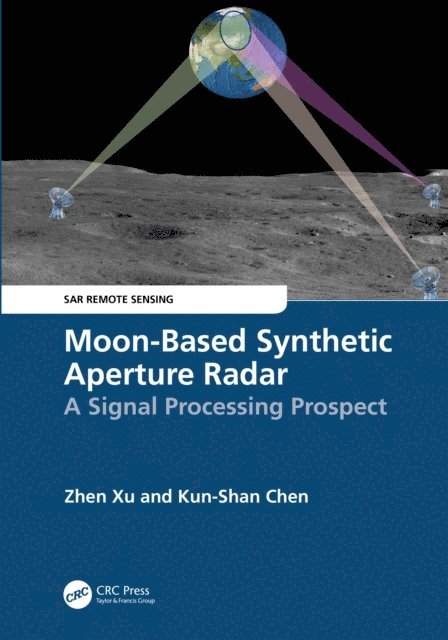
Lunar explorations have received increasing attention in recent years with tremendous application values, including using the Moon as a remote sensing platform for Earth observation. As an active sensor, the Synthetic Aperture Radar (SAR) can detect changes in the atmosphere, terrain, and ocean. Moon-based SAR, complementary to the spaceborne SAR systems, expands our capabilities of watching and understanding the Earth. This book explains the Moon-Earth observation geometry, generic parameters, image focusing, and outlook using the Moon-based SAR. Written as a SAR imaging of Earth on the lunar-based platform, it makes it an essential reference to those interested in planetary and Earth sciences.
FEATURES
Uses the Moon as a remote sensing platform for Earth observation Explains how to obtain a high spatial resolution with a short revisit time using the Moon-based SAR Covers the observation geometry, range and signal models, two-dimensional signal spectrum, and focusing algorithms for the Moon-based SAR Presents a detailed analysis of sources of phase errors in the Moon-based SAR signal Includes global case studies and introduces conceptual ideas for further researchThis book is intended for senior graduate students, professional researchers, and engineers studying and working in the fields of lunar exploration and remote sensing applications, especially when dealing with high-orbit SAR studies.

891 kr
Läs direkt efter köp
Lunar explorations have received increasing attention in recent years with tremendous application values, including using the Moon as a remote sensing platform for Earth observation. As an active sensor, the Synthetic Aperture Radar (SAR) can detect changes in the atmosphere, terrain, and ocean. Moon-based SAR, complementary to the spaceborne SAR systems, expands our capabilities of watching and understanding the Earth. This book explains the Moon-Earth observation geometry, generic parameters, image focusing, and outlook using the Moon-based SAR. Written as a SAR imaging of Earth on the lunar-based platform, it makes it an essential reference to those interested in planetary and Earth sciences.
FEATURES
Uses the Moon as a remote sensing platform for Earth observation Explains how to obtain a high spatial resolution with a short revisit time using the Moon-based SAR Covers the observation geometry, range and signal models, two-dimensional signal spectrum, and focusing algorithms for the Moon-based SAR Presents a detailed analysis of sources of phase errors in the Moon-based SAR signal Includes global case studies and introduces conceptual ideas for further researchThis book is intended for senior graduate students, professional researchers, and engineers studying and working in the fields of lunar exploration and remote sensing applications, especially when dealing with high-orbit SAR studies.
942 kr
Läs direkt efter köp
2 436 kr
Skickas inom 10-15 vardagar
774 kr
Läs direkt efter köp
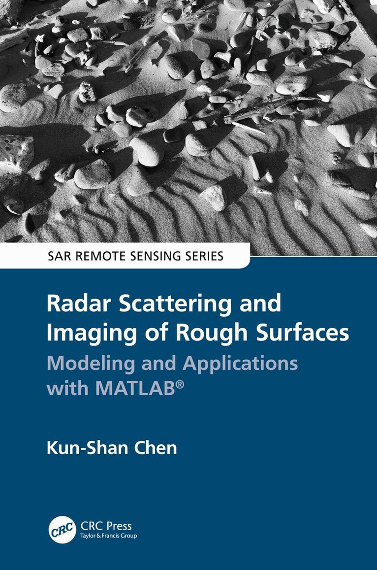
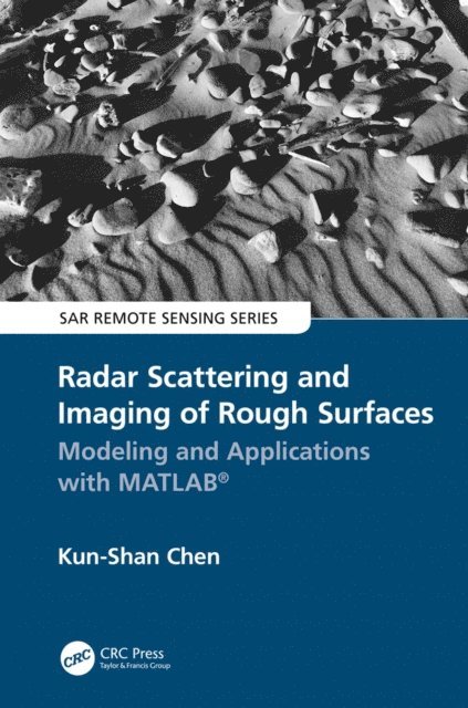
Radar scattering and imaging of rough surfaces is an active interdisciplinary area of research with many practical applications in fields such as mineral and resource exploration, ocean and physical oceanography, military and national defense, planetary exploration, city planning and land use, environmental science, and many more. By focusing on the most advanced analytical and numerical modeling and describing both forward and inverse modeling, Radar Scattering and Imaging of Rough Surfaces: Modeling and Applications with MATLAB® connects the scattering process to imaging techniques by vivid examples through numerical and experimental demonstrations and provides computer codes and practical uses. This book is unique in its simultaneous treatment of radar scattering and imaging.
Key Features
Bridges physical modeling with simulation for resolving radar imaging problems (the first comprehensive work to do so)
Provides excellent basic and advanced information for microwave remote-sensing professionals in various fields of science and engineering
Covers most advanced analytical and numerical modeling for both backscattering and bistatic scattering
Includes MATLAB® codes useful not only for academics but also for radar engineers and scientists to develop tools applicable in different areas of earth studies
Covering both the theoretical and the practical, Radar Scattering and Imaging of Rough Surfaces: Modeling and Applications with MATLAB® is an invaluable resource for professionals and students using remote sensing to study and explain the Earth and its processes. University and research institutes, electrical and radar engineers, remote-sensing image users, application software developers, students, and academics alike will benefit from this book.
The author, Kun-Shan Chen, is an internationally known and respected engineer and scientist and an expert in the field of electromagnetic modeling.

774 kr
Läs direkt efter köp
Radar scattering and imaging of rough surfaces is an active interdisciplinary area of research with many practical applications in fields such as mineral and resource exploration, ocean and physical oceanography, military and national defense, planetary exploration, city planning and land use, environmental science, and many more. By focusing on the most advanced analytical and numerical modeling and describing both forward and inverse modeling, Radar Scattering and Imaging of Rough Surfaces: Modeling and Applications with MATLAB® connects the scattering process to imaging techniques by vivid examples through numerical and experimental demonstrations and provides computer codes and practical uses. This book is unique in its simultaneous treatment of radar scattering and imaging.
Key Features
Bridges physical modeling with simulation for resolving radar imaging problems (the first comprehensive work to do so)
Provides excellent basic and advanced information for microwave remote-sensing professionals in various fields of science and engineering
Covers most advanced analytical and numerical modeling for both backscattering and bistatic scattering
Includes MATLAB® codes useful not only for academics but also for radar engineers and scientists to develop tools applicable in different areas of earth studies
Covering both the theoretical and the practical, Radar Scattering and Imaging of Rough Surfaces: Modeling and Applications with MATLAB® is an invaluable resource for professionals and students using remote sensing to study and explain the Earth and its processes. University and research institutes, electrical and radar engineers, remote-sensing image users, application software developers, students, and academics alike will benefit from this book.
The author, Kun-Shan Chen, is an internationally known and respected engineer and scientist and an expert in the field of electromagnetic modeling.
874 kr
Läs direkt efter köp
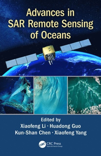
The oceans cover approximately 71% of Earth’s surface, 90% of the biosphere and contains 97% of Earth’s water. Since the first launch of SEASAT satellite in 1978, an increasing number of SAR satellites have or will become available, such as the European Space Agency’s ERS-1/-2, ENVISAT, and Sentinel-1 series; the Canadian RADARSAT-1/-2 and the upcoming RADARSAT Constellation Mission series satellites; the Italian COSMO-SkyMed satellites, the German TERRASAR-X and TANDEM-X, and the Chinese GAOFEN-3 SAR, among others. Recently, European Space Agency has launched a new generation of SAR satellites, Sentinel-1A in 2014 and Sentinel-1B in 2016. These SAR satellites provide researchers with free and open SAR images necessary to carry out their research on the global oceans. The scope of Advances in SAR Remote Sensing of Oceans is to demonstrate the types of information that can be obtained from SAR images of the oceans, and the cutting-edge methods needed for analysing SAR images.
Written by leading experts in the field, and divided into four sections, the book presents the basic principles of radar backscattering from the ocean surface; introduces the recent progresses in SAR remote sensing of dynamic coastal environment and management; discusses the state-of-the-art methods to monitor parameters or phenomena related to the dynamic ocean environment; and deals specifically with new techniques and findings of marine atmospheric boundary layer observations.
Advances in SAR Remote Sensing of Oceans is a very comprehensive and up-to-date reference intended for use by graduate students, researchers, practitioners, and R&D engineers working in the vibrant field of oceans, interested to understand how SAR remote sensing can support oceanography research and applications.

874 kr
Läs direkt efter köp
The oceans cover approximately 71% of Earth’s surface, 90% of the biosphere and contains 97% of Earth’s water. Since the first launch of SEASAT satellite in 1978, an increasing number of SAR satellites have or will become available, such as the European Space Agency’s ERS-1/-2, ENVISAT, and Sentinel-1 series; the Canadian RADARSAT-1/-2 and the upcoming RADARSAT Constellation Mission series satellites; the Italian COSMO-SkyMed satellites, the German TERRASAR-X and TANDEM-X, and the Chinese GAOFEN-3 SAR, among others. Recently, European Space Agency has launched a new generation of SAR satellites, Sentinel-1A in 2014 and Sentinel-1B in 2016. These SAR satellites provide researchers with free and open SAR images necessary to carry out their research on the global oceans. The scope of Advances in SAR Remote Sensing of Oceans is to demonstrate the types of information that can be obtained from SAR images of the oceans, and the cutting-edge methods needed for analysing SAR images.
Written by leading experts in the field, and divided into four sections, the book presents the basic principles of radar backscattering from the ocean surface; introduces the recent progresses in SAR remote sensing of dynamic coastal environment and management; discusses the state-of-the-art methods to monitor parameters or phenomena related to the dynamic ocean environment; and deals specifically with new techniques and findings of marine atmospheric boundary layer observations.
Advances in SAR Remote Sensing of Oceans is a very comprehensive and up-to-date reference intended for use by graduate students, researchers, practitioners, and R&D engineers working in the vibrant field of oceans, interested to understand how SAR remote sensing can support oceanography research and applications.
2 742 kr
Skickas inom 10-15 vardagar
992 kr
Läs direkt efter köp