
Mark Monmonier – författare

289 kr
Skickas inom 5-8 vardagar
10 190 kr
Läs direkt efter köp

736 kr
Läs direkt efter köp
423 kr
Läs direkt efter köp
336 kr
Skickas inom 11-20 vardagar
457 kr
Läs direkt efter köp

787 kr
Skickas inom 5-8 vardagar
198 kr
Skickas inom 5-8 vardagar

347 kr
Skickas inom 5-8 vardagar
256 kr
Skickas inom 5-8 vardagar

455 kr
Skickas inom 5-8 vardagar

223 kr
Skickas inom 5-8 vardagar
754 kr
Läs direkt efter köp
474 kr
Läs direkt efter köp

360 kr
Läs direkt efter köp

170 kr
Skickas inom 5-8 vardagar

787 kr
Skickas inom 5-8 vardagar

190 kr
Skickas inom 5-8 vardagar
5 124 kr
Skickas inom 5-8 vardagar

298 kr
Skickas inom 5-8 vardagar
602 kr
Läs direkt efter köp
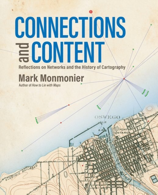
Behind every great map is a network and behind every great network is a map.
In Connections and Content: Reflections on Networks and the History of Cartography, cartographic cogitator Mark Monmonier shares his insights about the relationships between networks and maps. Using historical maps, he explores:
Triangulation networks that established the baselines to set a map’s scale Astronomical observations, ellipsoids, geodetic arcs, telegraph networks, and GPS constellations that put latitude and longitude on the map Cartographic symbols that portray a diverse range of network features Survey networks used to situate and construct canals, railways, roads, and power lines Postal and electronic networks that created and disseminated weather maps, and Topological networks that underlie modern census enumeration and satellite navigation systems.Connecting the past to the present via maps and reflection, Monmonier continues his contribution to cartographic scholarship by exploring the network''s power as a unifying concept for understanding and using maps.

449 kr
Läs direkt efter köp

396 kr
Läs direkt efter köp

309 kr
Skickas inom 10-15 vardagar

460 kr
Skickas inom 10-15 vardagar
613 kr
Tillfälligt slut