
Mike Meagher – författare
Visar alla böcker från författaren Mike Meagher. Handla med fri frakt och snabb leverans.
3 produkter
3 produkter
Engelska, 2024
225 kr
Skickas
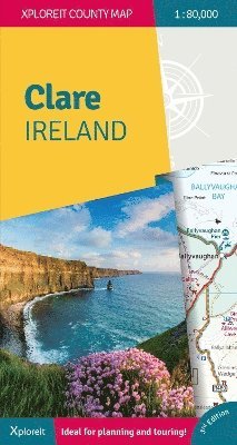
This Xploreit map is an essential companion for your next trip to County Clare. Whatever your location in the county, a quick scan of the map will reveal all the local attractions including the best drives, cycle routes and walks in the area. It is fully revised and now includes the Clare section of the long-distance Euro Velo Atlantic Cycle Route. From Loop Head, with its famous lighthouse, you can follow West Clare's wild and rugged coast as it rises to the spectacular Cliffs of Moher and meets The Burren, the unique limestone pavement of the northern uplands. East Clare has numerous walking and sightseeing opportunities also with Lough Derg and Slieve Bernagh as highlights. Convenient and informative, this touring map will help you discover ancient megalithic tombs, imposing castles, sparkling lakes, golden beaches and the many charming towns and villages dotted around 'The Banner County'. Topography is shown by altitude colouring with contours at 30m and numerous geographical features are illustrated. The road network includes local roads and tracks with scenic roads highlighted including the Clare section of the Wild Atlantic Way and associated Discovery Points. All of County Clare on one touring map Easy to read, clear mapping Local drives, cycle routes and walks Large range of tourist attractions highlighted Place name index with GPS compatible grid Handy street map of Ennis
Engelska, 2024
225 kr
Skickas
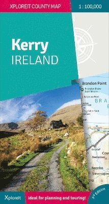
Whether you need to plan your daily activities or just need a quick scan of your existing location, this map is an excellent companion for your adventures in County Kerry. For many years now this convenient and informative Xploreit touring map has guided thousands of visitors and locals alike to the best drives, cycle routes, walks and other points of interest in Kerry (affectionately known as the 'The Kingdom'). It has been fully revised and updated for its 3rd Edition. The Kerry section of the new long-distance Euro Velo Atlantic Cycle Route is included along with the new greenways including Listowel to Abbeyfeale and Tralee to Fenit. Topography is shown by altitude colouring with contours at 30m and numerous geographical features are identified. The road network includes local roads and tracks with scenic roads highlighted including the Kerry section of the Wild Atlantic Way and associated Discovery Points. Each centimetre on the map is equivalent to 1 Kilometre so the map provides a good level of detail but is clear and easy to follow. The map sheet is double-sided for easy reading and folding and there is a good overlap between north and south. All of County Kerry on one touring map Easy to read, clear mapping Local drives, cycle routes and walks Large range of tourist attractions highlighted Place name index GPS compatible grid in decimal degrees

Häftad, Engelska, 2016
208 kr
Skickas inom 5-8 vardagar