
Paddy Dillon – författare
236 kr
Skickas
217 kr
Skickas

206 kr
Skickas
224 kr
Skickas
127 kr
Skickas
217 kr
Skickas
206 kr
Skickas
224 kr
Skickas
224 kr
Skickas
236 kr
Skickas
208 kr
Läs direkt efter köp

201 kr
Läs direkt efter köp
204 kr
Läs direkt efter köp
A guidebook to 21 day walks on Lanzarote, Fuerteventura and Isla La Graciosa plus 14 stages of the GR131. Exploring the varied scenery of these Canary Islands, the walks are suitable for beginner and experienced walkers alike.
The day walks range from 5 to 22km (3–14 miles) and can be enjoyed in 2–7 hours. The GR131 trek crosses all seven of the Canary Islands, and the Lanzarote and Fuerteventura sections are described in 14 stages covering 241km (150 miles).
1:50,000 maps included for each walkDetailed information on planning, facilities and public transportHighlights include Timanfaya volcanic national parkPart of a 5-volume Cicerone series on the whole of the Canary Islands
201 kr
Läs direkt efter köp

200 kr
Läs direkt efter köp
208 kr
Läs direkt efter köp
177 kr
Läs direkt efter köp
249 kr
Läs direkt efter köp

249 kr
Läs direkt efter köp
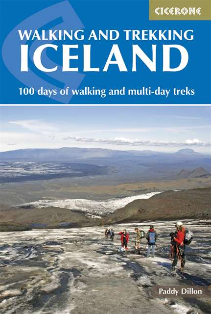
A guidebook to 49 day walks and 10 multi-day treks in Iceland. From short, waymarked walks to challenging glacier crossings, there is something for walkers of all levels of fitness and experience.
The day walks range in length from 5 to 35km (3–22 miles) and can be enjoyed in 2–10 hours. The multi-day treks vary in length from 34 to 143km (21–89 miles), take between 2 and 9 days to complete, and include the classic Laugavegur Trail and Hvannadalshnúkur, Iceland''s highest mountain.
Sketch maps included for each walk Detailed information on public transport, accommodation and facilities Advice on planning and preparation Highlights include Vatnajökull National Park
263 kr
Läs direkt efter köp
263 kr
Läs direkt efter köp
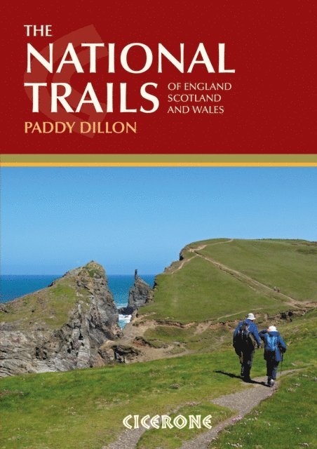
An inspirational guidebook to Britain''s National Trails - 19 long-distance walking routes through England, Wales and Scotland. Together, these routes (National Trails in England and Wales and Scotland''s Great Trails) cover well over 3100 miles (5000km), exploring the rich scenic and historic countryside of Britain.
If you''ve ever wanted to walk a National Trail, this larger format book is perfect for planning, offering stage by stage overviews for each route including the popular South West Coast Path, Hadrian''s Wall Path, Pennine Way, West Highland Way, Cotswold Way, Offa''s Dyke Path, South Downs Way, Southern Upland Way and many others.
Outline schedules for each of the National Trails allow you compare the routes and choose your next walking trail. Whether relatively short and easy, or longer and more strenuous, there''s a challenge for you. Basic day-by-day route descriptions for each trail are illustrated with maps and profiles, helping you choose the best routes to walk. Information is provided on access to and from the routes, maps, public transport, guidebooks, TICs, accommodation and useful websites.
175 kr
Läs direkt efter köp
259 kr
Läs direkt efter köp
201 kr
Läs direkt efter köp

249 kr
Läs direkt efter köp
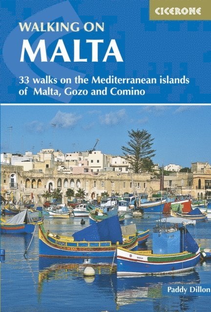
A guidebook to 33 day walks throughout the islands of Malta, Gozo and Comino. Exploring the beautiful Mediterranean scenery, the walks are suitable for beginner and experienced walkers alike.
Walks range from 3 to 22km (2–14 miles) in length and can be enjoyed in 2–8 hours. Routes vary from easy strolls and heritage trails to a challenging walk exploring the Victoria Lines, a fortified ridge running the length of Malta.
1:25,000 maps included for each walkGPX files available to downloadDetailed information on planning, facilities and public transportEasy access from Valetta, Rabat and Victoria
215 kr
Läs direkt efter köp

201 kr
Läs direkt efter köp
208 kr
Läs direkt efter köp
175 kr
Läs direkt efter köp
235 kr
Läs direkt efter köp