
Robin A. Vaughan – författare
Visar alla böcker från författaren . Handla med fri frakt och snabb leverans.
8 produkter
8 produkter
Häftad, Engelska, 2010
836 kr
Skickas inom 7-10 vardagar
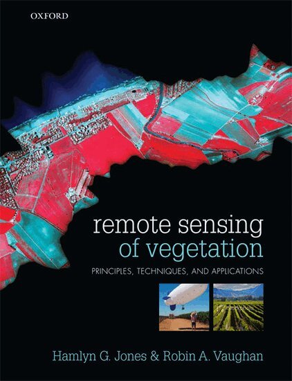
Remote sensing is becoming an increasingly important tool for agriculturalists, ecologists, and land managers for the study of Earth's agricultural and natural vegetation, and can be applied to further our understanding of key environmental issues, including climate change and ecosystem management.This timely introduction offers an accessible yet rigorous treatment of the basics of remote sensing at all scales, illustrating its practical application to the study of vegetation. Despite a quantitative approach, the advanced mathematics and complex models common in modern remote sensing literature is demystified through clear explanations that emphasise the key underlying principles, and the core physical aspects are explained in the biological context of vegetation and its adaptation to its specific environment.Various techniques and instruments are addressed, making this a valuable source of reference, and the advantages and disadvantages of these are further illustrated through worked examples and case studies.· Rigorous physical and mathematical principles presented in a way readily understood by those without a strong mathematical background· Boxes throughout summarize key information and concepts· The student is directed to carefully chosen further reading articles, allowing them to explore key topics in more detail Online Resource CentreThe Online Resource Centre to accompany Remote Sensing of Vegetation features:For Students:· Links to useful websitesFor lecturers:· Figures from the book in electronic format, ready to download
E-bok
PDF, Engelska, 20131 416 kr
Läs direkt efter köp
Experts report the state of the art in the study of global climate change using remote sensing techniques. Topics covered include the principles of remote sensing, the management of data, data requirements in climatology, the principles of modelling, the input of data into models, and the application of remote sensing to the atmosphere, ice and snow, seas and land. The book is highly topical given the current great public and scientific awareness of possible man-made changes to the climate. It is essential reading for anyone new to the field, and invaluable as a reference work to those already working in it.
Häftad, Engelska, 2011
1 086 kr
Skickas inom 10-15 vardagar
Experts report the state of the art in the study of global climate change using remote sensing techniques. Topics covered include the principles of remote sensing, the management of data, data requirements in climatology, the principles of modelling, the input of data into models, and the application of remote sensing to the atmosphere, ice and snow, seas and land. The book is highly topical given the current great public and scientific awareness of possible man-made changes to the climate. It is essential reading for anyone new to the field, and invaluable as a reference work to those already working in it.

Inbunden, Engelska, 1987
3 243 kr
Skickas inom 10-15 vardagar
This was the fourth postgraduate summer school on remote sensing to be held in Dundee. These summer schools were originated by, and continue to remain in, the programme of EARSel (European Association of Remote Sensing Laboratories) Working Group 3 on Education and Training in Remote Sensing. The first of these summer schools was held in 1980 on "Remote Sensing in Meteorology, Oceanography and Hydrology". This was followed in 1982 by a more specialised summer school on "Remote Sensing Applications in Marine Science and Technology" which built on the foundation laid in 1980 and then concentrated on the marine applications of remote sensing techniques. The present summer school was another follow-up of the original 1980 summer school but this time concentrating on the atmospheric rather than the marine applications of remote sensing techniques. The 1984 summer school had not specifically involved atmospheric and marine applications but had been involved with the use of remote sensing in the field of civil engineering. This year's summer school was extremely successful. First of all, this was due to our sponsors, for without their very significant material contributions there would have been no summer school. These sponsors included the Scientific Affairs Division of NATO, together with the European Association of Remote Sensing Laboratories, the Council of Europe, the European Space Agency, the German Aerospace Establishment (DFVLR) and the Natural Environment Research Council.
E-bok
PDF, Engelska, 2012712 kr
Läs direkt efter köp
The power of microwave remote sensing for studying the oceans of the world was demonstrated conclusively by the SEASAT mission in 1978. Since then, no further satellite-flown instruments have been available to provide further data of this type. However, the proposed launch of ESA''s ERS-1 satellite will lead to a new set of active microwave instruments being flown in space in 1990. Even though similar data has been obtained from aircraft-flown instruments SAR, scatterometers, altimeters etc. - a great deal of activity has been taking place to develop the necessary expertise in handling and analysing such data when it comes on-stream from ERS-1 and from subsequent satellites. It was against this background that the scientific Affairs Division of NATO again agreed to sponsor an ASI in Dundee in 1988. Its purpose was to review existing knowledge of the extraction of marine and atmospheric geophysical parameters from satellite-gathered microwave data and to enable scientists to prepare themselves and their computing systems to utilise the new data when it becomes available. The importance of the data is largely as input parameters to assist in the fitting of boundary conditions in large computer models. The course was concerned more with the non-imaging instruments, that is with passive radiometers, altimeters and scatterometers, than with the (imaging) synthetic aperture radar.
E-bok
PDF, Engelska, 20123 948 kr
Läs direkt efter köp
This was the fourth postgraduate summer school on remote sensing to be held in Dundee. These summer schools were originated by, and continue to remain in, the programme of EARSel (European Association of Remote Sensing Laboratories) Working Group 3 on Education and Training in Remote Sensing. The first of these summer schools was held in 1980 on "Remote Sensing in Meteorology, Oceanography and Hydrology". This was followed in 1982 by a more specialised summer school on "Remote Sensing Applications in Marine Science and Technology" which built on the foundation laid in 1980 and then concentrated on the marine applications of remote sensing techniques. The present summer school was another follow-up of the original 1980 summer school but this time concentrating on the atmospheric rather than the marine applications of remote sensing techniques. The 1984 summer school had not specifically involved atmospheric and marine applications but had been involved with the use of remote sensing in the field of civil engineering. This year''s summer school was extremely successful. First of all, this was due to our sponsors, for without their very significant material contributions there would have been no summer school. These sponsors included the Scientific Affairs Division of NATO, together with the European Association of Remote Sensing Laboratories, the Council of Europe, the European Space Agency, the German Aerospace Establishment (DFVLR) and the Natural Environment Research Council.
Häftad, Engelska, 2011
546 kr
Skickas inom 10-15 vardagar
The power of microwave remote sensing for studying the oceans of the world was demonstrated conclusively by the SEASAT mission in 1978. Since then, no further satellite-flown instruments have been available to provide further data of this type. However, the proposed launch of ESA's ERS-1 satellite will lead to a new set of active microwave instruments being flown in space in 1990. Even though similar data has been obtained from aircraft-flown instruments SAR, scatterometers, altimeters etc. - a great deal of activity has been taking place to develop the necessary expertise in handling and analysing such data when it comes on-stream from ERS-1 and from subsequent satellites. It was against this background that the scientific Affairs Division of NATO again agreed to sponsor an ASI in Dundee in 1988. Its purpose was to review existing knowledge of the extraction of marine and atmospheric geophysical parameters from satellite-gathered microwave data and to enable scientists to prepare themselves and their computing systems to utilise the new data when it becomes available. The importance of the data is largely as input parameters to assist in the fitting of boundary conditions in large computer models. The course was concerned more with the non-imaging instruments, that is with passive radiometers, altimeters and scatterometers, than with the (imaging) synthetic aperture radar.
Häftad, Engelska, 2011
3 243 kr
Skickas inom 10-15 vardagar
This was the fourth postgraduate summer school on remote sensing to be held in Dundee. These summer schools were originated by, and continue to remain in, the programme of EARSel (European Association of Remote Sensing Laboratories) Working Group 3 on Education and Training in Remote Sensing. The first of these summer schools was held in 1980 on "Remote Sensing in Meteorology, Oceanography and Hydrology". This was followed in 1982 by a more specialised summer school on "Remote Sensing Applications in Marine Science and Technology" which built on the foundation laid in 1980 and then concentrated on the marine applications of remote sensing techniques. The present summer school was another follow-up of the original 1980 summer school but this time concentrating on the atmospheric rather than the marine applications of remote sensing techniques. The 1984 summer school had not specifically involved atmospheric and marine applications but had been involved with the use of remote sensing in the field of civil engineering. This year's summer school was extremely successful. First of all, this was due to our sponsors, for without their very significant material contributions there would have been no summer school. These sponsors included the Scientific Affairs Division of NATO, together with the European Association of Remote Sensing Laboratories, the Council of Europe, the European Space Agency, the German Aerospace Establishment (DFVLR) and the Natural Environment Research Council.