
Stephen J. Hornsby – författare
Visar alla böcker från författaren . Handla med fri frakt och snabb leverans.
4 produkter
4 produkter
Inbunden, Engelska, 2017
415 kr
Skickas inom 5-8 vardagar
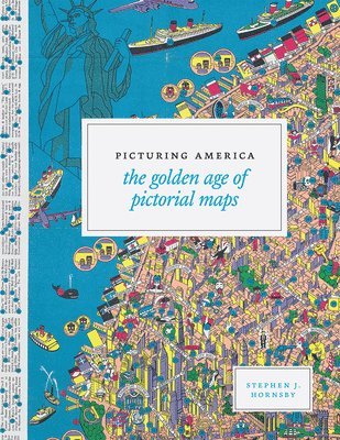
Instructive, amusing, colorful pictorial maps have been used and admired since the first medieval cartographer put pen to paper depicting mountains and trees across countries, people and objects around margins, and sea monsters in oceans. More recent generations of pictorial map artists have continued that traditional mixture of whimsy and fact, combining cartographic elements with text and images and featuring bold and arresting designs, bright and cheerful colors, and lively detail. In the United States, the art form flourished during the 1920s to the 1970s, when thousands of innovative maps were mass-produced for use as advertisements and decorative objects the golden age of American pictorial maps. Picturing America is the first book to showcase this vivid and popular genre of maps. Geographer and collector Stephen J. Hornsby gathers together 158 delightful pictorial jewels, most drawn from the extensive collections of the Library of Congress.In his informative introduction, Hornsby outlines the development of the cartographic form, identifies several representative artists, describes the process of creating a pictorial map, and considers the significance of the form in the history of Western cartography. Organized into six thematic sections, Picturing America covers a vast swath of the pictorial map tradition during its golden age, ranging from "Maps to Amuse" to "Maps for War." Hornsby has unearthed the most fascinating and visually striking maps the United States has to offer: Disney cartoon maps, college campus maps, kooky state tourism ads, WWII promotional posters, and many more. This remarkable, charming volume's glorious full -color pictorial maps will be irresistible to any map-lover or armchair traveler.
E-bok
PDF, Engelska, 19921 041 kr
Läs direkt efter köp
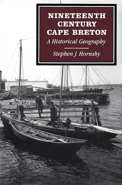
During the North American colonial period, the expansion of European capital and labour into North America created two broad patterns of regional development: agricultural settlement and the exploitation of raw materials or staples. Hornsby examines the development of nineteenth-century Cape Breton in light of these patterns, focusing on the impact of Scottish immigration on the island''s settlement and agricultural development, and on the role of mercantile and industrial capital in developing Cape Breton''s two great staple industries, cod fishing and coal mining. Hornsby also outlines the reasons for the massive exodus from Cape Breton during the late nineteenth century. The intersection of these two patterns of development gave rise to a distinctive regional geography. Over the course of a hundred years, a complex mosaic of different settlements, economies, and cultures emerged on the island. While the details and circumstances of these developments were unique to the island, elements of the Cape Breton experience were found in other areas of Maritime Canada. Viewed more generally, Hornsby suggests that the historical geography of this small, peripheral island offers a simple, somewhat stark encapsulation of some of the salient developments in the rest of settled Canada during the nineteenth century.
E-bok
PDF, Engelska, 2011699 kr
Läs direkt efter köp
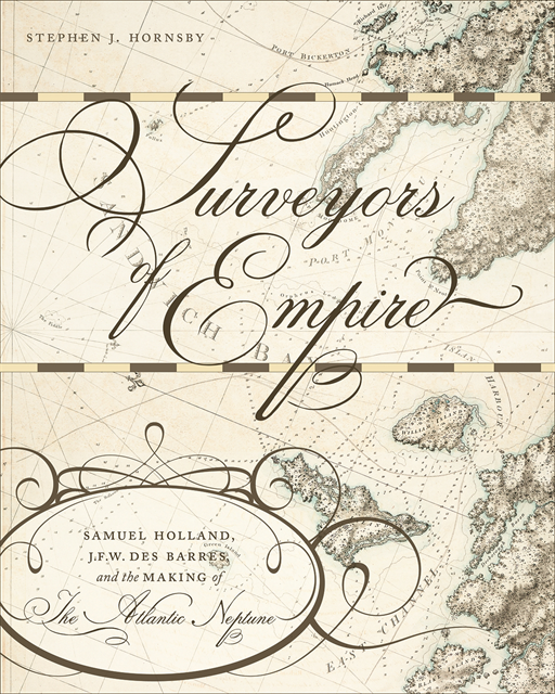
Using research from both sides of the Atlantic, Stephen Hornsby examines the development of British military cartography in North America during and after the Seven Years War, as well as advancements in military and scientific equipment used in surveying. At the same time, he follows the land speculation of two leading surveyors, Samuel Holland and J.F.W. Des Barres, and the publication history of The Atlantic Neptune. Richly illustrated with images from The Atlantic Neptune and earlier maps, Surveyors of Empire is an insightful account of the relationship between science and imperialism, and the British shaping of the Atlantic world.
Häftad, Engelska, 2004
327 kr
Skickas inom 5-8 vardagar