
Steve Davison – författare
173 kr
Skickas
204 kr
Skickas inom 5-8 vardagar
138 kr
Läs direkt efter köp
241 kr
Läs direkt efter köp
208 kr
Läs direkt efter köp
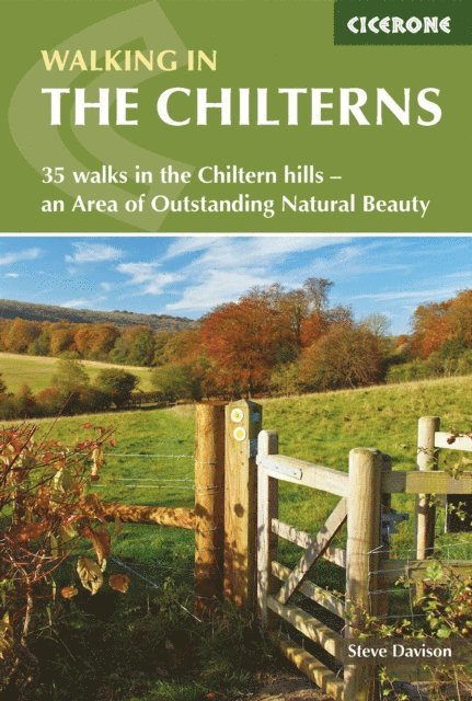
A guidebook to 35 day walks in the Chiltern Hills. Lying within reach of London, the spectacular Chilterns AONB extends across Oxfordshire, Buckinghamshire, Hertfordshire and Bedfordshire, and with routes in the guidebook covering the whole region, there’s something for beginner and experienced walkers alike.
The walks range in length from 6–19km (4–12 miles) and take between 2 and 6 hours to complete, perfect for either a short stroll or a full day out.
1:50,000 OS maps reproduced at 1:40,000 for greater clarity included for each walk Sized to easily fit in a jacket pocket GPX files available to download Detailed information on refreshments and public transport for each walk Local points of interest are featured including Ivanhoe Beacon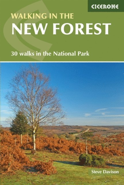
204 kr
Läs direkt efter köp
A guidebook to 30 day walks in the New Forest National Park. Exploring the beautiful scenery of Hampshire and Wiltshire, the walks are suitable for beginner and experienced walkers alike.
The walks range in length from 5–17km (3–10 miles) and can be enjoyed in 2–4 hours. Routes can be shortened, lengthened or combined allowing you to adapt the walks to suit you.
1:25,000 OS maps included for each walk Refreshment and transport options are given Information included on wildlife and local history Easy access from Southampton, Bournemouth and Salisbury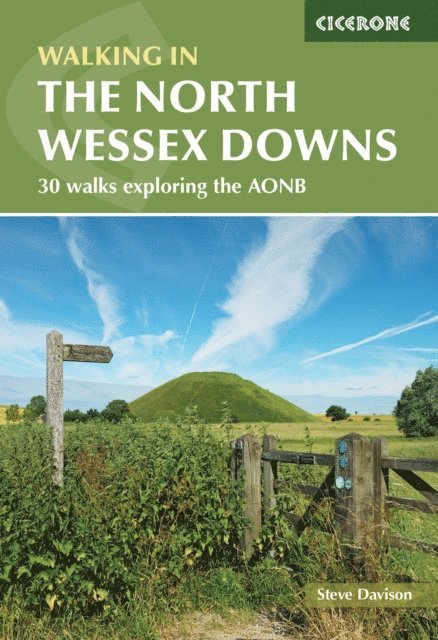
177 kr
Läs direkt efter köp
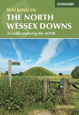
Guidebook to 30 circular walks in the North Wessex Downs Area of Outstanding Natural Beauty (AONB). The routes, which range from 7 to 21km (4 to 13 miles), take in parts of four counties - Berkshire, Hampshire, Wiltshire and Oxfordshire. The North Wessex Downs are accessible hills rising above the towns and rural plains of southern England and rolling gently west from Reading and Basingstoke to Swindon and down past Marlborough to Andover. The walks allow you to explore parts of the Ridgeway National Trail, the Kennet and Avon Canal and stunning historic sites such as Avebury, the 3000-year-old Uffington White Horse, impressive Neolithic long barrows and Iron Age hill forts. Alongside clear route descriptions and OS maps are plenty of details about points of interest, as well as practical information on the area, from public transport links to ideal refreshment stops on each walk. The result is an ideal companion to exploring both the popular and untouched corners of the North Wessex Downs.
208 kr
Läs direkt efter köp
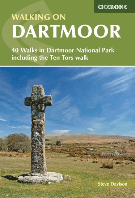
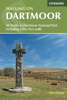
A guidebook to 39 day walks exploring Dartmoor, plus a 2-day Ten Tors challenge. Exploring the dramatic scenery of Devon’s national park there are walks suitable for all abilities, from low-level shorter walks to higher level more strenuous and demanding routes.
The day walks, all easily accessible from Ivybridge, Tavistock and Okehampton, range from 7–13km (4–21 miles) and can be enjoyed in 2–6 hours. The Ten Tors route is a longer more challenging walk that takes 2 days and covers 58km (36 miles).
1:50,000 OS maps included for each walk Sized to easily fit in a jacket pocket GPX files available to download Refreshment and public transport options are given for each walk Information given on local geology and wildlife
173 kr
Skickas
173 kr
Skickas
160 kr
Skickas
173 kr
Skickas
127 kr
Skickas
127 kr
Skickas
127 kr
Skickas
173 kr
Skickas
217 kr
Skickas
127 kr
Skickas
208 kr
Läs direkt efter köp
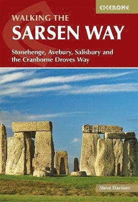
Guidebook to the Sarsen Way (79km) from Coate Water Park to Salisbury and the Cranborne Droves Way (28km) connecting Salisbury to Wessex Ridgeway at Win Green. These long-distance paths are part of the Great Chalk Way. Both can be walked in a week and are suitable for all abilities.
The routes are presented in 8 stages, ranging from 10.5km to 17.3km. Reverse route descriptions are also included.
Step-by-step route descriptions plus 1:50k OS mapping Centres include Swindon, Chiseldon, Avebury, Durrington, Amesbury, Great Durnford, Old Sarum, Salisbury, Shaftesbury Comprehensive planning information and notes on sites along the route GPX files available to download The compact format is conveniently sized for slipping into a jacket pocket or the top of a rucksack
208 kr
Läs direkt efter köp
Two-part guidebook to walking along the Kennet and Avon Canal. The first part describes the 152km (94 mile) route from Reading to Bristol, incorporating the UNESCO World Heritage Site of Bath and Bristol’s Floating Harbour. The second part describes 20 circular walks, taking in the best sections of the canal and interesting places nearby. All routes can be walked year-round and are suitable for walkers of every ability.
The canal path route is described in 7 stages of 15 to 29km (9 to 18 miles), though it can easily be split into shorter or longer stages. The day walks are between 7 and 15km (4 and 9 miles) are described, taking between 2-4.5 hours.
OS 1:50,000 mapping and step-by-step route descriptions for each walk Easy access from Reading, Newbury, Hungerford, Great Bedwyn, Pewsey, Devizes, Bradford-on-Avon, Bath, Keynsham and Bristol Highlights include Crofton Pumping Station, the Caen Hill flight of locks at Devizes, the ornate aqueducts at Avoncliff and Dundas and the North Wessex Downs and Cotswolds AONB Comprehensive planning information and information on local history, geology and wildlife GPX files available to download
138 kr
Läs direkt efter köp
Would you like to explore the best of Ivybridge and Princetown? This guidebook covers 15 of Dartmoor''s best short walks including Cox Tor, Great Staple Tor, Merrivale, Drizzlecombe, Ditsworthy, Sheepstor and Wistman''s Wood.
Why choose this guidebook?
Walks under three hours, plus one challenge route Easy to follow with clear route descriptions Facilities, parking and highlights for every route No specialist gear needed, walk all year round Ordnance Survey mappingCicerone’s Short Walks guidebooks contain everything you need to get outdoors and discover the best of an area. The routes are perfect if you’re new to walking or looking for something you can enjoy with the whole family. Let the adventures begin!
138 kr
Läs direkt efter köp
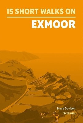
Would you like to explore the best of Exmoor? This guidebook covers 15 of the area''s best short walks (between 4.5 and 11km, all under three hours) including Dunkery Beacon, Valley of Rocks, Allerford, Selworthy, Tarr Steps, Great Hangman, Dunster and Malmsmead.
Why choose this guidebook?
Easy to moderate walks suitable for almost everyone Short climbs but no challenging terrain Numbered points which tie maps to clear route description Details of public toilets and refreshments along the route Route Summary Table to help you choose your walkCicerone’s Short Walks guidebooks contain everything you need to get outdoors and discover the best of an area. The routes are perfect if you’re new to walking or looking for something you can enjoy with the whole family. Let the adventures begin!
138 kr
Läs direkt efter köp
Would you like to explore the best of Okehampton and Chagford? This guidebook covers 15 of Dartmoor''s best short walks including Chagford, Belstone, Hound Tor and Bowerman''s Nose, High Willhays and Yes Tor, and Meldon Reservoir.
Why choose this guidebook?
Walks under three hours, plus one challenge route Easy to follow with clear route descriptions Facilities, parking and highlights for every route No specialist gear needed, walk all year round Ordnance Survey mappingCicerone’s Short Walks guidebooks contain everything you need to get outdoors and discover the best of an area. The routes are perfect if you’re new to walking or looking for something you can enjoy with the whole family. Let the adventures begin!
259 kr
Läs direkt efter köp

Dead Innocent (Second Edition)
268 kr
Skickas inom 3-6 vardagar
91 kr
Skickas
141 kr
Läs direkt efter köp