
Times Atlases – författare
Visar alla böcker från författaren Times Atlases. Handla med fri frakt och snabb leverans.
4 produkter
4 produkter
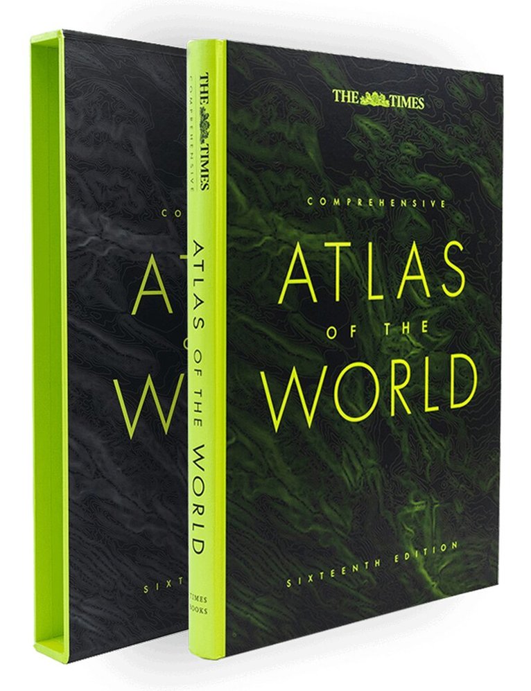
Inbunden, Engelska, 2023
1 803 kr
Skickas
Delight in the world’s most authoritative atlas – a unique and timeless gift for all occasions.Now in its 16th edition, the world’s most authoritative atlas has been extensively updated.Detailing our world as it is today, it includes more than 200,000 place names. At 45 cm high, this impressive world atlas will become a treasured possession.In addition to 263 pages of continuous mapping, there are a further 223 pages of extensive indexing, alongside a preliminary section containing essays from trusted academics who discuss topics ranging from global population, to climate change, and the composition of our solar system, to the water in our oceans.It is a benchmark of cartographic excellence, trusted by governments, media and international organisations, as well as households around the world.Updates include:• New country names for Eswatini (formerly Swaziland) and North Macedonia (previously the Former Yugoslav Republic of Macedonia)• More than 8000 place name changes with names comprehensively updated in Kazakhstan and Ukraine• Addition of Māori names in New Zealand and restored indigenous names in Australia, the most notable being the renaming of Fraser Island in Queensland to its Butchulla name K’gari• Administrative boundary updates in Ethiopia, Mali and Kazakhstan• Added road, railway and airport infrastructure across the globe including the 4km-long Dardanelles Bridge (Turkey), the Fehmarn Belt road/rail tunnel alignment (Germany/Denmark) and the Sandoy Tunnel (Faroe Islands)Produced in a high-quality finish this comprehensive atlas of the world comes in a protective slipcase with two ribbon markers for ease of use.
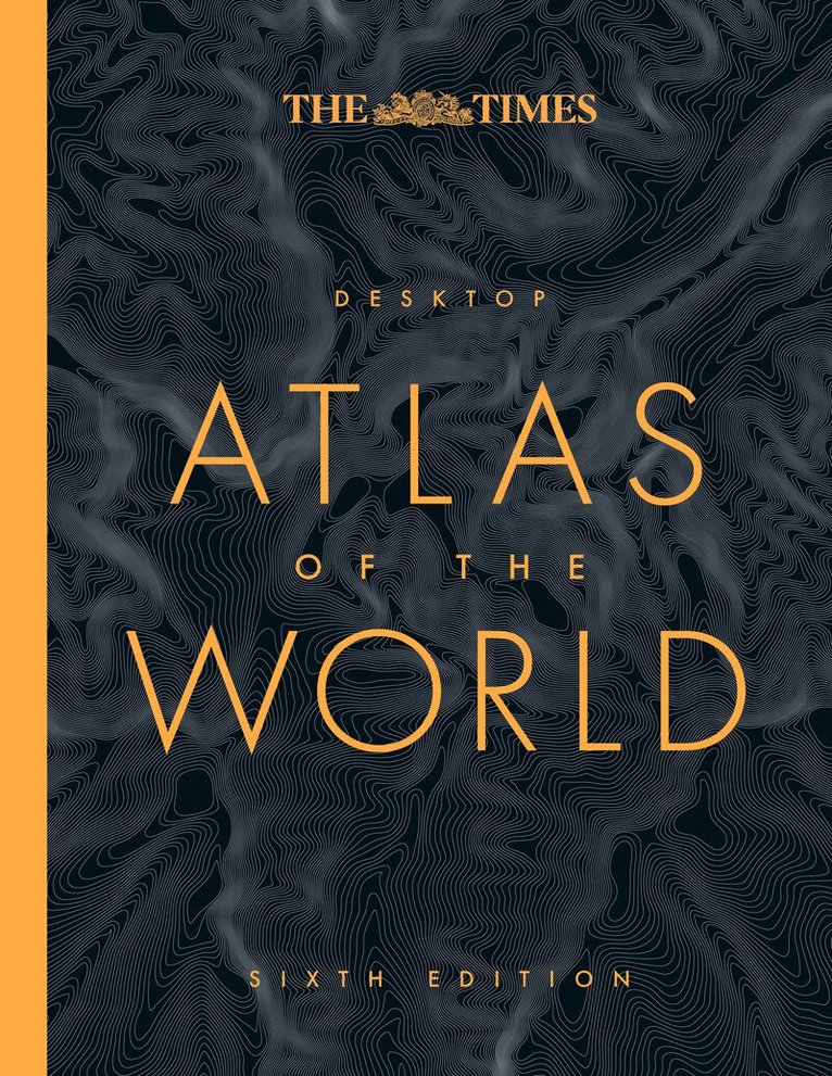
Inbunden, Engelska, 2024
304 kr
Skickas
Discover new places with authoritative atlases, beautifully designed and packaged.An excellent world atlas for everyday use at home or work, representing broad coverage at a great price. Clear, authoritative Times atlas mapping fully updated.Detailed maps in the distinctive and respected Times style provide balanced, systematic coverage of all parts of the world. Each continent is introduced by a political map showing individual countries, followed by regional maps showing towns and cities, roads, railways, international boundaries and topography.Main features of this atlas include: Authoritative updated Times mapping of the whole worldGeographical reference section with flags, statistics and facts for the world’s states and territoriesStatistics and world maps on major geographical themes, including population, cities, climate, the environment and telecommunicationsUnique 16 pages full of thousands of world facts and figuresOver 25,000 place namesAs with all the atlases in the Times range it offers great authority, outstanding quality and attention to detail.
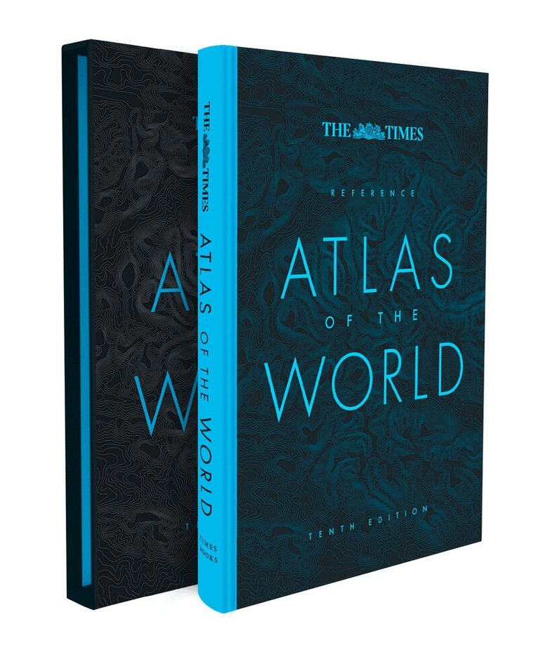
Inbunden, Engelska, 2024
623 kr
Skickas
Discover new places with authoritative atlases, beautifully designed and packaged.Tenth edition of this popular atlas from the prestigious and authoritative Times Atlas range. This world atlas contains the breadth, scale and detail to make it an ideal reference resource for school, home and business.The atlas has been brought fully up-to-date to provide a detailed and attractive picture of the world today. The beautifully illustrated introductory section gives a detailed profile of today’s world and covers major contemporary geographical and global issues – such as migration and population growth – through maps and graphics.The reference maps give exceptional detail and provide accurate, accessible and attractive coverage, helping you explore the world.A comprehensive guide to the world’s states and territories including flags, capitals and key statistics is included. Making this an ideal reference atlas for home, school or office.Main features include:• Authoritative mapping of the whole world• Plans of 46 of the world’s major cities• Geographical reference section with flags and statistics for the world’s states and territories• Maps and illustrations on major geographical themes, including earthquakes, population, cities, climate and migration• Historical mapping of the world from 1858 to the present day• More than 45,000 index entries
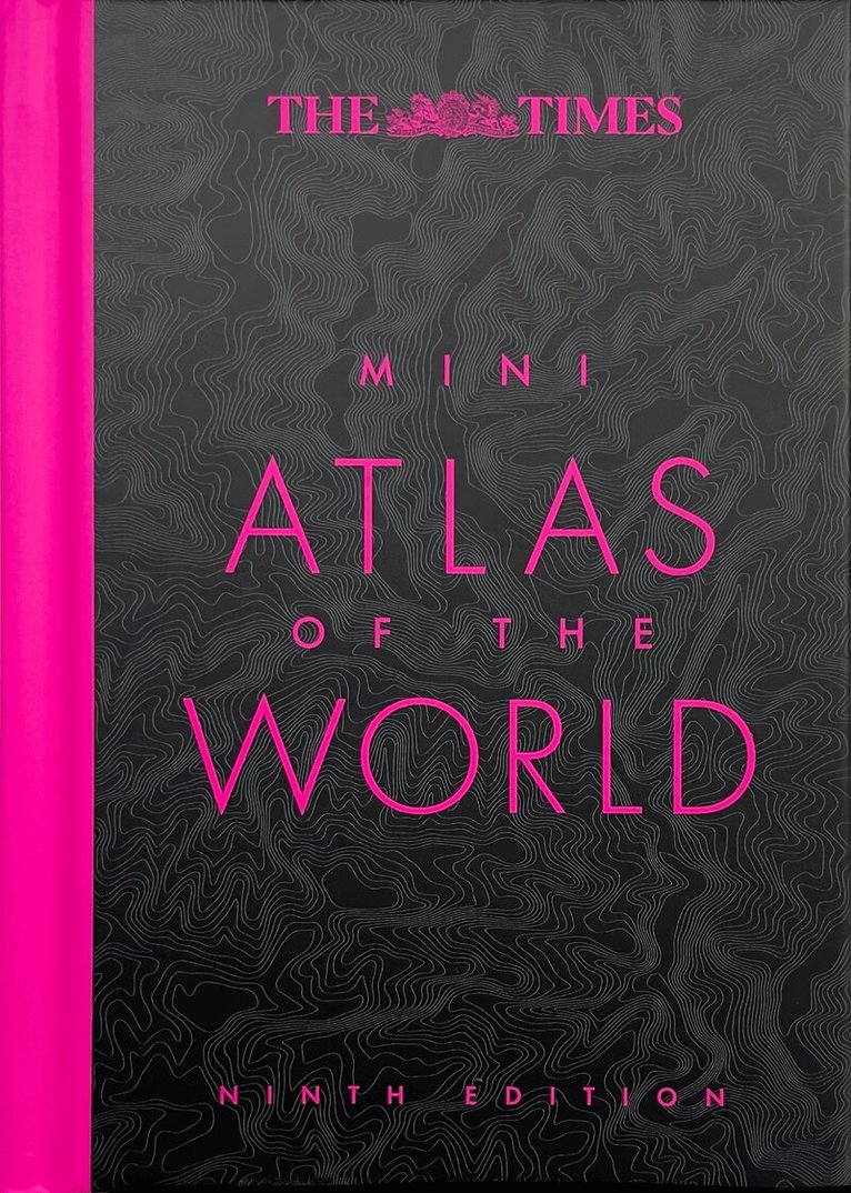
Inbunden, Engelska, 2025
140 kr
Skickas
Discover new places with authoritative atlases, beautifully designed and packaged.A pocket-sized Times World Atlas makes this a perfect little gift. Fully revised and improved to take account of all recent changes from around the world. The whole world is covered with the accuracy and authority for which Times atlases are renowned.Main features of this atlas include:• Geographical reference section with flags, statistics and facts for the world’s states and territories• Statistics and world maps on major geographical themes, including population, climate and the environment• Over 20,000 places mappedMapping updates include;• Country name changes – Czechia (formerly Czech Republic), Eswatini (formerly Swaziland) and North Macedonia (formerly Macedonia)• Extensive place name changes in New Zealand and Myanmar• Changes to capital cities in Burundi, Chad, Eswatini, Kazakhstan and Kiribati• Railways in France, Motorways in UK, Russia and Ireland, new rail and road bridge across Kerch Strait• Everest height updated to 8,849m / 289,031ftThis is a handy reference atlas for home, school or office.