
Imaging Science – serie
Visar alla böcker i serien Imaging Science. Handla med fri frakt och snabb leverans.
7 produkter
7 produkter
Häftad, Engelska, 2020
780 kr
Skickas inom 10-15 vardagar
Today, remote sensing technology is an essential tool for understanding the Earth and managing human-Earth interactions. There is a rapidly growing need for remote sensing and Earth observation technology that enables monitoring of world’s natural resources and environments, managing exposure to natural and man-made risks and more frequently occurring disasters, and helping the sustainability and productivity of natural and human ecosystems. The improvement in temporal resolution/revisit allows for the large accumulation of images for a specific location, creating a possibility for time series image analysis and eventual real-time assessments of scene dynamics. As an authoritative text, Remote Sensing Time Series Image Processing brings together active and recognized authors in the field of time series image analysis and presents to the readers the current state of knowledge and its future directions.Divided into three parts, the first addresses methods and techniques for generating time series image datasets. In particular, it provides guidance on the selection of cloud and cloud shadow detection algorithms for various applications. Part II examines feature development and information extraction methods for time series imagery. It presents some key remote sensing-based metrics, and their major applications in ecosystems and climate change studies. Part III illustrates various applications of time series image processing in land cover change, disturbance attribution, vegetation dynamics, and urbanization.This book is intended for researchers, practitioners, and students in both remote sensing and imaging science. It can be used as a textbook by undergraduate and graduate students majoring in remote sensing, imaging science, civil and electrical engineering, geography, geosciences, planning, environmental science, land use, energy, and GIS, and as a reference book by practitioners and professionals in the government, commercial, and industrial sectors.
Inbunden, Engelska, 2024
2 649 kr
Skickas inom 10-15 vardagar
This comprehensive handbook presents the current state of knowledge on geospatial technologies, techniques, and methods that are imperative for providing solutions to sustainable cities. It addresses the role of geospatial big data and AI techniques and how they are applied when analyzing the sustainability of urban development, land use, urban planning, and resource management, as well as monitoring the impact urbanization has on the environment and the ecosystem. Taking an interdisciplinary approach to sustainable cities, and with contributions from renowned experts around the world, this holistic handbook is a toolbox for geospatial, urban, and sustainability professionals, the artificial intelligence community, and those who work in related fields.Features:Explores cutting-edge geospatial and AI techniques in support of efficient, resilient, digital, and smart citiesBridges urban science and sustainability science via geospatial methodsContributes to the efforts of GEO by addressing and exemplifying pertinent societal benefit areas and engagement prioritiesIncludes 16 case studies with a broad geographic scope that integrate societal needs with technological advancesDraws expertise in geospatial technology, big data, and artificial intelligence from leading experts in the worldThis book is intended for researchers and scientists interested in learning techniques in GeoAI, including the technologies for collecting, analyzing, managing, processing, and visualizing geospatial datasets. Chapters 3, 6, 7, 8, and 15 of this book are freely available as a downloadable Open Access PDF at http://www.taylorfrancis.com under a Creative Commons Attribution-Non Commercial-No Derivatives (CC BY-NC-ND) 4.0 license.

Häftad, Engelska, 2026
892 kr
Skickas inom 10-15 vardagar
This comprehensive handbook presents the current state of knowledge on geospatial technologies, techniques, and methods that are imperative for providing solutions to sustainable cities. It addresses the role of geospatial big data and AI techniques and how they are applied when analyzing the sustainability of urban development, land use, urban planning, and resource management, as well as monitoring the impact urbanization has on the environment and the ecosystem. Taking an interdisciplinary approach to sustainable cities, and with contributions from renowned experts around the world, this holistic handbook is a toolbox for geospatial, urban, and sustainability professionals, the artificial intelligence community, and those who work in related fields.Features:Explores cutting-edge geospatial and AI techniques in support of efficient, resilient, digital, and smart citiesBridges urban science and sustainability science via geospatial methodsContributes to the efforts of GEO by addressing and exemplifying pertinent societal benefit areas and engagement prioritiesIncludes 16 case studies with a broad geographic scope that integrate societal needs with technological advancesDraws expertise in geospatial technology, big data, and artificial intelligence from leading experts in the worldThis book is intended for researchers and scientists interested in learning techniques in GeoAI, including the technologies for collecting, analyzing, managing, processing, and visualizing geospatial datasets. Chapters 3, 6, 7, 8, and 15 of this book are freely available as a downloadable Open Access PDF at http://www.taylorfrancis.com under a Creative Commons Attribution-Non Commercial-No Derivatives (CC BY-NC-ND) 4.0 license.

Inbunden, Engelska, 2024
2 059 kr
Skickas inom 10-15 vardagar
Point clouds from LiDAR and photogrammetry are vital and vast sources of geospatial information besides remote sensing imagery. This book provides the latest theory and methodology for point cloud processing with AI to better serve earth observation, 3D vision, autonomous driving, smart city, and geospatial information applications. It covers various aspects of 3D geospatial information, including data capturing, fusing, geocomputing, modeling, and vast downstream applications. With the inclusion of numerous illustrations, diagrams, and practical applications, readers will better understand the point cloud, and its technical challenges, and learn how to utilize point cloud in different fields.FeaturesProvides in-depth point cloud processing pipeline, cutting-edge theory, and technology with AI.Includes many specific applications of point cloud in the geospatial field.Offers a comprehensive step-by-step guide from theory to application in point cloud processing.Includes ample supplementary materials including datasets, tools, and other online resources.Helps readers across many disciplines, from geospatial to engineering, to understand the vast application of point clouds and how to further generate new ideas and innovative thoughts.This book is an excellent resource for researchers, academics, students, and professionals in a variety of fields including Geomatics, Remote Sensing, Cartography and Geographic Information Systems, Data Science, Geography, Earth Science, and more.
- Nyhet
Häftad, Engelska, 2026
794 kr
Skickas inom 10-15 vardagar
Point clouds from LiDAR and photogrammetry are vital and vast sources of geospatial information besides remote sensing imagery. This book provides the latest theory and methodology for point cloud processing with AI to better serve earth observation, 3D vision, autonomous driving, smart city, and geospatial information applications. It covers various aspects of 3D geospatial information, including data capturing, fusing, geocomputing, modeling, and vast downstream applications. With the inclusion of numerous illustrations, diagrams, and practical applications, readers will better understand the point cloud, and its technical challenges, and learn how to utilize point cloud in different fields.FeaturesProvides in-depth point cloud processing pipeline, cutting-edge theory, and technology with AI.Includes many specific applications of point cloud in the geospatial field.Offers a comprehensive step-by-step guide from theory to application in point cloud processing.Includes ample supplementary materials including datasets, tools, and other online resources.Helps readers across many disciplines, from geospatial to engineering, to understand the vast application of point clouds and how to further generate new ideas and innovative thoughts.This book is an excellent resource for researchers, academics, students, and professionals in a variety of fields including Geomatics, Remote Sensing, Cartography and Geographic Information Systems, Data Science, Geography, Earth Science, and more.
Inbunden, Engelska, 2018
2 424 kr
Skickas inom 10-15 vardagar
Today, remote sensing technology is an essential tool for understanding the Earth and managing human-Earth interactions. There is a rapidly growing need for remote sensing and Earth observation technology that enables monitoring of world’s natural resources and environments, managing exposure to natural and man-made risks and more frequently occurring disasters, and helping the sustainability and productivity of natural and human ecosystems. The improvement in temporal resolution/revisit allows for the large accumulation of images for a specific location, creating a possibility for time series image analysis and eventual real-time assessments of scene dynamics. As an authoritative text, Remote Sensing Time Series Image Processing brings together active and recognized authors in the field of time series image analysis and presents to the readers the current state of knowledge and its future directions.Divided into three parts, the first addresses methods and techniques for generating time series image datasets. In particular, it provides guidance on the selection of cloud and cloud shadow detection algorithms for various applications. Part II examines feature development and information extraction methods for time series imagery. It presents some key remote sensing-based metrics, and their major applications in ecosystems and climate change studies. Part III illustrates various applications of time series image processing in land cover change, disturbance attribution, vegetation dynamics, and urbanization.This book is intended for researchers, practitioners, and students in both remote sensing and imaging science. It can be used as a textbook by undergraduate and graduate students majoring in remote sensing, imaging science, civil and electrical engineering, geography, geosciences, planning, environmental science, land use, energy, and GIS, and as a reference book by practitioners and professionals in the government, commercial, and industrial sectors.
Inbunden, Engelska, 2018
3 661 kr
Skickas inom 10-15 vardagar
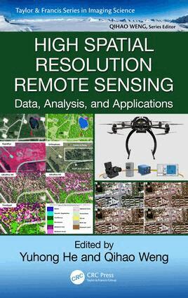
High spatial resolution remote sensing is an area of considerable current interest and builds on developments in object-based image analysis, commercial high-resolution satellite sensors, and UAVs. It captures more details through high and very high resolution images (10 to 100 cm/pixel). This unprecedented level of detail offers the potential extraction of a range of multi-resource management information, such as precision farming, invasive and endangered vegetative species delineation, forest gap sizes and distribution, locations of highly valued habitats, or sub-canopy topographic information. Information extracted in high spatial remote sensing data right after a devastating earthquake can help assess the damage to roads and buildings and aid in emergency planning for contact and evacuation.To effectively utilize information contained in high spatial resolution imagery, High Spatial Resolution Remote Sensing: Data, Analysis, and Applications addresses some key questions: What are the challenges of using new sensors and new platforms? What are the cutting-edge methods for fine-level information extraction from high spatial resolution images? How can high spatial resolution data improve the quantification and characterization of physical-environmental or human patterns and processes?The answers are built in three separate parts: (1) data acquisition and preprocessing, (2) algorithms and techniques, and (3) case studies and applications. They discuss the opportunities and challenges of using new sensors and platforms and high spatial resolution remote sensing data and recent developments with a focus on UAVs. This work addresses the issues related to high spatial image processing and introduces cutting-edge methods, summarizes state-of-the-art high spatial resolution applications, and demonstrates how high spatial resolution remote sensing can support the extraction of detailed information needed in different systems. Using various high spatial resolution data, the third part of this book covers a range of unique applications, from grasslands to wetlands, karst areas, and cherry orchard trees.