
MICHELIN Atlanten – serie
Visar alla böcker i serien MICHELIN Atlanten. Handla med fri frakt och snabb leverans.
11 produkter
11 produkter
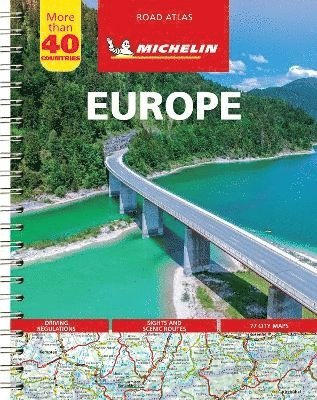
Häftad, Engelska, 2023
161 kr
Skickas inom 7-10 vardagar
Michelin motoring atlas Europe is the perfect companion for an enjoyable and safe drive in Europe. Convenient and easy to use thanks to its spiral bound cover, Michelin motoring altas Europe covers 40 countries and will provide you with precise and reliable information with its annually updated mapping scaled 1/500,000 - 1/3,000,000 and local driving regulations. The route planner as well as the time and distance charts will help you plan and optimise your journey. Tourist sights, leisure facilities and scenic routes will add pleasure to your journey.In addition to clear and accurate mapping, the Michelin motoring altas Europe features: * Detailed mapping with a scale 1/500,000 - 1/3,000,000* Mileage chart and journey times to help you plan your journey* Key to Map Pages to quickly access your region of interest* Motoring regulations to travel in Europe* 78 town plans for easy navigation in urban areas* An extensive place name index to easily identify the destination of your choice* Comprehensive and detailed key to symbols used* Tourist information with place of interest and leisure facilities* Scenic routes, cross-referenced with the famous Michelin Green Guides, with towns underlined in green
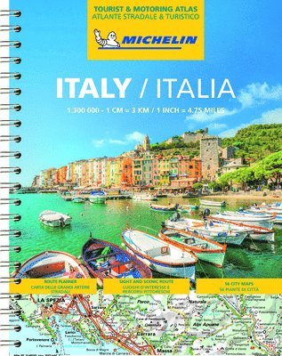
Häftad, Engelska, 2023
161 kr
Skickas inom 7-10 vardagar
Michelin Italy Tourist and Motoring Atlas is the perfect companion for a safe and enjoyable drive in Italy. Convenient and easy to use thanks to its spiral bound cover, Michelin Italy Atlas will provide you with precise and reliable information with its annually updated mapping scaled 1/300 000 (1 cm = 3 km). The route planner, the pages on the motorway system, as well as the time and distance charts will help you plan and optimise your journey. Tourist sights, leisure facilities, scenic routes and service areas will add pleasure to your journey, whilst the new location map on top of each page as well highly practical street maps will help you easily navigate within the atlas.Michelin's Italy tourist and motoring atlas features: * Detailed and easy-to-use mapping with a scale 1/300 000* Mileage chart and journey times to help you plan your journey* Key to Map Pages to quickly access your region of interest* 53 town plans for easy navigation in urban areas* An extensive place name index to easily identify the destination of your choice* Comprehensive and detailed key to symbols used* Tourist information with place of interest and leisure facilities, as well as scenic routes * Fixed and average speed cameras indicated * Pages on the motorway system to help you easily find the exits, service stations, etc.* Location maps on top of each pages for easy navigation within the atlas* Highly practical street maps embedded in the mapping of their surrounding areas
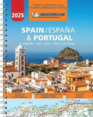
Häftad, Engelska, 2025
161 kr
Skickas inom 7-10 vardagar
Updated annually - Michelin Spain & Portugal tourist and motoring Atlas is the perfect companion for a safe and enjoyable drive. Convenient and easy to use thanks to its spiral bound cover, the Michelin Spain and Portugal atlas will provide you with precise and reliable information with its annually updated mapping scaled 1/400 000 (1 cm = 4 km) and safety alerts. The route planner, as well as the time and distance charts will help you plan and optimise your journey, whilst the new location map on top of each page and the hightly practical street maps will provide you with an easy navigation within the atlas. Tourist sights, leisure facilities, and scenic route will add pleasure to your journey. Michelin touring and motoring atlas Spain & Portugal features: * Detailed and easy-to-use mapping with a scale 1/400 000 * Mileage chart and journey times to help you plan your journey * Key to Map Pages to quickly access your region of interest * 64 town plans for easy navigation in urban areas * An extensive place name index to easily identify the destination of your choice * Comprehensive and detailed key to symbols used * Tourist information with place of interest and leisure facilities, as well as scenic routes * Location maps on top of each pages for an easy navigation within the atlas * Highly practical street map pages embedded in the mapping of their surrounding areas

166 kr
Skickas inom 3-6 vardagar
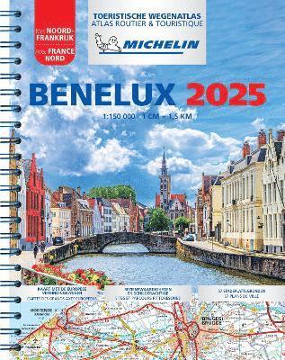
Häftad, Engelska, 2025
147 kr
Skickas inom 7-10 vardagar
(Updated 2025) Michelin Road Atlas Beneluxis the perfect companion for an enjoyable and safe drive. Convenient and easy to use thanks to its spiral bound cover. Michelin Road Atlas Benelux will provide you with precise and reliable information with its mapping scaled 1/150 000 for an enjoyable journey in Belgium, Luxembourg and Netherlands. The route planner as well as the time and distance charts will help you plan and optimise your journey, whilst new location maps on top of each page as well as highly practical street maps will ensure an easy navigation within the atlas. Tourist sights, leisure facilities and scenic routes will add pleasure to your journey. In addition to clear and accurate mapping, the Michelin motoring atlas Benelux and North of France will help you optimise and add comfort to your journey: * Detailed mapping with a scale 1/150 000 * Mileage chart and journey times to help you plan your journey * European route planner * Key to Map Pages to quickly access your region of interest * 68 town plans for easy navigation in urban areas * An extensive place name index to easily identify the destination of your choice * Comprehensive and detailed key to symbols used * Tourist information with place of interest and leisure facilities, as well as scenic routes * Michelin Safety Alerts (Steep gradients, dangerous routes, zones subject to tighter speed controls ...) * Location maps on top of each pages for an easy navigation within the atlas * Highly practical street maps embedded in the map of their surrounding areas Coverage: Netherlands Belgium Luxembourg
159 kr
Skickas inom 3-6 vardagar
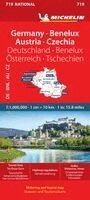
(Edition updated in 2022) MICHELIN National Map Germany, Benelux, Austria, Czech Rep (map 719) will give you an overall picture of your journey thanks to its clear and accurate mapping scale 1/1,000,000. Our map will help you easily plan your safe and enjoyable journey in Northern and Eastern Europe from Belgium to the Czech Republic, Germany to Austria thanks to a comprehensive key, a complete name index as well a clever time & distance chart. Michelin's driving information will help you navigate safely in all circumstances. In addition, Michelin's National map 719 is cross-referenced with the famous Michelin Green Guide highlighting worth stopping for! With MICHELIN National Maps, find more than just your way!MICHELIN NATIONAL MAPS feature:* Up-to-date mapping * A scale adapted to the size of the country * A clear and comprehensive key * Distance and time chart * Place name index * Driving and road safety information * Tourist sights informationOur maps are regularly updated even if the ISBN does not change.

Häftad, Engelska, 2025
123 kr
Skickas inom 7-10 vardagar
This newly updated Great Britain and Ireland Atlas includes Route Planner, Sights and Scenic Routes, and 41 Town Plans. (English/French) - Spiral Format. Scale: 1:300,000 1 inch = 4.75 miles, 1 cm = 3 km
Häftad, Franska, 2026
161 kr
Skickas inom 7-10 vardagar
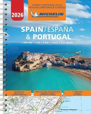
Updated annually - Michelin Spain & Portugal tourist and motoring Atlas is the perfect companion for a safe and enjoyable drive. Convenient and easy to use thanks to its spiral bound cover, the Michelin Spain and Portugal atlas will provide you with precise and reliable information with its annually updated mapping scaled 1/400 000 (1 cm = 4 km) and safety alerts. The route planner, as well as the time and distance charts will help you plan and optimise your journey, whilst the new location map on top of each page and the hightly practical street maps will provide you with an easy navigation within the atlas. Tourist sights, leisure facilities, and scenic route will add pleasure to your journey. Michelin touring and motoring atlas Spain & Portugal features: * Detailed and easy-to-use mapping with a scale 1/400 000 * Mileage chart and journey times to help you plan your journey * Key to Map Pages to quickly access your region of interest * 64 town plans for easy navigation in urban areas * An extensive place name index to easily identify the destination of your choice * Comprehensive and detailed key to symbols used * Tourist information with place of interest and leisure facilities, as well as scenic routes * Location maps on top of each pages for an easy navigation within the atlas * Highly practical street map pages embedded in the mapping of their surrounding areas
Häftad, Franska, 2026
255 kr
Skickas inom 3-6 vardagar
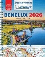
(Updated 2026) Michelin Road Atlas Beneluxis the perfect companion for an enjoyable and safe drive. Convenient and easy to use thanks to its spiral bound cover. Michelin Road Atlas Benelux will provide you with precise and reliable information with its mapping scaled 1/150 000 for an enjoyable journey in Belgium, Luxembourg and Netherlands. The route planner as well as the time and distance charts will help you plan and optimise your journey, whilst new location maps on top of each page as well as highly practical street maps will ensure an easy navigation within the atlas. Tourist sights, leisure facilities and scenic routes will add pleasure to your journey. In addition to clear and accurate mapping, the Michelin motoring atlas Benelux and North of France will help you optimise and add comfort to your journey: * Detailed mapping with a scale 1/150 000 * Mileage chart and journey times to help you plan your journey * European route planner * Key to Map Pages to quickly access your region of interest * 68 town plans for easy navigation in urban areas * An extensive place name index to easily identify the destination of your choice * Comprehensive and detailed key to symbols used * Tourist information with place of interest and leisure facilities, as well as scenic routes * Michelin Safety Alerts (Steep gradients, dangerous routes, zones subject to tighter speed controls ...) * Location maps on top of each pages for an easy navigation within the atlas * Highly practical street maps embedded in the map of their surrounding areas Coverage: Netherlands Belgium Luxembourg
315 kr
Skickas inom 3-6 vardagar
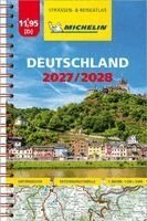
Tyska, 2026
159 kr
Skickas inom 3-6 vardagar