
National Geographic Trails Illustrated Map – serie
Visar alla böcker i serien National Geographic Trails Illustrated Map. Handla med fri frakt och snabb leverans.
4 produkter
4 produkter
231 kr
Tillfälligt slut
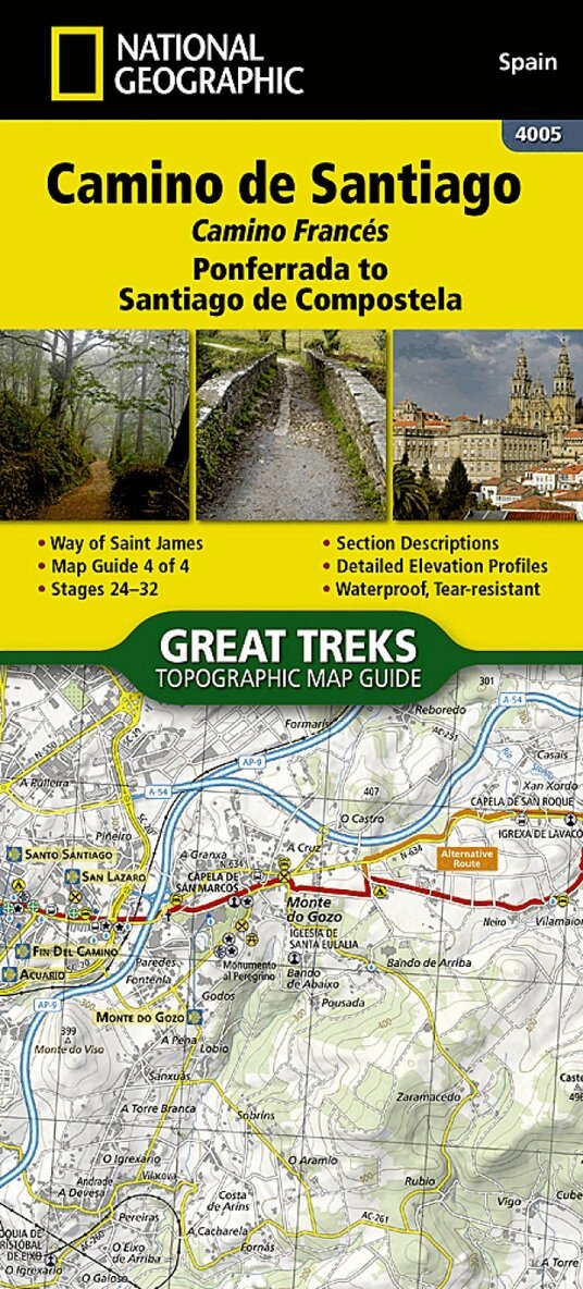
Waterproof Tear-Resistant Topographic Map The Way of Saint James, known in Spanish as Camino de Santiago - or simply El Camino (The Way) - has been one of Europe's most iconic walking routes since 9th century pilgrims began making their way to the Cathedral of Santiago de Compostela to venerate the remains of Saint James. Though rooted in Christian tradition, the route has been reborn as a nondenominational spiritual rite and epic long distance trail that runs along Roman roads, across mountains, and through picturesque countryside and historic towns. The Ponferrada to Santiago de Compostela Topographic Map Guide booklet makes a perfect traveling companion when traversing the last section of the Camino Frances (French Route). This section of the trail includes the final 100km required to receive the famous Compostela pilgrim certificate when arriving in Santiago. This final booklet includes sections 24 - 32. A detailed description of each trail section is included that tells travelers about the many landmarks encountered along the way. Each Camino de Santiago Topographic Map Guide includes detailed topographic maps of 2 cm = 1 km. Each page is centered on the trail and overlaps with the adjacent pages so there is little chance of getting lost. Along the bottom of each page is a trail profile that shows the distance between towns, rest houses, and trail access points. The map and trail profile provide a step by step visual guide to hiking the trail. Every Great Treks map is printed on 'Backcountry Tough' waterproof, tear-resistant paper. A full Lat/Long grid is printed on the map to aid with GPS navigation. Every map purchase helps support the National Geographic Society, an impact driven, nonprofit organization with global reach that uses the power of science, exploration, education, and storytelling to illuminate and protect the wonder of our world. Map 4005
297 kr
Skickas inom 3-6 vardagar
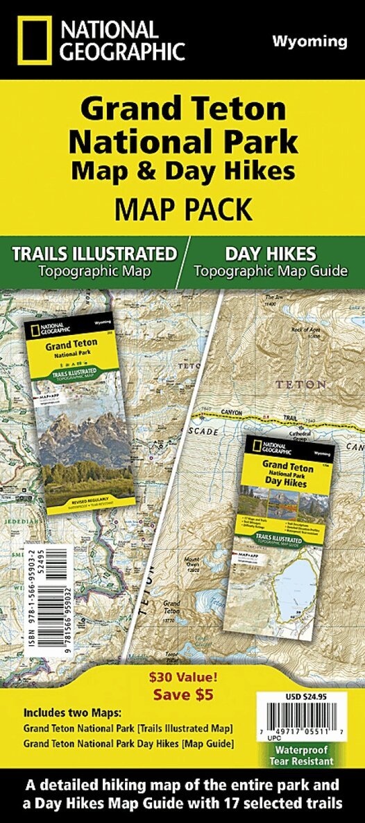
• Waterproof • Tear-Resistant • Topographic MapsThe Tetons evoke a sense of inspiration and aspiration in all who visit. Established in 1929, Grand Teton National Park now encompasses and protects 310,000 acres (485 square miles) for everyone to enjoy. This two title Map Pack helps explorers of all levels see everything this astounding park has to offer. The map pack includes an overview map that shows the entire park as well as a Day Hikes map guide. With this combination of maps visitors can feel comfortable planning a trip to a park with options for everyone, from multi-day backpack trips to short hikes on the shores of Jackson Lake.The Grand Teton National Park Day Hikes Topographic Map Guide includes seventeen diverse hikes for all hiking enthusiasts, from the easy, 1.1 mile long Schwabacher Landing to the strenuous, 12.9 mile long Granite Canyon with almost a mile of elevation loss. Each hike has a detailed map, a trail profile visualizing the changes in elevation, and a short summary of the interesting features encountered along the trip. Buy the Map Pack and save 15%!The Grand Teton Day Hikes and National Park Map Pack includes: • Map 202 :: Grand Teton National Park • Map 1706 :: Grand Teton National Park Day HikesEvery Trails Illustrated map is printed on 'Backcountry Tough' waterproof, tear-resistant paper. National Geographic's Topographic Map Guide booklets are printed on 'Backcountry Tough' waterproof, tear-resistant paper with stainless steel staples. A full UTM grid is printed on the map to aid with GPS navigation.
Engelska, 2024
231 kr
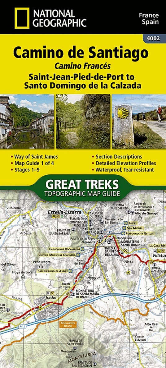
Waterproof & Tear-Resistant Topographic Map. The Way of Saint James, known in Spanish as Camino de Santiago; or simply El Camino (The Way), has been one of Europe's most iconic walking routes since 9th century pilgrims began making their way to the Cathedral of Santiago de Compostela to venerate the remains of Saint James. Though rooted in Christian tradition, the route has been reborn as a nondenominational spiritual rite and epic long distance trail that runs along Roman roads, across mountains, and through picturesque countryside and historic towns. The Saint-Jean-Pied-de-Port to Santo Domingo de la Calzada Map Guide booklet makes a perfect traveling companion when traversing the furthest east section of the Camino Frances (French Route). This section of the trail passes over the Pyrenees from France into Spain and then through Pamplona (Iruna) and includes sections 1-9. A detailed description of each trail section is included that tells travelers about the many landmarks encountered along the way. Each Camino de Santiago Topographic Map Guide includes detailed topographic maps of 2 cm = 1 km. Each page is centered on the trail and overlaps with the adjacent pages so there is little chance of getting lost. Along the bottom of each page is a trail profile that shows the distance between towns, rest houses, and trail access points. The map and trail profile provide a step by step visual guide to hiking the trail. Every Great Treks map is printed on 'Backcountry Tough' waterproof, tear-resistant paper. A full Lat/Long grid is printed on the map to aid with GPS navigation. Every map purchase helps support the National Geographic Society, an impact driven, nonprofit organization with global reach that uses the power of science, exploration, education, and storytelling to illuminate and protect the wonder of our world. Map number 4002
Engelska, 2024
231 kr
Skickas inom 3-6 vardagar
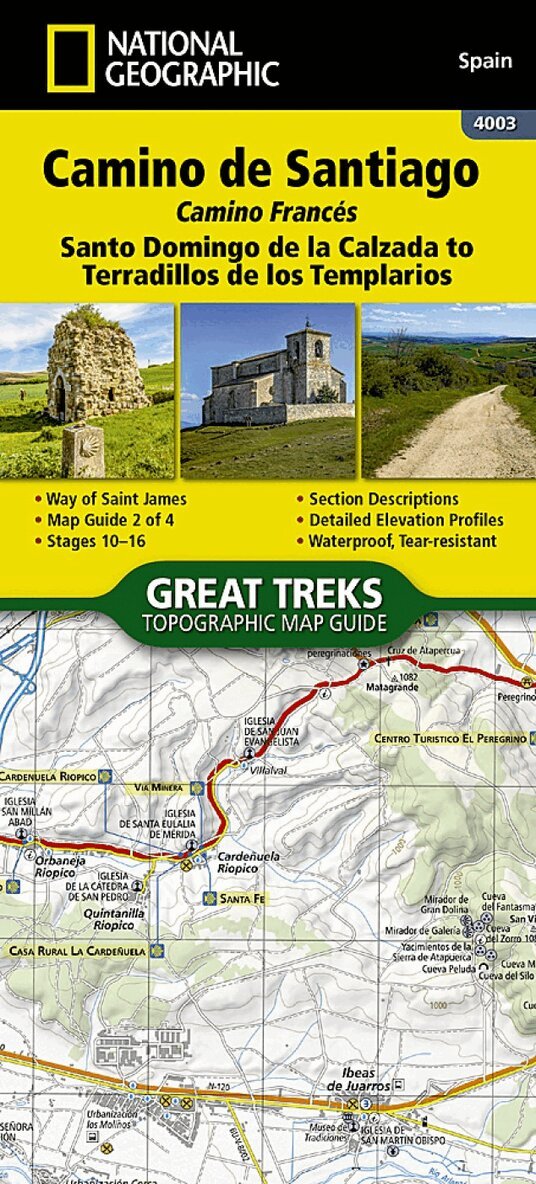
Waterproof, Tear-Resistant Topographic Map. The Way of Saint James, known in Spanish as Camino de Santiago - or simply El Camino (The Way) - has been one of Europe's most iconic walking routes since 9th century pilgrims began making their way to the Cathedral of Santiago de Compostela to venerate the remains of Saint James. Though rooted in Christian tradition, the route has been reborn as a nondenominational spiritual rite and epic long distance trail that runs along Roman roads, across mountains, and through picturesque countryside and historic towns. The Santo Domingo de la Calzada to Terradillos de los Templarios Topographic Map Guide booklet makes a perfect traveling companion when traversing the central-east section of the Camino Frances (French Route). This section of the trail passes trough the historic city of Burgos and includes sections 10 - 16. A detailed description of each trail section is included that tells travelers about the many landmarks encountered along the way. Each Camino de Santiago Topographic Map Guide includes detailed topographic maps of 2 cm = 1 km. Each page is centered on the trail and overlaps with the adjacent pages so there is little chance of getting lost. Along the bottom of each page is a trail profile that shows the distance between towns, rest houses, and trail access points. The map and trail profile provide a step by step visual guide to hiking the trail. Every Great Treks map is printed on 'Backcountry Tough' waterproof, tear-resistant paper. A full Lat/Long grid is printed on the map to aid with GPS navigation. Every map purchase helps support the National Geographic Society, an impact driven, nonprofit organization with global reach that uses the power of science, exploration, education, and storytelling to illuminate and protect the wonder of our world. Map 4003