
Philip's Sheet Maps – serie
Visar alla böcker i serien Philip's Sheet Maps. Handla med fri frakt och snabb leverans.
11 produkter
11 produkter
Engelska, 2024
87 kr
Skickas inom 5-8 vardagar
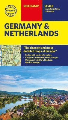
'THE CLEAREST AND MOST DETAILED MAPS OF EUROPE' David Williams MBE, former CEO Gem Motoring AssistPhilip's latest super-clear, double-sided road map of Germany and the Netherlands fully updated with the latest tourist, heritage and driving information. The bestselling fold-out road map has been updated for all travellers wanting to go places from Rotterdam to the Rhine. Whether driving through the most spectacular scenic routes the area has to offer along the Rhine or the Herengracht or planning your trip from Amsterdam to Berlin, this handy map has all you need.- Super-clear mapping scale 1:1,110,000 (17.5 miles to 1 inch)- Key driving information: motorways (toll, pre-pay and free), mountain passes, railways, canals, road numbers (European and local), plus distances between towns- Fully revised and up-to-date with the latest tourist and leisure information- Scenic routes clearly highlighted - Places of interest added: from castles, heritage sites, lakes and national parks to theme parks, places of worship and ancient monuments- Double-sided maps - more for your money and easier to use- Detailed city plans of Amsterdam, Berlin, Cologne, Dusseldorf, Frankfurt, Hamburg, Munich and StuttgartIn fact, everything you need for your trip to Germany and the Netherlands.
Engelska, 2026
121 kr
Skickas inom 5-8 vardagar
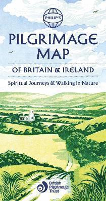
In association with The British Pilgrimage Trust, for walkers, thinkers and nature seekers, Philip's Pilgrimage map of Britain and Ireland depicts the best ancient and modern routes around the islands, providing the opportunity to reflect and absorb the beauty of the countryside and honour the ways and byways of the past.Nature lover, history lover or just someone who enjoys a good walk, we have gathered the best of the old ways and added some new routes for today's pilgrims. We map the various routes and provide details of the distances, level of difficulty and places to visit on the way, along with the significance of the ultimate destination. Whether your need is spiritual or simply a desire to soak up the green fields, woodlands or coastal paths, the routes give you options and alternatives. Thousands of years of history reverberate with every step in these islands. For centuries people of all sorts have simply strapped some boots on and stepped out to appreciate our heritage and meditate in nature. Nowadays we are giving ourselves an opportunity to quieten the clamour of the digital world, add a little meditative calm to our lives and enjoy the extraordinary heritage of the islands.* Top pilgrimages and ancient ways clearly mapped including the Camino Ingles* Over 30 Routes described listing distance, level of difficulty and highlights* Covering England, Ireland, Scotland and Wales in the footsteps of the Saints and their followers* Landscapes, history and spiritual reflection in one easy-to-use map* Published in association with The British Pilgrimage Trust

Engelska, 2025
107 kr
Skickas inom 5-8 vardagar
For all your holiday and travel needs, the latest up-to-date edition of Philip's super-clear map of Europe.'The Clearest and Most Detailed Maps of Europe' David Williams MBE, former CEO Gem Motoring AssistThe perfect all-inclusive map for planning and using on your European Road Trip:- The Main scale is super-clear 1: 3,890,000 (61 miles to 1 inch)- All of Europe is covered from Southern Portugal to Northern Russia- Fully updated with all the latest information for travelling in Europe- Map of Europe's High-speed railways- Handy Weather Maps for both Summer and Winter travels- City-to-City Distance Table for estimating your journeys- All the important information for motoring: motorways (toll, pre-pay and free), mountain passes, railways, road numbers (European and local), distances between towns In fact, everything you need for driving in Europe. Every country is covered from Portugal to Russia and it is a double-sided map for easy in-car use. Follow the sun (or the snow) and make the most of this small, but extraordinarily culture-packed continent.
Engelska, 2021
87 kr
Skickas inom 5-8 vardagar
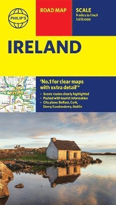
All of Ireland is clearly shown in this handy, up-to-date Philip's road map covering the whole island at 9 miles to 1 inch. By including the latest new roads and motorways, route-planning and touring is made wonderfully simple with this easy-to-read guide.'THE CLEAREST AND MOST DETAILED MAPS OF EUROPE' David Williams MBE, former CEO Gem Motoring AssistThe bestselling fold-out road map for navigating in Ireland has been updated for all travellers wanting to go places on the island. Whether driving through the most spectacular scenic routes on offer, enjoying the cultural and natural heritage or just planning city-to-city travel, this handy map has all you need.- Super-clear scale at 9 miles to 1 inch - Key driving information: motorways (toll and free), road numbers with distances between towns- Fully revised and up-to-date with the latest tourist and leisure information- Places of interest added: from castles, historic houses, beaches and national parks to theme parks, places of worship and ancient monuments- Includes the islands of Aran, Valentia, Blaskets- Detailed city plans: Dublin, Belfast, Derry/Londonderry, Cork- Full index of place namesWhether exploring the many enchanting sights and heritage of Ireland or getting from A to B in the most effective manner, this map caters for it all. Town plans, airports, ferry routes and motorways are added for clarity, alongside the Wild Atlantic Way and the Giant's Causeway for inspiration. Fáilte!
87 kr
Skickas inom 5-8 vardagar
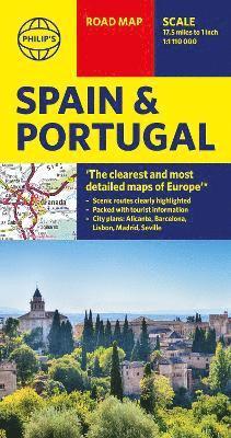
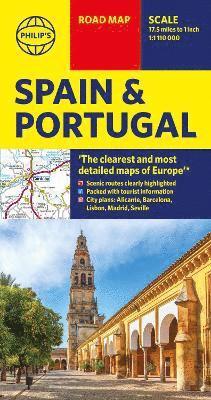
Philip's latest super-clear road map of Spain and Portugal has been fully updated with the latest tourist, heritage and driving information.'THE CLEAREST AND MOST DETAILED MAPS OF EUROPE' - David Williams MBE, former CEO Gem Motoring AssistThe bestselling fold-out road map for navigating in Spain and Portugal has been updated for all travellers wanting to go places in the Iberian peninsula. Whether driving through the most spectacular scenic routes the countries have to offer or tracking your city-to-city travel, this handy map has all you need.- Super-clear scale 1:1,110,000 (17.5 miles to 1 inch)- Key driving information: motorways (toll, pre-pay and free), mountain passes, railways, road numbers (European and local), plus distances between towns- Fully revised and up-to-date with the latest tourist and leisure information- Scenic routes clearly highlighted- Places of interest added: from castles, historic houses, beaches and national parks to theme parks, places of worship and ancient monuments- Includes the islands of Majorca, Minorca and Ibiza- Double-sided maps - more for your money and easier to use- Detailed city plans: Alicante, Barcelona, Lisbon, Madrid and Seville- Full index of place names- Major city location mapsIn fact, everything you need for your trip to Spain and Portugal.
87 kr
Skickas inom 5-8 vardagar
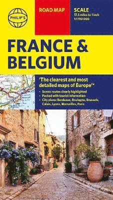
'THE CLEAREST AND MOST DETAILED MAPS OF EUROPE' David Williams MBE, former CEO Gem Motoring AssistA freshly updated edition of Philip's ultra-clear, double-sided road map covering the whole of France and Belgium, with the latest tourist, heritage and driving information, a comprehensive index and town plans for easy use.This bestselling fold-out map for navigating in France and Belgium has been thoroughly updated for easy travelling. Whether you are driving through vineyards to the most spectacular scenic routes the countries have to offer, meandering through the South of France or planning your trip from Brussels to Paris, this handy map has all you need.- Super-clear mapping scale 1:1,110,000 (17.5 miles to 1 inch)- Key driving information: motorways (toll, pre-pay and free), mountain passes, railways, road numbers (European and local), plus distances between towns- Fully revised and up-to-date with the latest tourist and leisure information- Scenic routes clearly highlighted- Places of interest added: from castles, heritage sites, beaches and national parks to theme parks, places of worship and ancient monuments- Includes the island of Corsica and sights of Monaco- Double-sided maps - more for your money and easier to use- Detailed city plans: Paris, Bordeaux, Boulogne, Brussels, Calais, Lyons and Marseilles- Full index of place namesIn fact, everything you need for your trip to and through France and Belgium.
Engelska, 2024
87 kr
Skickas inom 5-8 vardagar
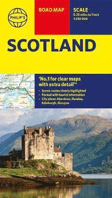
'THE CLEAREST AND MOST DETAILED MAPS OF EUROPE' David Williams MBE, former CEO Gem Motoring AssistPhilip's latest super-clear road map of Scotland and its islands - fully updated with the latest tourist, heritage and driving information for the best travelling experience.The bestselling fold-out road map for navigating in Scotland has been completely updated for anyone wanting to visit the lowlands, highlands and islands, including the Western Isles, the Orkney and Shetland Islands. Whether driving through the most spectacular scenic routes in the Highlands or planning your trip from Edinburgh to Inverness, this handy map has all you need.- Super-clear mapping scale 1:330,000 (5.25 miles to 1 inch)- Key driving information: motorways, railways, ferry routes, road numbers, plus distances between towns- Fully revised and up-to-date with the latest tourist and leisure information- Scenic routes clearly highlighted- Places of interest added: from castles, heritage sites, beaches and national parks to theme parks, places of worship and ancient monuments- Includes the islands and sights of the Western Isles and the Orkney and Shetland Islands- Double-sided maps - more for your money and easier to use- Detailed city plans: Aberdeen, Dundee, Edinburgh and Glasgow- Full index of place namesIn fact, everything you need for motoring in Scotland
Engelska, 2026
98 kr
Skickas inom 5-8 vardagar
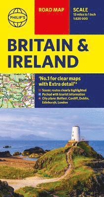
'THE BEST OF ITS KIND, WITH QUICK EASY-TO-USE INFORMATION' Fleet WeekPhilip's super-clear road map of Britain and Ireland, fully updated with the latest route-planning, tourist and driving information. Whether you are planning a road trip of the British Isles or just ensuring you take the best roads from A to B, this map will take you where you wish to go.The bestselling fold-out road map for navigating in Britain and Ireland has been completely updated for all those wanting to go places in the British Isles - England, Scotland, Wales and all of Ireland. Whether driving through the most spectacular scenic routes each country has to offer, working out which county boundary applies, or planning your trip from Edinburgh to London, this handy map has all you need.- Super-clear mapping scale 1:830,000 (13 miles to 1 inch)- Key driving information: motorways (toll, pre-pay and free), mountain routes, railways, canals, road numbers, plus distances between towns- All County Boundaries and Local Councils clearly marked- Fully revised and up-to-date with the latest tourist and leisure information- Scenic routes clearly highlighted from coastal to mountainous- Places of interest: from castles, heritage sites, beaches and national parks to theme parks, places of worship and ancient monuments- Includes the Channel Islands and Isle of Man- Double-sided maps - more for your money and easier to use- Detailed city plans: London, Edinburgh, Cardiff, Dublin and Belfast- Full index of place namesIn fact, everything you need for going places in Britain and Ireland
- Nyhet
Engelska, 2026
87 kr
Skickas inom 5-8 vardagar
Philip's latest super-clear road map of Spain and Portugal has been fully updated with the latest tourist, heritage and driving information.'THE CLEAREST AND MOST DETAILED MAPS OF EUROPE' - David Williams MBE, former CEO Gem Motoring AssistThe bestselling fold-out road map for navigating in Spain and Portugal has been updated for all travellers wanting to go places in the Iberian peninsula. Whether driving through the most spectacular scenic routes the countries have to offer or tracking your city-to-city travel, this handy map has all you need.- Super-clear scale 1:1,110,000 (17.5 miles to 1 inch)- Key driving information: motorways (toll, pre-pay and free), mountain passes, railways, road numbers (European and local), plus distances between towns- Fully revised and up-to-date with the latest tourist and leisure information- Scenic routes clearly highlighted- Places of interest added: from castles, historic houses, beaches and national parks to theme parks, places of worship and ancient monuments- Includes the islands of Majorca, Minorca and Ibiza- Double-sided maps - more for your money and easier to use- Detailed city plans: Alicante, Barcelona, Lisbon, Madrid and Seville- Full index of place names- Major city location mapsIn fact, everything you need for your trip to Spain and Portugal.
- Nyhet
87 kr
Skickas inom 5-8 vardagar
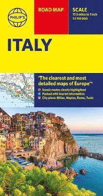
Philip's latest super-clear road map of Italy fully updated with the latest tourist, heritage and driving information.'THE CLEAREST AND MOST DETAILED MAPS OF EUROPE' David Williams MBE, former CEO Gem Motoring AssistThe bestselling fold-out road map for navigating in Italy has been updated for all travellers wanting to go places in the Italian peninsula, including Sardinia and Sicily. Whether driving through the most spectacular scenic routes the country has to offer on the Amalfi coast or planning your trip from Venice to Naples, this handy map has all you need.- Super-clear mapping scale 1:1,110,000 (17.5 miles to 1 inch)- Key driving information: motorways (toll, pre-pay and free), mountain passes, railways, road numbers (European and local), plus distances between towns- Fully revised and up-to-date with the latest tourist and leisure information- Scenic routes clearly highlighted- Places of interest added: from castles, heritage sites, beaches and national parks to theme parks, places of worship and ancient monuments- Includes the islands and sights of Sardinia and Sicily- Double-sided maps - more for your money and easier to use- Detailed city plans: Milan, Naples, Rome and Turin - Full index of place names- Major city location mapsIn fact, everything you need for your trip to Italy.
Engelska, 2020
91 kr
Tillfälligt slut
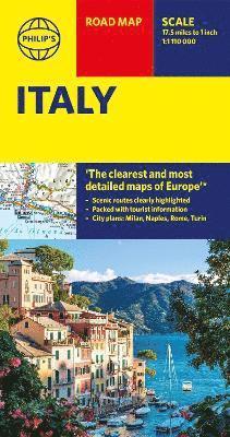
Philip's latest super-clear road map of Italy fully updated with the latest tourist, heritage and driving information.'THE CLEAREST AND MOST DETAILED MAPS OF EUROPE' David Williams MBE, former CEO Gem Motoring AssistThe bestselling fold-out road map for navigating in Italy has been updated for all travellers wanting to go places in the Italian peninsula, including Sardinia and Sicily. Whether driving through the most spectacular scenic routes the country has to offer on the Amalfi coast or planning your trip from Venice to Naples, this handy map has all you need.- Super-clear mapping scale 1:1,110,000 (17.5 miles to 1 inch)- Key driving information: motorways (toll, pre-pay and free), mountain passes, railways, road numbers (European and local), plus distances between towns- Fully revised and up-to-date with the latest tourist and leisure information- Scenic routes clearly highlighted- Places of interest added: from castles, heritage sites, beaches and national parks to theme parks, places of worship and ancient monuments- Includes the islands and sights of Sardinia and Sicily- Double-sided maps - more for your money and easier to use- Detailed city plans: Milan, Naples, Rome and Turin - Full index of place names- Major city location mapsIn fact, everything you need for your trip to Italy.