
Regional maps - Germany – serie
Visar alla böcker i serien Regional maps - Germany. Handla med fri frakt och snabb leverans.
10 produkter
10 produkter

Engelska, 2025
190 kr
Skickas inom 3-6 vardagar
The map shows the main attractions in Hamburg, Berlin, Hannover, Bielefeld, Dortmund, Essen, Dusseldorf, Cologne, Frankfurt am Main, Nuremberg, Stuttgart, Munich, etc.With its clearly marked, easy-to-read and up-to-date streets, clear, up-to-date map image and level of detail, the map is the perfect tool to fully enjoy your visit to this special country.The thematic map includes detailed information on cities and the connecting road network.Travellers by car or motorbike will always find their way thanks to the clearly visible and clearly displayed highways, motorways, main roads, provincial roads and secondary roads. The integrated public transport maps help you find your way around cities. Thanks to the integrated distance table, you can easily calculate routes between departure and arrival points and plan the required travel time.The attached quadrilingual brochure with a place name index, city maps, travel information, top attractions and travel tips completes the map.
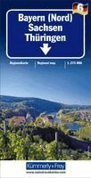
Del 1467 - Regional maps - Germany
Saxony Thuringe / Bavaria North
Engelska, 2022
132 kr
Skickas inom 3-6 vardagar
Optimum orientation - what you need are our regional maps. The Kümmerly+Frey regional maps will make you feel at home even when you're on holiday. Your will always know where you are and how far it is to the next tourist attraction. The regional maps are licensed editions published by well-known cartographical publishing houses.

Del 1465 - Regional maps - Germany
Berlin / Brandenburg
Engelska, 2023
132 kr
Skickas inom 3-6 vardagar
Optimum orientation - what you need are our regional maps. The Kümmerly+Frey regional maps will make you feel at home even when you're on holiday. Your will always know where you are and how far it is to the next tourist attraction. The regional maps are licensed editions published by well-known cartographical publishing houses.
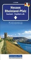
Del 1466 - Regional maps - Germany
Rhineland-Palatinate Saarland / Hessen, Frankfurt
Engelska, 2023
132 kr
Skickas inom 3-6 vardagar
Optimum orientation - what you need are our regional maps. The Kümmerly+Frey regional maps will make you feel at home even when you're on holiday. Your will always know where you are and how far it is to the next tourist attraction. The regional maps are licensed editions published by well-known cartographical publishing houses.
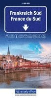
Engelska, 2025
167 kr
Skickas inom 3-6 vardagar
South France k&f 1:600 000The map shows the main attractions in Grenoble, Nice, Marseille, Toulouse, Bordeaux, Limoges, Perpignan, etc.With its clearly marked, easy-to-read and up-to-date streets, clear, up-to-date map image and level of detail, the map is the perfect tool to fully enjoy your visit to this special country.The thematic map includes detailed information on cities and the connecting road network.Travellers by car or motorbike will always find their way thanks to the clearly visible and clearly displayed highways, motorways, main roads, provincial roads and secondary roads. The integrated public transport maps help you find your way around cities. Thanks to the integrated distance table, you can easily calculate routes between departure and arrival points and plan the required travel time.The attached quadrilingual brochure with a place name index, city maps, travel information, top attractions and travel tips completes the map.
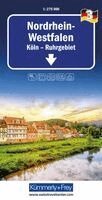
Del 3 - Regional maps - Germany
Nordrhein-Westfalen / Cologne, Ruhr
Engelska, 2025
167 kr
Skickas inom 3-6 vardagar
Optimum orientation - what you need are our regional maps. The Kümmerly+Frey regional maps will make you feel at home even when you're on holiday. Your will always know where you are and how far it is to the next tourist attraction. The regional maps are licensed editions published by well-known cartographical publishing houses.
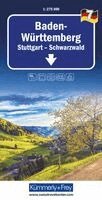
Del 7 - Regional maps - Germany
Baden-Württemberg / Stuttgart, Black Forest
Engelska, 2025
167 kr
Skickas inom 3-6 vardagar
Optimum orientation - what you need are our regional maps. The Kümmerly+Frey regional maps will make you feel at home even when you're on holiday. Your will always know where you are and how far it is to the next tourist attraction. The regional maps are licensed editions published by well-known cartographical publishing houses.

Del 1 - Regional maps - Germany
Germany North Sea Coast / Bremen, Hamburg
Engelska, 2026
167 kr
Skickas inom 3-6 vardagar
German North Sea Coast 1 k&f 1:275,000Bremen – HamburgThe Kümmerly+Frey road map of the German North Sea Coast, at a scale of 1:275,000, provides everything you need for navigation and inspiration.Thanks to the clearly marked, easy-to-read and up-to-date roads, the uncluttered, up-to-date map layout and the level of detail, the map is the perfect tool to help you make the most of your visit to this exceptional region.The thematic map contains detailed information on towns and the connecting road network. Travellers by car or motorbike will always find the right route thanks to the clearly marked, clearly laid-out motorways, dual-carriageways, main roads, country roads and minor roads.The integrated information, including a place index and travel information, completes the map.The fold-out map for motorists or motorcyclists is made from a sturdy cover and paper. Even after repeated use, it won’t let you down.Should your GPS fail or your mobile phone run out of battery, the roads, viewpoints, railway stations, places to stop for refreshments, campsites, car parks, etc., clearly marked on the map will always help you find your way.
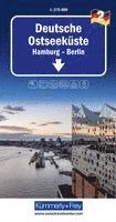
Del 2 - Regional maps - Germany
Germany East Sea Coast / Hamburg, Berlin
Engelska, 2026
167 kr
Skickas inom 3-6 vardagar
German Baltic Coast kf 1:275,000Including Hamburg and Berlin.Includes a place index and travel informationThe Kümmerly+Frey road map of the German Baltic Coast, at a scale of 1:275,000, provides everything you need for navigation and inspiration.Thanks to the clearly marked, easy-to-read and up-to-date roads, the uncluttered, up-to-date map layout and the level of detail, the map is the perfect tool to help you make the most of your visit to this exceptional region.The thematic map contains detailed information on towns and the connecting road network. Travellers by car or motorbike will always find the right route thanks to the clearly marked, clearly laid-out motorways, dual-carriageways, main roads, country roads and minor roads.The integrated information, including a place index and travel information, completes the map.The fold-out map for motorists or motorcyclists is made from a sturdy cover and paper. Even after repeated use, it won’t let you down.Should your GPS fail or your mobile phone run out of battery, the roads, viewpoints, railway stations, places to stop for refreshments, campsites, car parks, etc., clearly marked on the map will always help you find your way.
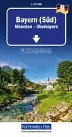
Del 8 - Regional maps - Germany
Bavaria South / München, Oberbayern
Engelska, 2026
167 kr
Skickas inom 3-6 vardagar
Southern Bavaria 8 k&f 1:275 000Munich and Upper BavariaThe Kümmerly+Frey road map of Bavaria (South), Munich – Upper Bavaria, at a scale of 1:275,000, provides everything you need for navigation and inspiration.The map highlights the most important areas of interest. Thanks to the clearly marked, easy-to-read and up-to-date roads, the uncluttered, up-to-date map layout and the level of detail, the map is the perfect tool to help you make the most of your visit to this exceptional region.The thematic map contains detailed information about towns and the connecting road network. Travellers by car or motorbike will always find the right route thanks to the clearly recognisable, clearly laid-out motorways, dual-carriageways, main roads, country roads and side roads.The fold-out map for motorists or motorcyclists features a sturdy cover and durable paper. Even after repeated use, it won’t let you down.Should your GPS fail or your mobile phone run out of battery, the clearly marked roads, viewpoints, railway stations, places to stop for refreshments, campsites, car parks, etc. on the map will always help you find your way.