
The Great Treks of the World – serie
Visar alla böcker i serien The Great Treks of the World. Handla med fri frakt och snabb leverans.
6 produkter
6 produkter
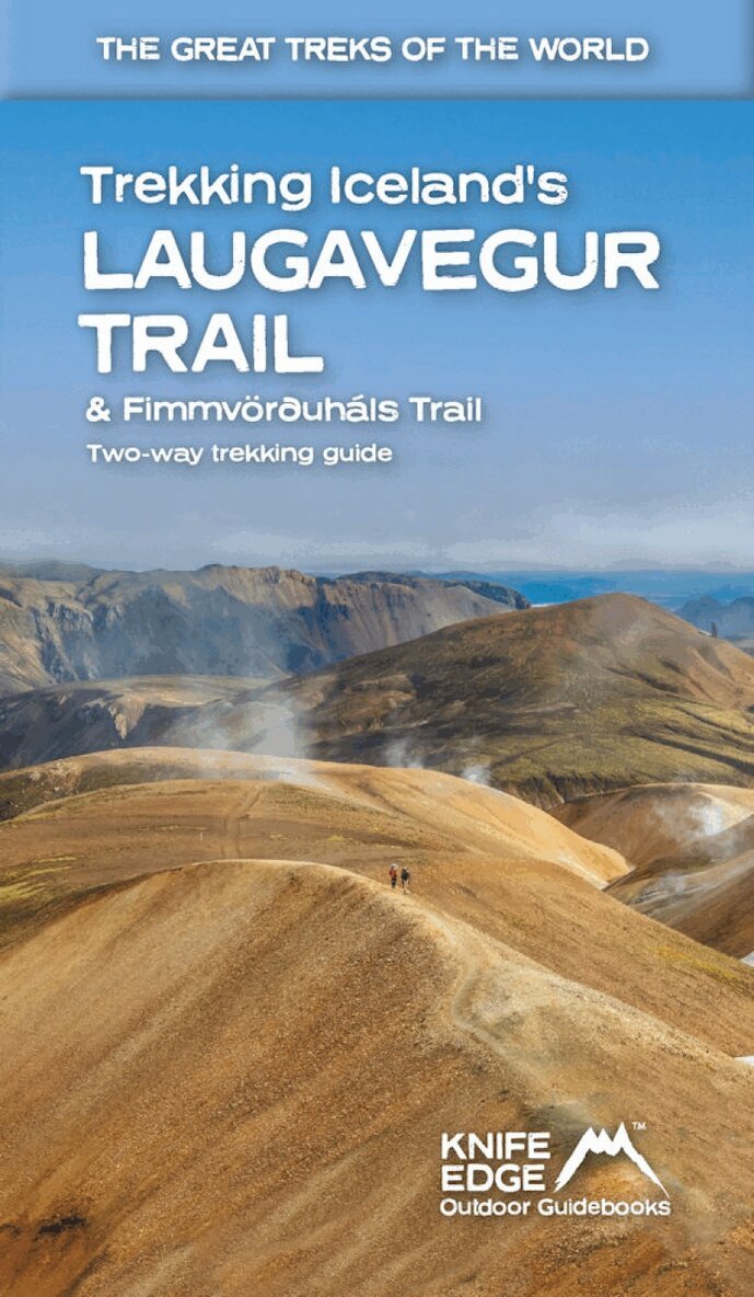
Häftad, Engelska, 2023
234 kr
Skickas
The definitive two-way guide to Iceland's Laugavegur Trail (& Fimmvorouhals Trail): both southbound and northbound routes are described in full. Real Maps: full mapping inside (1:40,000), made specifically for the treks by Knife Edge Outdoor Guidebooks. All accommodation/campsites are numbered and marked on the maps. 14 different itineraries: schedules of 2, 3, 4, 5, 6 and 7 days for hikers and runners. Includes both southbound and northbound itineraries. Difficult calculations of time, distance and altitude gain/loss are done for you. Also includes: - Detailed information on equipment and travelling light - Full accommodation/campsite listings - Everything the trekker needs to know: route, costs, difficulty, weather and more - Travel to the trail-head - Essential info for both self-guided and guided trekkers - Information on the volcanic sights along the route - Information on plants and wildlife - History of Iceland - Numbered waypoints linking the Real Maps to our clear descriptions The Laugavegur Trail is one of the world's most beautiful and aspirational treks. It leads you into the heart of Iceland's unique ice-capped, volcanic terrain. Experience spectacular and unusual landscapes, the likes of which you will not find anywhere else on the planet. Impressive volcanic peaks are a constant companion and steam gushes from the ground. This is Iceland at its best and it will be an adventure that you will never forget.

Häftad, Engelska, 2023
225 kr
Skickas
The definitive two-way guide to the Mallorca GR221 (the Drystone Way): both northbound and southbound routes are described in full. Real Maps: Full mapping inside (1:25,000) by Editorial Alpina. All accommodation is numbered and marked on the maps. 12 different itineraries: schedules of 7, 8, 9, 10 and 11 days for hikers and runners. Includes both northbound and southbound itineraries. Difficult calculations of time, distance and altitude gain/loss are done for you. Also includes: - Detailed information on equipment and travelling light - Full accommodation listings: the best hotels and refugis - Everything the trekker needs to know: route, costs, difficulty, weather, travel, and more - Public Transport map and information - Essential info for both self-guided and guided trekkers - Information on the drystone structures along the route - Information on plants and wildlife - History of drystone structures along the route - Numbered waypoints linking the Real Maps to our clear descriptions The GR221 is one of Europe's most beautiful and aspirational treks in Europe. It travels the length of Mallorca's rugged mountain range, the Serra de Tramuntana. Along the way, you find a textbook Mediterranean landscape of azure waters, sandy beaches, rocky coves, all overlooked by rugged limestone peaks. As you pass the numerous drystone structures on the trail, you will learn plenty of the island's fascinating history and you will spend the night in some of its finest villages. This is Spain at its best and it will be an adventure that you will never forget.

Häftad, Engelska, 2024
259 kr
Skickas
The definitive guidebook for trekking in the Everest Region: essential reading for both guided and self-guided trekkers. This book really knocks the ball out of the park. It fully describes the Classic Everest Base Camp Trek, 3-Passes Trek, Gokyo Lakes & 7 other incredible treks. It contains all the information you need to plan and execute your trek including: - How to organise a trek in the Everest region: booking a guided trip, independent trekking (which is still permitted around Everest), guides & porters. - Detailed advice on choice of trek: 29 different itineraries. - Altitude acclimatisation: how to avoid altitude sickness (AMS). - Travel to the trail-heads: air travel & hiking into the Everest region. - What equipment you need to bring. - What to expect on the trail: accommodation, food & daily routine. The book is also packed full of information that you will not find in any other guide: - Orientation charts show exactly which peaks are visible from each significant viewpoint: it a trip of a lifetime so we want you to know exactly what you will see from each viewpoint. - 1:40,000 scale mapping: the most detailed mapping available for the Everest region: all villages and accommodation locations are marked on the maps. - Detailed sections on Buddhist monuments and Sherpa culture. - Detailed information on Yetis.
Häftad, Engelska, 2023
222 kr
Skickas
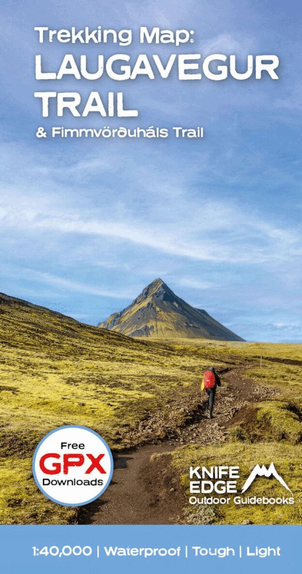
Waterproof sheet map for Iceland's Laugavegur Trail (& Fimmvorduhals Trail): 1:40,000. Includes free GPX downloads for the trails. The definitive map to Iceland's two best trails: larger scale and more detail than any other map. Made specifically for the treks by Knife Edge Outdoor Guidebooks. - Waterproof - Free GPX downloads - Tough - Lightweight - All huts/campsites are marked - Information on distances, times and altitude gain/loss between huts/campsites - Hot springs and fumaroles are marked - Unfolded 486 x 696mm. The Laugavegur Trail is one of the world's most beautiful and aspirational treks. It leads you into the heart of Iceland's unique ice-capped, volcanic terrain. Experience spectacular and unusual landscapes, the likes of which you will not find anywhere else on the planet. Impressive volcanic peaks are a constant companion and steam gushes from the ground. This is Iceland at its best and it will be an adventure that you will never forget.
225 kr
Skickas
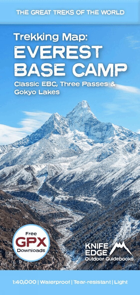
The best sheet map for the Everest treks: Classic EBC, Three Passes & Gokyo Lakes (all clearly colour coded). 1:40,000 - larger scale and more detail than any other Everest map. Perfect for planning and navigation. Includes walk-in route to Lukla. Made specifically for the Everest treks by Knife Edge Outdoor Guidebooks: - English/French/German map key - 1:40,000 - Numerous variants, side-routes & day-hikes - Includes free GPX downloads for the trail - GPS compatible - Tougher than traditional maps: try to tear me! - More water-resistant than traditional maps - Lighter than traditional maps - Huts/accommodation marked on the map

Häftad, Engelska, 2024
258 kr
Skickas
- The only two-way guidebook to the GR20: both northbound and southbound routes are described in full. - Real IGN Maps included (1:25,000): no need to carry separate maps. - 15 different itineraries: schedules of 9, 10, 11, 12, 13, 14, 15 and 16 days. Includes both northbound and southbound itineraries. Difficult calculations of time, distance and altitude gain are done for you. Also includes: - Detailed information on equipment and travelling light - Detailed information on getting to/from all trail-heads - Everything the trekker needs to know: route, costs, difficulty, weather, travel, and more - Full accommodation listings: spectacularly situated mountain huts and campsites - Information for both self-guided and guided trekkers - Numbered waypoints linking the Real Maps to our clear descriptions - Information on Wildlife and Plants