
Visar resultat för..."8th Atlas Publishing"
21 produkter
21 produkter

583 kr
Skickas
Winner of the André Simon Drinks Book of the Year 2019Shortlisted for the Louis Roederer Wine Book of the Year 2020"One book deserves a place on every wine drinker's shelf, and that is The World Atlas of Wine" - Victoria Moore in the Telegraph"magisterial" - Fiona Beckett, Guardian "a key reference material for any sommelier, wine professional or any amateur serious about their passion" - Imbibe "The most useful single volume on wine ever published... If I owned only one wine book, it would be this one." - Andrew Jefford, Decanter*** Few wine books can be called classic, but the first edition of The World Atlas of Wine made publishing history when it appeared in 1971. It is recognized by critics as the essential and most authoritative wine reference work available. This eighth edition will bring readers, both old and new, up to date with the world of wine.To reflect all the changes in the global wine scene over the past six years, the Atlas has grown in size to 416 pages and 22 new maps have been added to the wealth of superb cartography in the book. The text has been given a complete overhaul to address the topics of most vital interest to today's wine-growers and drinkers. With beautiful photography throughout, Hugh Johnson and Jancis Robinson, the world's most respected wine-writing duo, have once again joined forces to create a classic that no wine lover can afford to be without.***"The World Atlas of Wine is the single most important reference book on the shelf of any wine student." - Eric Asimov, New York Times'Simply superb work... buy it if you like wine at all.' - Victoria Moore, Telegraph"Like a good bottle of wine, you'll find yourself going back to it again and again... Perfect for anyone who has a thirst for greater wine knowledge." - Edward Deitch, NBC/today.com"The World Atlas of Wine belongs on your shelf... The essential rootstock of any true wine lover's library. A multi-layered snapshot of wine and how it has evolved." - Dave McIntyre, Washington Post

176 kr
Skickas inom 5-8 vardagar
130 kr
Skickas inom 5-8 vardagar

202 kr
Skickas inom 3-6 vardagar

118 kr
Skickas inom 5-8 vardagar

245 kr
Skickas inom 5-8 vardagar

201 kr
Skickas inom 5-8 vardagar

176 kr
Skickas inom 5-8 vardagar
153 kr
Skickas
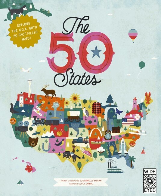
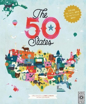
Explore every state of the USA from Alabama to Wyoming with these 51 charmingly illustrated infographic maps! Includes an expansive guide to the state flags and US presidents.Discover more than 2,000 facts about the people, cities, nature and historic events that have helped make America what it is today. Ghost towns, swamp tours, the centre of the universe… bacon donuts, brainy berries, salmon jerky… The French Fry King, The Mother of Oregon, The Queen of Blues… be inspired by the inventiveness, beauty and diversity of the United States in this curious collection of fact-filled maps.On each weird and wonderful map, find:A welcome box with a short introduction to the stateKey facts, including the capital; state bird, flower and tree; and statehood orderState icons celebrating the state’s people, places and historySix inspiring people who have a connection to the stateRegion spotlight bubbles to allow you to discover more about one particular placeA moments to remember box with a list of significant dates and their events in the state’s historyEach state’s map also contains information about which states it neighbours, its bodies of water and borders as well as where it is situated in the country. Did you know that while Hawaii shares its border with no one, both Missouri and Tennessee border eight other states? Many state parks, battlefields, national forests and reservations are also included to inspire you to explore the great outdoors.So pack your bags and say later ‘gator… the great States await! The 50 States series of books for young explorers celebrates the USA and the wider world with key facts and fun activities about the people, history and natural environments that make each location within them uniquely wonderful. Beautiful illustrations, maps and infographics bring the places to colourful life.Also available in this series:50 Adventures in the 50 States, 50 Trailblazers of the 50 States, Only in America, Only in California, Only in Texas, We Are the United States, and a wide range of activity books.
191 kr
Kommande
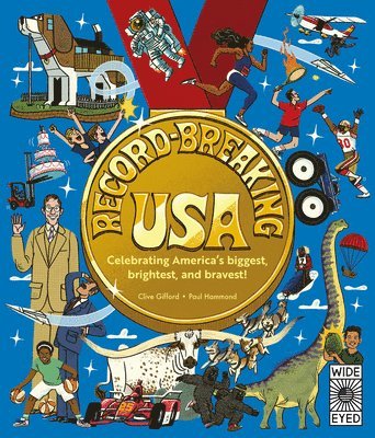
Get ready for a record-breaking road trip across the USA! From the world’s biggest bubblegum bubble in Alabama to the planet’s tallest volcanic columns in Wyoming, journey from state to state to uncover an incredible mix of quirky records and outstanding achievements. From the weird to the wonderful (and back again!), these remarkable records span every corner of the country and every kind of curiosity – from natural wonders and historical firsts to sporting triumphs, awe-inspiring individuals and astonishing animals. Inside you’ll discover mind-boggling facts, including: How many surfers can squeeze onto one surfboard Where you can find the world’s sunniest place Who owns the tallest hat ever made Where to meet social media’s most famous cat Which state is home to both the world’s largest pair of scissors AND the biggest dinosaur poo ever found Where the longest pizza ever cooked was made Readers will also explore records that span multiple states, those from US territories and even a few that reach into space! And for aspiring record-setters, there are tips on how to become a record-breaker yourself . . . if you’re up to the challenge. Written by award-winning author Clive Gifford and packed with bright, funny illustrations by Paul Hammond, this book is bursting with fun, facts and US pride. So, as we mark 250 years of US independence, let’s hear it for the States!
232 kr
Skickas
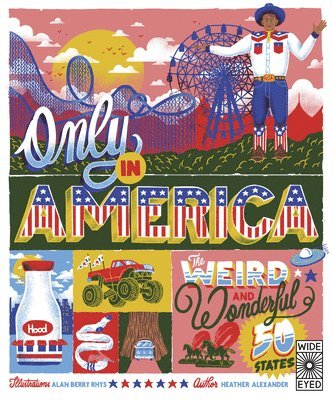
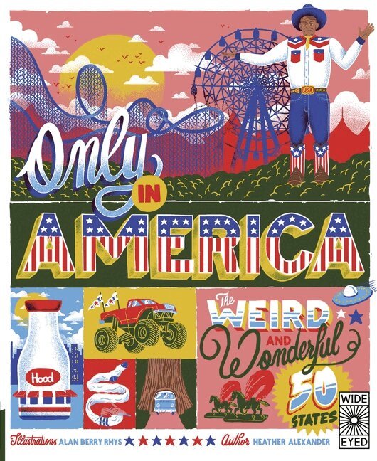
A state-by-state compendium of weird laws, quirks, one-offs and unusual records only to be found in the wonderfully wacky US of A. Only in America explores the strangest claims to fame and the most unusual place names every state has to offer. Visit the city of Dinosaur, drop by the Pizza Museum, find out where it is illegal to feed a pig without a permit and check out the world’s only ‘carhenge’ (that’s right, Stonehenge reconstructed using cars). Among many other marvels, discover: The longest gum wrapper chain (over 32 kilometers!)Which state has the highest ratio of cows to humans in the countryThe origin of shoo-fly pie, a molasses cake baked in a pie crustThe world’s largest (fake) bug, a 16.5-meter blue termiteWhere ‘dinner’ means lunch and ‘supper’ means dinnerIllustrated by the brilliant Alan Berry-Rhys in a bold graphic art style that evokes vintage Americana, the book is arranged state by state, giving key facts about each and presenting an alternative and hilarious look at quirky phenomena that are truly only in America.The 50 States series of books for young explorers celebrates the USA and the wider world with key facts and fun activities about the people, history and natural environments that make each location within them uniquely wonderful. Beautiful illustrations, maps and infographics bring the places to colourful life.Also available from the series: 50 Trailblazers of the 50 States, Only in America Activity Book, Only in California, Only in Texas, We Are the United States, 50 Adventures in the 50 States, and The 50 States.

209 kr
Skickas
Travel through America’s incredible history and amazing wild places, visiting the National Monuments that celebrate the most iconic and majestic landscapes and locations in the USA.Packed with maps and fascinating facts about the history, architecture, flora, and fauna in some of the most visited National Monuments in the United States, this gorgeously illustrated book showcases the nation’s most historically important and amazing places. Marvel at some of the world’s most famous landmarks, such as the Statue of Liberty.Discover lesser-known but just as breathtaking sites such as the Aniakchak volcano caldera.Read about geological wonders like the John Day Fossil Beds.Learn about places of solemn historical significance, such as the Birmingham Civil Rights National Monument.Divided into eight chapters covering the breadth of the US, pictographic maps locate each of the monuments explored, while double-page, poster-worthy scenes convey the beauty of the areas featured.Monuments covered include Statue of Liberty, Stonewall, Katahdin, the National Mall, Forts of the East, Jewel Cave, Pipestone, Pullman, Grand-Staircase Escalante, Chiricahua National Monument, Bandelier National Monument, Rainbow Bridge, the Dinosaur National Monument, Craters of the Moon National Monument and Preserve, Colorado National Monument, the Devil’s Tower, Muir Woods, Golden Gate Bridge, Tule Lake, Mount St. Helens, John Day Fossil Beds, Admiralty Island, the Misty Fjords, Aniakchak, Papahānaumokuākea, Marianas Trench, Rose Atoll, and more!Spot artworks and captions give important historical context for the memorial sites, as well as scientific information about the animals and plants found in the precious natural habitats.The perfect armchair escapism for adventure-hungry kids, readers will marvel at the fantastic sights to be seen throughout the United States of America.Brimming with facts, activities, and beautiful illustrations, the National Parks of the USA series of books immerses young people in the wonders of America’s outdoors. Learn about the wonderful wildlife, stunning scenery, and rare plants that inhabit these precious outdoor spaces. Celebrate these beautiful and rare locations, and be awed by the diversity and grandeur of the national parks’ living landscapes.Also in the series: National Parks of the USA and National Parks of the USA Postcards.
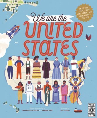
We Are the United States
Meet the People Who Live, Work, and Play Across the USA
Inbunden, Engelska, 2022
396 kr
Tillfälligt slut
This vibrantly illustrated compendium explores the beautiful diversity of the people who live, work, and love across the USA in this joyful follow-up to The 50 States.Across 51 charmingly illustrated infographic maps, covering every state of the USA from Alabama to Wyoming, We Are The United States celebrates the glorious rainbow of different heritages, religions, hobbies, vocations, and cultures that populate this great country.Say “ha'u” to the Hopi people in Arizona, and “xin chào” to Vietnamese Americans living in Orange County, California. Meet veterans in South Carolina, alligator farmers in Louisiana, and astronauts in Texas. Play with gamers at the E3 Expo in Los Angeles, party with drag queens in Atlanta, and ride with mountain bikers in Moab.Alongside an illustrated map, each state’s spread features a “Hall of Fame” highlighting important people from the state’s history, as well as “Spotlight” pull-out illustrations showcasing amazing cultural highlights from the area.Discover the local delicacies enjoyed by each state’s residents.Explore the unique traditions and celebrations that have been born on and brought to America’s shores.Brush up on key stats and facts about each state’s population.Learn about the powerful history of the people of this one nation, indivisible, the United States.Illustrated in Sol Linero’s bright and contemporary style, like the best-selling The 50 States, this is a captivating informational resource as well as a gorgeous gift.The 50 States series of books for young explorers celebrates the USA and the wider world with key facts and fun activities about the people, history, and natural environments that make each location within them uniquely wonderful. Beautiful illustrations, maps, and infographics bring the places to colorful life.Also available from the series: 50 Trailblazers of the 50 States, Only in America, Only in America Activity Book, Only in California, Only in Texas, 50 Adventures in the 50 States, 50 Maps of the World, 50 Maps of the World Activity Book, and The 50 States.
176 kr
Skickas
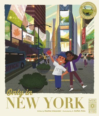
The next in this state-by-state strand of the best-selling 50 States series, Only in New York explores the most amazing sites, cities, history and natural landscapes of the Empire State.From the roar of Niagara Falls to the tip of Lady Liberty's torch, explore the length and breadth of New York with the help of little-known facts and colourful art. A state map, timelines and spotlight spreads shine a light on the best and most surprising sites, histories, places, people, culture and food this state has to offer.Locations include: New York City, Long Island, Albany, the Hudson Valley, the Catskills and Adirondacks, Syracuse, the Finger Lakes and many more.Discover fun-filled festivals, storied monuments, famous New Yorkers and even inventions you never knew came from the state. It's all here in Only in New York, so start spreadin' the news!Each book in the state-by-state subseries covers the following areas:Weird and wacky stats and factsHistorical timelineLocal sportsMuseums, amusement parks and cultural eventsFood and drinkAnimals and plantsInventionsFun festivalsChangemakers and superstarsQuiz questionsThe 50 States series of books for young explorers celebrates the USA and the wider world with key facts and fun activities about the people, history and natural environments that make each location within them uniquely wonderful. Beautiful illustrations, maps and infographics bring the places to colourful life.Also available from the series: 50 Trailblazers of the 50 States, Only in America, Only in Texas, Only in California, We Are the United States, 50 Adventures in the 50 States, and The 50 States, as well as a wide range of activity books and gifts.
176 kr
Skickas
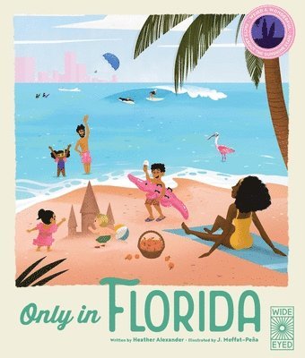
Explore Florida, the US state known for sea, sand, sun and fun, with this book full of quickfire facts and colourful maps.Glide by gators in the Everglades, ride rollercoasters in Orlando, and move to the music of Miami as you explore this unique and diverse state. You’ll learn why Key lime pie should never be green, how piracy landed on the coast of Florida, and how famous Floridians have changed the world.Each of Florida’s major cities and regions is covered in this comprehensive rundown of the Sunshine State, from Tallahassee to the Treasure Coast. Plus, get a dose of Florida’s fascinating past from a history timeline, and spot your favourite Florida locales on infographic maps.Wildlife, culture, trailblazers, and the quirkier side of Florida are all spotlit on dedicated spreads, with classic symbols of Floridian life in bold colours. Ideal for young readers with a keen interest in the states, Florida is a slice of American culture with something for everyone. And just like Florida, this book has it all!From The 50 States series. These books for young explorers celebrate the USA and the wider world with key facts and fun activities about the people, history and natural environments that make each location within them uniquely wonderful. Beautiful illustrations, maps and infographics bring the places to colourful life.Also available in this series: 50 Adventures in the 50 States, 50 Trailblazers of the 50 States, Only in America, Only in California, Only in Texas, We Are the United States, and a wide range of activity books.
217 kr
Tillfälligt slut
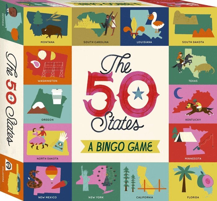
The ultimate all-American bingo game: Screen-free family fun with easy-to-learn gameplay for 2–6 players. Celebrate the 50 States: Explore every state of the USA from Alabama to Wyoming and celebrate the people, cities, nature and historic events that have helped make America what it is today. Sturdy gift box contains: 6 double-sided bingo cards, 50 bingo chips, 100 tokens, a cloth bag, and an educational booklet; box size is 22 × 22 × 4 cm / 8.5 × 8.5 × 1.5 in. Edutainment for ages 6+: Includes a full colour illustrated booklet with educational information on all 50 states. Bingo! Let’s play the latest game in The 50 States series! From palm trees and oranges in the Sunshine State, through the Heart of Dixie, past the Great Lakes, and all the way to Alaska’s last frontier, it’s time to explore! So pack your bags and say later ’gator… the great States await! Every bingo card contains 16 squares (4 × 4), each showing a different, stunning vintage-style illustration of one of America's 50 states. Explore the USA as you place the tokens to mark off each state as it is called out. The illustrated booklet offers fascinating facts about every state and the bingo card images. Play a complete line for a short game or go for an impressive whole-card collection to win – bingo! Discover even more of the USA with: The 50 States Trivia Game, The 50 States, The 50 States Activity Book, The 50 States Fun Facts and 50 Adventures in the 50 States.
152 kr
Skickas inom 7-10 vardagar
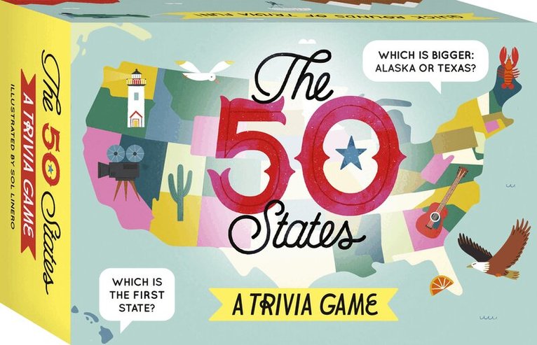
The ultimate all-American trivia game: Screen-free family fun with easy-to-learn gameplay for 2–8 players.Put your speed and knowledge to the test: Explore the key stats that make up every state of the USA, from Alabama to Wyoming.Sturdy gift box contains: 50 state cards each featuring six items of numerical trivia, six category cards, rules booklet and spinner.Edutainment for ages 6+: Will speedy reactions beat expert knowledge? Be first to collect 5 cards to win!Explore every state of the USA from Alabama to Wyoming in this fast and fun numbers-based trivia game that celebrates the geography of America. With this exciting extension of the best-selling 50 States book series, you’ll go deeper into the key stats behind all 50 states. From palm trees and oranges in the Sunshine State, through the Heart of Dixie, past the Great Lakes, and all the way to Alaska’s last frontier, it’s time to explore! So pack your bags and say later ’gator… the great States await! Is Vermont bigger than Hawaii? Which is the oldest state? Are the mountains taller in Alaska or California? Which state is the most densely populated? Compare numerical facts about all 50 states and play quickest to win. Speedy guessing is rewarded in this fast-moving family game, so fire right in and learn as you play! Players race to slap their hands on the card they think best fits the chosen category, such as ‘largest population’, for example. When all players have slapped, reveal the cards to discover the correct answer. The winning player keeps their card and chooses the next category. First to grab five correct cards wins! Try the 'relaxed' game variant with younger players and those who prefer to play at a slower pace. Discover even more of the USA with: The 50 States Bingo, The 50 States, The 50 States Activity Book, The 50 States Fun Facts and 50 Adventures in the 50 States.
153 kr
Skickas inom 5-8 vardagar
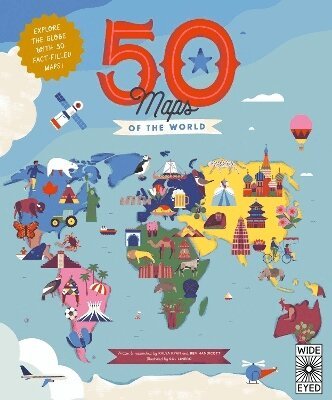
Discover the most awesome places on Earth. 50 Maps of the World is an essential addition to the bookshelf of any young travel lover, map maestro or geography genius.Geography, history and culture spill from the pages of this luxuriously illustrated treasure trove of travel knowledge for 7-to-10-year-olds. Each two-page spread is dedicated to a different country, providing both quick-fire facts and the chance to delve deeper into what makes every nation unique. Natural wonders, bustling metropolises, storied pasts and cultural icons are all presented in expert detail from experienced explorers Ben Handicott and Kalya Ryan, alongside Sol Linero’s eye-popping artwork.Meet our earliest ancestors in Ethiopia, marvel at Machu Picchu in Peru and visit the floating villages of Cambodia in this colourful guide to 50 fascinating countries. It’s a diverse guide that spans from Spain to Singapore, Colombia to Canada, Turkey to Tanzania, and more.Each page includes dozens of spotlighted locations, a timeline of the nation’s history and introductions to the people who have helped shape it.With the expertise of Ben Handicott (Hello Atlas, Atlas of Adventures: Wonders of the World) and Kalya Ryan, alongside the stunning illustrations of Sol Linero (The 50 States, 50 Cities of the U.S.A.), experience the diversity of our world like never before.50 Maps of the Worldreimagines what maps for kids can be, providing not just a geographical fact-fest but a vivid insight into the history, culture and wildlife that shape our living world. This is the perfect way for aspiring adventurers to find out more about all the exciting destinations around the world. This is a quirky, dynamic book of atlases that makes a perfect companion for holidays and during trip planning.Originally published in hardback under the title Our Wonderful World (2020).Also in the series: The 50 States, We Are the United States, 50 Cities of the U.S.A., Only in America, and many exciting, fun-filled activity books.
153 kr
Skickas
Explore this state-by-state compendium of weird laws, quirks, one-offs, and unusual records only to be found in the wonderfully wacky US of A. Only in America explores the strangest claims to fame and the most unusual place names every state has to offer. Visit the city of Dinosaur, drop by the Pizza Museum, find out where it is illegal to feed a pig without a permit, and check out the world’s only “carhenge” (that’s right, Stonehenge reconstructed using cars). Among many other marvels, discover: The longest gum wrapper chain (over 20 miles!) Which state has the highest ratio of cows to humans in the country The origin of shoo-fly pie, a molasses cake baked in a pie crust The world’s largest (fake) bug, a 58-foot blue termite Where “dinner” means lunch and “supper” means dinner Illustrated by the brilliant Alan Berry-Rhys in a bold graphic art style that evokes vintage Americana, the book is arranged state by state, giving key facts about each and presenting an alternative and hilarious look at quirky phenomena that are truly only in America.The 50 States series of books for young explorers celebrates the USA and the wider world with key facts and fun activities about the people, history, and natural environments that make each location within them uniquely wonderful. Beautiful illustrations, maps, and infographics bring the places to colorful life.Also available from the series:50 Trailblazers of the 50 States, Only in California, Only in Texas, We Are the United States, 50 Adventures in the 50 States, 50 Maps of the World, The 50 States, and a wide array of activity books..
232 kr
Skickas
Explore every state of the USA from Alabama to Wyoming with these 51 charmingly illustrated infographic maps! Includes an expansive guide to the state flags and US presidents.Discover more than 2,000 facts about the people, cities, nature and historic events that have helped make America what it is today. Ghost towns, swamp tours, the center of the universe… bacon donuts, brainy berries, salmon jerky… The French Fry King, The Mother of Oregon, The Queen of Blues… be inspired by the inventiveness, beauty and diversity of our great nation in this curious collection of fact-filled maps.On each weird and wonderful map, find:A welcome box with a short introduction to the stateKey facts, including the capital; state bird, flower and tree; and statehood orderState icons celebrating the state’s people, places and historySix inspiring people who have a connection to the stateRegion spotlight bubbles to allow you to discover more about one particular placeA moments to remember box with a list of significant dates and their events in the state’s historyEach state’s map also contains information about which states it neighbors, its bodies of water and borders as well as where it is situated in the country. Did you know that while Hawaii shares its border with no one, both Missouri and Tennessee border eight other states? Many state parks, battlefields, national forests and reservations are also included to inspire you to explore the great outdoors.So pack your bags and say later ‘gator… the great States await! The 50 States series of books for young explorers celebrates the USA and the wider world with key facts and fun activities about the people, history and natural environments that make each location within them uniquely wonderful. Beautiful illustrations, maps and infographics bring the places to colorful life.Also available in this series:50 Adventures in the 50 States, 50 Trailblazers of the 50 States, Only in America, Only in California, Only in Texas, We Are the United States, and a wide range of activity books.
Del 33 - Philip's World Atlas
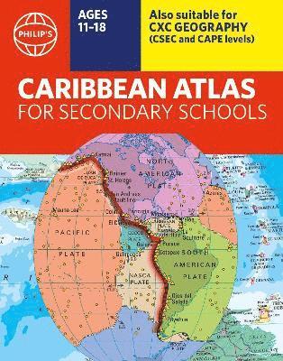
Philip's Caribbean Atlas for Secondary Schools
8th Edition
Häftad, Engelska, 2023
154 kr
Skickas inom 7-10 vardagar
A new edition of the market-leading atlas for CXC Geography students, Philip's Caribbean Atlas for Secondary Schools provides extensive coverage of the Caribbean area, together with a comprehensive selection of world and regional maps. The atlas is arranged in three sections for ease of use, with each page colour-coded for rapid reference. The first section is devoted to a detailed coverage of the Caribbean region in 48 pages, and includes maps of every island plus Belize and Guyana, as well as topographical, land use, tourism and mining maps.The second section is made up of 72 pages of World topographical maps, incorporating continental thematic maps on topics such as population, climate and biomes, followed by 32 pages of World thematic maps. This new 8th edition features updated mapping of all Caribbean islands, as well as the latest statistics. The World map section contains additional coverage of Brazil, the Americas and Asia, while the World thematic section includes maps on volcanoes, El Niño, tourism, energy, minerals, industry, trade and international organizations.Completing the atlas is a section of CXC study maps covering topics such as farming, soil conservation, economics, tourism and urban land use. Features regional studies of Mauritius, UK, Canada, USA and Brazil.The index gives letter-figure grid references as well as latitude and longitude co-ordinates.
Letar du efter digitala böcker?
E-böcker och ljudböcker handlar du än så länge på vår tidigare sajt.