
Felix Kogan – författare
1 774 kr
Skickas inom 10-15 vardagar
1 111 kr
Skickas inom 10-15 vardagar
1 434 kr
Läs direkt efter köp
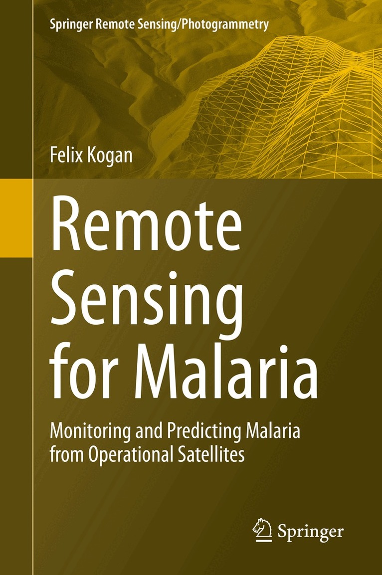
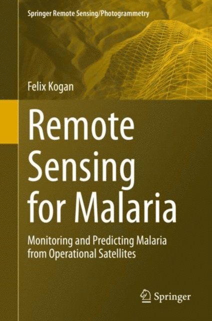
This book presents research using high-resolution operational satellite data for monitoring and assessing numerically how to reduce the area and intensity of malaria outbreaks. Satellite data and imageries a powerful and effective tool for malaria monitoring and reduction of the number of affected people as it bypasses the limitations imposed by the dearth of near-the-ground weather data in many malaria-prone areas. With this in mind, this volume provides readers with:
In-depth information in monitoring signs of malaria from operational polar-orbiting satellites
Examples of country-specific models for predicting malaria area (1 and 4 km2 resolution) and intensity
Information on the how the effects of climate change on malaria outbreak area and intensity can be monitored
A new Vegetation Health (VH) methodology to estimate vegetation moisture, temperature and moisture/temperature conditions as indicators of malaria vector activity
Advice to userson the application of VH technology for early assessments of malaria area, intensity and risk level
Remote Sensing for Malaria is intended for an audience of public health practitioners, environmentalists, and students and researchers working in spatial epidemiology and disease prevention.
1 111 kr
Skickas inom 10-15 vardagar
1 508 kr
Skickas inom 10-15 vardagar
1 899 kr
Läs direkt efter köp
This book discusses the detrimental consequences of climate-related land changes over a 40-year period between 1981 and 2020, and focuses on how climate warming is deteriorating the agricultural system due to excessive heat, lack of moisture and more intensive and widespread droughts leading to a reduction of agricultural production. Most of the existing literature on the unfavourable consequences of global warming for land are based on a relatively short period of weather station data, covering local land areas with limited networks and monitoring parameters. These concerns have led to the use of satellite data, whose measurements are controlled by such vegetation characteristics as chlorophyll, carotenoids, moisture contents in the plants and temperature inside the vegetation community. Therefore, the discussion of this book is completely based on high-resolution global land surface measurements by the sensors on the National Oceanic and Atmospheric Administration’s (NOAA) operational afternoon polar-orbiting satellites.
The book also focuses on understanding climate change impacts on land changes where humans are living, and combines biophysically-grounded methods and the 40-year data to develop models for monitoring large-scale Earth warming impacts on land and for timely prediction of climate consequences for humans. These 40-year trends in land characteristics will help to better inform the assessment of potential changes in the future and how to reach human sustainability. The book will of interest to scientists using satellite remote sensing to track climate change impacts on land over time, as well as students and researchers in climatology and environmental sustainability.

648 kr
Skickas inom 5-8 vardagar
1 508 kr
Skickas inom 10-15 vardagar
1 774 kr
Skickas inom 10-15 vardagar
2 273 kr
Läs direkt efter köp
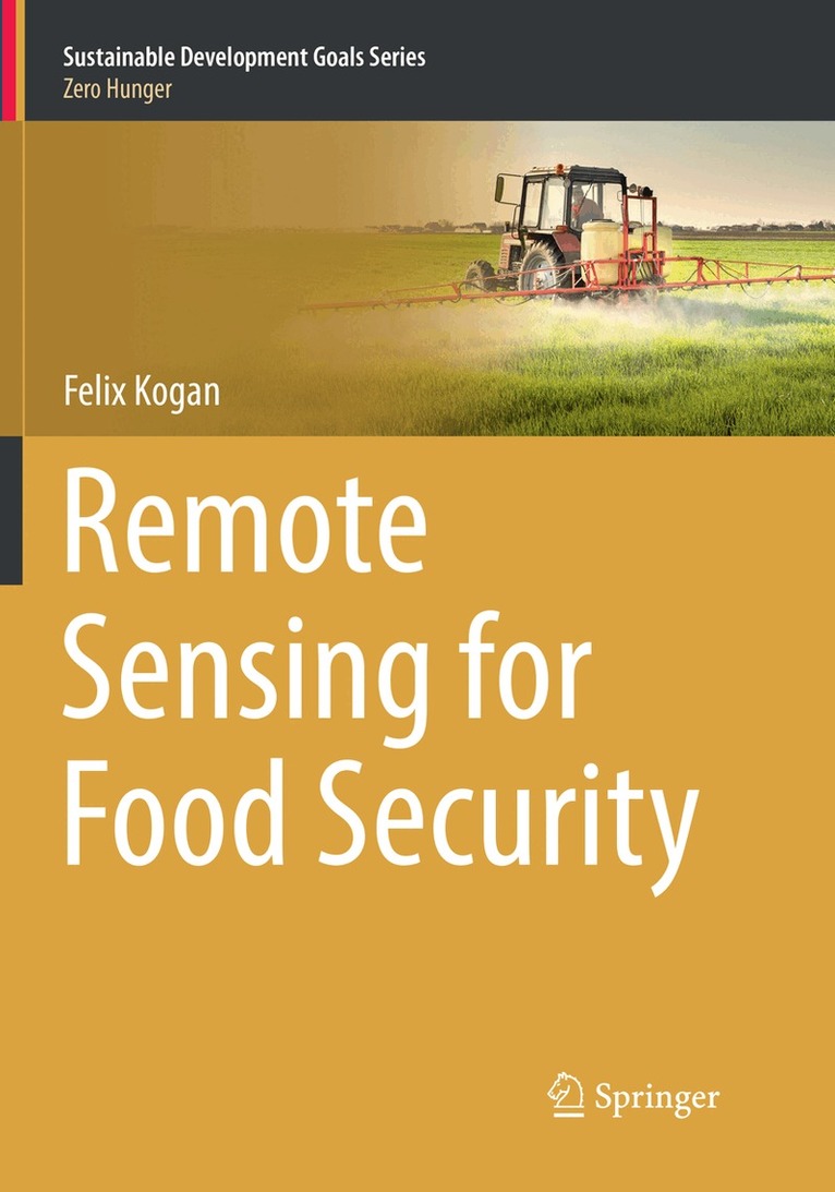
This volume gathers a variety of applications for remote sensing of vegetation health (VH) and concretely shows how this information can be used in service of ending hunger and of ensuring future food security. In this book’s ten chapters, Dr. Felix Kogan, one of the most prolific scientists in this sphere, shows how a new VH method, designed from operational environmental satellite data, can be used to provide advanced predictions of agricultural losses, helping to enhance food security and reducing the number of hungry people. Topics covered include the scientific basis of the VH method, drought monitoring, prediction of short-term agricultural yield and crop insurance, and impacts of long term climate variability and change on food security. A short discussion on VH for human health-related topics such as detection and prediction of malaria and fire risk is included as well.
2 215 kr
Skickas inom 10-15 vardagar
2 925 kr
Läs direkt efter köp
2 215 kr
Skickas inom 10-15 vardagar