
Henk J. Scholten – författare

734 kr
Läs direkt efter köp

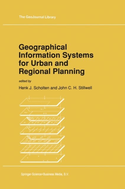
Geographical Information Systems for Urban and Regional Planning
1 627 kr
Skickas inom 10-15 vardagar

1 627 kr
Skickas inom 10-15 vardagar

2 168 kr
Skickas inom 10-15 vardagar
2 840 kr
Läs direkt efter köp
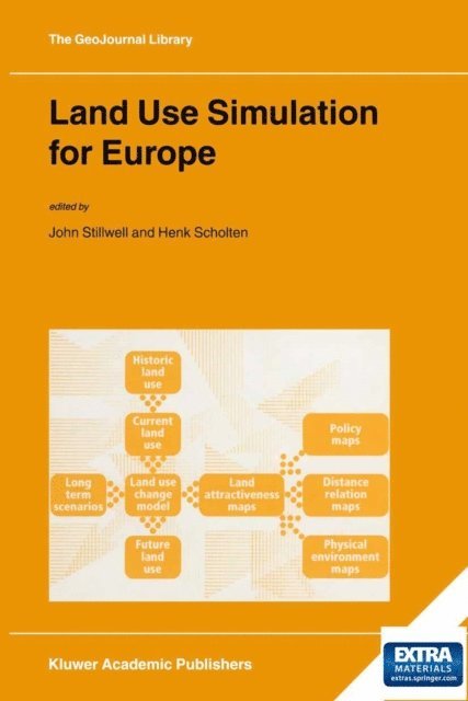
Models of land-use change incorporate a vast amount of knowledge from a wide range of disciplines. Geography contributes to the understanding of land-use change whilst demography and economics help explain underlying trends. This book offers a cross-sectional overview of current research progress that allows the construction of successful land-use models. The contributions range from methodology and calibration to actual applications in studies of recent policy implementation and evaluation. The contributors originate from academic and applied research institutes around the world and thus offer an interesting mix of theory and practice in different case study contexts. In summary, land-use change simulation modelling is a relatively new and dynamic field of study and this book provides a full overview of the topic, a wide range of applications (both geographically and thematically), a mix of theory and practice, a synthesis of recent research progress, and educational material for students and teachers.
2 168 kr
Skickas inom 10-15 vardagar
563 kr
Skickas inom 10-15 vardagar
734 kr
Läs direkt efter köp
In Europe, the emerging discipline of geodesign was earmarked by the first Geodesign Summit held in 2013 at the GeoFort, the Netherlands. Here researchers and practitioners from 28 different countries gathered to exchange ideas on how to merge the spatial sciences and design worlds. This book brings together experiences from this international group of spatial planners, architects, landscape designers, archaeologists, and geospatial scientists to explore the notion of ‘Geodesign thinking’, whereby spatial technologies (such as integrated 3D modelling, network analysis, visualization tools, and information dashboards) are used to answer ‘what if’ questions to design alternatives on aspects like urban visibility, flood risks, sustainability, economic development, heritage appreciation and public engagement. The book offers a single source of geodesign theory from a European perspective by first introducing the geodesign framework, then exploring various case studies on solving complex, dynamic, and multi-stakeholder design challenges. This book will appeal to practitioners and researchers alike who are eager to bring design analysis, intelligent planning, and consensus building to a whole new level.
563 kr
Skickas inom 10-15 vardagar

1 627 kr
Skickas inom 10-15 vardagar
2 049 kr
Läs direkt efter köp
Globalisation has not led to the ‘death of geography’. Intensified relations between communities in different parts of the world have only highlighted the need for understanding and managing phenomena on a variety of geographic scales. From global warming to credit crunch, and from epidemics to terrorism, causes and solutions are sought on local, regional, national as well as inter-continental levels. With the advent of Geospatial Technology, scholars, policymakers and entrepreneurs have valuable tools in hand to proceed.
This book offers the first systematic account of the science behind this mental and technological revolution. Tracing the adoption and dissemination of Geospatial Technology in a range of disciplines, it examines the impact this technology has had, and is likely to have, on the explanation of spatial behaviour, phenomena and processes. At the same time, stressing innovative usage, it explores scientific contributions to technology advancement.
Geographical Information Systems for Urban and Regional Planning
1 627 kr
Skickas inom 10-15 vardagar
Geospatial Technology and the Role of Location in Science
1 627 kr
Skickas inom 10-15 vardagar

712 kr
Läs direkt efter köp
2 049 kr
Läs direkt efter köp
Land Use Simulation for Europe
1 627 kr
Skickas inom 10-15 vardagar
Contemporary Research in Population Geography
A Comparison of the United Kingdom and The Netherlands
547 kr
Skickas inom 10-15 vardagar
2 049 kr
Läs direkt efter köp

667 kr
Skickas inom 5-8 vardagar
Added Value of Geographical Information Systems in Public and Environmental Health
563 kr
Skickas inom 10-15 vardagar