
Imray Iolaire – författare
Visar alla böcker från författaren Imray Iolaire. Handla med fri frakt och snabb leverans.
10 produkter
10 produkter
220 kr
Skickas inom 11-20 vardagar
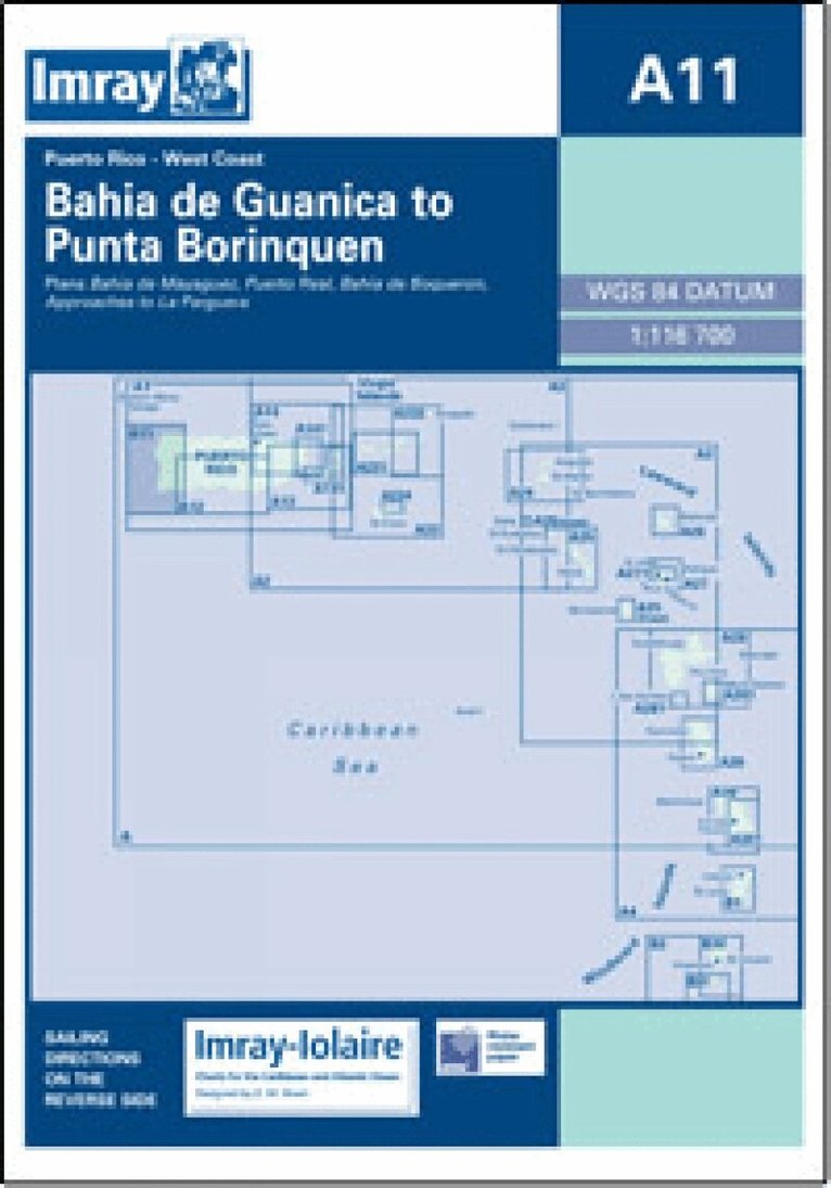
Imray-Iolaire charts for Caribbean are widely acknowledged as the best available for the cruising sailor. They combine the latest official survey Digital with first-hand information gathered over 60 years of research by Don Street Jr and his wide network of contributors. Like all Imray charts, they are printed on water resistant Pretex paper for durability, and they include many anchorages, facilities and inlets not included on official charts. West Coast of Puerto Rico Plans include: Bahia de Mayaguez Puerto Real Bahia de Boqueron Approaches to La Parguera
234 kr
Skickas inom 11-20 vardagar
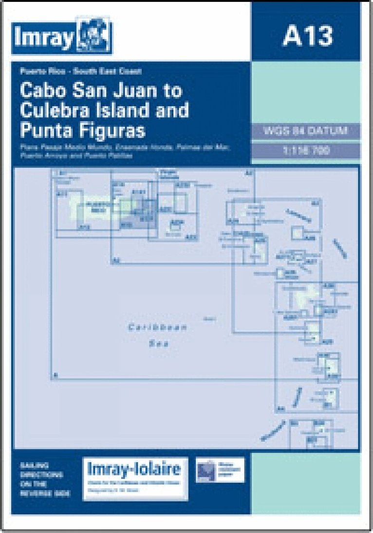
Imray-Iolaire charts for Caribbean are widely acknowledged as the best available for the cruising sailor. They combine the latest official survey Digital with first-hand information gathered over 60 years of research by Don Street Jr and his wide network of contributors. Like all Imray charts, they are printed on water resistant Pretex paper for durability, and they include many anchorages, facilities and inlets not included on official charts. Southeast Coast of Puerto Rico Plans include: Pasaje Medio Mundo Ensenada Honda Palmas del Mar Puerto Arroyo & Puerto Patillas
Engelska, 2022
291 kr
Skickas
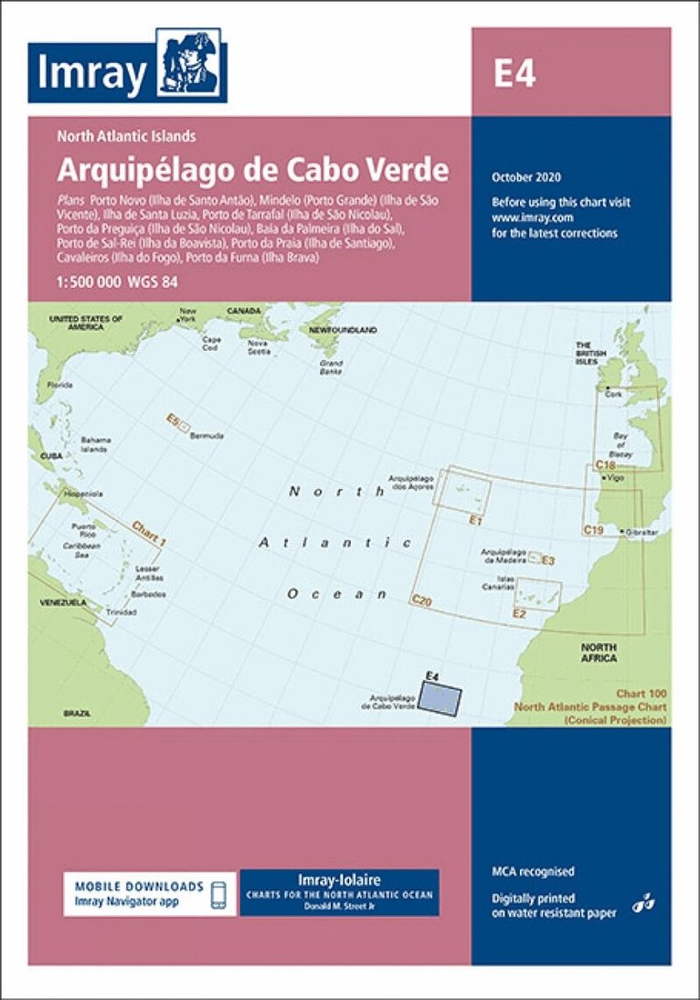
Plans included: Porto Novo (Ilha de Santo Antão) (1:10 000) Mindelo (Porto Grande) (Ilha de São Vicente) (1:20 000) Ilha de Santa Luzia (1:not known) Porto de Tarrafal (Ilha de São Nicolau) (1:8500) Porto da Preguiça (Ilha de São Nicolau) (1:8500) Baía da Palmeira (Ilha do Sal) (1:15 000) Porto de Sal-Rei (Ilha da Boavista) (1:30 000) Porto da Praia (Ilha de Santiago) (1:22 000) Cavaleiros (Ilha do Fogo) (1:10 000) Porto da Furna (Ilha Brava) (1:10 000) On this edition the chart specification has been improved to show coloured light flashes. Depths have been updated from the latest available surveys where available. Completed harbour works at Palmeira (Sal) are included as are the latest reclamation works at Praia (Santiago). There has been general updating throughout.
Engelska, 2022
281 kr
Skickas
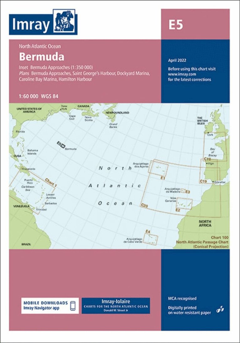
Plans included: Saint George's Harbour (1:17 500) Dockyard Marina (1:4000) Caroline Bay Marina (1:12 500) Hamilton Harbour (1:15 000) Bermuda Approaches (1:350 000) Imray-Iolaire charts for Caribbean & Atlantic Islands are widely acknowledged as the best available for the cruising sailor. They combine the latest official survey Digital with first-hand information gathered over 60 years of research by Don Street Jr and his wide network of contributors. Like all Imray charts, they are printed on water resistant Pretex paper for durability, and they include many anchorages, facilities and inlets not included on official charts. This edition includes the latest official Digital combined with additional information sourced from Imray's network to make it ideal for small craft. It includes the latest official bathymetric surveys. There has been general updating throughout.
Engelska, 2023
291 kr
Skickas
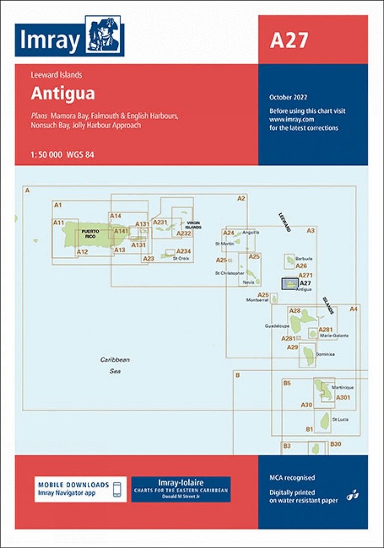
Plans included: Mamora Bay (1:10 000) Falmouth & English Harbours (1:20 000) Nonsuch Bay (1:40 000) Jolly Harbour Approaches (1:25 000) Imray-Iolaire charts for the Caribbean are widely acknowledged as the best available for the cruising sailor. They combine the latest official survey Digital with first-hand information gathered over 60 years of research by Don Street Jr and his wide network of contributors. Like all Imray charts, they are printed on water resistant Pretex paper for durability, and they include many anchorages, facilities and inlets not included on official charts. This edition includes the latest official Digital combined with additional information sourced from Imray's network to make it ideal for small craft. It includes the latest official bathymetric surveys. There has been general updating throughout.
Engelska, 2022
291 kr
Skickas
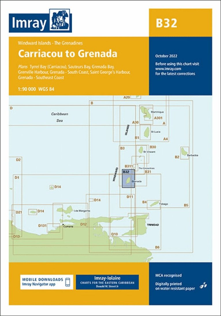
Plans included: Tyrell Bay (Carriacou) (1:17 500) Sauteurs Bay (1:10 000) Grenada Bay (1:30 000) Grenville Harbour (1:15 000) Grenada - Southeast Coast (1:45 000) Grenada - South Coast (1:40 000) Saint George's Harbour (1:12 500) Imray-Iolaire charts for the Caribbean are widely acknowledged as the best available for the cruising sailor. They combine the latest official survey Digital with first-hand information gathered over 60 years of research by Don Street Jr and his wide network of contributors. Like all Imray charts, they are printed on water resistant Pretex paper for durability, and they include many anchorages, facilities and inlets not included on official charts. This edition includes the latest official Digital combined with additional information sourced from Imray's network to make it ideal for small craft. It includes the latest official bathymetric surveys. New to this edition is the inclusion of a harbour plan of Sauteurs Bay. There has been general updating throughout.
Engelska, 2020
291 kr
Skickas
Imray-Iolaire charts for Caribbean are widely acknowledged as the best available for the cruising sailor. They combine the latest official survey Digital with first-hand information gathered over 60 years of research by Don Street Jr and his wide network of contributors. Like all Imray charts, they are printed on water resistant Pretex paper for durability, and they include many anchorages, facilities and inlets not included on official charts.
Engelska, 2023
291 kr
Skickas
Imray-Iolaire charts for Caribbean are widely acknowledged as the best available for the cruising sailor. They combine the latest official survey Digital with first-hand information gathered over 60 years of research by Don Street Jr and his wide network of contributors. Like all Imray charts, they are printed on water resistant Pretex paper for durability, and they include many anchorages, facilities and inlets not included on official charts. On this edition the chart specification has been improved to show coloured light flashes. There has been general updating throughout.
Engelska, 2022
328 kr
Tillfälligt slut
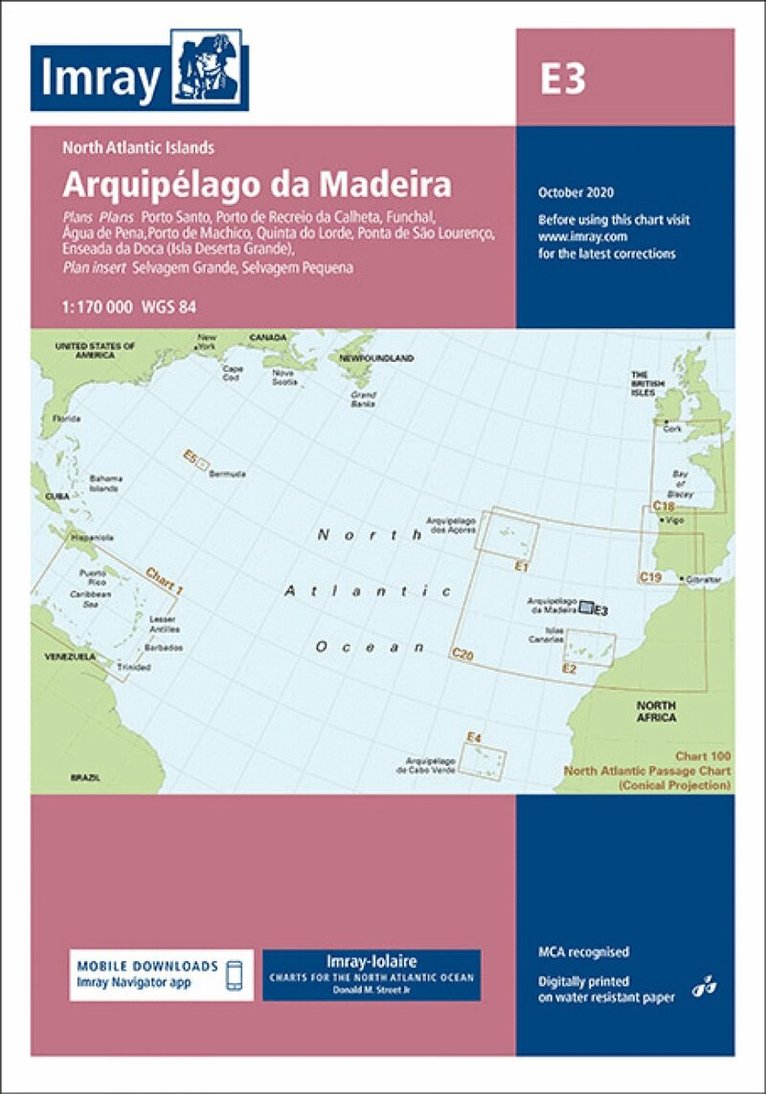
Plans included: Porto Santo (1:25 000) Porto de Recreio da Calheta (1:6250) Funchal (1:10 000) Água de Pena (1:5000) Porto de Machico (1:7500) Quinta do Lorde (1:5000) Ponta de São Lourenço (1:30 000) Enseada da Doca (Isla Deserta Grande) (1:25 000) Selvagem Grande (1:30 000) Selvagem Pequena (1:30 000) On this edition the chart specification has been improved to show coloured light flashes. There has been general updating throughout.
Engelska, 2020
281 kr
Tillfälligt slut
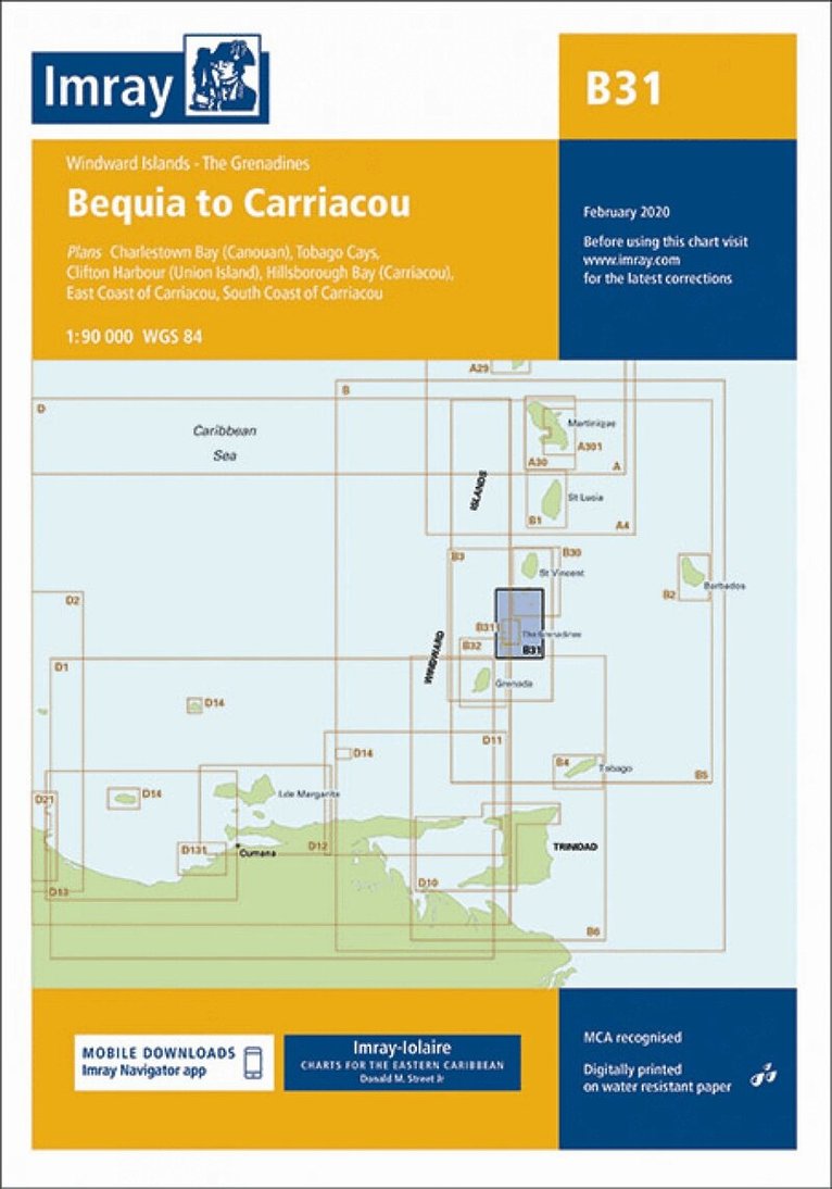
Imray-Iolaire charts for Caribbean are widely acknowledged as the best available for the cruising sailor. They combine the latest official survey Digital with first-hand information gathered over 60 years of research by Don Street Jr and his wide network of contributors. Like all Imray charts, they are printed on water resistant Pretex paper for durability, and they include many anchorages, facilities and inlets not included on official charts. Plans included: Charlestown Bay (Canouan) (1:20 000) Tobago Cays (1:30 000) Clifton Harbour (Union Island) (1:25 000) Hillsborough Bay (Carriacou) (1:35 000) East Coast of Carriacou (1:45 000) South Coast of Carriacou (1:50 000) For this edition the chart has been fully updated throughout. Two new plans have been added of the east and south coasts of Carriacou. These new plans display revised depths and anchorages in the waters around Carriacou.