
Imray – författare
Visar alla böcker från författaren Imray. Handla med fri frakt och snabb leverans.
32 produkter
32 produkter
Häftad, Engelska, 2021
284 kr
Skickas
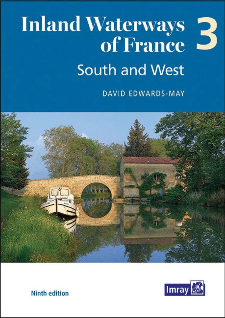
The ninth edition of Inland Waterways of France is the ideal guide for planning cruises in and through the most fascinating and diverse waterway network in Europe. Author David Edwards-May has researched the many changes that have taken place during the last 10 years, and presents a detailed overview of the waterways extending throughout the South ('Midi'), the Southwest and Western France. This system totals 3000 kilometres of waterways that are maintained and developed almost exclusively for recreational navigation. This third volume of the new edition sets out the current state of the network in 146 pages in full colour, with detailed maps of junctions and other key sites on the network, overview maps for each waterway, and route descriptions. It is a unique blend of practical information, maps, background historical notes and colour photographs. It also highlights ongoing waterway restoration projects, in which the author has been personally involved for many years.
114 kr
Skickas
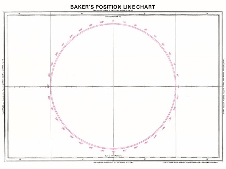
For plotting a vessel's position to a tenth of a mile.

Häftad, Engelska, 1995
217 kr
Skickas
Imray Laurie Norie & Wilson Ltd was formed in 1904 when three private chart publishing firms amalgamated. Each of these London companies had a long history going back to the mid-18th century. James Imray and Son published an extensive list of charts and pilot books. RH Laurie and Sons was associated with charts published for the East India Company. Norie and Wilson, founded by JW Norie, whose Nautical Tables are still supplied to navigators across the world, produced charts and books on navigation and sold nautical instruments.Until 1939 we were based in the City of London, where long serving cartographers produced charts from copper plate engravings which were supplied to mariners throughout the World. For over a century Blueback Charts were the first choice of many shipping companies. Now based in St Ives in Cambridgeshire, Imray charts are produced digitally for printed and electronic editions by our drawing office team. Our catalogue of yachting charts is regarded by the sailing community as the most comprehensive available. Our paper charts are complemented by a growing list of electronic publications and high quality pilot books by leading authors.
Inbunden, Engelska, 2021
515 kr
Skickas
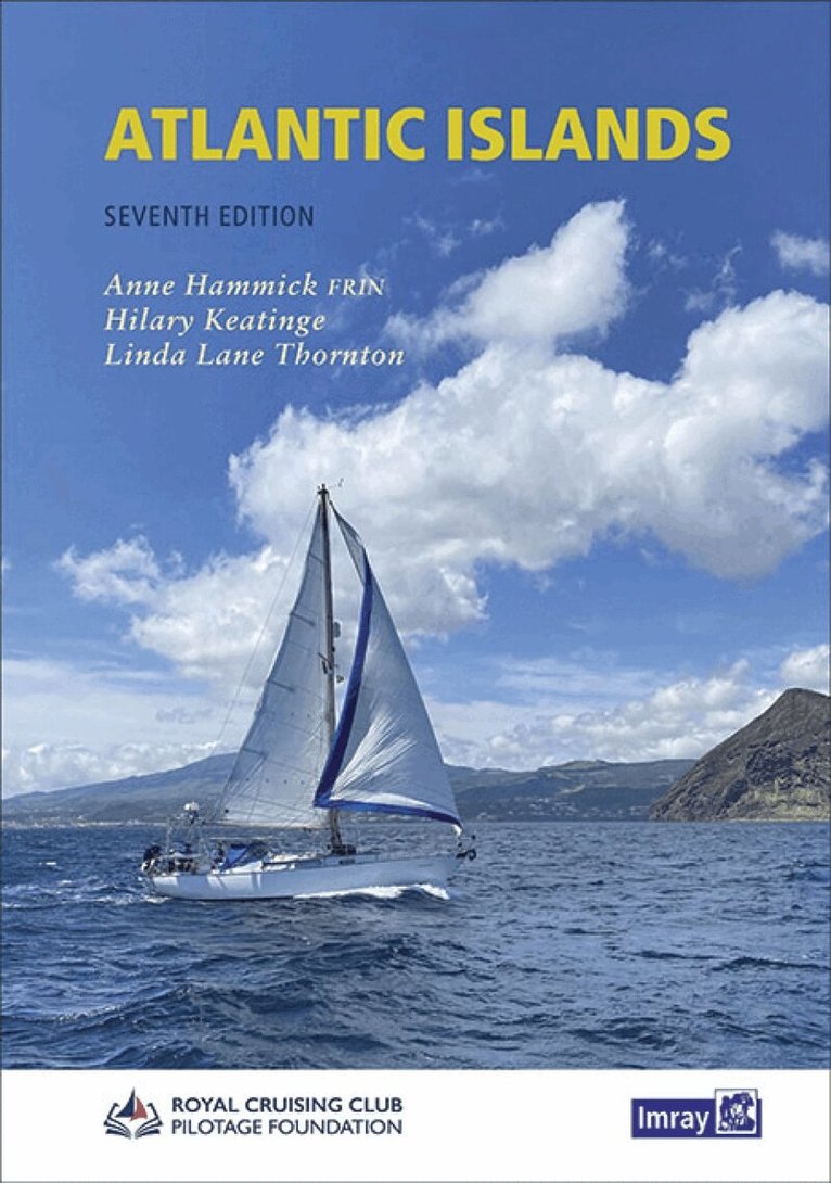
When Anne Hammick started research on the first edition of Atlantic Islands back in 1987, few would have guessed the changes which 25 years would bring. Facilities for yachts have improved immeasurably in all four island groups, bureaucracy has decreased and, from being seen mainly as convenient stepping stones on the Atlantic passage, all the archipelagos are now accepted as cruising destinations in their own right. The seventh edition of Atlantic Islands builds on solid foundations - the author''s long familiarity with the area, an invaluable network of local contacts, and the constant flow of information and feedback received from yachtsmen and women during the lifetime of the previous edition.
Häftad, Engelska, 2021
116 kr
Skickas
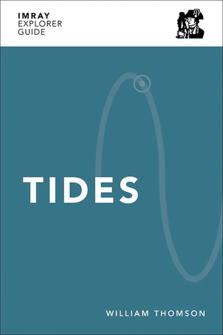
Part of an exciting new series of small format guides which help you better understand the sea, by William Thomson FRGS. An essential guide to Tides, clearly explained through a seamless blend of simple descriptions and rich infographics. Tides have a profound impact on adventures along the coast, whether you are sailing, swimming, surfing, scuba diving or stand-up paddleboarding. In this book, William de-mystifies their workings through a mixture of straightforward language and vivid illustrations, sharing the concepts of tides for anyone to understand. Inspired by explorations on his catamaran Luna, William has drawn upon a mixture of practical experience and theoretical study to create this Explorer Guide, equipping you with the knowledge to know what to expect where and when. With that know-how you can then make decisions with more confidence, planning adventures to harness the energy of tides and ?Seas The Power?. William is founder of Tide School and author of Book of Tides who is currently on a long-term sailing voyage with his young family aboard their yellow catamaran, Luna.
Häftad, Engelska, 2021
116 kr
Skickas
Part of an exciting new series of small format guides which help you better understand the sea by William Thomson FRGS. An essential guide to the Moon, clearly explained through a seamless blend of simple descriptions and rich infographics. As the moon orbits the earth its waxing and waning controls the tides while sharing clues for natural navigation. In this Explorer Guide, expert William Thomson shows how you can predict the tides with a single glance at the moon, and how that quick look can help you navigate through the ever-changing environment shaped by the gravitational pull from the moon. Inspired by explorations on his aptly-named catamaran Luna, William has drawn upon a mixture of practical experience and theoretical study to create this Explorer Guide, equipping you with the knowledge to make decisions with more confidence and plan adventures that harness the moon's energy and 'Seas The Power'. William is founder of Tide School (www.tide-school.com) and author of Book of Tides who is currently on a long-term sailing voyage with his young family aboard Luna.
956 kr
Skickas
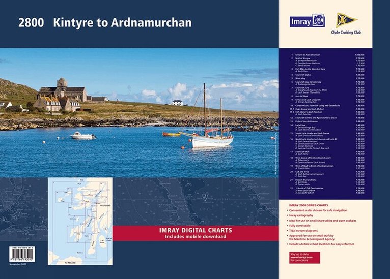
This complete redesign of our 2800 Kintyre to Ardnamurchan chart pack now includes more detailed coverage of the area and comes as a paper and digital edition. This edition consists of 11 extra chart sheets, twice the coverage of the previous edition, and incorporates all the latest official bathymetric surveys. Created in association with the Clyde Cruising Club for use alongside their sailing directions, coverage includes detail of this delightful area of Scotland and there is reference to the popular large scale Antares Charts. The 22 chart sheets in this pack provide all the necessary information for passage planning, detailed approach to yacht havens and marinas, and the numerous anchorages and sailing areas recommended for small craft. Coverage includes large scale charts from Kintyre sailing north, with newly included charts of Kintyre, Gigha, Islay, Jura and Colonsay. Large scale coverage continues with Mull, Loch Linnhe, Lock Etive, Lock Sunart Coll, Tiree to Ardnamurchan. Full details of charts and their scales are listed below. Also available wiro bound, see code IC2800-3W. 1st edition charts Y80, Y81, Y82, Y83, Y84, Y85, Y86 and Y87 have been published that replicate charts 2800.4, 2800.10, 2800.11, 2800.12, 2800.13, 2800.15, 2800.17 & 2800.18 respectively and sold individually. These are part of our 'small format Y chart series' that mirror coverage from the corresponding atlas and are A2 size. For details of these please see the relevant page on our website. Imray Digital Charts: Free mobile download A voucher code to download ID30 Imray digital charts into Imray Navigator (our app for iPad, iPhone and Android) is included with this pack. Charts included: 2800.1 Kintyre to Ardnamurchan (1:350 000) 2800.2 Mull of Kintyre (1:75 000) Plans Campbeltown Loch (1:35 000), Campbeltown Harbour (1:7500), Sanda Island (1:30 000) 2800.3 Port Ellen to the Sound of Jura (1:75 000) Plan Port Ellen (1:25 000) 2800.4 Sound of Gigha (1:25 000) 2800.5 West Islay (1:75 000) 2800.6 Sound of Islay to Colonsay (1:75 000) Plan Scalasaig (1:12 500) 2800.7 Sound of Jura (1:75000) Plans Craighouse Bay (Loch na Mile) (1:25 000), Loch Sween (Tayvallich) (1:25 000) 2800.8 Jura to Oban (1:75 000) 2800.9 Crinan and Loch Craignish (1:30 000) Plan Crinan Approaches (1:10 000) 2800.10 Corryvreckan, Sound of Luing and Garvellachs (1:30 000) 2800.11 Cuan Sound and Loch Melfort (1:30 000) Insh Island to Loch Feochan (1:30 000) Plan Loch Feochan (1:30 000) 2800.12 Sound of Kerrera and Approaches to Oban (1:15 000) 2800.13 Firth of Lorn & Lismore (1:40 000) 2800.14 Loch Etive (1:40 000) Plans Dunstaffnage Bay (1:15 000), Loch Etive Continuation (1:40 000) 2800.15 South Loch Linnhe and Loch Creran (1:40 000) Plan Loch Creran Continuation (1:25 000) 2800.16 North Loch Linnhe, Loch Leven and Loch Eil (1:40 000) Plans Loch Leven Narrows (1:15 000), Continuation of Loch Leven (1:40 000), Corran Narrows (1:15 000), Approaches to Corpach Sea Loch (1:20 000) 2800.17 Sound of Mull (1:40 000) Plan Loch Aline (1:10 000) 2800.18 West Sound of Mull and Loch Sunart (1:40 000) Plans Tobermory (1:20 000), Continuation of Loch Sunart (1:40 000) 2800.19 West Mull to Point of Ardnamurchan (1:75 000) Plan Treshnish Isles (1:37 500) 2800.20 Coll and Tiree (1:75 000) Plans Loch Eatharna (Arinagour) (1:17 500), Gott Bay (1:20 000) 2800.21 Ross of Mull and Iona (1:75 000) Plans Bull Hole (1:25 000), Tinkers Hole (1:25 000) 2800.22 North of Coll Continuation (1:75 000) West Loch Tarbert (1:30 000) Jura Loch Tarbert (1:25 000)
Häftad, Engelska, 2022
515 kr
Skickas
Engelska, 2022
956 kr
Skickas
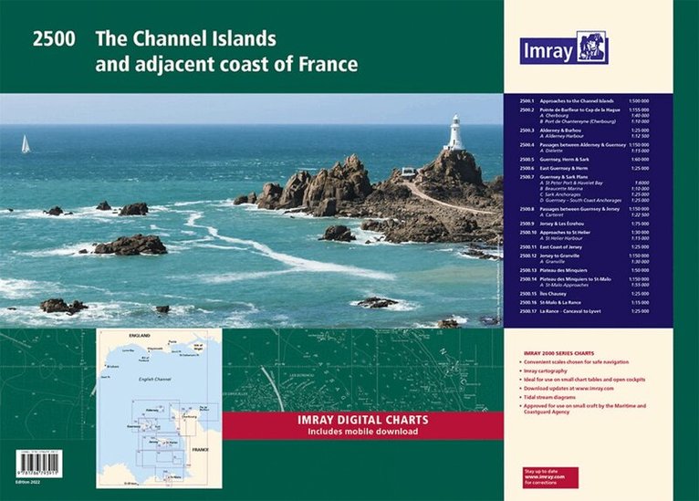
A convenient A2 format chart pack of the Channel Islands and the adjacent coast of France provided in a sturdy plastic wallet. This fully revised edition includes the latest official UKHO Digital, combined with additional information sourced from Imray's network to make it ideal for small craft. The chart pack includes all the navigational charts and tidal Digital for passage, approach and mooring. This edition has been reschemed to show passage from as far East as Saint-Vaast-la-Hougue and Barfleur. The harbour plan of Port de Chantereyne (Cherbourg) has been extended so show greater approach detail. There has been general updating throughout. This product is also available wiro bound, please use code IC2500-4W. 2500.1 Approaches to the Channel Islands 1: 500 000 WGS 84 2500.2 Pointe de Barfleur to Cap de la Hague 1: 155 000 WGS 84 Plans Cherbourg (1:40 000), Port de Chantereyne (Cherbourg) (1:10 000) 2500.3 Alderney & Burhou 1: 25 000 WGS 84 Plan Alderney Harbour (1:12 500) 2500.4 Passages Between Alderney & Guernsey 1: 150 000 WGS 84 Plan Diélette (1:15 000) 2500.5 Guernsey, Herm & Sark 1: 60 000 WGS 84 2500.6 East Guernsey & Herm 1: 25 000 WGS 84 2500.7 Guernsey & Sark Plans 1: various WGS 84 Plans St Peter Port & Havelet Bay (1:6000), Beaucette Marina (1:10 000), Sark Anchorages (1:25 000), Guernsey - South Coast Anchorages (1:25 000) 2500.8 Passages between Guernsey & Jersey 1: 150 000 WGS 84 Plan Carteret (1:22 500) 2500.9 Jersey & Les Écrehou 1: 75 000 WGS 84 2500.10 Approaches to St Helier 1: 30 000 WGS 84 Plan St Helier Harbour (1:15 000) 2500.11 East Coast of Jersey 1: 25 000 WGS 84 2500.12 Jersey to Granville 1: 150 000 WGS 84 Plan Granville (1:30 000) 2500.13 Plateau des Minquiers 1: 50 000 WGS 84 2500.14 Plateau des Minquiers to St-Malo 1: 150 000 WGS 84 Plan St-Malo Approaches (1:55 000) 2500.15 Îles Chausey 1: 25 000 WGS 84 2500.16 St-Malo & La Rance 1: 15 000 WGS 84 2500.17 La Rance - Cancaval to Lyvet 1: 25 000 WGS 84 A voucher code to download ID20 Imray English Channel charts into Imray Navigator (our app for iPad, iPhone and Android) is included with this chart pack.
956 kr
Skickas
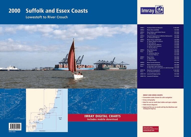
The pack includes: A convenient A2 format chart pack of Suffolk and Essex Coasts covering the waters from the River Crouch to Lowestoft. The pack is provided in a sturdy plastic wallet. This fully revised and extended edition of our popular 2000 Suffolk and Essex Coasts chart pack has been redesigned and expanded to 11 sheets, including improved coverage of Lowestoft and its approaches. The latest official UKHO Digital has been used and combined with additional information sourced from Imray's network to make it ideal for small craft. The chart pack includes all the navigational charts and tidal Digital for passage, approach, and mooring, and is designed to be used alongside East Coast Pilot by Garth Cooper and Dick Holness. 2000.1 Foulness Point to Harwich (1:120 000) 2000.2 Rivers Ore and Alde (1:35 000) 2000.3 River Deben and Orford Haven (1:35 000) Plan: Woodbridge (1:15 000) 2000.4 Harwich Approaches and Walton Backwaters (1:35 000) Plan: Titchmarsh Marina (1:12 500) 2000.5 Rivers Stour and Orwell (1:35 000) Plans: Upper Orwell to Ipswich (1:20 000), Fox's Marina (1:10 000), Woolverstone Marina (1:10 000), Suffolk Yacht Harbour (1:15 000), Shotley Marina (1:10 000) 2000.6 River Blackwater (1:35 000) Plans: Maldon (1:20 000), Tollesbury Marina (1:12 500), Bradwell Marina (1:12 500) 2000.7 River Colne (1:35 000) Plans: Wivenhoe (1:20 000), Brightlingsea (1:15 000) 2000.8 River Crouch Entrance (1:35 000) 2000.9 Rivers Crouch & Roach (1:35 000) Plans: Burnham Yacht Harbour (1:12 500), River Crouch continuation to Battlesbridge (1:35 000) 2000.10 Harwich to Lowestoft (1:125 000) Plan: Southwold Harbour (1:12 500) 2000.11 Lowestoft Approaches (1:35 000) Plan: Lowestoft Harbour (1:10 000) Imray Digital Charts: Free mobile download A voucher code to download the relevant Imray digital charts into our Imray Navigator app is included with this atlas.
956 kr
Skickas
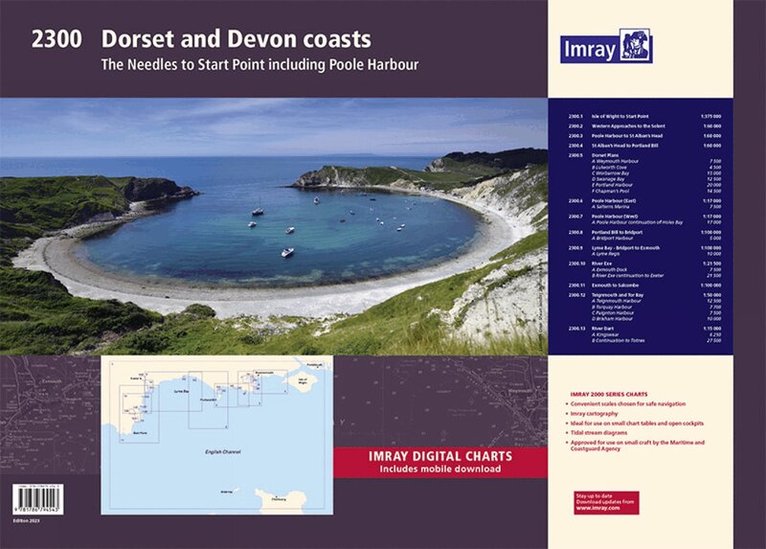
A convenient A2 format chart pack of Dorset and Devon Coasts covering waters from the River Dart to the western approaches to The Solent. The pack is provided in a sturdy plastic wallet. This fully revised and extended edition of our popular 2300 Dorset and Devon Coasts chart pack has been redesigned and expanded to 13 sheets and includes improved coastal coverage throughout. The latest official UKHO Digital has been used and combined with additional information sourced from Imray's network to make it ideal for small craft. The chart pack includes all the navigational charts and tidal Digital for passage, approach, and mooring, and is designed to be used alongside The Shell Channel Pilot by Tom Cunliffe. 2300.1 Isle of Wight to Start Point (1:375 000) 2300.2 Western Approaches to the Solent (1:60 000) 2300.3 Poole Harbour to St Alban's Head (1:60 000) 2300.4 St Alban's Head to Portland Bill (1:60 000) 2300.5 Dorset Plans Plans: Weymouth Harbour (1:7500), Lulworth Cove (1:4500), Worbarrow Bay (1:15 000), Swanage Bay (1:12 500), Portland Harbour (1:20 000), Chapman's Pool (1:14 500) 2300.6 Poole Harbour (East) (1:17 000) Plan: Salterns Marina (1:7500) 2300.7 Poole Harbour (West) (1:17 000) Plan: Poole Harbour continuation of Holes Bay (1:17 000) 2300.8 Portland Bill to Bridport (1:100 000) Plan: Bridport Harbour (1:5000) 2300.9 Lyme Bay - Bridport to Exmouth (1:100 000) Plan: Lyme Regis (1:10 000) 2300.10 River Exe (1:21 500) Plans: Exmouth Dock (1:7500), River Exe continuation to Exeter (1:21 500) 2300.11 Exmouth to Salcombe (1:100 000) 2300.12 Teignmouth & Tor Bay (1:50 000) Plan: Teignmouth Harbour (1:12 500), Torquay Harbour (1:7700), Paignton Harbour (1:7500), Brixham Harbour (1:10 000) 2300.13 River Dart (1:15 000) Plans: Kingswear (1:6250), River Dart continuation to Totnes (1:27 500)
Engelska, 2023
922 kr
Skickas
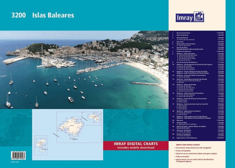
A convenient A2 format chart pack of the Balearic Islands (Ibiza, Formentera, Mallorca, Cabrera, and Menorca) provided in a sturdy plastic wallet. This fully revised edition of our popular 3200 Islas Baleares chart pack consists of 25 sheets. It includes the latest official Instituto Hidrográfico de la Marina Digital, combined with additional information sourced from Imray's network to make it ideal for small craft. The chart pack includes all the navigational charts required for passage, approach, and mooring, and is designed to be used alongside Balearic Islands by Royal Cruising Club Pilotage Foundation. Also available wiro-bound, please refer to stock code IC3200-2W. 3200.1 Ibiza & Formentera (1:150 000) 3200.2 Ibiza Southwest (1:60 000) 3200.3 Ibiza Northwest (1:60 000) Plan: Puerto de San Antonio (1:17 500) 3200.4 Ibiza East (1:60 000) 3200.5 Ibiza South to Formentera (1:60 000) Plan: Puerto de Savina (1:10 000) 3200.6 Puerto de Ibiza (1:15 000) and Passage between Ibiza & Espalmador (1:25 000) 3200.7 Mallorca & Menorca (1:350 000) 3200.8 Mallorca - Bahía de Palma (1:50 000) Plans: Cala Portals (Portals Vells) (1:10 000), Puerto de Portals Nous (1:10 000), San Antonio de la Playa (1:10 000), Puerto El Arenal (1:10 000) 3200.9 Puerto de Palma de Mallorca (1:17 500) 3200.10 Mallorca - Isla Dragonera to Punta de Cala Figuera (1:50 000) Plans: Puerto de Andratx (1:10 000), Puerto de Santa Ponça (1:10 000), Puerto de Port Adriano (1:10 000) 3200.11 Mallorca - Punta S'Aliga to Puerto de Sóller (1:50 000) and Cabo Tramuntana to Punta S'Aliga (1:50 000) 3200.12 Mallorca - Puerto de Sóller to Punta Beca (1:50 000) Plan: Puerto de Sóller (1:10 000) 3200.13 Mallorca - Punta Beca to Puerto de Alcúdia (1:50 000) Plans: Approaches to Port de Pollença (1:17 500), Bonaire (1:10 000) 3200.14 Mallorca - Bahía de Alcúdia (1:50 000) Plans: Puerto de Alcudia (1:15 000), Puerto de Ca'n Picafort (1:10 000), Puerto de Serra Nova (1:10 000), Colonia de Sant Pere (1:10 000) 3200.15 Mallorca - Cabo Ferrutx to Punta Rasa (1:50 000) Plans: Puerto de Cala Ratjada (1:7500), Puerto de Cala Bona (1:10 000) 3200.16 Mallorca - Punta de N'Amer to Porto Petro (1:50 000) Plans: Porto Cristo (1:10 000), Porto Colom (1:10 000) 3200.17 Mallorca - Colonia de Sant Jordi to Cala d'Or (1:50 000) Plans: Cala Llonga (1:10 000), Porto Petro (1:10 000), Cala Figuera (1:10 000) 3200.18 Mallorca - Approaches to Cabrera (1:50 000) Plans: Puerto de Cabrera (1:12 500), Cala Es Borri (1:15 000) 3200.19 Mallorca - Cabo Enderrocat to Cabo Blanco (1:50 000) and Cabo Blanco to Ensenada de la Rápita (1:50 000) 3200.20 Menorca (1:150 000) 3200.21 Menorca West (1:50 000) Plan: Approaches to Ciudadela (1:10 000) 3200.22 Menorca North - Islotes Bledes to Addaia (1:50 000) and Puerto de Fornells (1:15 000) 3200.23 Menorca Northeast (1:50 000) Plan: Puerto de Addaia (1:15 000) 3200.24 Menorca Southeast (1:50 000) Plan: Puerto de Mahón (1:20 000) 3200.25 Approaches to Islas Baleares (1:700 000) Imray Digital Charts: Mobile download A voucher code to download the relevant Imray digital charts into our Imray Navigator app is included with this atlas.
837 kr
Skickas
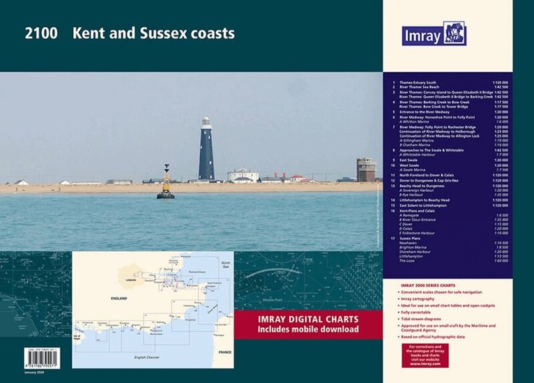
A handy-sized A2 pack of charts covering the Kent and Sussex coasts.This fully revised edition includes the latest official UKHO data combined with additional information sourced from Imray's network to make it ideal for small craft. This product is also available wiro bound, please use code IC2100-8W. 2100.1Thames Estuary South (1:120 000)2100.2River Thames Sea Reach (1:42 500)2100.3River Thames - Canvey Island to Queen Elizabeth II Bridge (1:42 500)River Thames - Queen Elizabeth II Bridge to Barking Creek (1:42 500)2100.4River Thames - Barking Creek to Bow Creek (1:17 500)River Thames - Bow Creek to Tower Bridge (1:17 500)2100.5Entrance to the River Medway (1:20 000)2100.6 River Medway: Horseshoe Point to Folly Point (1:20 000)Plan Whitton Marine (1:6000)2100.7River Medway: Folly Point to Rochester Bridge (1:20 000)Continuation of River Medway to Holborough (1:25 000)Continuation of River Medway to Allington Lock (1:25 000)Plans Gillingham Marina (1:10 000), Chatham Marina (1:10 000)2100.8Approaches to The Swale & Whitstable (1:42 500)Plan Whitstable Harbour (1:7000)2100.9East Swale (1:20 000)2100.10 West Swale (1:20 000)Plan Swale Marina (1:7500)2100.11North Foreland to Dover & Calais (1:120 000)2100.12Dover to Dungeness & Cap Gris-Nez (1:120 000)2100.13Beachy Head to Dungeness (1:120 000)Plans Sovereign Harbour (1:20 000), Rye Harbour (1:35 000) 2100.14 Littlehampton to Beachy Head (1:120 000)2100.15East Solent to Littlehampton (1:120 000)2100.16Plans Ramsgate (1:6500), River Stour Entrance (1:35 000), Dover (1:15 000), Calais (1:20 000), Folkestone Harbour (1:10 000)2100.17Plans Newhaven (1:16 500), Brighton Marina (1:8500), Shoreham Harbour (1:20 000), Littlehampton (1:13 500), The Looe (1:60 000)Imray Digital Charts: Free mobile download A voucher code to download the relevant Imray digital charts into our Imray Navigator app is included with this atlas.
Inbunden, Engelska, 2025
622 kr
Skickas
Since J W Norie published the first edition of his Complete Set of Nautical Tables and Epitome of Practical Navigation in 1803, many changes to the tables have been necessary in both content and presentation. New tables have been included, obsolete ones deleted to conform with changing techniques of navigation, with the aim of improving the accuracy of the calculated position and reducing the tedium of the calculation. Since the commissioning of the Global Navigation Satellite System (GNSS), its proven accuracy and reliability in all weather conditions have resulted in confidence and almost unquestioning dependence on its ability to provide a vessel's position, course and speed. Its use is widespread but the marine environment is a hostile one and failure of electronic equipment or of the system itself is a possibility. No prudent seafarer would proceed on an ocean passage without a reliable navigational back-up. The Explanation is in the form of a detailed step-by-step description, by means of worked examples, of the different methods of performing navigational calculations using a scientific calculator and/or the tables. A number of esteemed editors have worked on Nories' Nautical Tables over the years and this edition includes new contributions from Francois Hugo. This edition now presents formulae in an appropriate format for direct entry to a scientific calculator. Because the possibility of navigation without even an appropriate calculator exists, the logarithms have been retained. * All the tables required for coastal and deep sea navigation are included * A simple uniform method of interpolation for all the trigonometrical tables is used * Certain tables and data are also included which are not readily available on board ship or are only used in the examination room.
Engelska, 2016
148 kr
Skickas
First published over 60 years ago when interest in reviving Britain's network of navigable and rivers was starting to gather pace, this map provides the best coverage of the system in England, Wales and Scotland. Distances, the number of locks and restricting dimensions are given for each waterway. The simple cartography defines rivers, broad and narrow canals against generalized relief and the major road network. The 2016 edition has been updated to show progress in restoration schemes and other changes.
Engelska, 2024
291 kr
Tillfälligt slut
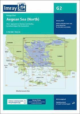
Plans included:Ayvalik (Turkey) (1:75 000)Sígri (N. Lésvos) (1:30 000) Entrance to Kólpos Kalloní (N. Lésvos) (1:30 000)Entrance to Kólpos Yéras (N. Lésvos) (1:40 000)Mitilíni (N. Lésvos) (1:10 000)Bademli Limani (Turkey) (1:40 000)Imray-Tetra charts for the Ionian and Aegean are widely acknowledged as the best available for the cruising sailor. They combine the latest official survey data with first-hand information gathered by Rod and Lucinda Heikell. The chart is designed to be used alongside Imray pilot guides of the area. Like all Imray charts, they are printed on water resistant Pretex paper for durability, and they include many anchorages, facilities and inlets not included on official charts.This edition includes the latest official data combined with additional information sourced from Imray's network to make it ideal for small craft. It includes the latest official bathymetric surveys. There has been general updating throughout.
268 kr
Tillfälligt slut
On this edition the latest depth surveys have been applied. The latest information on the works to extend Nanny Cay Marina are included. The chart specification has been improved to show coloured light flashes. There has been general updating throughout.
Engelska, 2020
291 kr
Tillfälligt slut
On this edition the chart specification has been improved to show coloured light flashes. Completed harbour works are included on the plan of the approaches to Istanbul. There has been general updating throughout.
220 kr
Tillfälligt slut
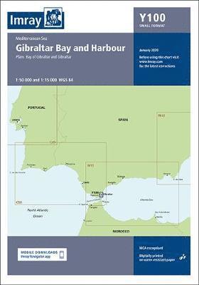
Includes panel of Gibraltar (1:15 000) A brand new chart for 2020 covering Gibraltar Bay & Harbour. This chart is a replica of the Gibraltar sheet found in the Imray chart atlas 3210 Gibraltar to Cabo de la Nao. It is printed on water resistant paper.
719 kr
Tillfälligt slut
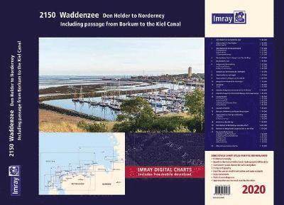
Part of Imray's popular small format chart coverage for the Netherlands, this atlas is a convenient A2 format, wirobound along one edge.
Häftad, 2020
305 kr
Tillfälligt slut
On this edition the chart specification has been improved to show coloured light flashes. The magnetic variation curves have been updated with 2020 data. Additional anchorage plans in Colombian waters have been removed for this edition. There has been general updating throughout.
Engelska, 2021
135 kr
Tillfälligt slut
A passage chart designed for planning and navigating across the North Atlantic between Gibraltar, the Azores and the Canary Islands. Based on official Hydrographic Office data with additional information from across Imray's network, tailored to appropriate scales and level of data for leisure sailors. Imray's award-winning cartography includes a familiar, logical colour scheme, coloured light sectors and fine overprinted latitude and longitude grids to make plotting easier. On this edition the magnetic variation curves have been updated with the latest data. There has been general updating throughout.
Engelska, 2021
208 kr
Tillfälligt slut
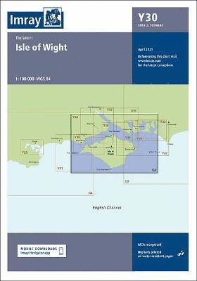
Y30 Isle of Wight (Small Format)
185 kr
Tillfälligt slut
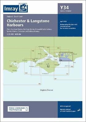
Plans included:Southsea Marina (1:20 000)Northney Marina (1:20 000)Emsworth Yacht Harbour (1:15 000)Sparkes Marina (1:15 000)Chichester and Birdham Marinas (1:20 000)This chart is a replica of Imray chart 2200.4 covering Chichester & Langstone Harbours. It is printed on water resistant paper. This edition includes the latest official UKHO data at time of publication, combined with additional information sourced from Imray's network to make it ideal for small craft. It includes the latest racing buoy information and official bathymetric surveys. There has been general updating throughout.Stock code ICY34-2SFAuthor ImrayPublisher ImrayISBN 9781786792778Edition date 2021Printed and corrected to April 2021Publication details Sheet size A2. 590 x 420mm. Folded in plastic wallet or flat.DOWNLOAD PDF CORRECTIONAlso available
Häftad, Engelska, 2025
296 kr
Tillfälligt slut
797 kr
Tillfälligt slut
122 kr
Tillfälligt slut
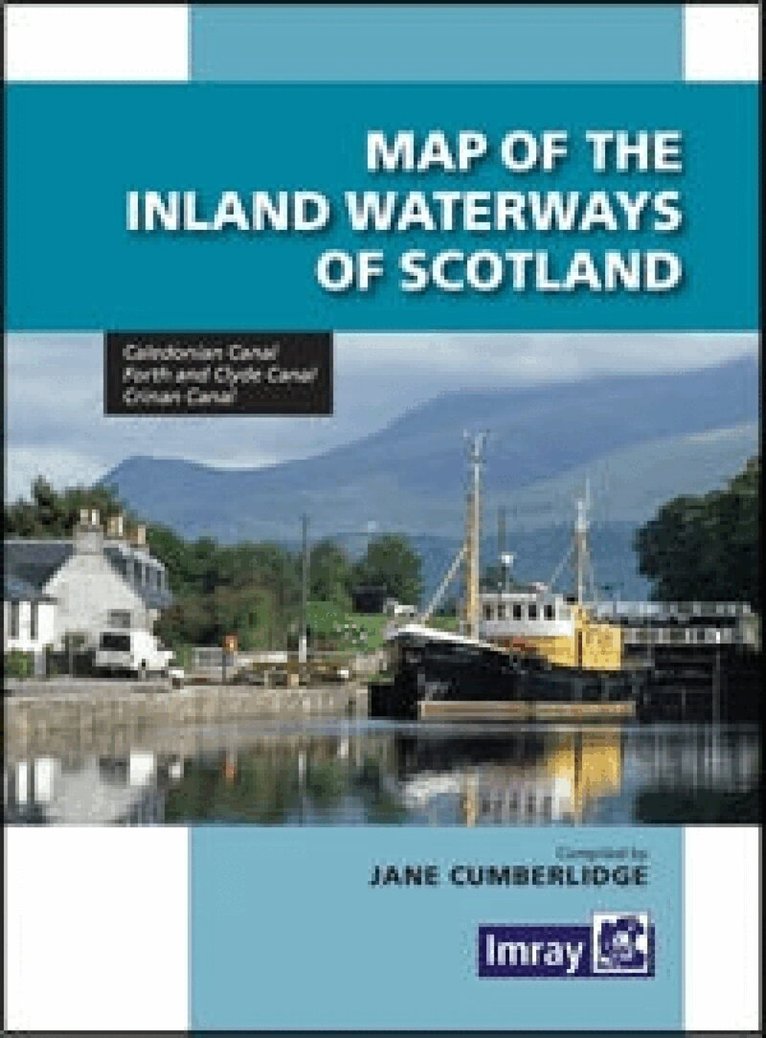
he second edition of Imray's Map of the Inland Waterways of Scotland has been updated. Contact details for the new Scottish Waterways body that replaces British Waterways have been added. The descriptive text has been improved with the addition of more photos. 'Imray are synonymous with nautical maps...and Jane Cumberlidge is a much respected writer on canals throughout Europe. Together they make a formidable pairing and this excellent map reflects all their combined knowledge and expertise. Map is perhaps something of a misnomer, for a comprehensive text is provided, with superb accommpanying photos featuring the Caledonian, Crinan, Forth & Clyde and Union canals. This second edition has been brought right up to date with contact details for Scottish Canals, the new body that took over from British Waterways Scotland in July last year.' Keith Goss, Waterways World July 2013.
Häftad, 2015
244 kr
Tillfälligt slut
Plans included: Marmaris Limani (1:50 000) Skopea Limani (1:100 000) Gocek (1:25 000) Fethiye (1:35 000) Approaches to Kastellorizo and Kas (1:75 000) On this 2015 edition restricted areas and depths have been updated throughout. Marina developments and new buoyage have been added to Marmaris Limani and Gocek plans.
Engelska, 2020
281 kr
Tillfälligt slut
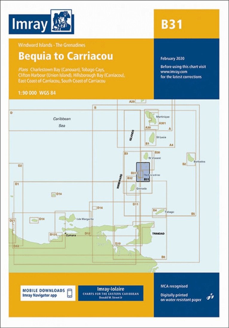
Imray-Iolaire charts for Caribbean are widely acknowledged as the best available for the cruising sailor. They combine the latest official survey Digital with first-hand information gathered over 60 years of research by Don Street Jr and his wide network of contributors. Like all Imray charts, they are printed on water resistant Pretex paper for durability, and they include many anchorages, facilities and inlets not included on official charts. Plans included: Charlestown Bay (Canouan) (1:20 000) Tobago Cays (1:30 000) Clifton Harbour (Union Island) (1:25 000) Hillsborough Bay (Carriacou) (1:35 000) East Coast of Carriacou (1:45 000) South Coast of Carriacou (1:50 000) For this edition the chart has been fully updated throughout. Two new plans have been added of the east and south coasts of Carriacou. These new plans display revised depths and anchorages in the waters around Carriacou.
268 kr
Tillfälligt slut
For this 2014 edition the latest depths have been applied throughout - in particular at Start Bay, R. Dart entrance, Tor Bay, Exmouth, The Shambles and Weymouth Bay. Positional inaccuracies have also been corrected on the Torquay Harbour plan.