
Massimo Menenti – författare
Visar alla böcker från författaren . Handla med fri frakt och snabb leverans.
6 produkter
6 produkter
E-bok
PDF, Engelska, 20062 049 kr
Läs direkt efter köp
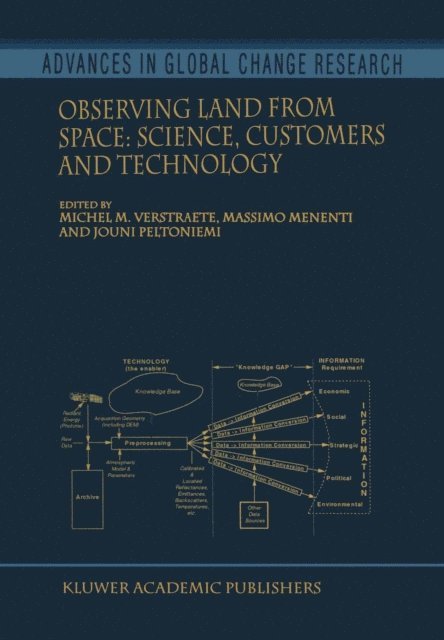
M. Verstraete (1) and M. Menenti (2, 3) (1) Space Applications Institute, Ispra, Italy, (2) The Winand Staring Centre for Integrated Land, Soil and Water Research, Wageningen, The Netherlands and (3) Université Louis Pasteur, Illkirch, France. The European Network for the development of Advanced Models to interpret Optical Remote Sensing data over terrestrial environments (ENAMORS) is a consortium of academic and research institutions involved in methodological research and in applications of remote sensing techniques for Earth Observation. It was supported initially through a Concerted Action from the Environment and Climate Research and Technology Development Program in the 4th Framework Program of the European Commission. Its activities include the organization of international scientific conferences, the first of which took place in Tuusula, Finland, from September 17 to 19, 1997. This book contains the proceedings of that conference and effectively summarizes the discussions and conclusions reached by the participants. The title of this meeting was ‘Optical Remote Sensing of Terrestrial Surfaces: New Sensors, Advanced Algorithms, and the Opportunity for Novel Applications’. It aimed at assembling representatives from the policy maker, remote sensing research and end-user communities, as well as from national and international space agencies and aerospace industries. Together, they discussed the need for R&D support, as well as the contents and priorities of such a program in this economic sector during the period covered by the 5th Framework Program (1999--2002).

Inbunden, Engelska, 2000
1 615 kr
Skickas inom 10-15 vardagar
This volume offers a broad overview of the science and technology of remote sensing, its policy implications, and the needs of operational users in the context of climate change and environmental degradation over land. The various chapters derive from presentations originally made at the first ENAMORS conference on Optical Remote Sensing of Terrestrial Surfaces: New Sensors, Advanced Algorithms, and the Opportunity for Novel Applications, held in Tuusula, Finland, in September 1997. This meeting assembled a panel of scientists, engineers, users, and policy makers, and provided a forum to debate scientific priorities, technological opportunities, and information requirements. Policy makers strive to take full advantage of investments in Earth Observation, scientists develop new and better algorithms to deliver more accurate characterizations of the environment, or propose innovative applications, while Space Agencies design observational systems better adapted to meet the requirements of a broad spectrum of scientific missions.
Inbunden, Engelska, 2006
2 151 kr
Skickas inom 10-15 vardagar
1. 1 Space View and Ground Observations 1 1. 2 Mediterranean Climatic Environment 2 1. 3 Processes at Surfaces 10 1. 3. 1 Deforestation and Land-use Changes 10 1. 3. 2 Water Related Problems 16 1. 3. 3 Fire, Grazing, and Land Degradation 19 1. 3. 4 Drought, Floods, Frost, and Desertification 21 1. 3. 5 Coupling Between Surface and Atmosphere: The Role of the Atmospheric Boundary Layer 25 1. 4 Role and Capabilities of Measurements Made From Space 30 1. 4. 1 Research Programmes 30 1. 4. 2 Expected Information 32 1. 4. 3 Research Strategy 33 1. 4. 4 Observation of Changes in Heterogeneous Landscapes: Spatial and Temporal Scales 35 1. 4. 5 Land-surface Change Indicators Observable from Space 36 Spectral Characteristics of Vegetation and Soils (36); Responses of Remote Sensing Signals to Changes of Land-surface Properties (40) 1. 5 About this Book 48 Chapter 2 Processing and Archiving of Satellite and Ancillary Data 51 2. 1 Introduction 51 2. 2 The Remote Sensing Data Base 55 2. 2. 1 Satellite Instruments 55 The NOAA Observing System (55); Meteosat (57); Nimbus-7 (59); Landsat (59); SPOT (61); DMSP (62); ERS-1 and ERS-2 (62); TRMM (63); Terra (64); Envisat (65); Aqua (66) 2. 2. 2 Aircraft Instruments 66 The Use of Aircraft for Land-surface Process Studies (66); AVIRIS (67); TMS (68); AIRSAR (68); DIAL (69) 2. 3 Reception, Acquisition and Availability of Satellite Data 70 2. 3.
E-bok
PDF, Engelska, 20072 840 kr
Läs direkt efter köp
1. 1 Space View and Ground Observations 1 1. 2 Mediterranean Climatic Environment 2 1. 3 Processes at Surfaces 10 1. 3. 1 Deforestation and Land-use Changes 10 1. 3. 2 Water Related Problems 16 1. 3. 3 Fire, Grazing, and Land Degradation 19 1. 3. 4 Drought, Floods, Frost, and Desertification 21 1. 3. 5 Coupling Between Surface and Atmosphere: The Role of the Atmospheric Boundary Layer 25 1. 4 Role and Capabilities of Measurements Made From Space 30 1. 4. 1 Research Programmes 30 1. 4. 2 Expected Information 32 1. 4. 3 Research Strategy 33 1. 4. 4 Observation of Changes in Heterogeneous Landscapes: Spatial and Temporal Scales 35 1. 4. 5 Land-surface Change Indicators Observable from Space 36 Spectral Characteristics of Vegetation and Soils (36); Responses of Remote Sensing Signals to Changes of Land-surface Properties (40) 1. 5 About this Book 48 Chapter 2 Processing and Archiving of Satellite and Ancillary Data 51 2. 1 Introduction 51 2. 2 The Remote Sensing Data Base 55 2. 2. 1 Satellite Instruments 55 The NOAA Observing System (55); Meteosat (57); Nimbus-7 (59); Landsat (59); SPOT (61); DMSP (62); ERS-1 and ERS-2 (62); TRMM (63); Terra (64); Envisat (65); Aqua (66) 2. 2. 2 Aircraft Instruments 66 The Use of Aircraft for Land-surface Process Studies (66); AVIRIS (67); TMS (68); AIRSAR (68); DIAL (69) 2. 3 Reception, Acquisition and Availability of Satellite Data 70 2. 3.
Häftad, Engelska, 2015
2 151 kr
Skickas inom 10-15 vardagar
1. 1 Space View and Ground Observations 1 1. 2 Mediterranean Climatic Environment 2 1. 3 Processes at Surfaces 10 1. 3. 1 Deforestation and Land-use Changes 10 1. 3. 2 Water Related Problems 16 1. 3. 3 Fire, Grazing, and Land Degradation 19 1. 3. 4 Drought, Floods, Frost, and Desertification 21 1. 3. 5 Coupling Between Surface and Atmosphere: The Role of the Atmospheric Boundary Layer 25 1. 4 Role and Capabilities of Measurements Made From Space 30 1. 4. 1 Research Programmes 30 1. 4. 2 Expected Information 32 1. 4. 3 Research Strategy 33 1. 4. 4 Observation of Changes in Heterogeneous Landscapes: Spatial and Temporal Scales 35 1. 4. 5 Land-surface Change Indicators Observable from Space 36 Spectral Characteristics of Vegetation and Soils (36); Responses of Remote Sensing Signals to Changes of Land-surface Properties (40) 1. 5 About this Book 48 Chapter 2 Processing and Archiving of Satellite and Ancillary Data 51 2. 1 Introduction 51 2. 2 The Remote Sensing Data Base 55 2. 2. 1 Satellite Instruments 55 The NOAA Observing System (55); Meteosat (57); Nimbus-7 (59); Landsat (59); SPOT (61); DMSP (62); ERS-1 and ERS-2 (62); TRMM (63); Terra (64); Envisat (65); Aqua (66) 2. 2. 2 Aircraft Instruments 66 The Use of Aircraft for Land-surface Process Studies (66); AVIRIS (67); TMS (68); AIRSAR (68); DIAL (69) 2. 3 Reception, Acquisition and Availability of Satellite Data 70 2. 3.

Del 4 - Advances in Global Change Research
Observing Land from Space
Science, Customers and Technology
Häftad, Engelska, 2010
1 615 kr
Skickas inom 10-15 vardagar
M. Verstraete (1) and M. Menenti (2, 3) (1) Space Applications Institute, Ispra, Italy, (2) The Winand Staring Centre for Integrated Land, Soil and Water Research, Wageningen, The Netherlands and (3) Université Louis Pasteur, Illkirch, France. The European Network for the development of Advanced Models to interpret Optical Remote Sensing data over terrestrial environments (ENAMORS) is a consortium of academic and research institutions involved in methodological research and in applications of remote sensing techniques for Earth Observation. It was supported initially through a Concerted Action from the Environment and Climate Research and Technology Development Program in the 4th Framework Program of the European Commission. Its activities include the organization of international scientific conferences, the first of which took place in Tuusula, Finland, from September 17 to 19, 1997. This book contains the proceedings of that conference and effectively summarizes the discussions and conclusions reached by the participants. The title of this meeting was ‘Optical Remote Sensing of Terrestrial Surfaces: New Sensors, Advanced Algorithms, and the Opportunity for Novel Applications’. It aimed at assembling representatives from the policy maker, remote sensing research and end-user communities, as well as from national and international space agencies and aerospace industries. Together, they discussed the need for R&D support, as well as the contents and priorities of such a program in this economic sector during the period covered by the 5th Framework Program (1999--2002).