
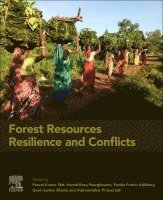
Partha Pratim Adhikary – författare
1 565 kr
Skickas inom 10-15 vardagar
2 190 kr
Läs direkt efter köp
1 876 kr
Skickas inom 10-15 vardagar
Spatial Modeling of Environmental Pollution and Ecological Risk provides valuable information and insights for researchers, students and professionals in geography, hydrology, sedimentology, soil science, agriculture, engineering and GIS as they face increasingly complex challenges around development strategies for a sustainable society. Written by the world's leading researchers in their field, each article will begin with a short introductory essay that includes an overview of the sections' papers.
Individual chapters focus on the core themes of research and knowledge and some topics that have received lesser attention. Each chapter will review the current understanding of knowledge regarding the present study and scope and consider where future efforts should be directed.
Discusses issues at the forefront of present research in environmental science, bioscience, ecology, pedogeomorphology, landscape, geoscience, forestry, hydrology and GIS Explores state-of-art techniques based on methodological and modeling in modern Deep learning and Machine learning geospatial techniques through case studies Describes novel control strategies, remediation and eco-restoration, and conservation techniques for sustainable development
2 670 kr
Läs direkt efter köp
1 589 kr
Skickas inom 10-15 vardagar
Case Studies in Geospatial Applications to Groundwater Resources provides thorough the most up-to-date techniques in GIS and geostatistics as they relate to groundwater, through detailed case studies that prove real-world applications of remote sensing applications to this subject. Groundwater is the primary source of fresh water in many parts of the world, while come regions are becoming overly dependent on it, consuming groundwater faster than it is naturally replenished and causing water tables to decline unremittingly. India is the largest user of groundwater in the world followed by China and the USA, with developing countries using groundwater at an unsustainable rate. Systematic planning of groundwater usage using modern techniques is essential for the proper utilization, management and modeling of this precious but shrinking natural resource. With the advent of powerful and highspeed personal computers, efficient techniques for water management have evolved, of which remote sensing, GIS (Geographic Information Systems), GPS (Global Positioning Systems) and Geostatistical techniques are of great significance. This book advances the scientific understanding, development, and application of geospatial technologies related to water resource management.
Case Studies in Geospatial Applications to Groundwater Resources is a valuable reference for researchers and postgraduate students in Earth and Environmental Sciences, especially GIS, agriculture, hydrology, natural resources, and soil science, who need to be able to apply the latest technologies in groundwater research in a practical manner.
Provides detailed case studies on groundwater resources around the world, including regions with highest groundwater resource use Covers modern remote sensing and geostatistical technique-based groundwater resource mapping, monitoring, and modelling Describes novel region-specific management strategies and techniques for sustainability with case studies to illustrate effectiveness Includes practical coverage of the use of geospatial analysis techniques in groundwater resources
2 328 kr
Läs direkt efter köp
1 403 kr
Skickas inom 10-15 vardagar
1 672 kr
Läs direkt efter köp
This book offers essential information on geospatial technologies for water resource management and highlights the latest GIS and geostatistics techniques as they relate to groundwater.
Groundwater is inarguably India''s single most important natural resource. It is the foundation of millions of Indian farmers'' livelihood security and the primary source of drinking water for a vast majority of Indians in rural and urban areas. The prospects of continued high rates of growth in the Indian economy will, to a great extent, depend on how judiciously we can manage groundwater in the years to come.
Over the past three decades, India has emerged as by far the single largest consumer of groundwater in the world. Though groundwater has made the country self-sufficient in terms of food, we face a crisis of dwindling water tables and declining water quality. Deep drilling by tube wells, which was once part of the solution to water shortages, is now in danger of becoming part of the problem. Consequently, we urgently need to focus our efforts on the sustainable and equitable management of groundwater. Addressing that need, this book presents novel advances in and applications of RS–GIS and geostatistical techniques to the research community in a precise and straightforward manner.
1 403 kr
Skickas inom 10-15 vardagar
1 725 kr
Skickas inom 10-15 vardagar
2 207 kr
Läs direkt efter köp
1 725 kr
Skickas inom 10-15 vardagar
1 510 kr
Skickas inom 10-15 vardagar
1 891 kr
Läs direkt efter köp
1 510 kr
Skickas inom 10-15 vardagar
1 940 kr
Skickas inom 10-15 vardagar
2 524 kr
Läs direkt efter köp
Floods and flash floods with hydro-meteorological and tropical cyclones are the some of the most devastating natural disasters causing massive damages to natural and man-made features. Flood hazards are a major threat to human life, properties (agricultural area, yield production, building and homes) and infrastructures (bridges, roads, railways, urban infrastructures, etc). Flood hazards susceptibility mapping (risk assessment) and modelling is an essential step for early warning systems, emergency services, prevention and mitigation of future environmental and social hazards and implementation of risk management strategies. Due to the lack of proper information, technology-based policies and strategies, mapping and modelling can often not be implemented to the best possible level. Geo-spatial techniques have enjoyed rising interest in recent decades among the earth environmental and social sciences research communities for their powerful ability to solve and understand various complex problems and develop novel approaches toward sustainable earth and human society.
By linking geo-spatial computational intelligence techniques with societal and environmental-oriented problems, this book demonstrates geospatial technology approaches to data mining techniques, data analysis, modelling, risk assessment and visualization and management strategies in different aspects of flood hazards. We believe that a diverse group of academics, scientists, geographers, hydrologist, remote sensing and GIS expertise, environmentalists, meteorologists and computing experts with a common interest in geospatial sciences within the earth environmental sciences and humanistic and social sciences will find this book to be of great value.
1 940 kr
Skickas inom 10-15 vardagar
1 188 kr
Skickas inom 10-15 vardagar
1 575 kr
Läs direkt efter köp
This book demonstrates the measurement, monitoring, mapping and modelling of soil pollution and land resources. This book explores state-of-the-art techniques based on open sources software & R statistical programming and modelling in modern geo-computation techniques specifically focusing on the recent trends in data mining/machine learning techniques and robust modelling in soil resources. Soil and agricultural systems are an integral part of the global environment and human well‐being, providing multiple goods and services essential for people worldwide and crucial for sustainable development. Soil contamination is an environmental hazard and has become a big issue related to environmental health. The challenge of the twenty-first century is to reduce the contaminant load and bring it to below permissible level. The contamination is not only a problem affecting local environments at the place of occurrence but also spreading to other regions because of easy transportation ofpollutants. This leads to direct and indirect contamination of land and aquatic systems, surface water and groundwater, inducing significant risks for natural ecosystems. In this context, the spatial modelling, prediction, efficient use, risk assessment, protection and management of soil resources in the agriculture system are the key to achieving sustainable development goals and ensuring the promotion of an economically, socially and environmental sustainability future. The aim of this book on soil contaminants and environmental health: application of geospatial technology is to identify the soil and sediment quality, sources of contaminants and risk assessment and focuses on the decision-making and planning point of view through GIS data management techniques. This book covers major topics such as spatial modelling in soil and sediments pollution and remediation; radioactive wastes, microbiology of soil and sediments, soil salinity and sodicity, pollution from landfill sites, soil erosion and contamination from agricultural activities, heavy metal pollution and health risk; environmental impact and risk assessment, sustainable land use, landscape management and governance, soil degradation and risk assessment, agricultural soil pollution, pollution due to urban activities, soil pollution by industrial effluents and solid wastes, pollution control and mitigation in extreme environments. The content of this book is of interest to researchers, professionals and policy-makers whose work is in soil science and agriculture practices. The book equips with the knowledge and skills to tackle a wide range of issues manifested in geographic data, including those with scientific, societal and environmental implications.
1 188 kr
Skickas inom 10-15 vardagar
1 725 kr
Skickas inom 10-15 vardagar
1 899 kr
Läs direkt efter köp
Dive into the dynamic world of environmental stewardship with "Soil, Water Pollution, and Mitigation Strategies: A Spatial Approach." This meticulously crafted volume offers a comprehensive journey through the measurement, monitoring, mapping, and modelling of soil and water pollution, coupled with innovative mitigation strategies. Discover cutting-edge techniques rooted in modern geospatial methodologies, with a sharp focus on the latest trends in data mining and robust modelling. As our planet grapples with the consequences of anthropogenic activities, such as indiscriminate chemical usage in agriculture, the need for precise quantification and risk assessment has never been more urgent. This book serves as a beacon, illuminating the path toward sustainable management of soil and water resources through the lens of geospatial technology. Explore a myriad of critical topics, including soil microbiology, salinity, pollution from industrial sources, heavy metals, and the pervasive impact of agricultural practices. Delve into environmental risk assessment, sustainable land use, and innovative remediation techniques, such as harnessing the power of Plant Growth-Promoting Rhizobacteria (PGPR) and embracing organic fertilizers.
Written for researchers, professionals, and policymakers alike, this book offers invaluable insights into the complex interplay between human activity and environmental health. Organized into two parts (I) Soil Contaminants, Risk Assessment, and Mitigation, and (II) Water Contaminants, Risk Assessment, and Mitigation—it provides a structured approach to understanding and addressing environmental challenges. Each chapter serves as a portal to a deeper understanding of the issues at hand, presenting a synthesis of current research, identifying future directions, and offering pragmatic solutions. This book promises to enrich the understanding of environmental science and empower the reader with the knowledge and skills needed to effect positive change. Designed to cater to a diverse audience—from students and researchers in environmental sciences to policymakers, NGOs, and corporate stakeholders—this book is a testament to the collaborative effort required to safeguard our planet''s precious resources. This is a transformative journey toward a more sustainable future—one informed by science, guided by innovation, and driven by a shared commitment to environmental stewardship.