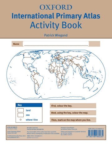
Patrick Wiegand - Böcker
Visar alla böcker från författaren Patrick Wiegand. Handla med fri frakt och snabb leverans.
19 produkter
19 produkter
168 kr
Skickas inom 5-8 vardagar
The Oxford Primary Atlas is a clear, bright and informative atlas for all 7-11 year olds. This new edition includes up-to-date country data and easy-to-read colourful mapping, presented in an accessible visual layout based on research into how young children use maps. It features key curriculum themes such as landscapes, water, settlements, connections, and environments. It includes easy-to-use features such as learning statements to summarize each theme, focus panels to prompt independent or group enquiry, innovative grid codes to help children find places listed in the index, colourful photographs to aid children's understanding of map symbols, attractive artwork to provide a 'sense of place', and stimulating graphics to make large numbers easy to understand.This new edition of the Oxford Primary Atlas, specially written to support the requirements of primary geography at Key Stage 2, and incorporating the most popular features of the bestselling Oxford Junior Atlas, uses simple, clear mapping and colourful illustration to create a stimulating and informative atlas for all 7-11 year olds.The Oxford Primary Atlas is also accompanied by the Activity Book for independent work to develop map literacy skills, and the e-Atlas CD-ROM for whole class display on interactive whiteboard.
131 kr
Skickas
The Oxford Primary Atlas is a clear, bright, and informative atlas designed for all 7–11 year olds. This new edition includes up-to-date country data and easy-to-read colourful mapping, presented in an accessible layout based on research into how children use maps.Key Features:• Curriculum-Aligned: Covers key themes such as landscapes, water, settlements, connections, and environments.• Engaging Design: Clear mapping, colourful illustrations, and attractive artwork to provide a sense of place.• Easy-to-Use Tools: Learning statements summarise each theme, focus panels prompt enquiry, and innovative grid codes help children find places.• Visual Support: Colourful photographs aid understanding of map symbols and stimulating graphics make large numbers easy to understand.• Supports Key Stage 2: Specially written to meet primary geography requirements and includes popular features from the Oxford Junior Atlas.The Oxford Primary Atlas is also accompanied by an Activity Book for independent work to develop map literacy skills and an e-Atlas CD-ROM for interactive whole-class display.
115 kr
Skickas inom 5-8 vardagar
The Oxford International First Atlas is a stimulating first atlas for young children, designed to introduce early map skills and inspire curiosity about the world. Completely up-to-date, it features accurate, easy-to-read, and colourful mapping in a layout based on research into how young children use maps.Have you ever wondered:• What the Earth looks like from space?• How many continents there are?• Where Mount Everest is?Find out in your very first atlas!Key Features:• Perfect for Early Learners: Introduces young children to maps and develops early atlas skills.• Comprehensive Coverage: Includes an introduction to the globe and places around the world.• Engaging Visuals: Stunning Earth-from-space images, clear maps of the world and continents, and popular themes such as world animals and holidays.• Fascinating Facts: Includes fun facts about places and people to spark curiosity.• Interactive Learning: Accompanied by an Activity Book for independent work to develop map literacy skills.This atlas is the ideal resource for introducing young learners to geography and encouraging exploration of the world.
81 kr
Skickas inom 5-8 vardagar
The Oxford International First Atlas Activity Book builds upon themes introduced in the Oxford International First Atlas to develop and reinforce geographical concepts and map skills. The Activity Book offers maps and activities to encourage pupils to work independently and to practise and develop their knowledge and understanding of the topics and themes covered in the atlas. Assessment for Learning support throughout the Activity Book enables teachers and pupils to monitor their progress.The Oxford International First Atlas is a stimulating first atlas for young children. It introduces young learners to maps and develops early atlas skills, encouraging them to talk about local and distant places and to find key places on maps. Based on the popular Oxford Infant Atlas, this new atlas uses colourful artwork-style maps, photographs and satellite images to create an exciting first atlas for all 3-6 year olds.
131 kr
Skickas
The Oxford International Primary Atlas is a clear, bright, and informative atlas designed for primary learners. This new edition includes up-to-date country data, easy-to-read colourful mapping, and worldwide topographic content, including regions such as Europe, Malta, Cyprus, Middle East, Malaysia, and Hong Kong.Key Features:• Comprehensive Coverage: Clear maps of the world and all continents, plus stunning aerial photographs and satellite images.• Curriculum-Aligned Themes: Landscapes, water, settlements, connections, and environments.• Accessible Design: Layout based on research into how children use maps, with colourful photographs and attractive artwork.• Learning Support: Learning statements introduce each theme, focus panels prompt enquiry, and innovative grid codes help children find places.• Interactive Learning: Accompanied by an Activity Book for independent work to develop map literacy skills.This atlas combines rigorous content with engaging visuals, making it the ideal resource for developing geographical knowledge and map skills.
74 kr
Skickas
The Oxford International Primary Atlas Activity Book builds upon themes introduced in the Oxford International Primary Atlas to develop and reinforce geographical concepts and map skills. The Activity Book offers maps and activities to encourage pupils to work independently and to practise and develop their knowledge and understanding of the topics and themes covered in the atlas. Assessment for Learning support throughout the Activity Book enables teachers and pupils to monitor their progress.The Oxford International Primary Atlas is a clear, bright and informative atlas for all 7-11 year olds in the international classroom. It introduces primary school pupils to key geographical themes and curriculum topics, including landscapes, water, settlements, connections, and environments.
159 kr
Skickas
The Oxford First Atlas is an accessible and informative atlas designed for young learners in their first years at school. Completely up-to-date, it features accurate, easy-to-read, and colourful mapping in a layout based on research into how children use maps.Key Features:• Comprehensive Coverage: Simple introduction to Planet Earth and places around the world.• Clear and Colourful Maps: Includes world maps, continental maps, and thematic maps showing coasts, rivers, mountains, weather, environments, cities, animals, and holidays.• Engaging Visuals: Colourful photographs, fascinating facts about places and people, and questions to encourage thinking and discussion.• Interactive Learning: Accompanied by a Teacher’s Handbook, an Activity Book for independent work, and an e-Atlas CD-ROM for whole-class display.• Perfect for Early Learners: Encourages children to explore their world and develop atlas and map skills.This atlas is the ideal resource for introducing young learners to geography and inspiring curiosity about the world.
153 kr
Skickas
The Oxford First Atlas is an accessible and informative atlas designed for young learners in their first years at school. Completely up-to-date, it features accurate, easy-to-read, and colourful mapping in a layout based on research into how children use maps.Key Features:• Perfect for Early Learners: Encourages children to explore their world and develop atlas and map skills.• Comprehensive Coverage: Includes a simple introduction to Planet Earth and places around the world.• Clear and Colourful Maps: World maps, continental maps, and thematic maps showing coasts, rivers, mountains, weather, environments, cities, animals, and holidays.• Engaging Visuals: Colourful photographs, fascinating facts about places and people, and questions to encourage thinking and discussion.• Interactive Learning: Accompanied by a Teacher’s Handbook, an Activity Book for independent work, and an e-Atlas CD-ROM for whole-class display.This atlas is the ideal resource for introducing young learners to geography and inspiring curiosity about the world.
91 kr
Skickas inom 5-8 vardagar
The Oxford Very First Atlas is the perfect introduction to maps for young learners. Completely up-to-date, it features accurate, easy-to-read, and colourful mapping in an accessible layout based on research into how children use maps.Have you ever wondered:• What the Earth looks like from space?• How many continents there are?• Where Mount Everest is?Find out in your very first atlas!Key Features:• Introduces young learners to maps and develops early atlas skills.• Engaging Content: Encourages children to talk about local and distant places and find key locations.• Comprehensive Coverage: Includes an introduction to the globe, stunning Earth-from-space images, and clear maps of the world and continents.• Interactive Learning: Accompanied by an Activity Book for independent work and an e-Atlas CD-ROM for whole-class display.This atlas is the ideal resource for developing map skills and inspiring curiosity about the world.
198 kr
Skickas
The Oxford Student Atlas is an essential resource for exam success, featuring stunning satellite images, comprehensive country data, and easy-to-read colourful mapping in an accessible layout based on research into how students use maps.Key Features:• Stunning Visuals: High-quality satellite images and clear, colourful mapping for easy understanding.• Exam Specification Coverage: Includes key themes such as earthquakes, volcanoes, climate change, economic activity, development, and globalisation.• Comprehensive Mapping: Detailed coverage of the British Isles, Europe, and the world.• Student-Friendly Layout: Accessible design based on research into how students interact with maps.• Ideal for Exam Courses: Perfect companion for A Level and GCSE Geography revision.This atlas combines rigorous content with engaging visuals, making it the ideal reference for students preparing for geography exams."
198 kr
Skickas
The Oxford Student Atlas is an essential resource for exam success. This atlas combines rigorous content with engaging visuals, making it the ideal reference for students preparing for geography exams.Key Features:• Stunning Visuals: High-quality satellite images and clear, colourful mapping for easy understanding.• Exam Specification Coverage: Includes key themes such as earthquakes, volcanoes, climate change, economic activity, development, and globalisation.• Comprehensive Mapping: Detailed coverage of the British Isles, Europe, and the world.• Student-Friendly Layout: Accessible design based on research into how students interact with maps.• Ideal for Exam Courses: Perfect companion for A Level and GCSE Geography revision.
171 kr
Skickas inom 5-8 vardagar
The Oxford School Atlas is an essential resource for students, featuring country data and easy-to-read colourful mapping in an accessible layout based on research into how students use maps.Key Features:• Curriculum-Aligned: Covers key themes such as earthquakes, volcanoes, climate, economic activity, and development.• Comprehensive Coverage: Includes detailed maps of the British Isles and global regions.• Case Studies: Features real-world examples including Italy, Kenya, Brazil, Japan, China, California, the Indian Ocean tsunami, Hurricane Katrina, and Antarctica.• Accessible Design: Clear, colourful mapping and engaging visuals to support learning.This atlas combines accurate data with practical features, making it ideal for classroom use and exam preparation.
153 kr
Skickas
The Oxford School Atlas includes country data and easy-to-read colourful mapping, presented in an accessible visual layout based on research into how students use maps. The atlas covers key curriculum themes such as earthquakes and volcanoes, climate, economic activity, and development. It includes comprehensive coverage of the British Isles, and case studies of Italy, Kenya, Brazil, Japan, China, California, the Indian Ocean tsunami, Hurricane Katrina, and Antarctica.
204 kr
Skickas
The new edition of the Oxford International Student's Atlas is the ideal atlas for secondary school students.It includes stunning satelite images alongside mapping to aid understanding, country data, and easy-to-read colourful mapping, presented in an accessible visual layout based on research into how students use maps.It covers key themes such as earthquakes and volcanoes, climate and climate change, economic activity, development, and globalisation. It provides comprehensive coverage of each continent and the world.It is the ideal atlas for students to use on exam courses, and is perfectly suited to Cambridge IGCSE® Geography and Cambridge International AS and A Level Geography courses.The Oxford International Student's Atlas is supported by the Oxford International Student's Atlas Skills Workbook - a fill-in skills workbook ideal for the classroom and homework.
125 kr
Skickas inom 5-8 vardagar
The Oxford International Student's Atlas Skills Workbook is the perfect companion to the International Student's Atlas, providing engaging fill-in activities to reinforce essential map skills.Key Features:• Comprehensive Map Skills: Covers projections, latitude and longitude, symbols, scale, distance, area, direction, grid codes, coordinates, and using an atlas index.• Place Knowledge Development: Activities designed to build understanding of global locations and geographical concepts.• Engaging Format: Clearly and attractively presented for classroom and homework use.• Supports Exam Success: Ideal for reinforcing key skills required for geography courses.This workbook combines practical exercises with clear guidance, making it an essential resource for students learning map and atlas skills."
526 kr
Skickas inom 10-15 vardagar
This book is a readable and lively introduction to the teaching of geography for all primary teachers and fills a gap in the literature available on the subject. In England and Wales the National Curriculum has pointed to the need for greated understanding of geography by primary teachers at Key Stage 2 to level 5 and beyond. The book takes each of the attainment targets in turn, looks at the evidence for childrens understanding and suggests appropriate classroom activities. There is a wealth of information gathered British, American, Australian and German source as well as the author's own research. Ideas are combined with reasons for putting them in to practice. Although structured around the National Curriculum, the book has wide international relevance and even non-specialists will find it enjoyable and stimulating. Patrick Wiegand teached at the University of Leeds, England.
2 111 kr
Skickas inom 10-15 vardagar
A comprehensive and authoritative account of how primary school children and teachers can use maps to enhance learning and deepen understanding of this essential skill. It includes all aspects of map use, such as reading and interpreting maps and using maps to find the way, covering maps of all scales, including globes and atlases. The text is extensively illustrated with examples, including maps made by children themselves using conventional materials as well as computer software.A particular feature of the book is the integration of digital and conventional mapping, and Internet and CD-ROM cartography together with simple applications of Geographic Information Systems (GIS) appropriate to the needs of children right through primary and secondary education.This book will be of great use to all primary teachers and subject teachers in secondary school as well as non-specialist geography teachers, and will enable children to use all types of maps in new, compelling and thoughtful ways.
533 kr
Skickas inom 10-15 vardagar
A comprehensive and authoritative account of how primary school children and teachers can use maps to enhance learning and deepen understanding of this essential skill. It includes all aspects of map use, such as reading and interpreting maps and using maps to find the way, covering maps of all scales, including globes and atlases. The text is extensively illustrated with examples, including maps made by children themselves using conventional materials as well as computer software.A particular feature of the book is the integration of digital and conventional mapping, and Internet and CD-ROM cartography together with simple applications of Geographic Information Systems (GIS) appropriate to the needs of children right through primary and secondary education.This book will be of great use to all primary teachers and subject teachers in secondary school as well as non-specialist geography teachers, and will enable children to use all types of maps in new, compelling and thoughtful ways.
2 505 kr
Skickas inom 10-15 vardagar
Using a cross-curricular approach, Wiegand discusses the knowledge necessary for preparing children for life in a pluralist society. Looking at theories of education for citizenship, environment education and economic and industrial understanding, it examines the evidence for what children know and feel about their own country, other countries and people in "distant" places. He offers practical suggestions for curriculum planning and classroom activities in the primary school and examines ways in which project work on different localities can be initiated and developed.