
Ros Brawn – författare
Visar alla böcker från författaren . Handla med fri frakt och snabb leverans.
7 produkter
7 produkter
Häftad, Engelska, 2016
160 kr
Skickas
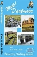
Kate and Alan Hobbs have reviewed and refreshed their Walk! Dartmoor classic guide book for its new 2016 edition. 40 fully detailed walking routes with OS maps and gps waypoints for you to enjoy adventuring on Dartmoor. Walk! Dartmoor with Kate and Alan Hobbs covers walks of varying length across Dartmoor - from the dramatic high moors, gentle riversides, idyllic country lanes, unspoilt villages, to sites of ancient archaeology and former industries, and all with spectacular views. This user friendly illustrated guide has a summary of walking routes and is rated by time, effort, distance and hills, as well as the availability of refreshments en route and the vertigo risk.Each walk is described in full and there are timings listed in the book to help with navigation and progress. Walk! Dartmoor contains a 1:40,000 scale Ordnance Survey map for each route. Within the heart of Devon lies Dartmoor's 365 square miles of natural beauty, one of the largest areas of exposed granite in southern England. Apart from its spectacular scenery, Dartmoor is rich in flora and fauna.Come with us to explore Dartmoor's dramatic high moors, gentle riversides, idyllic country lanes and unspoilt villages, discovering spectacular views, ancient archaeology and traces of bygone industries.All 40 walking routes include: walking route summary, ratings for Effort Time Distance Ascents/Descents Refreshments and Vertigo risk, fully detailed walk description including frequent timings to aid navigation and check your progress, GPS waypoints at every key point on every route, full colour 1:40,000 scale Ordnance Survey licenced mapping for each route, short walk and stroll alternatives.
Engelska, 2019
115 kr
Skickas
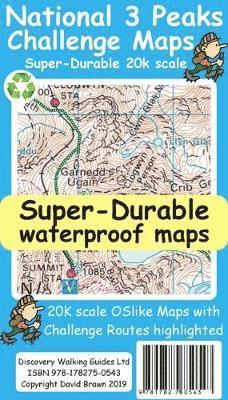
National 3 Peaks Challenge Maps. Ben Nevis, Scafell Pike and Snowdon at 20k scale. Waterproof, tearproof and 100% recyclable 820mm by 420mm double sided map sheet. Taking OS mapping at 50k scale we expand the mapping to produce 20k scale maps of the three challenge peaks, Ben Nevis, Scafell Pike and Snowdon. By expanding the OS mapping the features of names, roads, tracks and trails are more than doubled in size making them easier to read under Challenge conditions. We then add the Challenge Routes, specially highlighted to make them stand out against the OS map background information and add in additional information that will help your challenge. Each map covers the region to show the access roads as well as the walking routes. Ben Nevis includes the Glen Nevis Information Centre starting point and Glen Nevis Youth Hostel starting point. Scafell Pike includes the Wasdale and Seathwaite Challenge Routes. Snowdon includes the Pyg Track, Miners Track and Llamberis Challenge Routes. Each peak is a 420mm by 420mm OSlike map mounted on a double sided map sheet of 840mm by 420mm. The map designs are then printed on a 100 micron plastic substrate using UV cured inks on the UK's only press capable of using this latest technology. The result is a lightweight map that is both waterproof and tearproof, and fully recyclable, that will survive anything your 3 Peaks Challenge can throw at it and afterwards will fold up like new.
Engelska, 2019
151 kr
Skickas
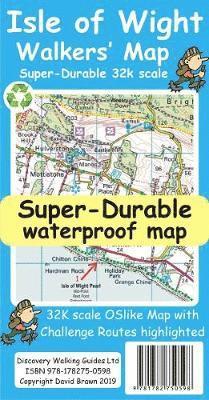
Isle of Wight Walkers' Map at 32k scale with challenge routes and walking trails highlighted. OS 50k scale mapping is expanded in size to produce a 32k map. The OS features, text and logos are now 50% larger making them much easier to read under outdoor conditions. Isle of Wight Challenge Route (66 miles) is specially highlighted in green and white so that the route stands out against the OS background map. Then we add the Earl Mountbatten Hospice's Walk (26.5 miles) highlighted in gold and white. A large range of gps surveyed walking trails are then highlighted in grey and white. The result is an easy to read `OSlike' map with walking trails specially highlighted. We then split the island into East (cover side) and West (reverse side) with a ten mile common overlap to the two sides; meaning you will only have to turn the map over if you are undertaking the longest Challenge or Earl Mountbatten routes. The result is a double sided 840mm by 694mm OSlike Super-Durable Map. We then print the map design on a 100 micron plastic substrate using a special UV curing inks process on the UK's only press capable of using this latest technology. The printed map sheets are then folded using a special concertina map fold to its pocket size of 230mm by 120mm. The result is the Isle of Wight Walkers' Map. A lightweight map that is both accurate and easy to read and use. Super-Durable means your map is waterproof and tearproof, and fully recyclable. This map will survive anything your Isle of Wight Challenges can throw at it and afterwards will fold up like new. Buying the Isle of Wight Walkers' Map also entitles you to receive the Custom Map digital edition of the map as a free download from Discovery Walking Guides.
Engelska, 2019
151 kr
Skickas inom 11-20 vardagar
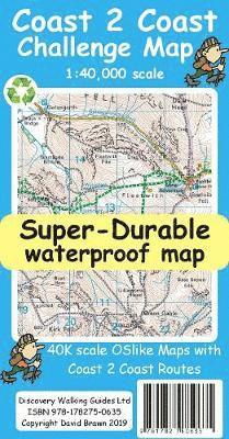
The whole 'Wainwright' Coast to Coast on one double sided, 960mm by 694mm, map sheet. All 193 miles (308 kilometres) of the Wainwright route along with its alternatives are highlighted across 9 map sections at 40k scale. Ordnance Survey accuracy is combined with Tour & Trail map design to produce 40k scale map sections which are easy to read. OS 50k Landranger mapping is expanded to 40k scale making the text and features over 40% larger making them easy to read and understand. Wainwright's C2C walking routes, and their alternatives, are specially highlighted in Tour & Trail style making the routes easy to find on the map and on the ground. Public `Rights of Way' paths and bridleways are also highlighted in Tour & Trail style making them easy to recognise and find. Coast 2 Coast Challenge Map design is then printed on Polyart using 100% oxygenation inks to produce a lightweight, Super-Durable, waterproof map that is tough enough to shrug off the worst that the C2C can subject it to and still fold up like new at the end of each day. In addition to the Super-Durable printed map, Discovery Walking Guides offers you a free `C2C Digital Resources Package'. Simply follow the instructions on the map to receive a download link to the zip file, which contains all 9 map sections as digital Custom Map editions in kmz file format along with 13 gpx waypoint files covering the 13 stages of the C2C. Combining the Super-Durable Map with the Digital Resources Package gives you trouble free navigation for the whole C2C Challenge route from St Bees to Robin Hood's Bay.
Häftad, Engelska, 2012
160 kr
Skickas
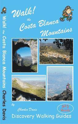
Walk! Costa Blanca Mountains includes 37 fully detailed walking route itineraries. Each walking route itinerary includes:- - walking route summary - ratings for Effort, Time, Distance, Ascents/Descents, Refreshments and Vertigo risk - fully detailed walk description, including frequent timings to aid navigation and check your progress - GPS Waypoints at every key point on every route where there is good gps reception - full colour 1:40,000 scale map of the route - short walk and stroll alternatives There are some easy routes. There are some challenging routes for fit experts. With Charles Davis' excellent walk descriptions you'll know which routes are for you - and all of them are a true adventure. Contents The Author INTRODUCTION: Climbing Into Cliche; a Better Costa Blanca The Terrain, Castles, Arcs & Karst , Pathways to Pleasure, Valls & Sierras Using GPS in the Costa Blanca Symbols Rating Guide Map Information THE WALKS. SIERRAS 1 Xalo: PR7 Serra de Bernia 3 walker, 2.5 hrs, 7.9 km, ascents & descents 260 metres (circular). 2 Polop: Monte Ponoig 4 hrs, 9.3 km, ascents & descents 770 metres (linear) 3 Finestrat: Puig Campana 4 hrs, 10.1 km, ascents & descents 1020 metres, vertigo warning (circular).4 Finestrat: Barranc de Sacarest 3 hours, 10.2 km, ascents & descents 545 metres (circular). 5 Sella: SL112 La Ruta del Aigua 1.5 hrs, 6.3 km, ascents & descents 200 metres (circular). 6 Sella: Barrancs del Xarquer and Arc 3.75 hours, 13 km, ascents & descents 400 metres (circular). 7 Confrides: Castell de Confrides 1 hr, 3.2 km, ascents & descents 130 metres (linear or circular). 8 Confrides: Cumbre de Aitana from Font de l'Arbre 3 hrs, 11 km, ascents & descents 450 metres (circular). 9 Benifato: Cumbre de Aitana from Font de Partagat 3.2 hrs, 10 km, ascents & descents 450 metres (circular). 10 Benimantell: Penyo Mulero 2.75 hrs, 10.7 km, ascents & descents 500 metres (circular). 11 Benimantell: Barrancs del Salt, Xarquer & Arc 3.5 hrs, 12.6 km, ascents & descents 500 metres (circular). 12 Benasu: El Recingle Alt 3 hrs, 11.5km, ascents & descents 500 metres (linear). 13 Quatredonteda: Els Frares (a) via Cami del Carrascal 50 mins one-way, 2.2 km one-way, ascents & descents 345 metres (linear). (b) via Cami des Clots 2.5 hrs, 6 km, ascents & descents 375 metres (linear). 14 Fageca: PR182 Pla de la Casa- Plus alternative access from the south 4.7 hrs, 9.4 km, ascents & descents 565 metres (circular).15 Famorca: Little Wolf - Mallada del Llop 3.5 hrs, 7.5 km, ascents & descents 580 metres (linear). 16 Famorca: Big Wolf - Barranc de la Canal, Mallada del Llop, El Regall 4.3 hrs, 10.3 km, ascents & descents 660 metres (circular). 17 Castell de Castells: PR149 El Castellet 2.8 hrs, 8.5 km, ascents & descents 540 metres (circular). 18 Castell de Castells: Cumbre de Aixorta and Els Arcs 5.5 hrs, 20.8 km, ascents & descents 845 metres (circular). 19 Tarbena: PR145 Parelles and Serrals via Font dels Olbis 3.5 hrs, 13.5 km, ascents & descents 450 metres (circular). 20 Bolulla: Tour of Raco Roig 2.5 hrs, 7.4 km, ascents & descents 250 metres (circular). 21 Orxa: Serra La Safor and Raco del Duc 6.3 hrs, 18.4 km, ascents & descents 730 metres (circular). 22 Orxa: Cim de la Safor 1.7 hrs, 6.3 km, ascents & descents 320 metres (linear). LES VALLS 23 Vall de Planes: Barranc de l'Encantada 40 mins one-way, 2.3 km one-way, ascents & descents 100 metres (linear). 24 Vall de Gallinera (Benissili): Castillo de Benissili 1.8 hrs, 6.3 km, ascents & descents 315 metres (circular). 25 Vall de Gallinera (Benissiva): La Forada Linear: 1 hour one-way, 2.5 km one-way, ascents & descents 224 metres.Circuit: 2.75 hrs, 10.5 km, ascents & descents 300 metres. 26 Pego: Refugio de la Figuereta 2.25 hours, 7.35 km, ascents & descents 445 metres (circular). 27 Vall d'Alcala: Alcala de la Jovada to Es Pouet 3.3 hrs, 15.3 km, ascents & descents 340 metres (circular). 28 Vall d'Ebo: Travessia del Masset 2 walker, 1.3 hrs, 4.7 km, ascents & descents 210 metres (circular). 29 Tormos: Sender dels Pintors 2.25 hrs, 3.8 km, ascents & descents 300 metres (circular). 30 Tormos: Sender dels Poets 2.5 hrs, 8.6 km, ascents & descents 380 metres (linear). 31 Vall de Laguar (Fleix): PR147 La Catedral del Senderisme 3.75 hrs, 13.5 km, ascents & descents 845 metres (circular). 32 Vall de Laguar (Fleix): Barranc dels Racons 3.75 hrs, 11.5 km, ascents & descents 450 metres (circular). 33 Vall de Laguar (Campell): Presa d'Isbert & Barranc del Moro 2 hrs, 5.2 km, ascents & descents 285 metres (circular). 34 Vall de Laguar (Campell): Cavall Verd - the conventional circuit 2.5 hrs, 7. 6 km, ascents & descents 315 metres (circular). 35 Vall de Laguar (Benimaurell): Cavall Verd - the western loop 2 hrs, 6.6 km, ascents & descents 246 metres (circular).36 Vall de Pop (Parcent): PR158 Sender de Parcent 4 hrs, 14.1 km, ascents & descents 700 metres (circular) 37 Vall de Pop (Pla de Petracos), Serra l'Alfaro and Barranc de Malafi 6 hrs, 20.5 km, ascents & descents 530 metres (circular). Gps waypoint files for all the walking routes are available as a free download from the Discovery Walking Guides website.
115 kr
Tillfälligt slut
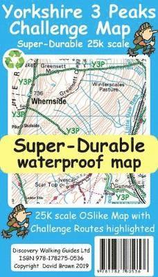
Yorkshire 3 Peaks Challenge Map at 25k scale with challenge routes highlighted. Waterproof, tearproof and recyclable.
Häftad, 2014
163 kr
Tillfälligt slut
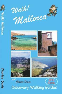
Looking for one Mallorca guide book that has all the walking adventures you could want? New for 2014 Walk! Mallorca is your choice. 53 fully detailed walking routes ranging from east strolls up to serious mountain hikes packed into 160 pages that you can fit into your pocket. At just GBP12.99 (or less) don't go to Mallorca without Walk! Mallorca.