
David Brawn – författare
Visar alla böcker från författaren . Handla med fri frakt och snabb leverans.
20 produkter
20 produkter
Engelska, 2021
153 kr
Skickas
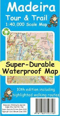
For your best adventures, use the best map. Madeira's favourite map just got a whole lot better. Now in its 10th edition including the new Palheiro golf development, goodbye to the abandoned Ponta Pargo golf course, final sections of the VE3 road, loads of minor road updating especially in the south west. For hikers we have added several new highlighted walking routes. Madeira Tour & Trail Map is a large 960mm by 700mm double sided map sheet. Super-Durable edition comes with a 2 year adventurous use guarantee. Specialist concertina map folding means the 960mm by 700mm double sided map folds quickly to its 235mm by 120mm pocket size. This most detailed map of Madeira includes our 'Tour & Trail' level of detail ranging from major roads to secondary roads to minor roads to streets and camino rural narrow country roads, plus dirt roads and walking trails. Altitude background colouring is designed to clearly show the altitude range when travelling across the island by car or on foot. 100 metre and 50 metre contours are clearly shown on the map along with a large number of individual height points and all of the official 'Trig' points. Tour & Trail attention to detail is legendary as is our useful symbol range including miradors, picnic areas, petrol stations, bar/restaurants and parking areas where you can pull off the road safely. You will easily identify springs, caves, sports grounds, cemetries, churchs, chapels, lighthouses, towers and forts, camping areas, wind turbines, hotels etc. For adventurers on foot Tour & Trail Maps are researched and designed by hikers for use by hikers. Our comprehensive gps ground surveys produce the best mapping available but the value of this on the ground research becomes even more important when you leave the tarmac. All of our DWG walking routes are accurately gps surveyed giving you confidence in the accuracy of our Tour & Trail Maps. Madeira Tour & Trail Map includes all the walking routes from 'Madeira Walks' volumes 1 & 2 by Shirley Whitehead highlighted in Red while other published walking routes (printed guide books and reliable web publications) are highlighted in Green. It all adds up to the most useful map of Madeira that you can buy anywhere. In use maps have a very tough life so you will appreciate our specialist concertina map fold that allows you to quickly open the map, and more importantly fold it back up to its pocket size after use. Paper maps will always suffer from the repeated unfolding, folding to the section you want to use, and then refolding. We recommend everybody to obtain our Super-Durable editions printed with 100% oxygenation inks on Polyart by the UK's leading map printer, which produces a map that feels like silk but will stand up to the roughest treatment of outdoor adventuring and yet fold up like new at the end of your adventure. Tour & Trail Super-Durable Maps are more expensive than paper maps, but represent better value as they produce a lightweight map that feels like silk while being both water-proof and incredibly tough so that after even the toughest of adventures your Tour & Trail Super-Durable Map will fold up like new. Digital editions of Madeira Tour & Trail Map for phone apps and Garmin users are available on the dwgwalking website.

Inbunden, Engelska, 2015
135 kr
Skickas
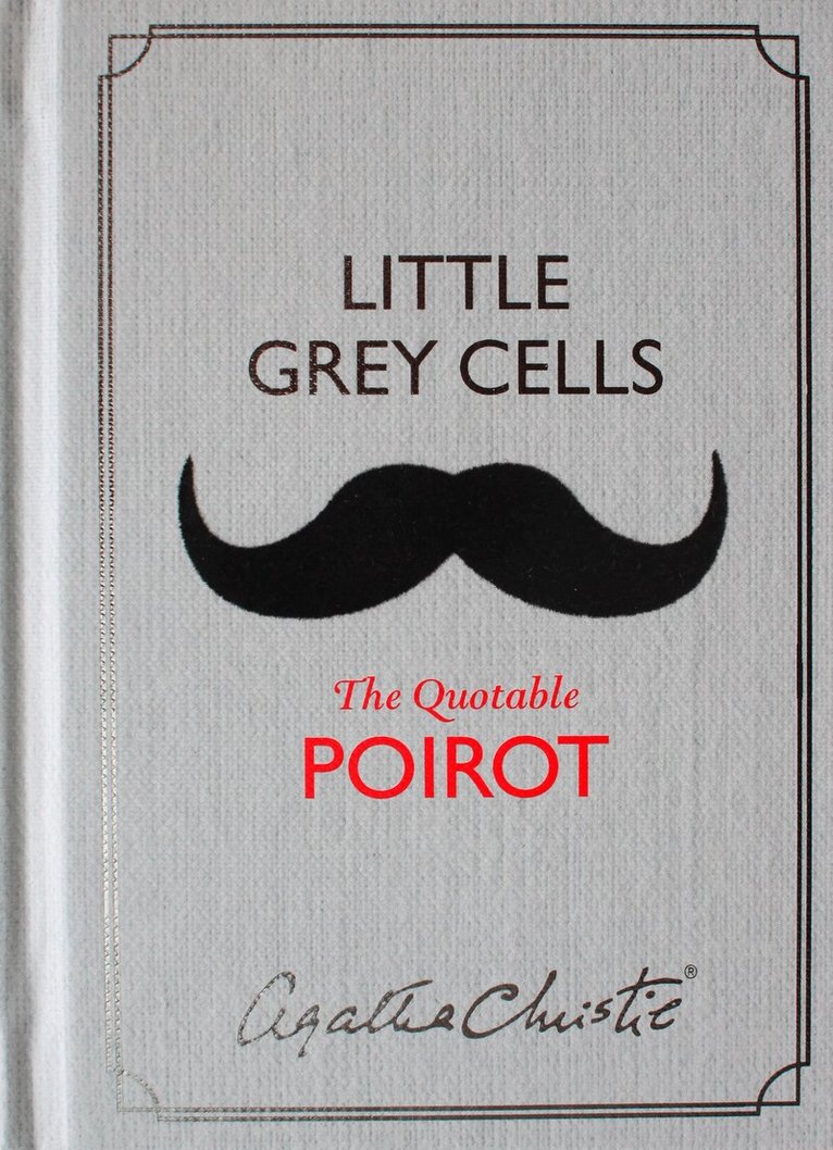
Discover the man behind the moustache in this book of one-liners by the world’s most famous Belgian detective, revealing the wit and wisdom of Hercule Poirot and his creator, Agatha Christie. A perfect stocking-filler for every Christie fan, to help celebrate her 125th birthday.‘My name is Hercule Poirot and I am probably the greatest detective in the world.’The dapper, moustache-twirling little Belgian with the egg-shaped head, curious mannerisms and inordinate respect for his own ‘little grey cells’ solved some of the twentieth century’s most puzzling crimes. But what do we really know about the eccentric genius underneath that fussy façade?Sometimes funny, often profound, and always revealing, this book of quotes and comments, from more than 50 Poirot novels and short stories, gives an entertaining glimpse of the man behind the moustache, and the wit and wisdom of the Queen of Crime who created him.Includes an exclusive essay by Agatha Christie from the archives on her love/hate relationship with her most famous creation.
E-bok
Engelska, 201578 kr
Läs direkt efter köp
Discover the man behind the moustache in this book of one-liners by the world’s most famous Belgian detective, revealing the wit and wisdom of Hercule Poirot and his creator, Agatha Christie.‘My name is Hercule Poirot and I am probably the greatest detective in the world.’The dapper, moustache-twirling little Belgian with the egg-shaped head, curious mannerisms and inordinate respect for his own ‘little grey cells’ solved some of the twentieth century’s most puzzling crimes. But what do we really know about the eccentric genius underneath that fussy façade?Sometimes funny, often profound, and always revealing, this book of quotes and comments, from more than 50 Poirot novels and short stories, gives an entertaining glimpse of the man behind the moustache, and the wit and wisdom of the Queen of Crime who created him.Includes an exclusive essay by Agatha Christie from the archives on her love/hate relationship with her most famous creation.

E-bok
Engelska, 201675 kr
Läs direkt efter köp
A ‘shilling shocker’ from the late 19th century, a macabre novel of murder and its consequences, originally published as a Christmas Annual for adults and now reissued complete with a hilarious parody by satirist Andrew Lang released the same Christmas.In the eyes of the law, murder is murder. When Dr North discovers that his beloved Philippa – surely the most beautiful murderess who ever crossed the pages of fiction – has killed her abusive husband, he must decide whether to turn her in or take the law into his own hands. There are dark days ahead as he wrestles with his conscience: can a crime ever be justified? And is Philippa the villain or the victim?Combining the thrills of the Penny Dreadful with the melodrama of the Sensation Novel, Hugh Conway wrote some of the most successful Christmas crime stories ever published. Dark Days followed his enthralling Called Back as a Christmas Annual, published just before his untimely death ended a writing career of only four years, robbing the world of one of the most popular detective writers since Wilkie Collins.THIS DETECTIVE STORY CLUB CLASSIC is introduced by David Brawn, and includes Much Darker Days by Scottish writer, critic and satirist Andrew Lang, a hilarious retelling of the story which sold almost as well as the original.
Engelska, 2016
151 kr
Skickas inom 11-20 vardagar
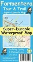
For better adventures, use the best map. Water-proof, split-proof, tear-proof, adventure-proof. Formentera Tour & Trail Super-Durable Map is simply the toughest, most accurate, easy to read, easy to use map of the island you can buy at any price. David & Ros Brawn surveyed this beautiful island carrying out their 'gps ground survey' pinpointing all the details needed to produce the definitive map of Formentera. Large, 25k scale, easy to read map sheet includes a wealth of useful details. 20 metre and 100 metre contours combined with altitude shading bring the Formentera landscape to life. All of the legendary Tour & Trail attention to detail is included so that you will find those petrol stations, mirador viewpoints with parking, refreshment stops with parking and accurate road numbering that are so essential when adventuring by hire car; 'watts' new and unique to Formentera we have included the 'Electric hire car' recharging points making sure you never run out of go. 'Off-Tarmac' Formentera Tour & Trail Map is in a league of its own thanks to all the gps information for the cycling and walking trails plus all of the island's famous beaches are shown and named.Printed on a large 840mm by 620mm super-durable map sheet the island of Formentera at 25,000 scale is on the facing page of the map sheet which folds back to a pocketable 235mm by 120mm when folded.On the reverse side of the map sheet you will find large scale street plans along with a host of useful information to make the most of your time on the island. 'Super-Durable' means a waterproof, tear-proof, map that can take the roughest treatment and still folds up like new after your adventures. Printed on Polyart using specialist 100% oxygenation inks produces a lightweight map that feels like silk but is a tough as old boots as it shrugs off water, resists tearing and damage better than any other map. 'Super-Durable' combined with our special concertina map fold means this 'near indestructible' Tour & Trail Map unfolds easily for use, and more importantly folds back up easily to its compact pocket size even after the toughest use. Digital editions for phone apps and Garmin users are available on the Discovery Walking Guides website.
Engelska, 2018
151 kr
Skickas
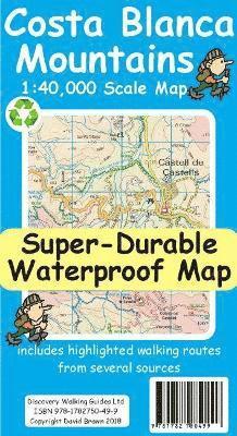
For better adventures, use the best map. Costa Blanca Mountains Tour & Trail Super-Durable Map 2nd edition is the essential map for everyone looking to explore the exciting mountainous hinterland of the Costa Blanca. Whether you are exploring on foot, bike or horse this is your first choice map. Scale 1:40,000 2.5cms = 1km. Double-sided 780mm by 600mm folded to 21cm by 12cm. For the 2nd edition we have carried out a thorough makeover while also adding a large number of walking tracks and trails. Walk! the Costa Blanca Mountains' 37 walking routes are highlighted in red, Official PR/GR walking routes are highlighted in green. For the 2nd edition we have added 72 walking routes from the Costa Blanca Mountain Walkers website maintained by Bob and Jean Hall, these are highlighted in blue. Our red/green/blue highlighting makes it easy to identify your walking routes on the new map. We have also checked that Costa Blanca by Landscapes 13 walking routes are correctly shown, along with 27 walking routes from Costa Blanca by Rother. All the usual details of Tour & Trail Maps are included: Roads; Motorway, major roads, secondary roads, minor roads & tarmacked lanes including latest road numbering system. Tracks & Trails; Unsurfaced (dirt) roads and walking trails. Heights; 100 & 20 metre contours, height & trig points in metres, height background colours in 200 metre colour bands. UTM 1km Grid with WGS84 Datum. The map region is divided into North and South sheets with a generous overlap, and configured so that for the continuation North-South, or South-North, you simply turn the map sheet towards, or away, from you. Super-Durable means we print this map on a special material, using special inks combined with a unique curing to give a map that is as `tough as old boots' and which will take you through the toughest adventures and still fold up like new. DWG back Super-Durable Maps with a 2 Year Adventurous Use guarantee, see our website for details. A special map concertina map fold means your map unfolds easily and more importantly folds back easily to pocket sized folded format. Tour & Trail Super-Durable Maps are fully recyclable. Digital editions of our Costa Blanca Mountains Tour & Trail Map for phone app and Garmin users are available on our Discovery Walking Guides website.
Engelska, 2019
115 kr
Skickas
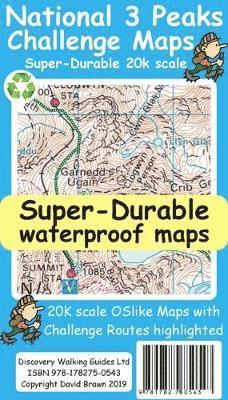
National 3 Peaks Challenge Maps. Ben Nevis, Scafell Pike and Snowdon at 20k scale. Waterproof, tearproof and 100% recyclable 820mm by 420mm double sided map sheet. Taking OS mapping at 50k scale we expand the mapping to produce 20k scale maps of the three challenge peaks, Ben Nevis, Scafell Pike and Snowdon. By expanding the OS mapping the features of names, roads, tracks and trails are more than doubled in size making them easier to read under Challenge conditions. We then add the Challenge Routes, specially highlighted to make them stand out against the OS map background information and add in additional information that will help your challenge. Each map covers the region to show the access roads as well as the walking routes. Ben Nevis includes the Glen Nevis Information Centre starting point and Glen Nevis Youth Hostel starting point. Scafell Pike includes the Wasdale and Seathwaite Challenge Routes. Snowdon includes the Pyg Track, Miners Track and Llamberis Challenge Routes. Each peak is a 420mm by 420mm OSlike map mounted on a double sided map sheet of 840mm by 420mm. The map designs are then printed on a 100 micron plastic substrate using UV cured inks on the UK's only press capable of using this latest technology. The result is a lightweight map that is both waterproof and tearproof, and fully recyclable, that will survive anything your 3 Peaks Challenge can throw at it and afterwards will fold up like new.
Engelska, 2019
151 kr
Skickas
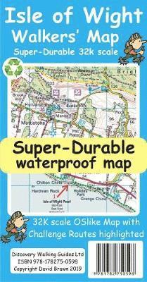
Isle of Wight Walkers' Map at 32k scale with challenge routes and walking trails highlighted. OS 50k scale mapping is expanded in size to produce a 32k map. The OS features, text and logos are now 50% larger making them much easier to read under outdoor conditions. Isle of Wight Challenge Route (66 miles) is specially highlighted in green and white so that the route stands out against the OS background map. Then we add the Earl Mountbatten Hospice's Walk (26.5 miles) highlighted in gold and white. A large range of gps surveyed walking trails are then highlighted in grey and white. The result is an easy to read `OSlike' map with walking trails specially highlighted. We then split the island into East (cover side) and West (reverse side) with a ten mile common overlap to the two sides; meaning you will only have to turn the map over if you are undertaking the longest Challenge or Earl Mountbatten routes. The result is a double sided 840mm by 694mm OSlike Super-Durable Map. We then print the map design on a 100 micron plastic substrate using a special UV curing inks process on the UK's only press capable of using this latest technology. The printed map sheets are then folded using a special concertina map fold to its pocket size of 230mm by 120mm. The result is the Isle of Wight Walkers' Map. A lightweight map that is both accurate and easy to read and use. Super-Durable means your map is waterproof and tearproof, and fully recyclable. This map will survive anything your Isle of Wight Challenges can throw at it and afterwards will fold up like new. Buying the Isle of Wight Walkers' Map also entitles you to receive the Custom Map digital edition of the map as a free download from Discovery Walking Guides.
Engelska, 2019
151 kr
Skickas
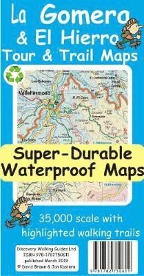
Quite simply La Gomera and El Hierro Tour & Trail Maps are the most detailed, accurate, toughest, easy to read, large scale maps of La Gomera and El Hierro that you can buy. Our map sheet is 840mm by 680mm. On the cover side you get the latest 35k scale 8th edition La Gomera Tour & Trail Map by David Brawn. On the reverse side is our 35k scale 1st edition El Hierro Tour & Trail Map by Jan Kostura. Both maps are produced to our 'Tour & Trail' level of detail ranging from major roads to secondary roads to minor roads to streets and camino rural narrow country roads, plus dirt roads and walking trails. Walking trails are specially highlighted, GR (Gran Recorido trails in green) and Walk La Gomera (in red), making them easier to identify on the maps and easier to find on the ground. Altitude background colouring is designed to clearly show the altitude range when traveling across each island by car or on foot. 100 metre and 50 metre contours, 100m and 20m on El Hierro, are clearly shown on the map along with a large number of individual height points and all of the official 'Trig' points. Tour & Trail attention to detail is legendary as is our useful symbol range including miradors, picnic areas, petrol stations, bar/restaurants and parking areas where you can pull off the road safely.You will easily identify springs, caves, sports grounds, cemeterys, churchs, chapels, lighthouses, towers and forts, camping areas, wind turbines, hotels and those all important information offices. For adventurers on foot Tour & Trail Maps are researched and designed by hikers for use by hikers. Our comprehensive gps ground surveys produce the best road mapping available but the value of this on the ground research becomes even more important when you leave the tarmac. Digital editions of these maps are available on the dwgwalking website. These Super-Durable Maps are printed using UV cured inks printed onto a 100 micron plastic substrate. This produces a Super-Durable map sheet that feels like silk but will stand up to the roughest treatment of outdoor adventuring and yet fold up like new at the end of your adventure. DWG's special concertina map fold means your map is easy to unfold, and easy to fold back to its folded pocket size. Super-Durable Maps come with a 2 year adventurous use wear and tear guarantee. For your best adventures, choose the best map.
Engelska, 2019
151 kr
Skickas
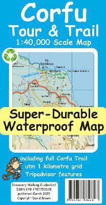
For better adventures, use the best map. Corfu Tour & Trail Super-Durable Map is the most detailed, accurate, toughest, large scale map of the island that you can buy. Our large 1:40,000 scale produces a double sided map sheet of 840mm by 680mm; big enough to show masses of detail but compact enough to use in the car or on the trail. Corfu North is on the facing sheet of the map with Corfu South on the reverse side, including a generous overlap between the two sides. Our special concertina map fold means your map is easy to unfold, and more importantly easy to refold back to its pocket size. You get the most detailed map of Corfu that is produced including our 'Tour & Trail' level of detail ranging from major roads to secondary roads to minor roads to streets and narrow country roads, plus dirt roads and walking trails. We have a new method of highlighting the full Corfu Trail, including its options, with the trails, tracks, lanes and roads making up the Corfu Trail being outlined in green. This makes it easier to identify the Corfu Trail on the map and easier to find it on the ground. Altitude background colouring is designed to clearly show the altitude range when travelling across the island by car or on foot. 100 metre and 20 metre contours are clearly shown on the map along with a large number of individual height points. Tour & Trail attention to detail is legendary as is our useful symbol range including miradors, picnic areas, petrol stations, bar/restaurants and parking areas where you can pull off the road safely. We have included special Place-Name Plaques for Tripadvisor's most popular destinations making them easy to find. For adventurers on foot Tour & Trail Maps are researched and designed by hikers for use by hikers. Our comprehensive gps ground surveys produce the best road mapping available but the value of this on the ground research becomes even more important when you leave the tarmac. Super-Durable editions are printed on a plastic substrate with UV cured inks to produce a Super-Durable Map that feels like silk but will stand up to the roughest treatment of outdoor adventuring and yet fold up like new at the end of your adventure. Quite simply Corfu Tour & Trail Super-Durable Map is the most detailed, accurate, toughest, large scale Corfu map that you can buy. Super-Durable maps are 100% recyclable. Digital editions of Corfu Tour & Trail Map are available for phone apps and Garmin users at our Discovery Walking Guides website.
Engelska, 2019
151 kr
Skickas inom 11-20 vardagar
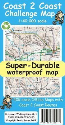
The whole 'Wainwright' Coast to Coast on one double sided, 960mm by 694mm, map sheet. All 193 miles (308 kilometres) of the Wainwright route along with its alternatives are highlighted across 9 map sections at 40k scale. Ordnance Survey accuracy is combined with Tour & Trail map design to produce 40k scale map sections which are easy to read. OS 50k Landranger mapping is expanded to 40k scale making the text and features over 40% larger making them easy to read and understand. Wainwright's C2C walking routes, and their alternatives, are specially highlighted in Tour & Trail style making the routes easy to find on the map and on the ground. Public `Rights of Way' paths and bridleways are also highlighted in Tour & Trail style making them easy to recognise and find. Coast 2 Coast Challenge Map design is then printed on Polyart using 100% oxygenation inks to produce a lightweight, Super-Durable, waterproof map that is tough enough to shrug off the worst that the C2C can subject it to and still fold up like new at the end of each day. In addition to the Super-Durable printed map, Discovery Walking Guides offers you a free `C2C Digital Resources Package'. Simply follow the instructions on the map to receive a download link to the zip file, which contains all 9 map sections as digital Custom Map editions in kmz file format along with 13 gpx waypoint files covering the 13 stages of the C2C. Combining the Super-Durable Map with the Digital Resources Package gives you trouble free navigation for the whole C2C Challenge route from St Bees to Robin Hood's Bay.
Engelska, 2019
151 kr
Skickas inom 11-20 vardagar
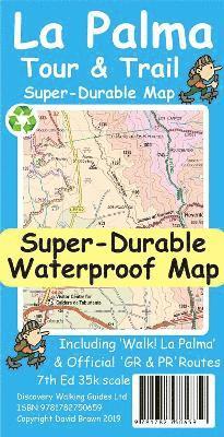
For the best adventures, use the best map. Water-proof, split-proof, tear-proof, adventure-proof. La Palma Tour & Trail Super-Durable Map 7th edition is simply the toughest, most accurate, easy to read, easy to use map of the island you can buy at any price. Super-Durable Maps come with a 2 year adventurous use `Wear and Tear' guarantee. 7th Edition of our La Palma Tour & Trail Super-Durable Map is a large 1:40,000 scale map, plus you can get digital editions from dwgwalking.co.uk . Splitting the island into a North (Landscape view) and South (Portrait view) with a generous overlap, produces a double sided map of 900mm by 700mm which folds to 235mm by 120mm. Our legendary 'Tour & Trail' level of detail ranges from major roads to secondary roads to minor roads to streets and camino rural narrow country roads, plus dirt roads and walking trails. Altitude background colouring is designed to clearly show the altitude range when travelling across the island by car or on foot. 100 metre and 50 metre contours are clearly shown on the map, along with a large number of individual height points and all of the official 'Trig' points. Tour & Trail attention to detail includes our useful symbol range including miradors, picnic areas, petrol stations, bar/restaurants and parking areas where you can pull off the road safely. You will easily identify springs, caves, sports grounds, cemeteries, churches, chapels, lighthouses, towers and forts, camping areas, wind turbines, hotels etc. For adventurers on foot Tour & Trail Maps are researched and designed by hikers for use by hikers. Our comprehensive gps ground surveys produce the best road mapping available but the value of this on the ground research becomes even more important when you leave the tarmac. All of our DWG walking routes are accurately gps surveyed, giving you confidence in the accuracy of our Tour & Trail Maps. La Palma Tour & Trail Super-Durable Map includes all the walking routes from Walk! La Palma (highlighted in red) along with the GR130 (in eight one day sections) and GR131 (in three one day sections) long distance hiking routes (highlighted in green), plus details of the PR walking routes (Pequeno Recoridos, highlighted in purple), plus details of the SL walking routes (Senderos Locales). It all adds up to the most detailed, most durable, most useful map of La Palma that you can buy anywhere. 'Super-Durable' means a waterproof, tear-proof, map that can take the roughest treatment and still folds up like new after your adventures. Our special concertina map fold means this 'near indestructible' Tour & Trail Map unfolds easily for use, and more importantly folds back up easily to its compact pocket size even after the toughest use. Digital editions of Tour & Trail Maps for phone apps and Garmin users are available on the dwgwalking website.
Engelska, 2020
91 kr
Skickas
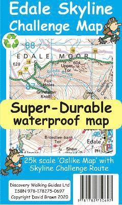
Edale Skyline Challenge is the most scenic of challenge routes thanks to the ridge line nature of its route. At just over 20 miles with a 10 hour challenge time it is suitable for fit leisure walkers as a great day out in good weather; in bad weather it really is a challenge. Free digital app and gps editions included in your purchase To produce our Edale Skyline Challenge Map first we licence Ordnance Survey 50k scale mapping. Then we double it in size to produce a 25k map. Now the OS map features, text and logos are doubled in size making for a map with outstanding clarity which is easy to read under challenge conditions. The Skyline Challenge Route, with its options, are added and specially highlighted so that the challenge route stands out against the OS background map. Then we add any additional detail you might need. The result is a 600mm by 400mm 25k scale map with outstanding clarity and durability. Our special concertina map fold means the map is easy to unfold and to refold to its pocketable 200mm by 120mm folded size.On the reverse of the map sheet we present our detailed Challenge Route description complete with distances and timings for the sections of the route along with the 44 waypoints which define the challenge.We then print the map design on a 100 micron plastic substrate using a special UV curing inks process on the UK's only press capable of using this latest technology. The result is a lightweight map that is both waterproof and tearproof, and fully recyclable, that will survive anything your Challenge can throw at it and afterwards will fold up like new.In addition to our printed Challenge Map we offer you a choice of free digital editions for use with Viewranger and Locus apps and Garmin software and gps units (including Google Earth). We also include the gpx waypoint file for the 44 waypoints in our detailed route description. See the information on the reverse of the map for details of how to download your free digital edition map and gpx waypoint file. After downloading you will have the complete package of Edale Skyline Challenge Map, choice of digital edition Map and gpx file of the waypoints to aid your navigation.
Engelska, 2020
151 kr
Skickas
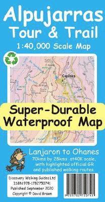
For the best adventures, use the best map. The Moorish white villages of the Alpujarras are well known to day trippers from the Costa del Sol. For walkers this is an idyllic region with stone-laid donkey trails linking the tipico villages and stretching up the southern slopes of the Sierra Nevada to Mulhacen; at 3,483 metres the highest mountain peak on mainland Spain. From Spring to the end of Autumn this is a paradise for hikers, whether you are walking from village to village sampling the local delicacies or tackling the challenging major ascents. One thing you will know is that using the Alpujarras Tour & Trail Map will help you plan, and get the best out of, your adventures. On a large 960mm by 700mm, double sided, map sheet at 40k scale this map has all the detail you need including 20 and 100 metre contours, combined with altitude shading, giving you a true feel to this impressive landscape stretching from west of Lanjaron to Ohanes in the east taking in the Poqueira and Trevelez valleys, while going north to include Mulhacen and Veleta mountain peaks along with the Sierra Nevada ski area. The GR240, GR142 & GR7 (official long distance hiking routes) are specially highlighted (in green) along with all the walking routes from Walk! the Alpujarras guidebook (in red). Our new edition Alpujarras Tour & Trail Map covers an area of 70 kms (E-W) by 28 kms (N-S); more than twice the land area of our earlier editions. A special 'Concertina Map Fold' makes Tour & Trail Maps easy to use, and more importantly easy to fold back to their handy pocket size. Digital editions of Alpujarras Tour & Trail Map are available for phone apps and Garmin users on our Discovery Walking Guides website. Tour & Trail Super-Durable Maps are printed on a specially finished plastic substrate using special inks which produces a lightweight map that feels like silk while being both water-proof and incredibly tough so that after even the toughest of adventures your Tour & Trail Super-Durable Map will fold up like new. Super-Durable Maps come with a 2 year adventurous use wear and tear guarantee. All the materials used for this map are 100% recyclable in category 2 HDPE.
Engelska, 2022
115 kr
Skickas
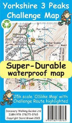
Yorkshire 3 Peaks Challenge Map and Guide at 25k scale with challenge route specially highlighted. We licence OS 50k scale mapping which is then doubled in size to produce a 25k map but the features, text and logos are now doubled in size making them much easier to read under challenge conditions. Y3P 12 Hour Challenge Route is added and specially highlighted so that the route stands out against the OS background map. Then we add the additional detail you might need including the popular Challenge starting points of the Pen Y Ghent Cafe (Horton), Station Inn (Ribblehead) and the Hill Inn (Chapel-le-Dale). Then we add the four parts of our Challenge Guide; 1 Horton to Pen-y-ghent, 2 Pen-y-ghent to Whernside, 3 Whernside to Ingleborough, 4 Ingleborough to Horton. The gps track and 47 waypoints (highlighted on the map) of our Challenge is available as a free gpx file download, and can be used on all gps phone apps and gps units. On the reverse of the map sheet is our Locator Map using OS Opendata showing the location of, and access to, the Yorkshire 3 Peaks Challenge relative to a wide area of England. The result is a double sided 600mm by 600mm map design. We then print the map design on a 100 micron plastic substrate using a special UV curing inks process on the UK's only press capable of using this latest technology. The result is a lightweight map that is both waterproof and tearproof, and fully recyclable, that will survive anything your Yorkshire 3 Peaks Challenge can throw at it and afterwards will fold up like new.
Engelska, 2022
67 kr
Skickas
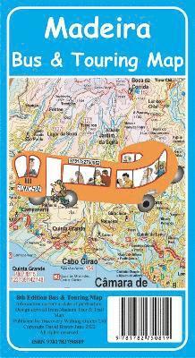
Madeira Bus & Touring Map - 8th Edition. Madeira's most popular map has been updated for its 8th edition. Madeira Island road map, at 60k scale, based on our latest Madeira Tour & Trail Map (40k scale) is combined with a Greater Funchal Street Plan showing the horario publico Funchal bus service. We have our 'Funchal Hotel Locator' index of over 60 hotels so that you can quickly find where your Funchal hotel is located. Timetable details for the country bus services operated by SAM Buses, Rodoeste Buses, Transportes Publicos Interurbana Service and Automoveis do Canico. This is a big map, 840mm by 600mm, printed on top quality map paper by one of the UK's top map printers. If you don't need the off - tarmac detail of our Madeira Tour & Trail Map then our Madeira Bus & Touring Map 8th Edition contains all the information you need for planning your touring around the 'Garden Isle' by bus or hire car.
Engelska, 2022
115 kr
Skickas
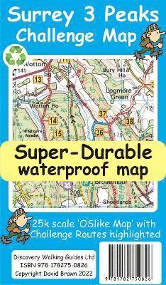
All hiking challenges are personal, yourself against the required completion time. A successful Challenge is a personal triumph. With its easy access, and ten hours target time, the Surrey 3 Peaks Challenge can be completed in a single (long) day if you are within commuting distance of Dorking.The Surrey Hills is an 'Area of Outstanding National Beauty'. It is difficult to think of anywhere more picturesque in which to undertake a walking Challenge. With all this natural beauty to hand do not forget that this is a Challenge, requiring a good level of fitness, good navigation, suitable clothing and footwear, along with refreshments and water to consume during our Challenge adventure. If you are new to Challenge walks you might consider our Rutland Water Challenge a first step in your long distance walking before tackling the Surrey 3 Peaks.Surrey 3 Peaks Challenge Map and Guide is a 25k scale OSlike map with the Challenge route specially highlighted. We licence OS 50k scale mapping which is then doubled in size to produce an OSlike 25k map but the features, text and logos are now doubled in size making them much easier to read under Challenge conditions. Our preferred Challenge Route, and two slightly different alternatives, are added and specially highlighted so that our route stands out against the OSlike 25k map. Gps track and waypoints for the three routes are available to download as gpx files in a zip file. The 50 waypoints of our Challenge route are highlighted on the map. These gpx files can be used with all gps phone apps and gps units. A digital Custom Map edition of our Surrey 3 Peaks map is available as a free download for use by Garmin users.On the reverse of the map sheet is our Locator Map using OS Opendata showing the location of, and access to, Surrey 3 Peaks relative to a wide area of southern England. The result is a double sided 600mm by 600mm map design. We then print the map design on a 100 micron plastic substrate using a special UV curing inks process on the UK's only press capable of using this latest technology. The result is a lightweight map that is both waterproof and tearproof, and fully recyclable, that will survive anything your Surrey 3 Peaks Challenge can throw at it and afterwards will fold up like new.
115 kr
Tillfälligt slut
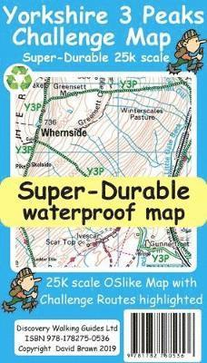
Yorkshire 3 Peaks Challenge Map at 25k scale with challenge routes highlighted. Waterproof, tearproof and recyclable.
Engelska, 2022
115 kr
Tillfälligt slut
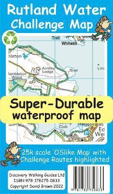
Rutland Water is the UK's largest man-made lake set in 4,200 acres of parkland including a wide, hard surfaced, walkway making the 'Water' an ideal introduction to long distance walking. There are four official, family friendly, recreation centres and nature reserves including the Rutland Osprey Project. Add in picturesque villages and the town of Oakham and you will soon understand why Rutland Water has become one of England's favourite 'Daycation' destinations.Rutland Water Challenge Map and Guide is a 25k scale OSlike map with the Challenge route specially highlighted. We licence OS 50k scale mapping which is then doubled in size to produce an OSlike 25k map but the features, text and logos are now doubled in size making them much easier to read under Challenge conditions. Rutland Water Challenge Route is added and specially highlighted so that our route stands out against the OSlike 25k map. Then we add the additional detail you might need including local hostelries along with the three walking routes; Hambleton Peninsula 8.3kms, Circular 24.5kms and the full Challenge route at 36kms. For each of the three routes we have gps track and waypoints as a gpx file; the zip file of the gpx files is available as a free download. These gps track and waypoints gpx files can be used on all gps phone apps and gps units. The 33 waypoints of the full Challenge route are highlighted on the map, and our Rutland Water Challenge Map is available as a free digital Custom Map download for Garmin gps users. On the reverse of the map sheet is our Locator Map using OS Opendata showing the location of, and access to, Rutland Water relative to a wide area of England. The result is a double sided 600mm by 600mm map design. We then print the map design on a 100 micron plastic substrate using a special UV curing inks process on the UK's only press capable of using this latest technology. The result is a lightweight map that is both waterproof and tearproof, and fully recyclable, that will survive anything your Rutland Water Challenge can throw at it and afterwards will fold up like new.
Häftad, 2006
66 kr
Tillfälligt slut
The exercises using OS mapping and BNG co-ordinates deals with the GPS navigation for walkers. Exercises are replicated in the user's own region of UK. This is the 2nd edition of UK's best selling GPS manual.