
Winston Ramsey – författare
Visar alla böcker från författaren . Handla med fri frakt och snabb leverans.
6 produkter
6 produkter
E-bok
Engelska, 2021257 kr
Läs direkt efter köp
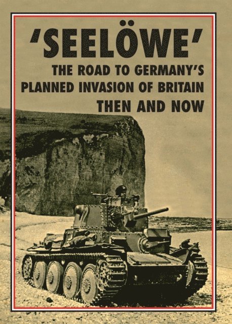
In July 1940 Britain faced the very real possibility of being invaded by Germany. Hitler’s war machine had subjugated the Continent in six weeks and ‘Engeland’ was next on the list. The German Navy had been working on the logistics for a seaborne invasion of England since the autumn of 1939, just in case it was sprung on them at short notice some time in the future. In July 1940 the operation was given the code-name ‘Seelöwe’ (Sealion) which was to be mounted from French, Belgian and Dutch ports on the Channel coast. However, arguments between the German Army, Navy and Air Force took weeks to resolve, yet in the end it was the failure of Hermann Göring’s Luftwaffe to achieve air supremacy over the Royal Air Force that prevented the invasion becoming a reality. In this book we recount the story right from the beginning, covering all the significant events in the months from August 1939, through the build-up in the summer months, to October 1940 when Hitler accepted that orders must be given to postpone ‘Seelöwe’.

E-bok
PDF, Engelska, 2021257 kr
Läs direkt efter köp
In July 1940 Britain faced the very real possibility of being invaded by Germany. Hitler's war machine had subjugated the Continent in six weeks and 'Engeland' was next on the list. The German Navy had been working on the logistics for a seaborne invasion of England since the autumn of 1939, just in case it was sprung on them at short notice some time in the future. In July 1940 the operation was given the code-name 'Seelowe' (Sealion) which was to be mounted from French, Belgian and Dutch ports on the Channel coast. However, arguments between the German Army, Navy and Air Force took weeks to resolve, yet in the end it was the failure of Hermann Goring's Luftwaffe to achieve air supremacy over the Royal Air Force that prevented the invasion becoming a reality. In this book we recount the story right from the beginning, covering all the significant events in the months from August 1939, through the build-up in the summer months, to October 1940 when Hitler accepted that orders must be given to postpone 'Seelowe'.
Häftad, Engelska, 2022
187 kr
Skickas
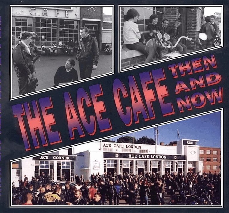
During the 1960s swarms of motorcyclists roamed along London's North Circular Road in nightly burn ups. Their pit stop was the Ace Cafe at Stonebridge Park. This is their story as told by the boys who raced and the policemen who chased, woven against a background of contemporary reports.
Inbunden, Engelska, 2017
402 kr
Skickas
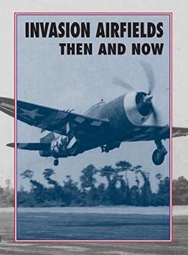
In his 1945 report to the Combined Chiefs-of-Staff on the success of Operation `Overlord', the Supreme Commander General Eisenhower wrote that `on the morning of June 9 I was able to announce that for the first time since 1940, Allied air forces were operating from France, and that within three weeks of D-Day, 31 Allied squadrons were operating from the beach-head bases'.In their forecasts for the first three months following D-Day, the planners plotted the number of the advanced landing grounds that would be required in Normandy to support the Allied air forces up to September 1944. Using maps andaerial photographs, individual sites were surveyed and plans drawn up so that when each location was captured, eitherUS Aviation Engineers, the Royal Engineers or RAF Airfield Construction Wings, could move in without delay to begin work to build them.This book tells the story of every airfield that became operational by D+90, explaining the methods used to construct them and the units that flew from them. The vast majority of the temporary airstrips have now been returned to the farmland from which they came, but by using engineers' plans from the period and modern aerial photographs, we have portrayed the sites in true After the Battle fashion: as they were then and as they are today.
Inbunden, Engelska, 2022
483 kr
Skickas
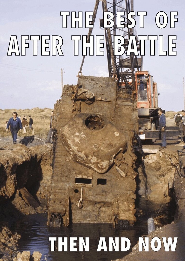
It was nearly half a century ago that After the Battle first began visiting the battlefields of the Second World War, matching up photographs of the period with their present-day comparisons. Our 'then and now' theme caught on with like-minded readers around the world, all interested to know what the places looked like today - as we say 'keeping history alive'. Searching for the locations where the wartime captions were imprecise, took much time, and there were occasions when a whole day might be spent in pin-pointing where a particular photograph had been taken. No stone was left unturned if a particular comparison was important to illustrate the story, even if it meant a special visit to take one photo. Most of the battlefields have changed over the years so it has been our intention where possible to illustrate many of the places with new colour comparisons rather than use those in the original story, many of which were taken in the old black and white days. Since we launched our first edition in August 1973, After the Battle has travelled around the globe and has covered hundreds of battles - over 750 at the last count and taken thousands of photographs, covering major operations down to individual exploits. Selecting a cross-section of just a few from the stories that we have covered has not been easy, but we hope that you will find some of your favourites within the pages of this volume, covering the best of After the Battle. 750 illustrations
Inbunden, Engelska, 2020
447 kr
Skickas
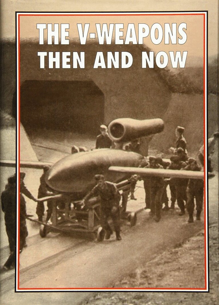
Day-by-day listings are included covering the locations in Britain where every V1 was either destroyed or where they impacted, plus those for all the V2s. Illustrated with many censored photographs from the period, 'then and now' comparisons bring history alive to illustrate the passage of time over the intervening years. 750 illustrations