
Ronny H�nsch – författare
Visar alla böcker från författaren . Handla med fri frakt och snabb leverans.
2 produkter
2 produkter
Häftad, Engelska, 2025
1 677 kr
Skickas inom 10-15 vardagar
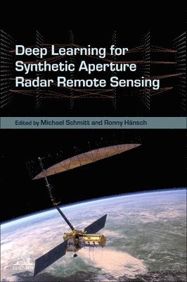
Deep Learning for Synthetic Aperture Radar Remote Sensing delves into the transformative synergy between synthetic aperture radar (SAR) and cutting-edge machine learning techniques. Traditionally rooted in signal processing, SAR's active imaging capabilities rise above optical limitations, offering resilience to environmental factors like cloud cover. This book showcases how machine learning augments every stage of SAR image processing, from raw data refinement to advanced information extraction. Through comprehensive coverage of acquisition modes and processing methodologies, including polarimetry and interferometry, this book equips readers with the tools to harness SAR's full potential. Aiming to further enhance remote sensing imaging, it serves as a vital resource for those seeking to integrate SAR data seamlessly into the modern machine learning landscape. Deep Learning for Synthetic Aperture Radar Remote Sensing addresses a critical gap in the intersection of SAR technology and machine learning, offering a pioneering roadmap for researchers and practitioners alike. With its emphasis on modern techniques, it serves as a catalyst for unlocking SAR's untapped potential and shaping the future of Earth observation.Combines Synthetic Aperture Radar and Machine Learning/Deep Learning, addressing a highly innovative fieldCovers the complete life-cycle of an SAR image from creation over enhancement to analysis instead of focusing on only one aspectProvides a holistic view of the application of DL to SAR, addressing the unique properties and challenges of SAR
- Nyhet
Häftad, Engelska, 2026
1 726 kr
Skickas inom 10-15 vardagar
GeoAI for Earth Observation Imagery: Fundamentals and Practical Applications comprehensively covers methodologies of AI and Machine Learning applications of image processing for Earth Observation (EO) Imagery. As traditional image processing methods face challenges with handling vast volumes of EO imagery, leading to efficiencies and limitations when extracting meaningful insights, AI-driven approaches can enhance the efficiency, accuracy, and scalability of image processing. Chapters cover essential methodologies including atmospheric compensation, image enhancement techniques like deblurring and superresolution, and advanced analysis methods such as semantic segmentation and object detection.Cutting-edge approaches to computing, automating, and optimizing image processing tasks are also covered. Additionally, emerging trends in GeoAi and their implication on future research are reviewed. The book serves as an essential guide for navigating the complexities of spatial data and equips readers with knowledge to enhance their analytical capabilities.Examines the essentials of image preprocessing, enhancement, analysis, and computing techniques tailored for EO imageryProvides an introductory resource for implementing AI for EO image analysisDemonstrates practical deployment of GeoML methodologies through case studies