
Urban Good – författare
Visar alla böcker från författaren Urban Good. Handla med fri frakt och snabb leverans.
11 produkter
11 produkter
108 kr
Skickas inom 7-10 vardagar
87 kr
Skickas inom 7-10 vardagar
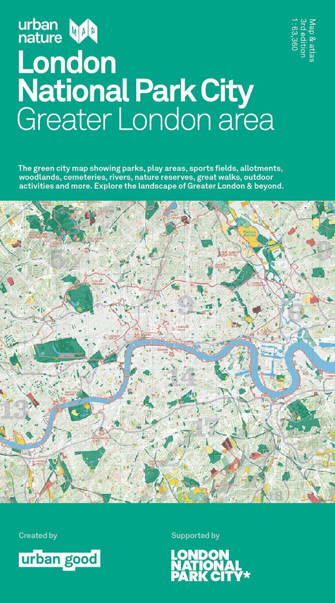
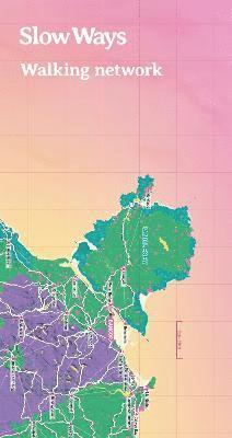
2nd Edition, double-sided, folded map (2023) Slow Ways is a grassroots initiative to create a national network of walking routes that connect all of Great Britain's towns and cities as well as thousands of villages. This giant network is being co-created and drawn by thousands of volunteers. We want to make it easier for people to imagine, plan and enjoy walking journeys - and we'd love your help to do that. The maps are big, bold, beautiful and designed to inspire and support people imagine, plan and share journeys. The map is great for: imagining, planning journeys, drawing on, using as a companion to the website, marking Slow Ways you plan to walk, recording routes you have walked, learning about active travel in schools, making walls look fantastic! The map highlights and celebrates our National Parks, Areas of Outstanding Natural Beauty, cities and towns - with all the Slow Ways walking paths that connect them.
87 kr
Skickas inom 7-10 vardagar
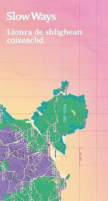
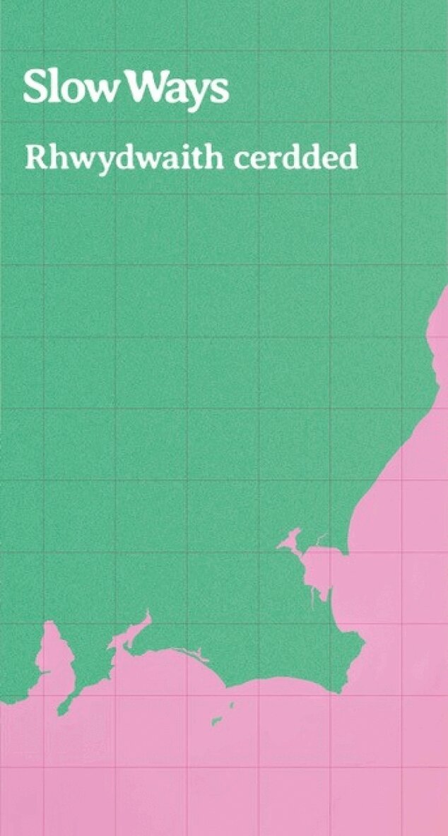
Mae Slow Ways yn fenter i greu rhwydwaith genedlaethol o lwybrau cerdded sy'n cysylltu holl drefi a dinasoedd Prydain Fawr yn ogystal a miloedd o bentrefi. Hyd yma, mae gwirfoddolwyr wedi rhannu dros 8,000 o lwybrau posib. Gallwch ein helpu yn rhwydd iawn, trwy gerdded ein llwybrau, rhannu eich profiadau ag eraill a phostio adolygiadau ar ein gwefan.Is e iomairt a th' ann an Slow Ways airson lionra naiseanta de shlighean coiseachd a chruthachadh, a tha a' co-cheangal bhailtean beaga is mora Bhreatainn a thuilleadh air na miltean de bhailtean-fearainn. Gu ruige seo, tha saor-thoilich air corr air 8000 slighe a tha comasach a cho-roinn. Faodaidh sibh cuideachadh le bhith direach a' coiseachd nan slighean, a' roinn ur fiosrachaidh le cach agus a' postadh ath-sgrudaidhean air an laraich-lin againn.
87 kr
Skickas inom 7-10 vardagar
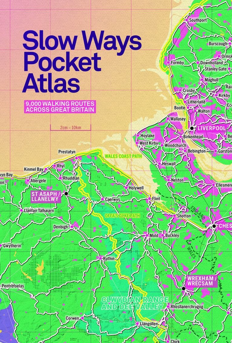
Slow Ways Pocket Atlas
An atlas of walking routes connecting all of Britain's towns, cities and national landscapes.
Häftad, Engelska, 2024
136 kr
Skickas inom 7-10 vardagar
Discover a network of over 9,000 walking routes connecting all of Britain's towns, cities and national landscapes. This bright and beautiful new collection of maps shows every Slow Way route in Great Britain, which between them join up 2,500 settlements via 130,000km of existing paths, lanes and trails. Use the pocket atlas to dream of journeys. Colour in where you've been or where you'd like to go. This pocket atlas has been made thanks to thousands of people. Contributors have volunteered hundreds of thousands of hours plotting, walking, wheeling, testing and reviewing the routes. This book accompanies the Slow Ways website which includes more routes and over 1.5 million words of route-specific guidance from people who have already walked or wheeled them. In this atlas you can find out more about the Slow Ways movement, how it is changing what we think is possible, and creating a network of connection and joy!
171 kr
Skickas inom 7-10 vardagar
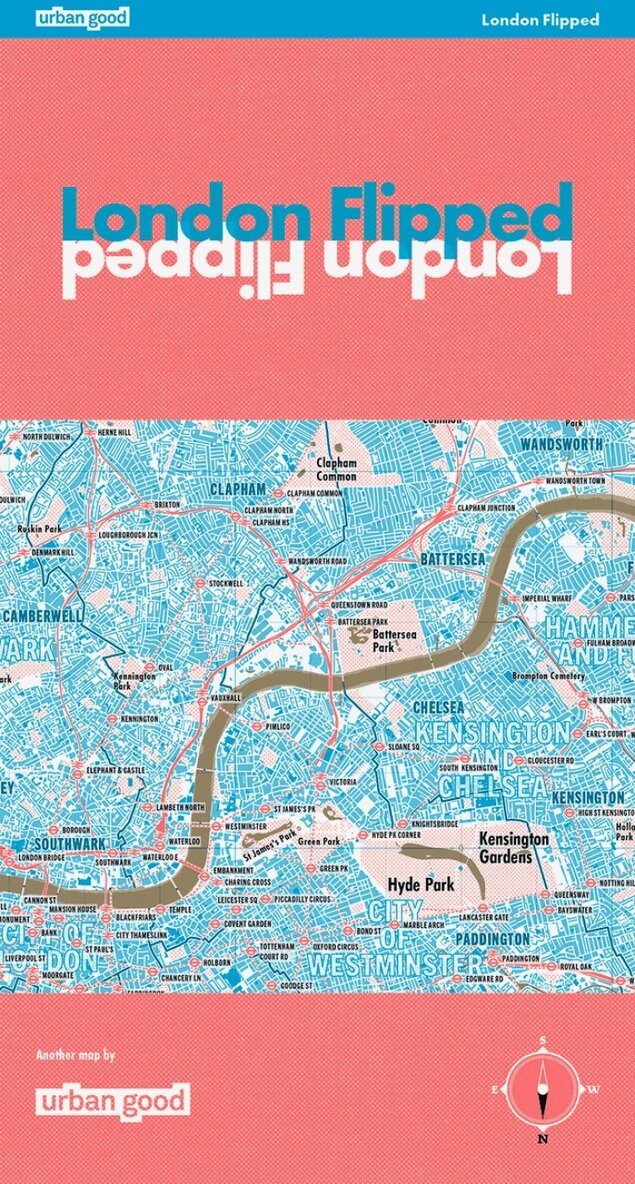
The first full-size map of London drawn upside-down - this map surprises even those most familiar with the capital's cartography. It is a true, topographical map covering the whole of Greater London and its surroundings, but rotated 180 Degrees. With south at the top and north at the bottom, this map challenges conventional perspectives and helps people re-imagine London without the perverse and pervasive bias of north-up.The underground and overground rail networks help situate the map-reader spectacularly. Parks, woods, and open spaces form novel geometries that reawaken. Three recognisable London edges are imposed, and the water has turned gold!Printed in the same format as Ordnace Survey Explorer maps, over a meter wide, this paper map will look great on a wall or in the readers hands. Every station is marked and labeled along with hundreds of the key parks, woods and open spaces across the city. The waterways, lakes and ponds are drawn in gold. A great gift for anyone London-curious.
- Nyhet
116 kr
Skickas inom 7-10 vardagar
This map offers a different way to explore Bristol.It brings together the rivers you can follow, the hills you can climb, the woods you can wander through, and the green spaces woven through everyday streets. Seen this way, the city becomes a connected landscape rather than a collection of destinations.Use it to find a new way across Bristol. Take a longer route home. Walk a river you’ve never noticed, or cycle out along a green corridor and see where it leads. The map makes it easy to explore without over-planning, and often works best when you let it reshape your routine. It is an alternative guidebook for visitors, and helps residents see their city anew.Turn it over and the atlas on the back offers ideas rather than instructions: seasonal moments, small adventures, and ways to engage with the city’s wildlife and landscapes. Nothing prescriptive, just prompts to help you look again.Printed on durable paper with vivid fluorescent inks, it’s designed to be used — folded into a bag, taken out on a walk, marked, shared.For those who like to explore as they go, and for anyone who wants to see more of Bristol than they expected.Printed on the same press as Ordnance Survey maps, it is a large-format (950 × 1270mm), high-quality, folded map – custom drawn to highlight all the places to explore on foot or by bike. A little bit about this map:It shows Bristol as a city of nature, bringing its green and blue spaces to the fore – its parks, woodlands, playing fields, nature reserves, rivers, and estuary. It incorporates walk and cycle travel options, places to take in views, and other outdoor activities. It shows open space rather than roads and buildings.On the reverse is an atlas of information, graphics, and ideas. Bristol Urban Nature Map aims to stimulate us to see the city differently: to think more deeply about the city as a place, and our place in it. It’s a resource to encourage more awareness and more action for people and nature…to help put nearby nature in everyday lives.
116 kr
Skickas inom 7-10 vardagar
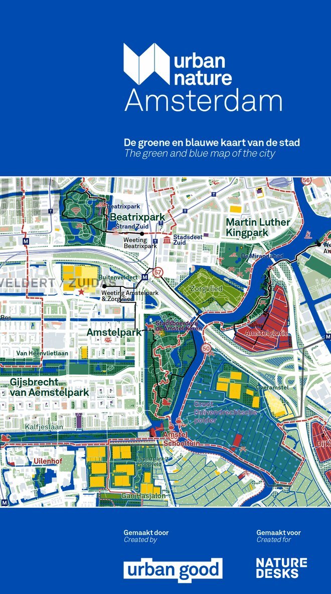
Urban Good Maps make green city maps that celebrate open space, walking and natural heritage in cities. The unique and eye-catching, colourful lay-out outlines walks, trails and identifies green spots, water spots and sports and activities center. Ideal for any city-dwellers in search of nature.A large-format, folded paper map with a protective card cover. Printed by the best cartographic press in the UK with special pantone inks to highlight amazing walks and fun activities. Double-sided, with a city atlas on the reverse. It shows Amsterdam and the surrounding areas in detail as a green and blue landscape fit for outdoor exploration.
116 kr
Skickas inom 7-10 vardagar
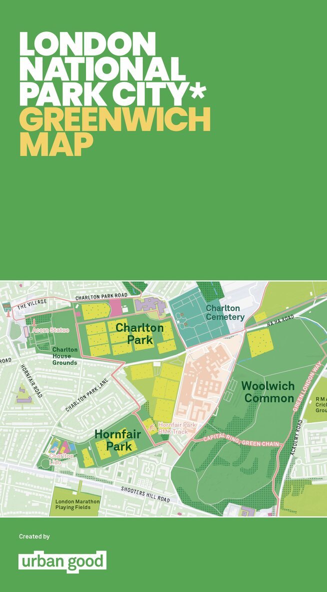
Urban Good Maps make green city maps that celebrate open space, walking and natural heritage in cities. The unique and eye-catching, colourful lay-out outlines walks, trails and identifies green spots, water spots and sports and activities center. Ideal for any city-dwellers in search of nature.A large-format, folded paper map with a protective card cover. Printed by the best cartographic press in the UK with special pantone inks to highlight amazing walks and fun activities. Double-sided, with a city atlas on the reverse. It shows Greenwich and the surrounding areas in detail as a green and blue landscape fit for outdoor exploration.
116 kr
Skickas inom 7-10 vardagar
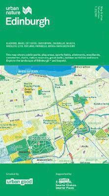
A large-format, folded paper map with a protective card cover. Printed by the best cartographic press in the UK with special pantone inks to highlight amazing walks and fun activities. Double-sided, with a city atlas on the reverse. It shows Edinburgh and the surrounding areas in detail as a green and blue landscape fit for outdoor exploration.
116 kr
Skickas inom 7-10 vardagar
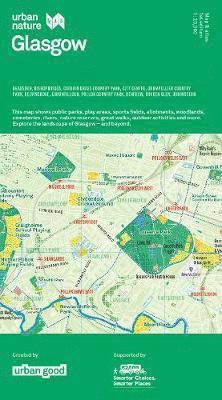
A large-format, folded paper map with a protective card cover. Printed by the best cartographic press in the UK with special pantone inks to highlight amazing walks and fun activities. Double-sided, with a city atlas on the reverse. It shows Glasgow in detail as a green and blue landscape fit for outdoor exploration.