
Mapping Science Committee – författare
1 301 kr
Skickas
600 kr
Skickas

664 kr
Läs direkt efter köp
National Land Parcel Data looks at the current status of land parcel data in the United States. The book concludes that nationally integrated land parcel data is necessary, feasible, and affordable. It provides recommendations for establishing a practical framework for sustained intergovernmental coordination and funding required to overcome the remaining challenges and move forward.

505 kr
Läs direkt efter köp
Comprehensive and authoritative baseline geospatial data content is crucial to the nation and to the U.S. Geological Survey (USGS). The USGS founded its Center of Excellence for Geospatial Information Science (CEGIS) in 2006 to develop and distribute national geospatial data assets in a fast-moving information technology environment. In order to fulfill this mission, the USGS asked the National Research Council to assess current GIScience capabilities at the USGS, identify current and future needs for GIScience capabilities, recommend strategies for strengthening these capabilities and for collaborating with others to maximize research productivity, and make recommendations regarding the most effective research areas for CEGIS to pursue. With an initial focus on improving the capabilities of The National Map, the report recommends three priority research areas for CEGIS: information access and dissemination, data integration, and data models, and further identifies research topics within these areas that CEGIS should pursue. To address these research topics, CEGIS needs a sustainable research management process that involves a portfolio of collaborative research that balances short and long term goals.

278 kr
Läs direkt efter köp
The National Geospatial-Intelligence Agency (NGA) within the Department of Defense has the primary mission of providing timely, relevant, and accurate imagery, imagery intelligence, and geospatial information—collectively known as geospatial intelligence (GEOINT)—in support of national security. In support of its mission, NGA sponsors research that builds the scientific foundation for geospatial intelligence and that reinforces the academic base, thus training the next generation of NGA analysts while developing new approaches to analytical problems. Historically, NGA has supported research in five core areas: (1) photogrammetry and geomatics, (2) remote sensing and imagery science, (3) geodesy and geophysics, (4) cartographic science, and (5) geographic information systems (GIS) and geospatial analysis. Positioning NGA for the future is the responsibility of the InnoVision Directorate, which analyzes intelligence trends, technological advances, and emerging customer and partner concepts to provide cutting-edge technology and process solutions. At the request of InnoVision, the National Research Council (NRC) held a 3-day workshop to explore the evolution of the five core research areas and to identify emerging disciplines that may improve the quality of geospatial intelligence over the next 15 years. This workshop report offers a potential research agenda that would expand NGA''s capabilities and improve its effectiveness in providing geospatial intelligence.
404 kr
Läs direkt efter köp
The National Geospatial-Intelligence Agency (NGA) within the Department of Defense has the primary mission of providing timely, relevant, and accurate imagery, imagery intelligence, and geospatial information—collectively known as geospatial intelligence (GEOINT)—in support of national security. In support of its mission, NGA sponsors research that builds the scientific foundation for geospatial intelligence and that reinforces the academic base, thus training the next generation of NGA analysts while developing new approaches to analytical problems. Historically, NGA has supported research in five core areas: (1) photogrammetry and geomatics, (2) remote sensing and imagery science, (3) geodesy and geophysics, (4) cartographic science, and (5) geographic information systems (GIS) and geospatial analysis. Positioning NGA for the future is the responsibility of the InnoVision Directorate, which analyzes intelligence trends, technological advances, and emerging customer and partner concepts to provide cutting-edge technology and process solutions. At the request of InnoVision, the National Research Council (NRC) held a 3-day workshop to explore the evolution of the five core research areas and to identify emerging disciplines that may improve the quality of geospatial intelligence over the next 15 years. This workshop report offers a potential research agenda that would expand NGA''s capabilities and improve its effectiveness in providing geospatial intelligence.
892 kr
Läs direkt efter köp
National Land Parcel Data looks at the current status of land parcel data in the United States. The book concludes that nationally integrated land parcel data is necessary, feasible, and affordable. It provides recommendations for establishing a practical framework for sustained intergovernmental coordination and funding required to overcome the remaining challenges and move forward.
555 kr
Läs direkt efter köp
A Geospatial Framework for the Coastal Zone National Needs identifies and suggests mechanisms for addressing national needs for spatial information in the coastal zone. It identifies high priority needs, evaluates the potential for meeting those needs based on the current level of effort, and suggests steps to increase collaboration and ensure that the nation''s need for spatial information in the coastal zone is met in an efficient and timely manner.

723 kr
Läs direkt efter köp
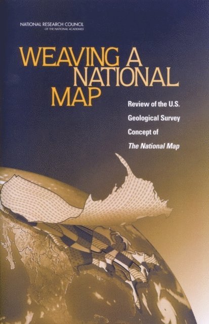
Weaving a National Map draws on contributions to a September 2002 workshop and the U.S. Geological Survey''s (USGS) "vision" document for The National Map, envisioned by the USGS as a database providing "public domain core geographic data about the United States and its territories that other agencies can extend, enhance, and reference as they concentrate on maintaining other data that are unique to their needs." The demand for up-to-date information in real time for public welfare and safety informs this need to update an aging paper map series that is, on average, 23 years old. The NRC report describes how The National Map initiative would gain from improved definition so that the unprecedented number of partners needed for success will become energized to participate. The challenges faced by USGS in implementing The National Map are more organizational than technical. To succeed, the USGS will need to continue to learn from challenges encountered in its ongoing pilot studies as well as from other federal-led programs that have partnered with multiple sectors.

723 kr
Läs direkt efter köp
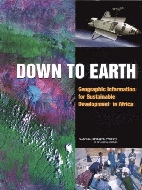
In 1992, world leaders adopted Agenda 21, the work program of the 1992 U.N. Conference on Environment and Development. This landmark event provided a political foundation and action items to facilitate the global transition toward sustainable development. The international community marked the tenth anniversary of this conference in Johannesburg, South Africa, in August 2002. Down to Earth, a component of the U.S. State Department''s "Geographic Information for Sustainable Development" project for the World Summit, focuses on sub-Saharan Africa with examples drawn from case-study regions where the U.S. Agency for International Development and other agencies have broad experience. Although African countries are the geographic focus of the study, the report has broader applicability. Down to Earth summarizes the importance and applicability of geographic data for sustainable development and draws on experiences in African countries to examine how future sources and applications of geographic data could provide reliable support to decision-makers as they work towards sustainable development. The committee emphasizes the potential of new technologies, such as satellite remote-sensing systems and geographic information systems, that have revolutionized data collection and analysis over the last decade.

635 kr
Läs direkt efter köp
Public and private institutions are committing resources and making important long-term decisions concerning the collection, management, and use of spatial data. Although these actions are influenced by current pressures, priorities, and opportunities, their ultimate success depends on how these spatial data activities will be relevant to future needs and demands.
The Mapping Science Committee, in cooperation with the Federal Geographic Data Committee, convened a workshop in April 1996 to examine societal and technological changes that might occur within the next 15 years. The purpose was to consider within the context of spatial data activities a series of long-term visions and to identify societal forces and changes that would make those visions more or less likely. The workshop provided a framework for thinking about the future of U.S. spatial data activities.

690 kr
Läs direkt efter köp
In the past few years the United States has experienced a series of disasters, such as Hurricane Katrina in 2005, which have severely taxed and in many cases overwhelmed responding agencies. In all aspects of emergency management, geospatial data and tools have the potential to help save lives, limit damage, and reduce the costs of dealing with emergencies. Great strides have been made in the past four decades in the development of geospatial data and tools that describe locations of objects on the Earth''s surface and make it possible for anyone with access to the Internet to witness the magnitude of a disaster. However, the effectiveness of any technology is as much about the human systems in which it is embedded as about the technology itself. Successful Response Starts with a Map assesses the status of the use of geospatial data, tools, and infrastructure in disaster management, and recommends ways to increase and improve their use. This book explores emergency planning and response; how geospatial data and tools are currently being used in this field; the current policies that govern their use; various issues related to data accessibility and security; training; and funding. Successful Response Starts with a Map recommends significant investments be made in training of personnel, coordination among agencies, sharing of data and tools, planning and preparedness, and the tools themselves.
698 kr
Läs direkt efter köp
Comprehensive and authoritative baseline geospatial data content is crucial to the nation and to the U.S. Geological Survey (USGS). The USGS founded its Center of Excellence for Geospatial Information Science (CEGIS) in 2006 to develop and distribute national geospatial data assets in a fast-moving information technology environment. In order to fulfill this mission, the USGS asked the National Research Council to assess current GIScience capabilities at the USGS, identify current and future needs for GIScience capabilities, recommend strategies for strengthening these capabilities and for collaborating with others to maximize research productivity, and make recommendations regarding the most effective research areas for CEGIS to pursue. With an initial focus on improving the capabilities of The National Map, the report recommends three priority research areas for CEGIS: information access and dissemination, data integration, and data models, and further identifies research topics within these areas that CEGIS should pursue. To address these research topics, CEGIS needs a sustainable research management process that involves a portfolio of collaborative research that balances short and long term goals.
673 kr
Läs direkt efter köp
The National Geospatial-Intelligence Agency (NGA) provides geospatial intelligence (GEOINT) to support national security, both as a national intelligence and a combat support agency. In the post-9/11 world, the need for faster and more accurate geospatial intelligence is increasing. GEOINT uses imagery and geospatial data and information to provide knowledge for planning, decisions, and action. For example, data from satellites, pilotless aircraft and ground sensors are integrated with maps and other intelligence data to provide location information on a potential target. This report defines 12 hard problems in geospatial science that NGA must resolve in order to evolve their capabilities to meet future needs. Many of the hard research problems are related to integration of data collected from an ever-growing variety of sensors and non-spatial data sources, and analysis of spatial data collected during a sequence of time (spatio-temporal data). The report also suggests promising approaches in geospatial science and related disciplines for meeting these challenges. The results of this study are intended to help NGA prioritize geospatial science research directions.

639 kr
Läs direkt efter köp
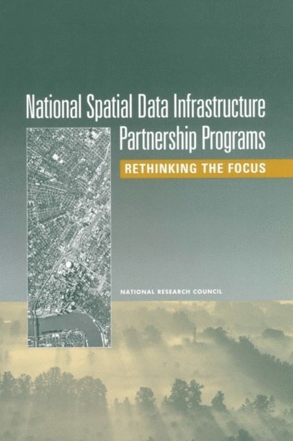
The National Spatial Data Infrastructure (NSDI) was envisioned as a way of enhancing the accessibility, communication, and use of geospatial data to support a wide variety of decisions at all levels of society. The goals of the NSDI are to reduce redundancy in geospatial data creation and maintenance, reduce the costs of geospatial data creation and maintenance, improve access to geospatial data, and improve the accuracy of geospatial data used by the broader community. At the core of the NSDI is the concept of partnerships, or collaborations, between different agencies, corporations, institutions, and levels of government. In a previous report, the Mapping Science Committee (MSC) defined a partnership as "...a joint activity of federal and state agencies, involving one or more agencies as joint principals focusing on geographic information." The concept of partnerships was built on the foundation of shared responsibilities, shared costs, shared benefits, and shared control. Partnerships are designed to share the costs of creation and maintenance of geospatial data, seeking to avoid unnecessary duplication, and to make it possible for data collected by one agency at a high level of spatial detail to be used by another agency in more generalized form.
Over the past seven years, a series of funding programs administered by the Federal Geographic Data Committee (FGDC) has stimulated the creation of such partnerships, and thereby promoted the objectives of the NSDI, by raising awareness of the need for a coordinated national approach to geospatial data creation, maintenance, and use. They include the NSDI Cooperative Agreements Program, the Framework Demonstration Projects Program, the Community Demonstration Projects, and the Community-Federal Information Partnerships proposal. This report assesses the success of the FGDC partnership programs that have been established between the federal government and state and local government, industry, and academic communities in promoting the objectives of the National Spatial Data Infrastructure.
538 kr
Läs direkt efter köp
Science is increasingly driven by data, and spatial data underpin the science directions laid out in the 2007 U.S. Geological Survey (USGS) Science Strategy. A robust framework of spatial data, metadata, tools, and a user community that is interactively connected to use spatial data in an efficient and flexible way—known as a spatial data infrastructure (SDI)—must be available for scientists and managers to find, use, and share spatial data both within and beyond the USGS.
Over the last decade, the USGS has conducted breakthrough research that has overcome some of the challenges associated with implementing a large SDI. Advancing Strategic Science: A Spatial Data Infrastructure Roadmap for the U.S. Geological Survey is intended to ground those efforts by providing a practical roadmap to full implementation of an SDI to enable the USGS to conduct strategic science.
505 kr
Läs direkt efter köp
In 1992, world leaders adopted Agenda 21, the work program of the 1992 U.N. Conference on Environment and Development. This landmark event provided a political foundation and action items to facilitate the global transition toward sustainable development. The international community marked the tenth anniversary of this conference in Johannesburg, South Africa, in August 2002. Down to Earth, a component of the U.S. State Department''s "Geographic Information for Sustainable Development" project for the World Summit, focuses on sub-Saharan Africa with examples drawn from case-study regions where the U.S. Agency for International Development and other agencies have broad experience. Although African countries are the geographic focus of the study, the report has broader applicability. Down to Earth summarizes the importance and applicability of geographic data for sustainable development and draws on experiences in African countries to examine how future sources and applications of geographic data could provide reliable support to decision-makers as they work towards sustainable development. The committee emphasizes the potential of new technologies, such as satellite remote-sensing systems and geographic information systems, that have revolutionized data collection and analysis over the last decade.
505 kr
Läs direkt efter köp
Weaving a National Map draws on contributions to a September 2002 workshop and the U.S. Geological Survey''s (USGS) "vision" document for The National Map, envisioned by the USGS as a database providing "public domain core geographic data about the United States and its territories that other agencies can extend, enhance, and reference as they concentrate on maintaining other data that are unique to their needs." The demand for up-to-date information in real time for public welfare and safety informs this need to update an aging paper map series that is, on average, 23 years old. The NRC report describes how The National Map initiative would gain from improved definition so that the unprecedented number of partners needed for success will become energized to participate. The challenges faced by USGS in implementing The National Map are more organizational than technical. To succeed, the USGS will need to continue to learn from challenges encountered in its ongoing pilot studies as well as from other federal-led programs that have partnered with multiple sectors.

387 kr
Läs direkt efter köp
A Geospatial Framework for the Coastal Zone National Needs identifies and suggests mechanisms for addressing national needs for spatial information in the coastal zone. It identifies high priority needs, evaluates the potential for meeting those needs based on the current level of effort, and suggests steps to increase collaboration and ensure that the nation''s need for spatial information in the coastal zone is met in an efficient and timely manner.
311 kr
Läs direkt efter köp
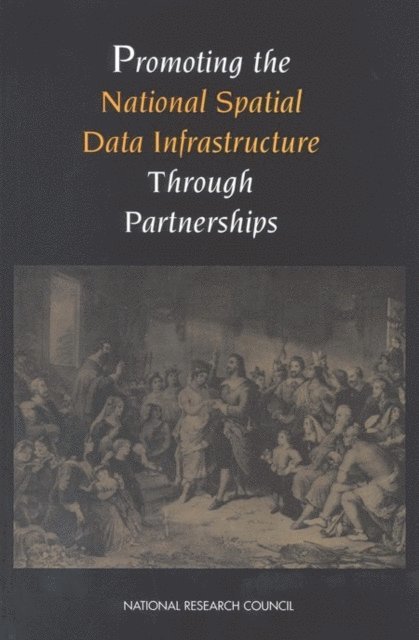
Cooperation and partnerships for spatial data activities among the federal government, state and local governments, and the private sector will be essential for the development of a robust National Spatial Data Infrastructure (NSDI). This book addresses the nature of these partnerships and examines factors that could optimize their success.
454 kr
Läs direkt efter köp
The National Spatial Data Infrastructure (NSDI) was envisioned as a way of enhancing the accessibility, communication, and use of geospatial data to support a wide variety of decisions at all levels of society. The goals of the NSDI are to reduce redundancy in geospatial data creation and maintenance, reduce the costs of geospatial data creation and maintenance, improve access to geospatial data, and improve the accuracy of geospatial data used by the broader community. At the core of the NSDI is the concept of partnerships, or collaborations, between different agencies, corporations, institutions, and levels of government. In a previous report, the Mapping Science Committee (MSC) defined a partnership as "...a joint activity of federal and state agencies, involving one or more agencies as joint principals focusing on geographic information." The concept of partnerships was built on the foundation of shared responsibilities, shared costs, shared benefits, and shared control. Partnerships are designed to share the costs of creation and maintenance of geospatial data, seeking to avoid unnecessary duplication, and to make it possible for data collected by one agency at a high level of spatial detail to be used by another agency in more generalized form.
Over the past seven years, a series of funding programs administered by the Federal Geographic Data Committee (FGDC) has stimulated the creation of such partnerships, and thereby promoted the objectives of the NSDI, by raising awareness of the need for a coordinated national approach to geospatial data creation, maintenance, and use. They include the NSDI Cooperative Agreements Program, the Framework Demonstration Projects Program, the Community Demonstration Projects, and the Community-Federal Information Partnerships proposal. This report assesses the success of the FGDC partnership programs that have been established between the federal government and state and local government, industry, and academic communities in promoting the objectives of the National Spatial Data Infrastructure.
353 kr
Läs direkt efter köp
The National Spatial Data Infrastructure (NSDI) is the means to assemble geographic information that describes the arrangement and attributes of features and phenomena on the Earth. This book advocates the need to make the NSDI more robust. The infrastructure includes the materials, technology, and people necessary to acquire, process, store, and distribute such information to meet a wide variety of needs. The NSDI is more than hardware, software, and data; it is the public foundation on which a marketplace for spatial products will evolve.
468 kr
Läs direkt efter köp
Public and private institutions are committing resources and making important long-term decisions concerning the collection, management, and use of spatial data. Although these actions are influenced by current pressures, priorities, and opportunities, their ultimate success depends on how these spatial data activities will be relevant to future needs and demands.
The Mapping Science Committee, in cooperation with the Federal Geographic Data Committee, convened a workshop in April 1996 to examine societal and technological changes that might occur within the next 15 years. The purpose was to consider within the context of spatial data activities a series of long-term visions and to identify societal forces and changes that would make those visions more or less likely. The workshop provided a framework for thinking about the future of U.S. spatial data activities.

463 kr
Läs direkt efter köp
The National Geospatial-Intelligence Agency (NGA) provides geospatial intelligence (GEOINT) to support national security, both as a national intelligence and a combat support agency. In the post-9/11 world, the need for faster and more accurate geospatial intelligence is increasing. GEOINT uses imagery and geospatial data and information to provide knowledge for planning, decisions, and action. For example, data from satellites, pilotless aircraft and ground sensors are integrated with maps and other intelligence data to provide location information on a potential target. This report defines 12 hard problems in geospatial science that NGA must resolve in order to evolve their capabilities to meet future needs. Many of the hard research problems are related to integration of data collected from an ever-growing variety of sensors and non-spatial data sources, and analysis of spatial data collected during a sequence of time (spatio-temporal data). The report also suggests promising approaches in geospatial science and related disciplines for meeting these challenges. The results of this study are intended to help NGA prioritize geospatial science research directions.
572 kr
Läs direkt efter köp
In the past few years the United States has experienced a series of disasters, such as Hurricane Katrina in 2005, which have severely taxed and in many cases overwhelmed responding agencies. In all aspects of emergency management, geospatial data and tools have the potential to help save lives, limit damage, and reduce the costs of dealing with emergencies. Great strides have been made in the past four decades in the development of geospatial data and tools that describe locations of objects on the Earth''s surface and make it possible for anyone with access to the Internet to witness the magnitude of a disaster. However, the effectiveness of any technology is as much about the human systems in which it is embedded as about the technology itself. Successful Response Starts with a Map assesses the status of the use of geospatial data, tools, and infrastructure in disaster management, and recommends ways to increase and improve their use. This book explores emergency planning and response; how geospatial data and tools are currently being used in this field; the current policies that govern their use; various issues related to data accessibility and security; training; and funding. Successful Response Starts with a Map recommends significant investments be made in training of personnel, coordination among agencies, sharing of data and tools, planning and preparedness, and the tools themselves.

1 312 kr
Tillfälligt slut
1 376 kr
Tillfälligt slut

707 kr
Tillfälligt slut
707 kr
Tillfälligt slut
684 kr
Tillfälligt slut