
Richard J.A. Talbert – författare
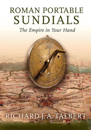
950 kr
Skickas inom 5-8 vardagar
477 kr
Läs direkt efter köp
437 kr
Skickas inom 5-8 vardagar
674 kr
Skickas inom 10-15 vardagar

769 kr
Läs direkt efter köp
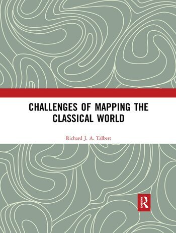
Challenges of Mapping the Classical World collects together in one volume fourteen varied items written by Richard Talbert over the past thirty years. They cohere around the theme of mapping the classical world since the nineteenth century. All were originally prompted by Talbert’s commission in the late 1980s to produce a definitive classical atlas after more than a century of failed attempts by the Kieperts and others. These he evaluates, as well as probing the Smith/Grove atlas, a successful twenty-year initiative launched in the mid-1850s, with a cartographic approach that departs radically from established practice. Talbert’s initial vision for the international collaborative project that resulted in the Barrington Atlas of the Greek and Roman World (2000) is presented, and the successive twice-yearly reports on its progress from 1991 through to completion are published here for the first time. A further item reflects retrospectively on the project’s cartographic challenges and on how developments in digital map production were decisive in overcoming them. This volume will be invaluable to anyone with an interest in the development and growing impact of mapping the classical world.
769 kr
Läs direkt efter köp
Challenges of Mapping the Classical World collects together in one volume fourteen varied items written by Richard Talbert over the past thirty years. They cohere around the theme of mapping the classical world since the nineteenth century. All were originally prompted by Talbert’s commission in the late 1980s to produce a definitive classical atlas after more than a century of failed attempts by the Kieperts and others. These he evaluates, as well as probing the Smith/Grove atlas, a successful twenty-year initiative launched in the mid-1850s, with a cartographic approach that departs radically from established practice. Talbert’s initial vision for the international collaborative project that resulted in the Barrington Atlas of the Greek and Roman World (2000) is presented, and the successive twice-yearly reports on its progress from 1991 through to completion are published here for the first time. A further item reflects retrospectively on the project’s cartographic challenges and on how developments in digital map production were decisive in overcoming them. This volume will be invaluable to anyone with an interest in the development and growing impact of mapping the classical world.
4 575 kr
Skickas inom 5-8 vardagar

5 449 kr
Skickas inom 11-20 vardagar
621 kr
Skickas inom 5-8 vardagar
856 kr
Läs direkt efter köp
Richard J. A. Talbert examines the composition, procedure, and functions of the Roman senate during the Principate (30 B.C.-A.D. 238). Although it is of central importance to the period, this great council has not previously received such scholarly treatment. Offering a fresh approach to major ancient authors (Pliny and Tacitus in particular), the book also draws on inscriptions and legal writers never before fully exploited for the study of the senate.
2 255 kr
Skickas inom 10-15 vardagar
Cartography in Antiquity and the Middle Ages
Fresh Perspectives, New Methods
2 544 kr
Skickas inom 5-8 vardagar