• Fri frakt över 249 kr
  • •
  • Snabba leveranser
  • •
  • Billiga böcker
Kundservice

Du är på sajten för privatpersoner.

Företag, bibliotek eller offentlig verksamhet?

Du handlar på classic.bokus.com, där alla dina funktioner finns intakta.
Till classic.bokus.com
Bokus logotyp. Gå till startsidan.
  • Erbjudanden
  • Nyheter
  • Student
  • Topplistor
  • Barn & ungdom
  • Bokus Play
  • E-böcker
  • Pocketböcker
  • Spel & pussel

10% rabatt på allt med kod NYSTART10 →

Sidfot

Mina sidor

    Hjälp

    • Kundservice
    • Vanliga frågor och svar
    • Frakt och leverans
    • Retur vid ångerrätt
    • Reklamera vara
    • Betalning
    • Köpvillkor
    • Allmänna villkor
    • Information om webbplatsens tillgänglighet

    Om Bokus

    • Om oss
    • Pressrum
    • För studenter
    • För företag
    • För bibliotek och offentlig verksamhet
    • För leverantörer
    • Hållbarhet

    Populärt

    • Aktuella erbjudanden
    • Presentkort
    • Studentlitteratur
    • Nya böcker
    • Topplistor
    • Signerade böcker
    • Engelska böcker

    Inspiration

    • Boktips
    • BookTok
    • Populära bokserier
    • Barnbokskaraktärer
    • Populära författare
    Logotyp för Bokus
    Följ oss på Facebook (extern länk)Följ oss på Instagram (extern länk)Följ oss på YouTube (extern länk)Följ oss på TikTok (extern länk)
    bokus @ CookiesAnpassa cookiesIntegritetspolicyKöpvillkor
    Till Citymail hemsida (extern länk)Till Budbee hemsida (extern länk)Till Postnord hemsida (extern länk)Till Schenker hemsida (extern länk)Till Early Bird hemsida (extern länk)Till Walleys hemsida (extern länk)
    1. Kultur
    2. Konstböcker
    3. Konsthistoria

    Roman Portable Sundials

    The Empire in Your Hand

    AvRichard J.A. Talbert

    Häftad, Engelska, 2020

    728 kr

    Beställningsvara. Skickas inom 5-8 vardagar. Fri frakt över 249 kr.

    Fler format och utgåvor

    Inbunden

    1 459 kr

    E-bok

    476 kr

    Beskrivning

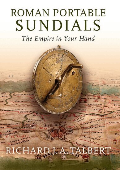
    In an unscientific era when maps were rarities, how did ancient Romans envisage their far flung empire? This was done by various means for certain, including with the aid of an ingenious type of portable sundial that has barely attracted notice. As the Romans understood before the first century BCE, to track the passage of the sun across the sky hour-by-hour one needed to know one's latitude and the time of year, and that, furthermore, sundials did not have to be fixed objects. These portable instruments, crafted in bronze, were adjustable for the changes of latitude to be expected on long journeys--say, for instance, from Britain to Spain, or from Alexandria to Rome, or even on a Mediterranean tour. For convenient reference, these sundials incorporated lists of twenty to thirty names of cities or regions, each with its specific latitude. One of the insights of Roman Portable Sundials is that the choice of locations offers unique clues to the mental world-map and self-identity of individuals able to visualize Rome's vast empire latitudinally. The sixteen such sundials known to date share common features but designers also vied to create enhancements. Comparison with modern calculations shows that often the latitudes listed are incorrect, in which case the sundial may not perform at its best. But then the nature of Romans' time-consciousness (or lack of it) must be taken into consideration. Richard Talbert suspects that owners might prize these sundials not so much for practical use but rather as prestige objects attesting to scientific awareness as well as imperial mastery of time and space. In retrospect, they may be seen as Roman precursors to comparable Islamic and European instruments from the Middle Ages onwards, and even to today's luxury watches which display eye-catching proof of their purchasers' wealth, sophistication, and cosmopolitanism. Richly enhanced with detailed photographs, line drawings, maps, a gazetteer, and a table of latitudes and locations, Roman Portable Sundials brings these overlooked gadgets out of the shadows at last to reveal their hitherto untapped layers of meaning.

    Produktinformation

    • Utgivningsdatum:2020-03-10
    • Mått:231 x 165 x 15 mm
    • Vikt:476 g
    • Format:Häftad
    • Språk:Engelska
    • Antal sidor:262
    • Förlag:OUP USA
    • ISBN:9780197503669

    Utforska kategorier

    • Konsthistoria inom Kultur
    • Forntidens historia inom Historia och arkeologi
    • Arkeologiska perioder och områden inom Historia och arkeologi

    Mer om författaren

    Richard Talbert is a Cambridge Classics graduate who taught in the United Kingdom and Canada before becoming Kenan Professor of History at the University of North Carolina, Chapel Hill, where he has established the Ancient World Mapping Center. His many books include The Senate of Imperial Rome, the collaborative Barrington Atlas of the Greek and Roman World, and Rome's World: The Peutinger Map Reconsidered.

    Recensioner i media

    It is useful to think of this book as the historical counterpart of what in literary studies would be the first major scholarly edition and commentary on a recently discovered text. Talbert writes (p. xiii): 'My hope is that the book will both enlighten and intrigue readers across disciplines by uncovering a fresh, imaginative vision of the world shared by what might be termed a loose community of Romans.' Mission accomplished.

    Innehållsförteckning

    • List of Figures and Maps Abbreviations Chapter 1 Sundials and their Place in the Roman Empire Sundial Environment Sundial Thinking Portable Sundials: Types and FunctioningChapter 2 The Geographical Portable Sundials Illustrated and Described Presentation Format Rome, no. 1 Kircher Museum, no. 2 Memphis, no. 3 Aquileia, no. 4 Kunsthistorisches Museum, Vienna/Wien, no. 5 Crêt-Châtelard, no. 6 Museum of the History of Science, Oxford, no. 7 Aphrodisias, no. 8 Samos, no. 9 Time Museum, no. 10 Philippi, no. 11 Science Museum, London, no. 12 Vignacourt/Berteaucourt-les-Dames, no. 13 Mérida, no. 14 British Museum, London, no. 15 Balkans, no. 16 Chapter 3 Geographical Awareness and Worldviews Names Figures: The Concept of Latitude Figures: The Concept of Latitude Applied Distinguishing Homonymous Cities Comparative Frameworks and Orientation Latitude and WorldviewChapter 4 A Community of Diallers ? Time-Telling: Margins of Error Table: Time Museum, no. 10, and British Museum, London, no. 15 Criteria for the Choice of Names The Appeal of the Object The Spreading of Knowledge and Related Attractions Time-Telling Needs Conclusion: A Community of Diallers ?Chapter 5 Post-Classical Comparisons The Astrolabe The Navicula and 'Regiomontanus' Types Nuremberg Sundials Scottish Stone Sundials The Twentieth Century and BeyondAppendix The Aquincum Fragment: A Sundial-Maker's Manual ? GazetteerTable of Latitudes and LocationsBibliography Ancient and Medieval Texts and Inscriptions Modern ScholarshipArt CreditsIndex