
Rob Atkins – författare
Visar alla böcker från författaren . Handla med fri frakt och snabb leverans.
7 produkter
7 produkter
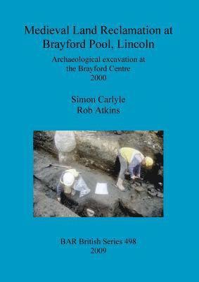
Häftad, Engelska, 2009
439 kr
Skickas inom 5-8 vardagar
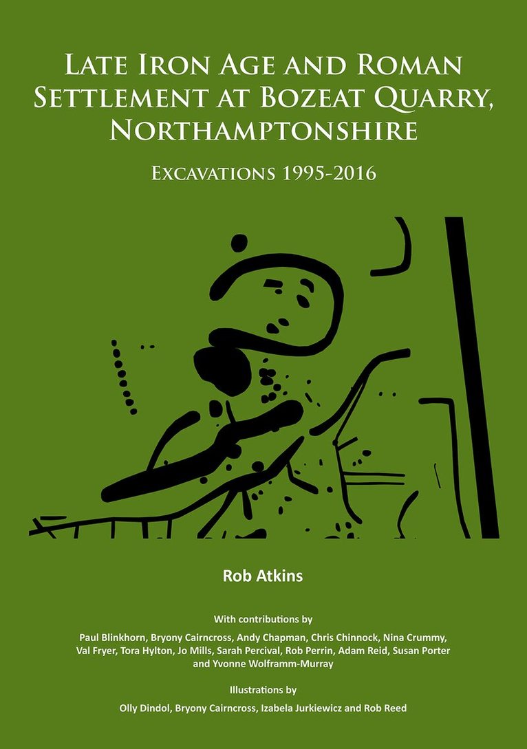
Häftad, Engelska, 2018
695 kr
Skickas
MOLA (formerly Northamptonshire Archaeology), has undertaken intermittent archaeological work within Bozeat Quarry over a twenty-year period from 1995-2016 covering an area of 59ha. The earliest archaeological features lay in the extreme northern area where a Bronze Age to Iron Age cremation burial was possibly contemporary with an adjacent late Bronze Age/early Iron Age pit alignment. In the middle to late Iron Age a settlement was established at the southern part of the site over a c170m by 150m area. It was a well organised farmstead, mostly open in plan with two roundhouses, routeway, enclosures, boundary ditches and pits. In the early 1st century AD, cAD 30, two separate settlements lay c0.5km apart. The former southern Iron Age farmstead had perhaps shifted location c150m to the north-west and a there was new farmstead to the north. Both settlements were located on a west facing slope of a valley side and were sited on sands and gravels at between 64m and 66m aOD. The Northern Settlement was only occupied for about 150 years and was involved in pastoral farming, but local coarseware pottery production was of some importance with a group of 12 pottery kilns dated to the middle to late 1st century AD. This is seemingly the largest number of pottery kilns from a single settlement of this period yet found in the regionally important Upper Nene Valley pottery producing area. The Southern Settlement was larger and continued to the end of the Roman period. In this area there was a notable scatter of 12 Iron Age and 1st century AD Roman coins as well as 24 contemporary brooches found over an area measuring c170m by c130m. This collection of finds may suggest the presence of a shrine or temple located in the area. It is perhaps significant that in 1964 directly to the west of the excavation, a middle Roman round stone building was found, perhaps an associated shrine. Within the excavation area in the latest Iron Age to early Roman period there was a possible roundhouse, a large oval enclosure and a field system. The latter largely related to pastoral farming including areas where paddocks were linked to routeways suggesting significant separation of livestock had occurred. Four cremation burials, including one deposited in a box, and an inhumation lay in three locations. Pastoral farming was a significant activity throughout the Roman period with enclosures, paddocks and linked routeways uncovered. In the late 2nd to 4th century there were two stone buildings and a stone malt oven at the extreme western extent of the site, within 50m to the east of the probably contemporary shrine recorded in 1964. There was minor evidence of early to middle Saxon occupation within the area of the former middle to late Iron Age settlement. No structures were found, although a few pits may date to this period and mark short stay visits. A small cemetery of five individuals respected the former Roman field system and probably dated to the late 6th to 7th centuries. The burials included a decapitation and a burial with a knife and a buckle. The site was then not re-occupied and became part of the fields of Bozeat medieval and post-medieval settlements.
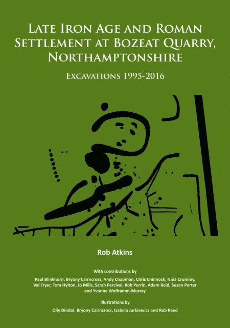
E-bok
PDF, Engelska, 2018229 kr
Läs direkt efter köp
MOLA (formerly Northamptonshire Archaeology), has undertaken intermittent archaeological work within Bozeat Quarry over a twenty-year period from 1995-2016 covering an area of 59ha. The earliest archaeological features lay in the extreme northern area where a Bronze Age to Iron Age cremation burial was possibly contemporary with an adjacent late Bronze Age/early Iron Age pit alignment. In the middle to late Iron Age a settlement was established at the southern part of the site over a c170m by 150m area. It was a well organised farmstead, mostly open in plan with two roundhouses, routeway, enclosures, boundary ditches and pits. In the early 1st century AD, cAD 30, two separate settlements lay c0.5km apart. The former southern Iron Age farmstead had perhaps shifted location c150m to the north-west and a there was new farmstead to the north. Both settlements were located on a west facing slope of a valley side and were sited on sands and gravels at between 64m and 66m aOD. The Northern Settlement was only occupied for about 150 years and was involved in pastoral farming, but local coarseware pottery production was of some importance with a group of 12 pottery kilns dated to the middle to late 1st century AD. This is seemingly the largest number of pottery kilns from a single settlement of this period yet found in the regionally important Upper Nene Valley pottery producing area. The Southern Settlement was larger and continued to the end of the Roman period. In this area there was a notable scatter of 12 Iron Age and 1st century AD Roman coins as well as 24 contemporary brooches found over an area measuring c170m by c130m. This collection of finds may suggest the presence of a shrine or temple located in the area. It is perhaps significant that in 1964 directly to the west of the excavation, a middle Roman round stone building was found, perhaps an associated shrine. Within the excavation area in the latest Iron Age to early Roman period there was a possible roundhouse, a large oval enclosure and a field system. The latter largely related to pastoral farming including areas where paddocks were linked to routeways suggesting significant separation of livestock had occurred. Four cremation burials, including one deposited in a box, and an inhumation lay in three locations. Pastoral farming was a significant activity throughout the Roman period with enclosures, paddocks and linked routeways uncovered. In the late 2nd to 4th century there were two stone buildings and a stone malt oven at the extreme western extent of the site, within 50m to the east of the probably contemporary shrine recorded in 1964. There was minor evidence of early to middle Saxon occupation within the area of the former middle to late Iron Age settlement. No structures were found, although a few pits may date to this period and mark short stay visits. A small cemetery of five individuals respected the former Roman field system and probably dated to the late 6th to 7th centuries. The burials included a decapitation and a burial with a knife and a buckle. The site was then not re-occupied and became part of the fields of Bozeat medieval and post-medieval settlements.
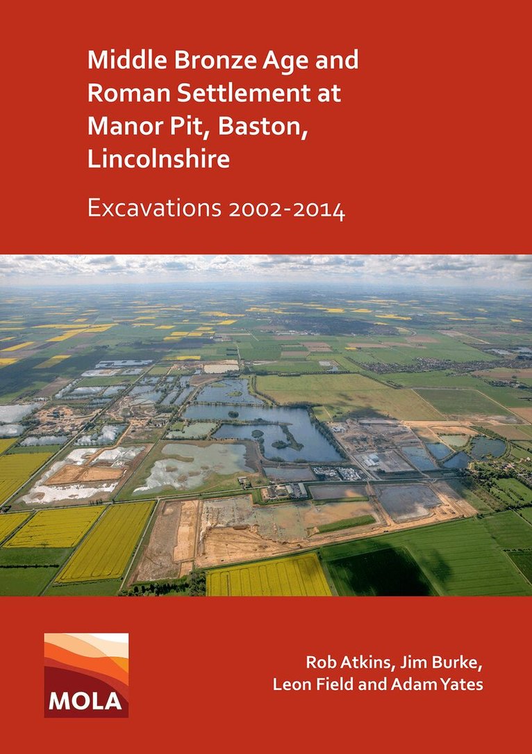
Häftad, Engelska, 2020
695 kr
Skickas
Between 2002 and 2014 MOLA Northampton carried out evaluation and excavation work over an area of approximately 49.65ha ahead of mineral extraction for the quarry at the Manor Pit, Baston, Lincolnshire. The earliest activity dated to the Neolithic with the first occupation dating to the early Bronze Age, but it was within the middle Bronze Age that significant occupation took place within the site. Part of a large co-axial field system was recorded over an area approximately c800m long and up to 310m wide. Cropmarks and the results from other archaeological excavations suggest the field system continued beyond Manor Pit for c4km and was up to 1km wide. The field system was a well-planned pastoral farming landscape at a scale suggesting that cattle and other animals were being farmed for mass trade. The site was reoccupied in the early 2nd century AD when two adjacent Roman settlements were established. One of the settlements was arranged along a routeway which led from the Car Dyke whilst the other settlement connected to this routeway by a long straight boundary. In both settlements there were a series of fields/enclosures situated in a largely open environment, with some evidence for cultivation, areas of wet ground and stands of trees. Well/watering holes lay within these enclosures and fields indicating that stock management was a key component of the local economy. In the later medieval period a trackway ran across the site, associated with which was a small enclosure, which perhaps contained fowl. During the early post-medieval period the land was subject to a final period of enclosure, with a series of small rectilinear fields established aligned with Baston Outgang Road, forming the basis of the current landscape.
Häftad, Engelska, 2023
496 kr
Skickas
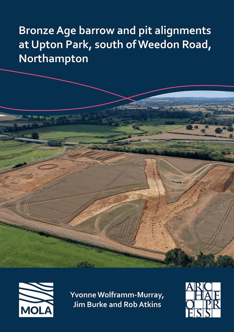
MOLA (Museum of London Archaeology) was commissioned by RPS Group PLC, on behalf of Morris Homes, to undertake archaeological work on land at Upton Park south of Weedon Road, Northampton. Two adjacent palaeochannels crossed the western extent of the site and are likely to have dated to the Pleistocene period. The earliest evidence of human activity consisted of a background scatter of Neolithic flint. The first feature was an isolated barrow that was established in the early Bronze Age. A later unurned cremation was cut into the backfill of the recut ditch and radiocarbon dated to the end of the early Bronze Age or the beginning of the middle Bronze Age. At least one isolated early Bronze Age pit was found in another part of the site. Parts of two late Bronze Age/early Iron Age sinuous pit alignments were recorded over nearly 0.5km within the site with c257 pits revealed. An estimated 66% of these pits by volume were examined. This is the first time in the county since Wollaston Quarry in the 1990s that pit alignments were seen over such a distance within a single planning application. The archaeological excavation of these has resulted in them being by some distance the two most examined pit alignments in the county, if not the region. Both had most likely fallen out of use by the early Iron Age, but a middle Iron Age date should not be ruled out. In the northern and southern pit alignments there were 16 and seven areas respectively where there were different variables in the pits such as circular or rectangular plan form (and some pit areas had be recut by ditches), which may suggest they had been constructed and maintained by different gangs/communities over probably hundreds of years. Relatively little detailed work has been recorded on this enigmatic feature type. The extensive work and examination of the two pit alignments at Upton has allowed a typology of the variable areas of pits (and related ditches) to be postulated. A detailed discussion has compared these features in a local, regional and national context. Future recommendations for excavation of pit alignments have been recorded.A Roman trackway lay within the western part of the development area and it was part of the routeway network located around the nearby Duston Roman town. Medieval drainage ditches and field systems relating to part of the medieval settlement of Upton lay within the eastern part of the development area.
Häftad, Engelska, 2024
496 kr
Skickas
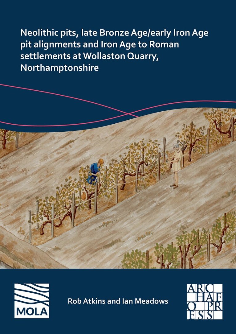
Between 1990 and 1998, MOLA (Museum of London Archaeology) undertook a series of archaeological excavations within Wollaston Quarry covering an area of 116ha. Eight excavation areas and a watching brief were undertaken. The proximity of the River Nene and at least four palaeochannels formed the dominant natural landscape features. This dynamic environment affected settlement and land use throughout prehistoric and Roman periods.Seventeen pits, largely in small groups, were identified containing early Neolithic to late Neolithic/early Bronze Age pottery. Some of these features were located within the area of the palaeochannels. Later, of especial interest was a notable collection of eleven different late Bronze Age to early Iron Age pit alignments, which were part of a co-axial landscape over an area of 2.5km². There was also a small area of domestic activity reflected by pits dating to the early Iron Age as well as two large watering holes in other locations. The pit alignment boundaries influenced subsequent settlement from the middle Iron Age to the late Roman periods. While individual settlements and related agricultural enclosures changed location over time, they followed the same alignments as the earlier pit alignments suggesting some form of continuity for over 800 years.In the middle to late Iron Age four separate farmsteads were established of which two overlaid the former pit alignments. All four comprised sub-rectangular enclosed farmsteads with internal roundhouses and paddocks. Towards the end of the Iron Age at least one of the middle Iron Age settlements was abandoned, while at roughly the same time an unenclosed settlement was created nearby which continued to the late Roman period. Overall, within the quarry, six new late Iron Age and Roman settlements were established and two more have been preserved without excavation. In the middle Roman period, there was extensive and organised agriculture activity which included two vineyards in two different parts of the site as well as two areas of paddock type enclosures. This level of planning suggests significant investment and could reflect the development by a villa estate. In the early to middle Saxon period there were four different areas of activity which comprised a sunken featured building, pits and a late 7th century grave of a high-status Anglian warrior burial (the latter has previously been reported on separately).
Del 22 - Oxford Archaeology Monograph
Broughton, Milton Keynes, Buckinghamshire
Inbunden, Engelska, 2014
466 kr
Skickas
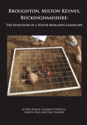
Extensive excavations near the village of Broughton, which lies on the outskirts of Milton Keynes, revealed the fluctuating fortunes of neighbouring settlements from the Iron Age to the medieval period. A middle Iron Age ‘hamlet’ was succeeded in the 1st century BC by various farmsteads which were at their height in the early Roman period. Associated with these were richly furnished cremation cemeteries of Aylesford(-Swarling) type, with burial continuing into the Romano-British period. The cemeteries provide the largest group of such burials yet found in Buckinghamshire and reflect the position of Broughton within the territory of the Catuvellauni. Cremation burial ceased in the mid 2nd century and two of the farmsteads were abandoned soon afterwards. The main settlement continued to develop during the late Roman period, while a new farmstead nearby survived into the early 5th century. Elsewhere, a cluster of sunken-featured buildings yielded early Saxon pottery in Roman form and possible feasting waste. These settlements were in turn abandoned, to be replaced after the Norman Conquest by a farmstead and surrounding ridge and furrow field system which formed an outlying part of the village that had, by the time of Domesday, taken the name of Broughton – ‘the farm or settlement by the brook’.