
Flood Resilience: Preparedness and Recovery – serie
Visar alla böcker i serien Flood Resilience: Preparedness and Recovery. Handla med fri frakt och snabb leverans.
10 produkter
10 produkter
Häftad, Engelska, 2013
363 kr
Skickas
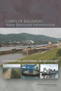
Over the past century, the U.S. Army Corps of Engineers has built a vast network of water management infrastructure that includes approximately 700 dams, 14,000 miles of levees, 12,000 miles of river navigation channels and control structures, harbors and ports, and other facilities. Historically, the construction of new infrastructure dominated the Corps' water resources budget and activities. Today, national water needs and priorities increasingly are shifting to operations, maintenance, and rehabilitation of existing infrastructure, much of which has exceeded its design life. However, since the mid-1980s federal funding for new project construction and major rehabilitation has declined steadily. As a result, much of the Corps' water resources infrastructure is deteriorating and wearing out faster than it is being replaced. Corps of Engineers Water Resources Infrastrucutre: Deterioration, Investment, or Divestment? explores the status of operations, maintenance, and rehabilitation of Corps water resources infrastructure, and identifies options for the Corps and the nation in setting maintenance and rehabilitation priorities.
Häftad, Engelska, 2004
790 kr
Tillfälligt slut
The nation's network of more than 130 Next Generation Radars (NEXRADs) is used to detect wind and precipitation to help National Weather Service forecasters monitor and predict flash floods and other storms. This book assesses the performance of the Sulphur Mountain NEXRAD in Southern California, which has been scrutinized for its ability to detect precipitation in the atmosphere below 6000 feet. The book finds that the Sulphur Mountain NEXRAD provides crucial coverage of the lower atmosphere and is appropriately situated to assist the Los Angeles-Oxnard National Weather Service Forecast Office in successfully forecasting and warning of flash floods. The book concludes that, in general, NEXRAD technology is effective in mountainous terrain but can be improved.
Häftad, Engelska, 2009
624 kr
Tillfälligt slut
Federal Emergency Management Agency (FEMA) Flood Insurance Rate Maps portray the height and extent to which flooding is expected to occur, and they form the basis for setting flood insurance premiums and regulating development in the floodplain. As such, they are an important tool for individuals, businesses, communities, and government agencies to understand and deal with flood hazard and flood risk. Improving map accuracy is therefore not an academic question--better maps help everyone. Making and maintaining an accurate flood map is neither simple nor inexpensive. Even after an investment of more than $1 billion to take flood maps into the digital world, only 21 percent of the population has maps that meet or exceed national flood hazard data quality thresholds. Even when floodplains are mapped with high accuracy, land development and natural changes to the landscape or hydrologic systems create the need for continuous map maintenance and updates. Mapping the Zone examines the factors that affect flood map accuracy, assesses the benefits and costs of more accurate flood maps, and recommends ways to improve flood mapping, communication, and management of flood-related data.
Häftad, Engelska, 2012
446 kr
Tillfälligt slut
Although advances in engineering can reduce the risk of dam and levee failure, some failures will still occur. Such events cause impacts on social and physical infrastructure that extend far beyond the flood zone. Broadening dam and levee safety programs to consider community- and regional-level priorities in decision making can help reduce the risk of, and increase community resilience to, potential dam and levee failures. Collaboration between dam and levee safety professionals at all levels, persons and property owners at direct risk, members of the wider economy, and the social and environmental networks in a community would allow all stakeholders to understand risks, shared needs, and opportunities, and make more informed decisions related to dam and levee infrastructure and community resilience. Dam and Levee Safety and Community Resilience: A Vision for Future Practice explains that fundamental shifts in safety culture will be necessary to integrate the concepts of resilience into dam and levee safety programs.
Häftad, Engelska, 2013
482 kr
Tillfälligt slut
The Federal Emergency Management Agency's (FEMA) Federal Insurance and Mitigation Administration (FIMA) manages the National Flood Insurance Program (NFIP), which is a cornerstone in the U.S. strategy to assist communities to prepare for, mitigate against, and recover from flood disasters. The NFIP was established by Congress with passage of the National Flood Insurance Act in 1968, to help reduce future flood damages through NFIP community floodplain regulation that would control development in flood hazard areas, provide insurance for a premium to property owners, and reduce federal expenditures for disaster assistance. The flood insurance is available only to owners of insurable property located in communities that participate in the NFIP. Currently, the program has 5,555,915 million policies in 21,881 communities3 across the United States. The NFIP defines the one percent annual chance flood (100-year or base flood) floodplain as a Special Flood Hazard Area (SFHA). The SFHA is delineated on FEMA's Flood Insurance Rate Maps (FIRM's) using topographic, meteorologic, hydrologic, and hydraulic information.Property owners with a federally back mortgage within the SFHAs are required to purchase and retain flood insurance, called the mandatory flood insurance purchase requirement (MPR). Levees and floodwalls, hereafter referred to as levees, have been part of flood management in the United States since the late 1700's because they are relatively easy to build and a reasonable infrastructure investment. A levee is a man-made structure, usually an earthen embankment, designed and constructed in accordance with sound engineering practices to contain, control, or divert the flow of water so as to provide protection from temporary flooding. A levee system is a flood protection system which consists of a levee, or levees, and associated structures, such as closure and drainage devices, which are constructed and operated in accordance with sound engineering practices. Recognizing the need for improving the NFIP's treatment of levees, FEMA officials approached the National Research Council's (NRC) Water Science and Technology Board (WSTB) and requested this study.The NRC responded by forming the ad hoc Committee on Levee and the National Flood Insurance Program: Improving Policies and Practices, charged to examine current FEMA treatment of levees within the NFIP and provide advice on how those levee-elated policies and activities could be improved. The study addressed four broad areas, risk analysis, flood insurance, risk reduction, and risk communication, regarding how levees are considered in the NFIP. Specific issues within these areas include current risk analysis and mapping procedures behind accredited and non-accredited levees, flood insurance pricing and the mandatory flood insurance purchase requirement, mitigation options to reduce risk for communities with levees, flood risk communication efforts, and the concept of shared responsibility. The principal conclusions and recommendations are highlighted in this report.
Häftad, Engelska, 2014
506 kr
Tillfälligt slut
Hurricane- and coastal-storm-related losses have increased substantially during the past century, largely due to increases in population and development in the most susceptible coastal areas. Climate change poses additional threats to coastal communities from sea level rise and possible increases in strength of the largest hurricanes. Several large cities in the United States have extensive assets at risk to coastal storms, along with countless smaller cities and developed areas. The devastation from Superstorm Sandy has heightened the nation's awareness of these vulnerabilities. What can we do to better prepare for and respond to the increasing risks of loss? Reducing Coastal Risk on the East and Gulf Coasts reviews the coastal risk-reduction strategies and levels of protection that have been used along the United States East and Gulf Coasts to reduce the impacts of coastal flooding associated with storm surges. This report evaluates their effectiveness in terms of economic return, protection of life safety, and minimization of environmental effects. According to this report, the vast majority of the funding for coastal risk-related issues is provided only after a disaster occurs.This report calls for the development of a national vision for coastal risk management that includes a long-term view, regional solutions, and recognition of the full array of economic, social, environmental, and life-safety benefits that come from risk reduction efforts. To support this vision, Reducing Coastal Risk states that a national coastal risk assessment is needed to identify those areas with the greatest risks that are high priorities for risk reduction efforts. The report discusses the implications of expanding the extent and levels of coastal storm surge protection in terms of operation and maintenance costs and the availability of resources. Reducing Coastal Risk recommends that benefit-cost analysis, constrained by acceptable risk criteria and other important environmental and social factors, be used as a framework for evaluating national investments in coastal risk reduction.The recommendations of this report will assist engineers, planners and policy makers at national, regional, state, and local levels to move from a nation that is primarily reactive to coastal disasters to one that invests wisely in coastal risk reduction and builds resilience among coastal communities.
Häftad, Engelska, 2015
655 kr
Tillfälligt slut
In the devastation that follows a major disaster, there is a need for multiple sectors to unite and devote new resources to support the rebuilding of infrastructure, the provision of health and social services, the restoration of care delivery systems, and other critical recovery needs. In some cases, billions of dollars from public, private and charitable sources are invested to help communities recover. National rhetoric often characterizes these efforts as a "return to normal." But for many American communities, pre-disaster conditions are far from optimal. Large segments of the U.S. population suffer from preventable health problems, experience inequitable access to services, and rely on overburdened health systems. A return to pre-event conditions in such cases may be short-sighted given the high costs - both economic and social - of poor health. Instead, it is important to understand that the disaster recovery process offers a series of unique and valuable opportunities to improve on the status quo. Capitalizing on these opportunities can advance the long-term health, resilience, and sustainability of communities - thereby better preparing them for future challenges.Healthy, Resilient, and Sustainable Communities After Disasters identifies and recommends recovery practices and novel programs most likely to impact overall community public health and contribute to resiliency for future incidents. This book makes the case that disaster recovery should be guided by a healthy community vision, where health considerations are integrated into all aspects of recovery planning before and after a disaster, and funding streams are leveraged in a coordinated manner and applied to health improvement priorities in order to meet human recovery needs and create healthy built and natural environments. The conceptual framework presented in Healthy, Resilient, and Sustainable Communities After Disasters lays the groundwork to achieve this goal and provides operational guidance for multiple sectors involved in community planning and disaster recovery. Healthy, Resilient, and Sustainable Communities After Disasters calls for actions at multiple levels to facilitate recovery strategies that optimize community health.With a shared healthy community vision, strategic planning that prioritizes health, and coordinated implementation, disaster recovery can result in a communities that are healthier, more livable places for current and future generations to grow and thrive - communities that are better prepared for future adversities.
Häftad, Engelska, 2015
458 kr
Tillfälligt slut
The National Flood Insurance Program (NFIP) is housed within the Federal Emergency Management Agency (FEMA) and offers insurance policies that are marketed and sold through private insurers, but with the risks borne by the U.S. federal government. NFIP's primary goals are to ensure affordable insurance premiums, secure widespread community participation in the program, and earn premium and fee income that covers claims paid and program expenses over time. In July 2012, the U.S. Congress passed the Biggert-Waters Flood Insurance Reform and Modernization Act (Biggert-Waters 2012), designed to move toward an insurance program with NFIP risk-based premiums that better reflected expected losses from floods at insured properties. This eliminated policies priced at what the NFIP called "pre-FIRM subsidized" and "grandfathered." As Biggert-Waters 2012 went into effect, constituents from multiple communities expressed concerns about the elimination of lower rate classes, arguing that it created a financial burden on policy holders. In response to these concerns Congress passed The Homeowner Flood Insurance Affordability Act of 2014 (HFIAA 2014).The 2014 legislation changed the process by which pre-FIRM subsidized premiums for primary residences would be removed and reinstated grandfathering. As part of that legislation, FEMA must report back to Congress with a draft affordability framework. Affordability of National Flood Insurance Program Premiums: Report 1 is the first part of a two-part study to provide input as FEMA prepares their draft affordability framework. This report discusses the underlying definitions and methods for an affordability framework and the affordability concept and applications. Affordability of National Flood Insurance Program Premiums gives an overview of the demand for insurance and the history of the NFIP premium setting. The report then describes alternatives for determining when the premium increases resulting from Biggert-Waters 2012 would make flood insurance unaffordable.

Häftad, Engelska, 2015
494 kr
Tillfälligt slut
River and coastal floods are among the nation's most costly natural disasters. One component in the nation's approach to managing flood risk is availability of flood insurance policies, which are offered on an individual basis primarily through the National Flood Insurance Program (NFIP). Established in 1968, the NFIP is overseen by the Federal Emergency Management Agency (FEMA) and there are about 5.4 million individual policies in the NFIP. The program has experienced a mixture of successes and persistent challenges. Successes include a large number of policy holders, the insurance of approximately $1.3 trillion of property, and the fact that the large majority of policy holders - 80% - pay rates that are risk based. NFIP challenges include large program debt, relatively low rates of purchase in many flood-prone areas, a host of issues regarding affordability of premiums, ensuring that premiums collected cover payouts and administrative fees, and a large number of properties that experience severe repetitive flood losses.At the request of FEMA, A Community-Based Flood Insurance Option identifies a range of key issues and questions that would merit consideration and further analysis as part of a community-based flood insurance program. As the report describes, the community-based option certainly offers potential benefits, such as the prospect of providing coverage for all (or nearly all) at-risk residents and properties in flood-prone communities. At the same time, many current challenges facing the NFIP may not necessarily be resolved by a community-based approach. This report discusses these and other prominent issues to be considered and further assessed.
Häftad, Engelska, 2016
446 kr
Tillfälligt slut
When Congress authorized the National Flood Insurance Program (NFIP) in 1968, it intended for the program to encourage community initiatives in flood risk management, charge insurance premiums consistent with actuarial pricing principles, and encourage the purchase of flood insurance by owners of flood prone properties, in part, by offering affordable premiums. The NFIP has been reauthorized many times since 1968, most recently with the Biggert-Waters Flood Insurance Reform Act of 2012 (BW 2012). In this most recent reauthorization, Congress placed a particular emphasis on setting flood insurance premiums following actuarial pricing principles, which was motivated by a desire to ensure future revenues were adequate to pay claims and administrative expenses. BW 2012 was designed to move the NFIP towards risk-based premiums for all flood insurance policies. The result was to be increased premiums for some policyholders that had been paying less than NFIP risk-based premiums and to possibly increase premiums for all policyholders.Recognition of this possibility and concern for the affordability of flood insurance is reflected in sections of the Homeowner Flood Insurance Affordability Act of 2014 (HFIAA 2014). These sections called on FEMA to propose a draft affordability framework for the NFIP after completing an analysis of the efforts of possible programs for offering a /means-tested assistancea to policyholders for whom higher rates may not be affordable. BW 2012 and HFIAA 2014 mandated that FEMA conduct a study, in cooperation with the National Academies of Sciences, Engineering, and Medicine, which would compare the costs of a program of risk-based rates and means-tested assistance to the current system of subsidized flood insurance rates and federally funded disaster relief for people without coverage. Production of two reports was agreed upon to fulfill this mandate. This second report proposes alternative approaches for a national evaluation of affordability program policy options and includes lessons for the design of a national study from a proof-of-concept pilot study.