
Pathfinder Guides – serie
Visar alla böcker i serien Pathfinder Guides. Handla med fri frakt och snabb leverans.
34 produkter
34 produkter
Häftad, Engelska, 2016
163 kr
Skickas
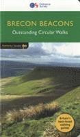
Pathfinder Brecon Beacons covering the Maen Madoc, Carn Goch and Carreg Cennen. This selection offers interest, regional variety and balance of routes in the Brecon Beacons providing the best walks in the area. From an easy stroll through Llangors Lake to the much more challenging walks in Waun Fach this volume contains something for everyone. Covering walks through the whole of the Brecon Beacons both popular and little know scenic routes including Crug Hywel, the Brecon Beacons Horseshoe and Monmouthshire. -See walk locations by Looking Inside Inside: -28 great walks in the Brecon Beacons from 2 to 10 miles -Clear, large scale Ordnance Survey route maps -GPS reference for all Brecon Beacons waypoints -Where to park, good pubs and places of interest en route -All routes have been fully researched and written by expert outdoor writers -Beautiful photography of scenes from the walks Pathfinder Guides are Britain's best loved walking guides. Made with durable covers, they are the perfect companion for countryside walks throughout Britain. Each title features circular walks with easy-to-follow route descriptions, large-scale Ordnance Survey route maps and GPS waypoints.With over 70 titles in the series, they offer essential information for walkers throughout the country.
Häftad, Engelska, 2016
163 kr
Skickas
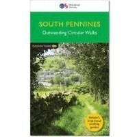
Pathfinder are Britain's best-loved walking guides. Enjoy 28 circular walks around the beautiful South Pennines, with Pathfinder, enjoy the stunning scenery with: Easy to follow directions Route highlights from the best view to great pubs Tried and tested for everyone from families to seasoned walkers Stunning photography Clear maps for easy navigations The South Pennines is truly an enigmatic land; the most glorious countryside sharing the same land as the country's most industrialised belt. Enjoy the beauty of the South Pennines with Pathfinder.
Häftad, Engelska, 2016
163 kr
Skickas
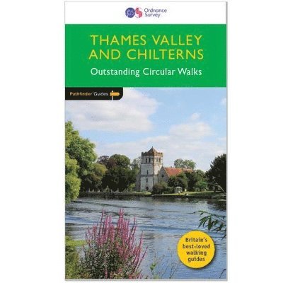
The Chilterns form part of the long line of chalk hills stretching intermittently across southern and eastern England. It is an area characterised by beech woods and dry valleys, and these natural features are explored in the routes. The Thames Valley is steeped in history, from Windsor Castle and Richmond Park to Runnymede Meadows, where the Magna Carta was signed in 1215, and there are opportunities to absorb this evocative atmosphere, as well as genteel towns like Dorchester, Henley and Princes Risborough. -See walk locations by Looking Inside Inside: -28 great walks in Thames Valley & Chilterns from 2 to 10 miles -Clear, large scale Ordnance Survey route maps -GPS reference for all waypoints -Where to park, good pubs and places of interest en route -All routes have been fully researched and written by expert outdoor writers -Beautiful photography of scenes from the walks Pathfinder(R) Guides are Britain's best loved walking guides. Made with durable covers, they are the perfect companion for countryside walks throughout Britain. Each title features circular walks with easy-to-follow route descriptions, large-scale Ordnance Survey route maps and GPS waypoints.With over 70 titles in the series, they offer essential information for walkers throughout the country.Contents* Wallingford* Watlington Hill* Hedgerley and Burnham Beeches* West Woodhay and Inkpen* Dorchester and Wittenham Clumps* Aldermaston and the Kennet and Avon Canal* Cuckhamsley Hill and the Ridgeway* Port Meadow* Old Boars Hill* Marlow and Hurley* Widbrook Common and Cliveden Reach* Goring* Whitehorse Hill and Kingston Lisle* Great Hampden and Little Hampden* Cookham, Winter Hill and Cock Marsh* Abingdon and Sutton Courtenay* Henley-on-Thames and Hambleden* Runnymede and Windsor Great Park* Longworth and Hinton Waldrist* Aldbury, Ivinghoe Beacon and Ashridge* Ibstone, Turville and Fingest* Coombe Hill and Chequers* Whitchurch and Mapledurham* West Wycombe, Hughenden and Bradenham* Chesham and Little Missenden* Chess Valley* Lardon Chase, Moulsford and Streatley* Princes Risborough and Chinnor Hill
Häftad, Engelska, 2016
163 kr
Skickas
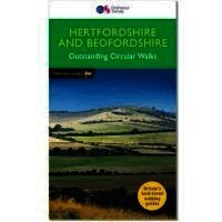
Both counties tend to be underrated by walkers, often overlooked in favour of the delights of the Thames Valley or the hillier Chiltern country of Buckinghamshire. But they do possess much fine walking country, with a diversity of terrain, gentle hilly regions, lots of pleasant woodland, attractive riverside landscapes and an impressive collection of pretty villages. There are a large number of country parks, especially in Bedfordshire, which make excellent starting points for walks in the local countryside, linking up with the public footpath network. Both Hertfordshire and Bedfordshire have an extensive network of well-maintained rights of way and a large number of well-waymarked recreational footpaths. Routes include explorations along the Greensand Ridge Walk, the Icknield Way Path, the Ouse Valley Way, the Lea Valley Walk, as well as the Grand Union Canal Walk, the Bunyan Trail and a part of the Chiltern way.
Häftad, Engelska, 2016
163 kr
Skickas
This collection of walks complements Pathfinder South Devon & Dartmoor, an area acclaimed as the last great wilderness in Britain. The haunting beauty of the central moorland studded with old tin mines and one of Britain's highest concentrations of historic remains is explored on several routes through the national park, including those passing Vixen Tor, one of the tallest and most distinctive granite tors on Dartmoor, Princetown and Buckfastleigh Moor. However, there are also explorations of the hills, river valleys and picturesque villages of the surrounding countryside the South Hams and south-east Devon, and especially the spectacular coastline. Contents 1. Cockington Valley 2. Bench Tor 3. Gara Rock and Portlemouth Down 4. Stover Country Park and the River Teign 5. Vixen Tor and Pew Tor 6. Exe estuary and Exminster Marshes 7. The Yealm Estuary 8. Venn Ottery Common 9. Dart Estuary and Dartmouth Castle 10. Broadhembury 11. Loddiswell and the Avon Valley Woods 12. Ashburton and Whiddon Scrubs 13. Three Reservoirs Walk 14. Brixham and Churston Point 15. Prawle Point and Woodcombe Point 16. Otter Estuary, East Budleigh and Otterton 17.Kingston and the River Erme 18.Bolt Head and Salcombe Estuary 19.Start Point and Hallsands 20. Torcross, Slapton Ley and Stokenham 21. Beer and Branscombe 22. Rippon Tor, Pil Tor and Buckland Beacon 23. Widgery Cross and Great Links Tor 24. Yes Tor and High Willhays 25. Sidmouth, Salcombe Regis and Weston Combe 26. Princetown, Dartmoor Railway and Leather Tor 27. Dittisham, Cornworthy and Tuckenhay 28. Buckfastleigh Moor
Häftad, Engelska, 2016
163 kr
Skickas
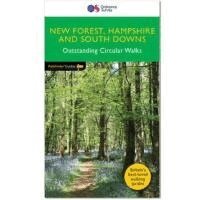
Pathfinder Hampshire(R) covers parts of the New Forest, South Downs and Fullerton. This selection offers interest, regional variety and balance of routes in Hampshire providing the best walks in the area. From an easy stroll through Bishop's Dyke to the much more challenging walks in the East Meion and the Downs this volume contains something for everyone. Covering walks through the whole of Hampshire both popular and little known scenic routes including Highland Water, Standing Hat and Brockenhurst. See walk locations by Looking Inside. Inside: *28 great Hampshire walks from 2 to 10 miles * Clear, large scale Ordnance Survey route maps * GPS reference for all Hampshire walk waypoints * Where to park, good pubs and places of interest on route * All routes have been fully researched and written by expert outdoor writers * Beautiful photography of scenes from the walks Pathfinder(R) Guides are Britain's best loved walking guides. Made with durable covers, they are the perfect companion for countryside walks throughout Britain. Each title features circular walks with easy-to-follow route descriptions, large-scale Ordnance Survey route maps and GPS waypoints.With over 70 titles in the series, they offer essential information for walkers throughout the country.
Häftad, Engelska, 2016
163 kr
Skickas
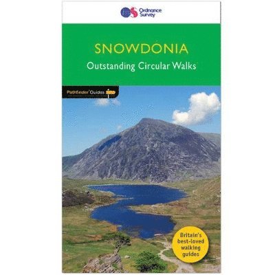
Pathfinder(R) Snowdonia covering Bont Newydd, Aber and Tal-y-lln. This selection offers interest, regional variety and balance of routes in Snowdonia providing the best walks in the area. From an easy stroll along in Aber Falls to the much more challenging walk up the summit of Cnicht, this volume contains something for everyone. Covering walks through the whole of Snowdonia both popular and little know scenic routes including Tryfan, Beddgelert and Barmouth Bay. -See walk locations by Looking Inside Inside: -28 great walks in Snowdonia from 2 to 10 miles -Clear, large scale Ordnance Survey route maps -GPS reference for all Snowdonia waypoints -Where to park, good pubs and places of interest en route -All routes have been fully researched and written by expert outdoor writers -Beautiful photography of scenes from the walks Pathfinder(R) Guides are Britain's best loved walking guides. Made with durable covers, they are the perfect companion for countryside walks throughout Britain. Each title features circular walks with easy-to-follow route descriptions, large-scale Ordnance Survey route maps and GPS waypoints.With over 70 titles in the series, they offer essential information for walkers throughout the country.Contents* Aber Falls* Cwm Pennant* Precipice Walk* Ceunant Cynfal* Tal-y-Llyn Lake* Capel Curig* Penmaenpool and the Mawddach Trail* Llyn y Gader and Beddgelert Forest* Lledr Valley* Gwydyr Forest and Trefriw* Coed-y-brenin* Vale of Ffestiniog* Cregennen Lakes* Tanygrisiau and Rhosydd* Tryfan* Moel Hebog* Drum and Llyn Anafon* Pont Scethin* Cnicht* Carnedd Llywelyn* Gwydyr Forest and the Swallow Falls* Nanmor Valley and Aberglaslyn* Aran Benllyn* Moel Eilio* Snowdon (Yr Wyddfa)* Cadair Idris* Glyder Fach and Glyder Fawr* Y Llethr and Moelfre
Häftad, Engelska, 2016
163 kr
Skickas
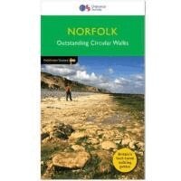
Pathfinder(R) Norfolk covering Castle Rising, Oxburgh Hall and Overstrand. This selection offers interest, regional variety and balance of routes in Norfolk providing the best walks in the area. From an easy stroll in Tyrrel's Wood to the much more challenging walk in Fordham this volume contains something for everyone. Covering walks through the whole of Norfolk both popular and little know scenic routes including Wells-next-the-Sea, Peddars Way and Binham. -See walk locations by Looking Inside Inside: -28 great walks in Norfolk from 2 to 10 miles -Clear, large scale Ordnance Survey route maps -GPS reference for all Norfolk waypoints -Where to park, good pubs and places of interest en route -All routes have been fully researched and written by expert outdoor writers -Beautiful photography of scenes from the walks Pathfinder(R) Guides are Britain's best loved walking guides. Made with durable covers, they are the perfect companion for countryside walks throughout Britain. Each title features circular walks with easy-to-follow route descriptions, large-scale Ordnance Survey route maps and GPS waypoints.With over 70 titles in the series, they offer essential information for walkers throughout the country.Contents* Horsey* Binham Priory* Oxborough and Gooderstone* Hales Green from Loddon* Marham Fen and the Nar Valley Way* Tyrrel's Wood and Shelton* Felbrigg Park and Metton* Langmere and the Devil's Punchbowl* River Bure and Upton Marshes* How Hill and Ludham* The Buckenhams* Hardley Cross* Blickling and the River Bure* Peddars Way - Fring and Sedgeford* Castle Acre and West Acre* Boudica's Way - Shotesham and Saxlingham Nethergate* Thompson Common and the Pingos* Westwick Woods and the Weavers Way* West Runton and Beacon Hill* Wiveton Downs and Cley next the Sea* The Burnhams* Denver Sluice - a three rivers walk* Wells-next-the-Sea, Warham and Wighton* Weavers Way to the Berney Arms* Reepham, Marriott's Way and Salle* Weeting Castle and Grime's Graves* Castle Rising and Roydon Common* Ringstead Downs and the Norfolk Coast
Häftad, Engelska, 2016
163 kr
Skickas
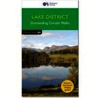
Pathfinder(R) Lake District covering Coniston, Kewswick and Devoke Water. This selection offers interest, regional variety and balance of routes in the Lake District providing the best walks in the area. From an easy stroll through Buttermere to the much more challenging walks in Rosthwaite and Stonethwaite this volume contains something for everyone. Covering walks through the whole of the Lake District both popular and little know scenic routes including Bowfell, Wetherlan and the Langdale Valleys. -See walk locations by Looking Inside Inside: -28 great walks in the Lake District from 2 to 10 miles -Clear, large scale Ordnance Survey route maps -GPS reference for all Lake District waypoints -Where to park, good pubs and places of interest en route -All routes have been fully researched and written by expert outdoor writers -Beautiful photography of scenes from the walks Pathfinder(R) Guides are Britain's best loved walking guides. Made with durable covers, they are the perfect companion for countryside walks throughout Britain. Each title features circular walks with easy-to-follow route descriptions, large-scale Ordnance Survey route maps and GPS waypoints.With over 70 titles in the series, they offer essential information for walkers throughout the country.
Häftad, Engelska, 2016
157 kr
Skickas
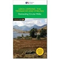
The walks in this guide introduce the many facets of the Southern Highlands and range from easy loch-side strolls to strenuous expeditions onto some of the area's highest mountains. Walking in Scotland is quite different from walking south of the border. In England there are only eight summits that top 3000 ft, while in Scotland there are 277, with 45 of them situated in the Southern Highlands. Walks taking in the mountains of the National Park include Beinn Dubh, Ben Vorlich, The Cobbler, Ben Ledi, Ben Lomond and Ben Venue. The Trossachs are particularly spectacular when clothed in autumn colours and provided the setting for The Lady of the Lake and Rob Roy, by Sir Walter Scott. The Ochil Hills, Loch Lomond and the West Highland Way are also included, and there is an opportunity to see Stirling and the Wallace monument, overlooking the scene of the Scottish patriot's victory over Edward I.
Häftad, Engelska, 2016
163 kr
Skickas
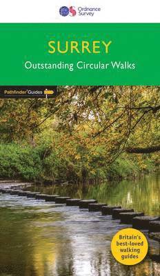
The Pathfinder(R) Guide to Surrey Walks contains 28 fantastic circular walks across the county, much of which lies only a few miles away from the heart of London but which contains some of the country's most beaufiul landscapes, including the oldest untouched area of natural woodland in the UK and the rolling contours of the North Downs. Each walk in Pathfinder(R) Guide to Surrey Walks is accompanied by clear, large-scale Ordnance Survey route maps and GPS waypoints to help you navigate your hike with ease. Exploring one of the most popular Home Counties, Pathfinder(R) Guide to Surrey Walks guides the walker to some of the best walking destinations in the county, from Box Hill and Wisley to the Devil's Punch Bowl and the River Wey. Away from the city, Pathfinder(R) Guide to Surrey Walks presents a host of beautiful countryside walks that offer remarkable hikes with unspoilt landscapes accessible to walkers of all abilities. Pathfinder(R) Guide to Surrey Walks takes you through the North Downs and heathlands of western Surrey to locations made popular in Jane Austen's Emma and War of the Worlds by H. G. Wells.Inside you'll also find a wealth of helpful information accompanying each walk, including good pubs along the way, where to park before you start your walk and places of interest en route.Pathfinder(R) Guides are Britain's best loved walking guides. They are the perfect companion for countryside walks throughout Britain. Each title features circular walks with easy-to-follow route descriptions, tried and tested by seasoned walkers and accompanied by beautiful photography and clear Ordnance Survey mapping. The routes range from extended strolls to exhilarating hikes, so there is something for everyone.
Häftad, Engelska, 2017
127 kr
Skickas
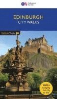
Are you wondering what to do in Edinburgh? Whether you're a first-time visitor or visit Edinburgh regularly, City Walks Edinburgh provides a new look at this historic city with original walks and insightful stories. Discover the best things to do in Edinburgh from the Edinburgh dungeons to Edinburgh Castle. Walk through one of the most interesting cities in the world and watch Edinburgh come to life, from Bruntsfield to Royal Mile, expert guide Margot McMurdo gives you a personal Edinburgh tour, with each walk packed full of intriguing tales and unique features including, Calton Hill, New Town, Edinburgh castles and Arthur's Seat. Learn little known facts and stories in a fun and exciting way, and discover the events that shaped Edinburgh into the vibrant city it is today. Take this handy guide with you as you travel around and explore the off route detours to find out Edinburgh's deeper secrets or link two or more routes to create your own unique day out.Be guided to the most famous areas and lesser known corners of Edinburgh with City Walks, including: -15 short walks in Edinburgh - Dozens of intriguing tales and fascinating history told in each walk - Simple route description and easy-to-follow maps - Key features and viewpoints for each walk - Walk statistics including distance and estimated time - Accompanying colour photographs - Recommended refreshment stops Your own personal walking tour of Edinburgh.
Häftad, Engelska, 2017
163 kr
Skickas
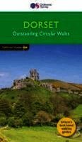
Dorset must rank as one of the most unspoilt counties in England. Dominating the landscape are the chalk downs open, sweeping, grassy uplands that stretch from the former forest lands of Cranborne Chase on the Wiltshire and Hampshire borders right across the middle of the county to the coast. The many ridge-top footpaths (including one starting from Cerne Abbas which ends with the Cerne Giant in all its glory) that cross these downs provide splendid walking and a succession of panoramic views. -See walk locations by Looking Inside Inside: -28 great walks in Dorset all revised and updated -Clear, large scale Ordnance Survey route maps -GPS reference for all waypoints -Where to park, good pubs and places of interest en route -All routes have been fully researched and written by expert outdoor writers -Beautiful photography of scenes from the walks Pathfinder(R) Guides are Britain's best loved walking guides. Made with durable covers, they are the perfect companion for countryside walks throughout Britain. Each title features circular walks with easy-to-follow route descriptions, large-scale Ordnance Survey route maps and GPS waypoints.With over 70 titles in the series, they offer essential information for walkers throughout the country.
Häftad, Engelska, 2017
163 kr
Skickas
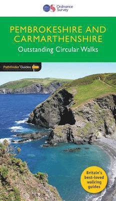
Although deep in South Wales, Pembrokeshire and Carmarthenshire have a strong English influence, but their most striking feature, from the point of view of the walker, is that they contain some of the most spectacular coastal scenery and finest stretches of coast path in Britain. Although the walks in this guide inevitably concentrate on the coast, especially using the Pembrokeshire Coast Path, their characters vary considerably, ranging from the splendid cliff scenery around the peninsula of Dinas Island and to the west of Port-Eynon Bay, to the wooded stretches between Saundersfoot and Tenby. Inland, and by way of contrast, the Preseli hills offer a splendid ridge walk.
Häftad, Engelska, 2017
163 kr
Skickas
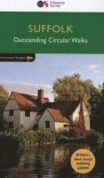
Suffolk's riverside meadows of the Stour valley remain as beautiful today as when Constable painted them two centuries ago. Similarly, the county's lonely expanses of estuarine marsh, which are a feature of the coast, have a quality that appeal to writers as well as artists. A walk through Flatford and East Bergholt passes one of Constable's most famous viewpoints, and Flatford Mill itself. There is a choice of coastal walks, including routes through Southwold, Shingle Street, Dingle Marshes, Thorpeness and the Shotley peninsula. With 28 walks through the Suffolk countryside, if you're a walker who really wants to make the most of the Suffolk countryside, make sure you don't set off on your walk without a copy of Pathfinder Guide to Suffolk Walks in your rucksack! Pathfinder(R). Guides are Britain's best loved walking guides. Made with durable covers, they are the perfect companion for countryside walks throughout Britain. Each title features circular walks with easy-to- follow route descriptions, tried and tested by seasoned walkers and accompanied by beautiful photography and clear, large-scale Ordnance Survey mapping.
Häftad, Engelska, 2017
160 kr
Skickas
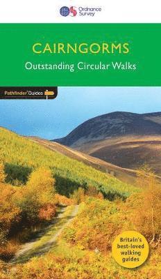
The Cairngorms cover 300 sq miles, making it the most mountainous area in Britain, with an equally wide range of wildlife. The native pine forest, one of the final retreats of the red squirrel, supports small, uncommon birds like crested tits, redwings and crossbills. Loch Garten is the RSPB osprey breeding site where in summer the birds fly over a considerable tract of country in search of food. In scenic contrast, there is also an ascent to the summit of Carn Daimh, part of the Speyside Way, with its splendid panorama of the countryside surrounding Glenlivet.
Häftad, Engelska, 2017
160 kr
Skickas
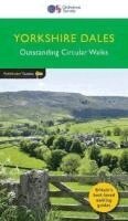
Pathfinder Yorkshire Dales covering parts of the National Park, Ribblesdale and Swaledale. This selection offers interest, regional variety and balance of routes in the Yorkshire Dales providing the best walks in the area. From an easy stroll through Ingleton Waterfalls to the much more challenging walks in Gunnerside, this volume contains something for everyone. Covering walks through the whole of the Yorkshire Dales both popular and little know scenic routes including Wharfedale, Wendleydale, and Burnsall. -See walk locations by Looking Inside Inside: 28 great Yorkshire Dales walks from 2 to 10 miles -Clear, large scale Ordnance Survey route maps -GPS reference for all Yorkshire Dales waypoints -Where to park, good pubs and places of interest en route -All routes have been fully researched and written by expert outdoor writers -Beautiful photography of scenes from the walks Pathfinder Guides are Britain's best loved walking guides. Made with durable covers, they are the perfect companion for countryside walks throughout Britain. Each title features circular walks with easy-to-follow route descriptions, large-scale Ordnance Survey route maps and GPS waypoints.With over 70 titles in the series, they offer essential information for walkers throughout the country.
Del 71 - Pathfinder Guides
Pathfinder The High Fells of Lakeland
Häftad, Engelska, 2018
160 kr
Skickas
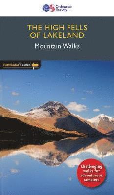
Are you planning a holiday to the Lake District? Do you enjoy a hill-walking challenge with impressive mountain-top views? Inside Pathfinder (R) Guide to the High Fells of Lakeland are 20 majestic and challenging fell walks amid the glorious scenery of the Lake District mountains with clear and easy-to-follow route directions compiled from the author's 40 years' experience of Lakeland walking. For adventurous ramblers and walkers wanting a hill-walking challenge, this brand new Pathfinder (R) walking guide features 20 demanding day-walks in the mountains of the Lake District, from Scafell Pike (highest mountain in the Lake District), to Helvellyn, Skiddaw, Great End and Bowfell - all over 900m (nearly 3000 feet) high. Giving a detailed guide to 20 inspiring expeditions on the high fells of Lakeland, Pathfinder (R) Guide to the High Fells of Lakeland explores some of the best fell walking country in the Lake District. With views over to Buttermere, Derwentwater and Grasmere, the Lakeland Fells offer some of the most superb experiences of the Lake District for the adventurous walker and Pathfinder (R) Guide to the High Fells of Lakeland allows ramblers to easily enjoy these mountain views with clear, large-scale Ordnance Survey route maps and GPS waypoints to help you navigate your walk with ease. If you're a walker who really wants to make the most of what Wainwright described as the `splendid walking country' of the Lake District, make sure you don't set off on your fell walk without a copy of Pathfinder (R) Guide to the High Fells of Lakeland in your rucksack. Pathfinder (R) Guides are Britain's best loved walking guides. Made with durable covers, they are the perfect companion for countryside walks throughout Britain. Each title features circular walks with easy-to-follow route descriptions, tried and tested by seasoned walkers and accompanied by beautiful photography and clear, large-scale Ordnance Survey mapping.
Del 19 - Pathfinder Guides
Dumfries & Galloway
Häftad, Engelska, 2018
160 kr
Skickas
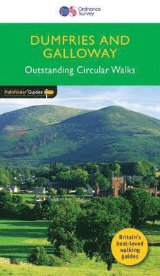
Dumfries and Galloway form the south-west of Scotland, a broad wedge of land jutting out into the Irish Sea between the Solway Firth and the Firth of Clyde. The area is also part of Scotland's border country a peaceful, unspoilt region that possesses a mild climate, a great variety of scenery and a rich historic legacy. The mountains of Dumfries and Galloway offer plenty of remote and challenging walking, with over 40 peaks that exceed 2000 feet. Also featured are clifftop walks around the Mull of Galloway and Rascarrel Bay, a route around the Solway Marshes, and Gretna Green destination for romantic elopements for 200 years.
Del 47 - Pathfinder Guides
EDINBURGH, PENTLANDS & LOTHIANS
Häftad, Engelska, 2018
160 kr
Skickas
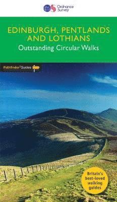
The countryside around Edinburgh is ideal for walking comprising a superb mixture of rolling hills, expansive moorland and attractive rivers, bounded by fertile lowlands and an impressive coastline. The stunning views from Arthur's Seat and the Braid Hills give amazing panoramas of Edinburgh itself. Stretches of the sandy Lothian coast are explored on the John Muir Way from Cockenzie and at Gullane, with the more rugged Berwickshire coast featuring at North Berwick and Dunbar. The atmospheric and simple beauty of the Lammermuirs, Moorfoots and Pentlands provide a hard to match excellence in breezy and peaceful upland wanderings.
Del 53 - Pathfinder Guides
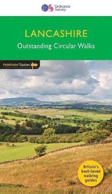
Lancashire
Häftad, Engelska, 2018
160 kr
Skickas
With its fen-like lowlands, its coastal scenery, the high fells of Bowland and the lush river valleys of the Ribble and Lune, Lancashire is a county of surprising diversity from its great Industrial heritage towns to its attractive, rural villages and its numerous historic monuments. There can be no better way of exploring Lancashire than by foot; it has a number of satisfying long-distance paths - both inland and coastal - and, as this book shows, opportunity for a great number of circular walks in highly distinctive surroundings, including the Lune Valley, Formby Point and Forest of Bowland.
Del 75 - Pathfinder Guides
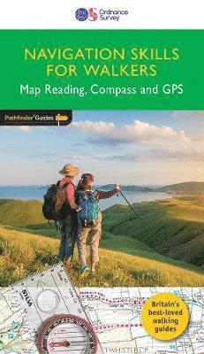
PF NAVIGATIONAL SKILLS FOR WALKERS – MAP READING
Häftad, Engelska, 2019
160 kr
Skickas
Discover more of the great outdoors with Navigation Skills for Walkers and Pathfinder (R) Guides. Build confidence and competence in reading maps: using grid references, contour interpretation and visualising terrain. Learn how to use a compass, with map and compass navigation: taking a bearing, magnetic variation and `aiming off'. Make the most of your GPS device: using the information it provides, understanding the limitations of GPS, and geocaching. Gain familiarity with digital mapping: introducing OS Maps, its app and online versions ideal for creating, following and reviewing your own walks.
Häftad, Engelska, 2022
163 kr
Skickas
Häftad, Engelska, 2022
163 kr
Skickas
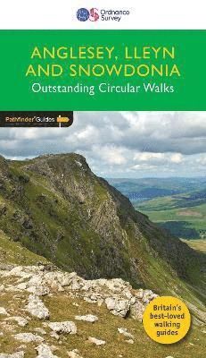
Del 78 - Pathfinder Guides
ANGLESEY, LLEYN AND SNOWDONIA
Häftad, Engelska, 2022
160 kr
Skickas
Pathfinder® Guide to Anglesey, Lleyn and Snowdonia, featuring 28 outstanding and mostly circular rambles across the Isle of Anglesey, western Conwy and Gwynedd: from Holyhead Mountain to Aran Benlynn and Aran Fawddwy, and from Aberdaron to Conwy. A new Pathfinder® title, now including 11 brand new walks for Anglesey, three new walks on the Lleyn Peninsula and one new mountain walk in Snowdonia National Park, there's something for everyone with a range of routes designed for walkers of varying experience and ability, from country walking novices to seasoned ramblers. This new book retains the classic Snowdonia walks from the previous guide such as Llyn Padarn and Snowdon (Yr Wyddfa) itself from Rhyd Ddu, and the must-include North Wales walks at Aber and Conwy Mountain, and adds to the itinerary by way of delightful new routes along Anglesey’s Heritage Coast at Cemlyn Bay and Aberffraw, along the Menai shore at Brynsiencyn, and new explorations of Lleyn from Porthor, Llanbedrog and Trefor.
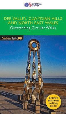
Del 79 - Pathfinder Guides
DEE VALLEY, CLWYDIAN HILLS AND NORTH EAST WALES
Häftad, Engelska, 2022
160 kr
Skickas
Pathfinder® Guide to North East Wales, featuring 28 outstanding and mostly circular rambles in the Dee Valley, over the Clwdian Hills and across Conwy east of the Vale of Conwy, Denbighshire, Flintshire and Wrexham: from the Great Orme to Chirk and from the Point of Ayr (the most northerly tip of mainland Wales) to the lofty summit of Cadair Berwyn. A new Pathfinder® title, now including 14 walks in the Clwydian Range and Dee Valley Area of Outstanding Natural Beauty, three routes along the North Wales coast and more adventurous explorations of the less frequented but exceptionally beautiful Berwyn Mountains, there's something for everyone with a range of routes designed for walkers of varying experience and ability, from country walking novices to seasoned ramblers.
Häftad, Engelska, 2021
163 kr
Skickas
Häftad, Engelska, 2021
163 kr
Skickas
Del 82 - Pathfinder Guides
ORKNEY AND SHETLAND
Häftad, Engelska, 2022
160 kr
Skickas
In Orkney, the first walk is a short stroll around Hoxa Head with its extensive views across Scapa Flow and subsequent routes go on to explore more widely over Mainland Orkney and take in the islands of Hoy, Rousay and South Ronaldsay, concluding with a ramble along the breathtaking clifftops of Yesnaby .n Shetland, the first walk sets out from Sandsayre jetty to the tiny island of Mousa. Walks range across Shetland from wild and remote Hermaness, on the far northern tip of Unst, down to Sumburgh Head, its most southerly point
Del 83 - Pathfinder Guides
NORTH COAST 500 AND NORTHERN HIGHLANDS
Häftad, Engelska, 2022
163 kr
Skickas
"Pathfinder (R) Guide North Coast 500 presents 28 fabulous walks and 32 not-to-be-missed stop-off opportunities in the Northern Highlands, following Scotland's longest and most spectacularly scenic road trip. This guide follows the North Coast 500 in a clockwise circuit, arranged in four convenient chapters:South - Inverness to Braemore JunctionWest - Braemore Junction to DurnessNorth - Durness to WickEast - Wick to InvernessSetting out in the first chapter in a westerly direction from Inverness, the first walk is encountered at Loch Kinellan, north-west of Muir of Ord. The first west coast-based walk is from Applecross, with others following at Shieldaig, Gairloch and Poolewe, while inland there's a circuit of Loch Coulin in the Torridon mountains and an ascent of Beinn Eighe.In the second chapter, walks explore the amazing geology and landscapes of the west coast from Ullapool, northwards through the wild terrain of Assynt and the Northwest Geo Park, visiting the Traligill Caves and Lochinver, and with a glorious finale to the remote and outstandingly beautiful Sandwood Bay - a real treat.Chapter three provides the opportunity to climb Ben Hope, Scotland's most northerly Munro, where the views from the summit reach over the inaccessible blanket bog expanse of the Flow Country. The other walks explore the headlands, beaches, bays and north coast heritage from Durness, Tongue, Torrisdale and Castletown, with the impressive Stacks of Duncansby the objective of the last walk in the chapter, reaching the most north-easterly tip of mainland Scotland.Visiting a clifftop castle, an historic fishing harbour and seabird colony, chapter four begins with a circuit of Noss Head. Moving down the east coast to Helmsdale, there's a detour inland to tackle Morven and Maiden Pap, and the itinerary continues with a climb up Ben Bhraggie from Golspie, a wood-flanked estuary ramble at Loch Fleet, a stroll around the Seaboard Villages and fishing heritage associated with Hilton, Balintore and Shandwick, and finishing with a walk to the Fyrish Monument and far-reaching views over Cromarty Firth.28 outstanding circular walks and 32 stop-off strolls at points around the North Coast 500: walks range from 2 to 101/2 miles with clear, large scale Ordnance Survey route maps, GPS waypoints, where to park, and all the places of interest en route. These all-new routes have been researched and written by expert outdoor writer Felicity Martin and showcase beautiful photography of scenes from the walks. Pathfinder (R) Guides are Britain's best-loved walking guides. Printed with weather-resistant covers featuring durable rounded corners, they are the perfect companion for country walking throughout Britain. With 80 titles in the series, and 2000 routes to choose from, a wealth of walks is available throughout England, Scotland and Wales from Land's End to Shetland and the Lleyn Peninsula to Southwold."