
Signal and Image Processing of Earth Observations – serie
Visar alla böcker i serien Signal and Image Processing of Earth Observations. Handla med fri frakt och snabb leverans.
17 produkter
17 produkter
Häftad, Engelska, 2022
556 kr
Skickas inom 10-15 vardagar
In today’s world, deep learning source codes and a plethora of open access geospatial images are readily available and easily accessible. However, most people are missing the educational tools to make use of this resource. Deep Learning for Remote Sensing Images with Open Source Software is the first practical book to introduce deep learning techniques using free open source tools for processing real world remote sensing images. The approaches detailed in this book are generic and can be adapted to suit many different applications for remote sensing image processing, including landcover mapping, forestry, urban studies, disaster mapping, image restoration, etc. Written with practitioners and students in mind, this book helps link together the theory and practical use of existing tools and data to apply deep learning techniques on remote sensing images and data. Specific Features of this Book: The first book that explains how to apply deep learning techniques to public, free available data (Spot-7 and Sentinel-2 images, OpenStreetMap vector data), using open source software (QGIS, Orfeo ToolBox, TensorFlow) Presents approaches suited for real world images and data targeting large scale processing and GIS applications Introduces state of the art deep learning architecture families that can be applied to remote sensing world, mainly for landcover mapping, but also for generic approaches (e.g. image restoration) Suited for deep learning beginners and readers with some GIS knowledge. No coding knowledge is required to learn practical skills. Includes deep learning techniques through many step by step remote sensing data processing exercises.
Häftad, Engelska, 2020
739 kr
Skickas inom 10-15 vardagar
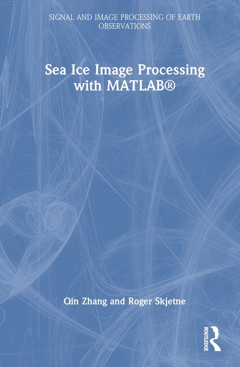
Sea Ice Image Processing with MATLAB addresses the topic of image processing for the extraction of key sea ice characteristics from digital photography, which is of great relevance for Artic remote sensing and marine operations. This valuable guide provides tools for quantifying the ice environment that needs to be identified and reproduced for such testing. This includes fit-for-purpose studies of existing vessels, new-build conceptual design and detailed engineering design studies for new developments, and studies of demanding marine operations involving multiple vessels and operational scenarios in sea ice. A major contribution of this work is the development of automated computer algorithms for efficient image analysis. These are used to process individual sea-ice images and video streams of images to extract parameters such as ice floe size distribution, and ice types. Readers are supplied with Matlab source codes of the algorithms for the image processing methods discussed in the book made available as online material. FeaturesPresents the first systematic work using image processing techniques to identify ice floe size distribution from aerial imagesHelps identify individual ice floe and obtain floe size distributions for Arctic offshore operations and transportationExplains specific algorithms that can be combined to solve various problems during polar sea ice investigationsIncludes MATLAB® codes useful not only for academics, but for ice engineers and scientists to develop tools applicable in different areas such as sustainable arctic marine and coastal technology researchProvides image processing techniques applicable to other fields like biomedicine, material science, etc
Inbunden, Engelska, 2020
1 476 kr
Skickas inom 10-15 vardagar
In today’s world, deep learning source codes and a plethora of open access geospatial images are readily available and easily accessible. However, most people are missing the educational tools to make use of this resource. Deep Learning for Remote Sensing Images with Open Source Software is the first practical book to introduce deep learning techniques using free open source tools for processing real world remote sensing images. The approaches detailed in this book are generic and can be adapted to suit many different applications for remote sensing image processing, including landcover mapping, forestry, urban studies, disaster mapping, image restoration, etc. Written with practitioners and students in mind, this book helps link together the theory and practical use of existing tools and data to apply deep learning techniques on remote sensing images and data. Specific Features of this Book: The first book that explains how to apply deep learning techniques to public, free available data (Spot-7 and Sentinel-2 images, OpenStreetMap vector data), using open source software (QGIS, Orfeo ToolBox, TensorFlow) Presents approaches suited for real world images and data targeting large scale processing and GIS applications Introduces state of the art deep learning architecture families that can be applied to remote sensing world, mainly for landcover mapping, but also for generic approaches (e.g. image restoration) Suited for deep learning beginners and readers with some GIS knowledge. No coding knowledge is required to learn practical skills. Includes deep learning techniques through many step by step remote sensing data processing exercises.
Häftad, Engelska, 2019
837 kr
Skickas inom 10-15 vardagar
A synthesis of more than ten years of experience, Remote Sensing Image Fusion covers methods specifically designed for remote sensing imagery. The authors supply a comprehensive classification system and rigorous mathematical description of advanced and state-of-the-art methods for pansharpening of multispectral images, fusion of hyperspectral and panchromatic images, and fusion of data from heterogeneous sensors such as optical and synthetic aperture radar (SAR) images and integration of thermal and visible/near-infrared images. They also explore new trends of signal/image processing, such as compressive sensing and sparse signal representations.The book brings a new perspective to a multidisciplinary research field that is becoming increasingly articulate and comprehensive. It fosters signal/image processing methodologies toward the goal of information extraction, either by humans or by machines, from remotely sensed images. The authors explain how relatively simple processing methods tailored to the specific features of the images may be winning in terms of reliable performance over more complex algorithms based on mathematical theories and models unconstrained from the physical behaviors of the instruments.Ultimately, the book covers the births and developments of three generations of RS image fusion. Established textbooks are mainly concerned with the earliest generation of methods. This book focuses on second generation methods you can use now and new trends that may become third generation methods. Only the lessons learned with second generation methods will be capable of fostering the excellence among the myriad of methods that are proposed almost every day by the scientific literature.
Häftad, Engelska, 2020
837 kr
Skickas inom 10-15 vardagar
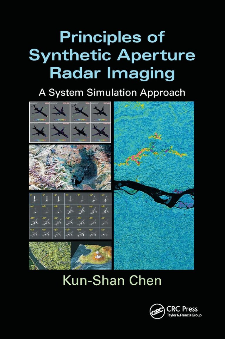
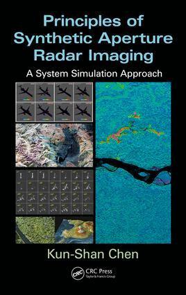
Principles of Synthetic Aperture Radar Imaging: A System Simulation Approach demonstrates the use of image simulation for SAR. It covers the various applications of SAR (including feature extraction, target classification, and change detection), provides a complete understanding of SAR principles, and illustrates the complete chain of a SAR operation. The book places special emphasis on a ground-based SAR, but also explains space and air-borne systems. It contains chapters on signal speckle, radar-signal models, sensor-trajectory models, SAR-image focusing, platform-motion compensation, and microwave-scattering from random media. While discussing SAR image focusing and motion compensation, it presents processing algorithms and applications that feature extraction, target classification, and change detection. It also provides samples of simulation on various scenarios, and includes simulation flowcharts and results that are detailed throughout the book. Introducing SAR imaging from a systems point of view, the author: Considers the recent development of MIMO SAR technologyIncludes selected GPU implementationProvides a numerical analysis of system parameters (including platforms, sensor, and image focusing, and their influence)Explores wave-target interactions, signal transmission and reception, image formation, motion compensationCovers all platform motion compensation and error analysis, and their impact on final image radiometric and geometric qualityDescribes a ground-based SFMCW system Principles of Synthetic Aperture Radar Imaging: A System Simulation Approach is dedicated to the use, study, and development of SAR systems. The book focuses on image formation or focusing, treats platform motion and image focusing, and is suitable for students, radar engineers, and micr
Häftad, Engelska, 2019
1 035 kr
Skickas inom 10-15 vardagar
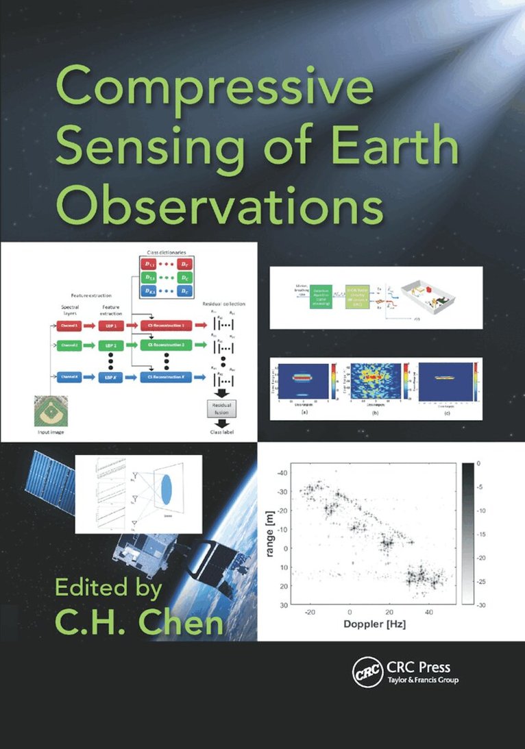
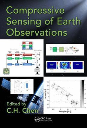
Future remote sensing systems will make extensive use of Compressive Sensing (CS) as it becomes more integrated into the system design with increased high resolution sensor developments and the rising earth observation data generated each year. Written by leading experts in the field Compressive Sensing of Earth Observations provides a comprehensive and balanced coverage of the theory and applications of CS in all aspects of earth observations. This work covers a myriad of practical aspects such as the use of CS in detection of human vital signs in a cluttered environment and the corresponding modeling of rib-cage breathing. Readers are also presented with three different applications of CS to the ISAR imaging problem, which includes image reconstruction from compressed data, resolution enhancement, and image reconstruction from incomplete data.
Inbunden, Engelska, 2024
2 653 kr
Skickas inom 10-15 vardagar
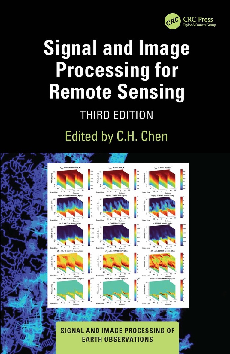
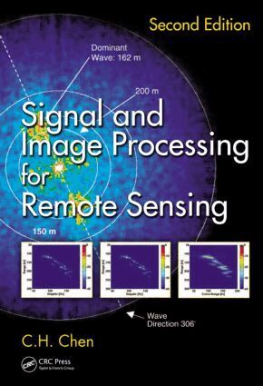
Advances in signal and image processing for remote sensing have been tremendous in recent years. The progress has been particularly significant with the use of deep learning based techniques to solve remote sensing problems. These advancements are the focus of this third edition of Signal and Image Processing for Remote Sensing. It emphasizes the use of machine learning approaches for the extraction of remote sensing information. Other topics include change detection in remote sensing and compressed sensing. With 19 new chapters written by world leaders in the field, this book provides an authoritative examination and offers a unique point of view on signal and image processing.FeaturesIncludes all new content and does not replace the previous editionCovers machine learning approaches in both signal and image processing for remote sensingStudies deep learning methods for remote sensing information extraction that is found in other booksExplains SAR, microwave, seismic, GPR, and hyperspectral sensors and all sensors consideredDiscusses improved pattern classification approaches and compressed sensing approachesProvides ample examples of each aspect of both signal and image processingThis book is intended for university academics, researchers, postgraduate students, industry, and government professionals who use remote sensing and its applications.
- Nyhet

Häftad, Engelska, 2026
880 kr
Skickas inom 10-15 vardagar
Advances in signal and image processing for remote sensing have been tremendous in recent years. The progress has been particularly significant with the use of deep learning based techniques to solve remote sensing problems. These advancements are the focus of this third edition of Signal and Image Processing for Remote Sensing. It emphasizes the use of machine learning approaches for the extraction of remote sensing information. Other topics include change detection in remote sensing and compressed sensing. With 19 new chapters written by world leaders in the field, this book provides an authoritative examination and offers a unique point of view on signal and image processing.FeaturesIncludes all new content and does not replace the previous editionCovers machine learning approaches in both signal and image processing for remote sensingStudies deep learning methods for remote sensing information extraction that is found in other booksExplains SAR, microwave, seismic, GPR, and hyperspectral sensors and all sensors consideredDiscusses improved pattern classification approaches and compressed sensing approachesProvides ample examples of each aspect of both signal and image processingThis book is intended for university academics, researchers, postgraduate students, industry, and government professionals who use remote sensing and its applications.

E-bok
Engelska, 2015942 kr
Läs direkt efter köp
A synthesis of more than ten years of experience, Remote Sensing Image Fusion covers methods specifically designed for remote sensing imagery. The authors supply a comprehensive classification system and rigorous mathematical description of advanced and state-of-the-art methods for pansharpening of multispectral images, fusion of hyperspectral and
Inbunden, Engelska, 2018
2 752 kr
Skickas inom 10-15 vardagar
Sea Ice Image Processing with MATLAB addresses the topic of image processing for the extraction of key sea ice characteristics from digital photography, which is of great relevance for Artic remote sensing and marine operations. This valuable guide provides tools for quantifying the ice environment that needs to be identified and reproduced for such testing. This includes fit-for-purpose studies of existing vessels, new-build conceptual design and detailed engineering design studies for new developments, and studies of demanding marine operations involving multiple vessels and operational scenarios in sea ice. A major contribution of this work is the development of automated computer algorithms for efficient image analysis. These are used to process individual sea-ice images and video streams of images to extract parameters such as ice floe size distribution, and ice types. Readers are supplied with Matlab source codes of the algorithms for the image processing methods discussed in the book made available as online material. FeaturesPresents the first systematic work using image processing techniques to identify ice floe size distribution from aerial imagesHelps identify individual ice floe and obtain floe size distributions for Arctic offshore operations and transportationExplains specific algorithms that can be combined to solve various problems during polar sea ice investigationsIncludes MATLAB® codes useful not only for academics, but for ice engineers and scientists to develop tools applicable in different areas such as sustainable arctic marine and coastal technology researchProvides image processing techniques applicable to other fields like biomedicine, material science, etc
Häftad, Engelska, 2018
1 288 kr
Skickas inom 10-15 vardagar
Based on the experiences of the Department of Information Engineering of the University of Pisa and the Radar and Surveillance System (RaSS) national laboratory of the National Interuniversity Consortium of Telecommunication (CNIT), Radar Imaging for Maritime Observation presents the most recent results in radar imaging for maritime observation. The book explores both the areas of sea surface remote sensing and maritime surveillance providing key theoretical concepts of SAR and ISAR imaging and more advanced and ad-hoc techniques for applications in maritime scenarios. The book is organized in two sections. The first section discusses the fundamentals of standard SAR/ISAR processing and novel imaging techniques, such as Bistatic, Passive, and, 3D Interferometric ISAR. The second section focuses on the applications and results obtained by processing real data from maritime observations like SAR image processing for oil spill, detection in SAR images and fractal analysis. Useful to both beginners and experts in maritime observation, this book provides several examples of (mainly space-borne) radar imaging of maritime targets. Nevertheless, the same principles and techniques apply to the case of manned or unmanned carriers and to ground and air moving targets.
Inbunden, Engelska, 2016
3 315 kr
Skickas inom 10-15 vardagar
Based on the experiences of the Department of Information Engineering of the University of Pisa and the Radar and Surveillance System (RaSS) national laboratory of the National Interuniversity Consortium of Telecommunication (CNIT), Radar Imaging for Maritime Observation presents the most recent results in radar imaging for maritime observation. The book explores both the areas of sea surface remote sensing and maritime surveillance providing key theoretical concepts of SAR and ISAR imaging and more advanced and ad-hoc techniques for applications in maritime scenarios. The book is organized in two sections. The first section discusses the fundamentals of standard SAR/ISAR processing and novel imaging techniques, such as Bistatic, Passive, and, 3D Interferometric ISAR. The second section focuses on the applications and results obtained by processing real data from maritime observations like SAR image processing for oil spill, detection in SAR images and fractal analysis. Useful to both beginners and experts in maritime observation, this book provides several examples of (mainly space-borne) radar imaging of maritime targets. Nevertheless, the same principles and techniques apply to the case of manned or unmanned carriers and to ground and air moving targets.
Inbunden, Engelska, 2015
2 501 kr
Skickas inom 10-15 vardagar
A synthesis of more than ten years of experience, Remote Sensing Image Fusion covers methods specifically designed for remote sensing imagery. The authors supply a comprehensive classification system and rigorous mathematical description of advanced and state-of-the-art methods for pansharpening of multispectral images, fusion of hyperspectral and panchromatic images, and fusion of data from heterogeneous sensors such as optical and synthetic aperture radar (SAR) images and integration of thermal and visible/near-infrared images. They also explore new trends of signal/image processing, such as compressive sensing and sparse signal representations.The book brings a new perspective to a multidisciplinary research field that is becoming increasingly articulate and comprehensive. It fosters signal/image processing methodologies toward the goal of information extraction, either by humans or by machines, from remotely sensed images. The authors explain how relatively simple processing methods tailored to the specific features of the images may be winning in terms of reliable performance over more complex algorithms based on mathematical theories and models unconstrained from the physical behaviors of the instruments.Ultimately, the book covers the births and developments of three generations of RS image fusion. Established textbooks are mainly concerned with the earliest generation of methods. This book focuses on second generation methods you can use now and new trends that may become third generation methods. Only the lessons learned with second generation methods will be capable of fostering the excellence among the myriad of methods that are proposed almost every day by the scientific literature.
E-bok
PDF, Engelska, 2015970 kr
Läs direkt efter köp
A synthesis of more than ten years of experience, Remote Sensing Image Fusion covers methods specifically designed for remote sensing imagery. The authors supply a comprehensive classification system and rigorous mathematical description of advanced and state-of-the-art methods for pansharpening of multispectral images, fusion of hyperspectral and
Inbunden, Engelska, 2015
2 732 kr
Skickas inom 10-15 vardagar
Principles of Synthetic Aperture Radar Imaging: A System Simulation Approach demonstrates the use of image simulation for SAR. It covers the various applications of SAR (including feature extraction, target classification, and change detection), provides a complete understanding of SAR principles, and illustrates the complete chain of a SAR operation. The book places special emphasis on a ground-based SAR, but also explains space and air-borne systems. It contains chapters on signal speckle, radar-signal models, sensor-trajectory models, SAR-image focusing, platform-motion compensation, and microwave-scattering from random media. While discussing SAR image focusing and motion compensation, it presents processing algorithms and applications that feature extraction, target classification, and change detection. It also provides samples of simulation on various scenarios, and includes simulation flowcharts and results that are detailed throughout the book. Introducing SAR imaging from a systems point of view, the author: Considers the recent development of MIMO SAR technologyIncludes selected GPU implementationProvides a numerical analysis of system parameters (including platforms, sensor, and image focusing, and their influence)Explores wave-target interactions, signal transmission and reception, image formation, motion compensationCovers all platform motion compensation and error analysis, and their impact on final image radiometric and geometric qualityDescribes a ground-based SFMCW systemPrinciples of Synthetic Aperture Radar Imaging: A System Simulation Approach is dedicated to the use, study, and development of SAR systems. The book focuses on image formation or focusing, treats platform motion and image focusing, and is suitable for students, radar engineers, and microwave remote sensing researchers.
Inbunden, Engelska, 2017
2 963 kr
Skickas inom 5-8 vardagar
Future remote sensing systems will make extensive use of Compressive Sensing (CS) as it becomes more integrated into the system design with increased high resolution sensor developments and the rising earth observation data generated each year. Written by leading experts in the field Compressive Sensing of Earth Observations provides a comprehensive and balanced coverage of the theory and applications of CS in all aspects of earth observations. This work covers a myriad of practical aspects such as the use of CS in detection of human vital signs in a cluttered environment and the corresponding modeling of rib-cage breathing. Readers are also presented with three different applications of CS to the ISAR imaging problem, which includes image reconstruction from compressed data, resolution enhancement, and image reconstruction from incomplete data.
Inbunden, Engelska, 2012
2 053 kr
Tillfälligt slut
Continuing in the footsteps of the pioneering first edition, Signal and Image Processing for Remote Sensing, Second Edition explores the most up-to-date signal and image processing methods for dealing with remote sensing problems. Although most data from satellites are in image form, signal processing can contribute significantly in extracting information from remotely sensed waveforms or time series data. This book combines both, providing a unique balance between the role of signal processing and image processing. Featuring contributions from worldwide experts, this book continues to emphasize mathematical approaches. Not limited to satellite data, it also considers signals and images from hydroacoustic, seismic, microwave, and other sensors. Chapters cover important topics in signal and image processing and discuss techniques for dealing with remote sensing problems. Each chapter offers an introduction to the topic before delving into research results, making the book accessible to a broad audience.This second edition reflects the considerable advances that have occurred in the field, with 23 of 27 chapters being new or entirely rewritten. Coverage includes new mathematical developments such as compressive sensing, empirical mode decomposition, and sparse representation, as well as new component analysis methods such as non-negative matrix and tensor factorization. The book also presents new experimental results on SAR and hyperspectral image processing.The emphasis is on mathematical techniques that will far outlast the rapidly changing sensor, software, and hardware technologies. Written for industrial and academic researchers and graduate students alike, this book helps readers connect the "dots" in image and signal processing. New in This EditionThe second edition includes four chapters from the first edition, plus 23 new or entirely rewritten chapters, and 190 new figures. New topics covered include:Compressive sensingThe mixed pixel problem with hyperspectral imagesHyperspectral image (HSI) target detection and classification based on sparse representationAn ISAR technique for refocusing moving targets in SAR imagesEmpirical mode decomposition for signal processingFeature extraction for classification of remote sensing signals and imagesActive learning methods in classification of remote sensing imagesSignal subspace identification of hyperspectral dataWavelet-based multi/hyperspectral image restoration and fusionThe second edition is not intended to replace the first edition entirely and readers are encouraged to read both editions of the book for a more complete picture of signal and image processing in remote sensing. See Signal and Image Processing for Remote Sensing (CRC Press 2006).