• Fri frakt över 249 kr
  • •
  • Snabba leveranser
  • •
  • Billiga böcker
Kundservice

Du är på sajten för privatpersoner.

Företag, bibliotek eller offentlig verksamhet?

Du handlar på classic.bokus.com, där alla dina funktioner finns intakta.
Till classic.bokus.com
Bokus logotyp. Gå till startsidan.
  • Erbjudanden
  • Student
  • Topplistor
  • Barn & ungdom
  • Bokus Play
  • E-böcker
  • Ljudböcker
  • Pocketböcker
  • Spel och pussel

Pocketfynda! Hundratals böcker för 49 kr/st →

Sidfot

Mina sidor

    Hjälp

    • Kundservice
    • Vanliga frågor och svar
    • Frakt och leverans
    • Retur vid ångerrätt
    • Reklamera vara
    • Betalning
    • Köpvillkor
    • Allmänna villkor
    • Information om webbplatsens tillgänglighet

    Om Bokus

    • Om oss
    • Pressrum
    • För studenter
    • För företag
    • För bibliotek och offentlig verksamhet
    • För leverantörer
    • Hållbarhet

    Populärt

    • Aktuella erbjudanden
    • Presentkort
    • Studentlitteratur
    • Nya böcker
    • Topplistor
    • Signerade böcker
    • Engelska böcker

    Inspiration

    • Boktips
    • BookTok
    • Barnbokskaraktärer
    • Populära författare
    Logotyp för Bokus
    Följ oss på Facebook (extern länk)Följ oss på Instagram (extern länk)Följ oss på YouTube (extern länk)Följ oss på TikTok (extern länk)
    bokus @ CookiesAnpassa cookiesIntegritetspolicyKöpvillkor
    Till Citymail hemsida (extern länk)Till Budbee hemsida (extern länk)Till Postnord hemsida (extern länk)Till Schenker hemsida (extern länk)Till Early Bird hemsida (extern länk)Till Walleys hemsida (extern länk)
    1. Naturvetenskap och teknik
    2. Geovetenskap
    3. Miljövetenskap och miljöpolitik

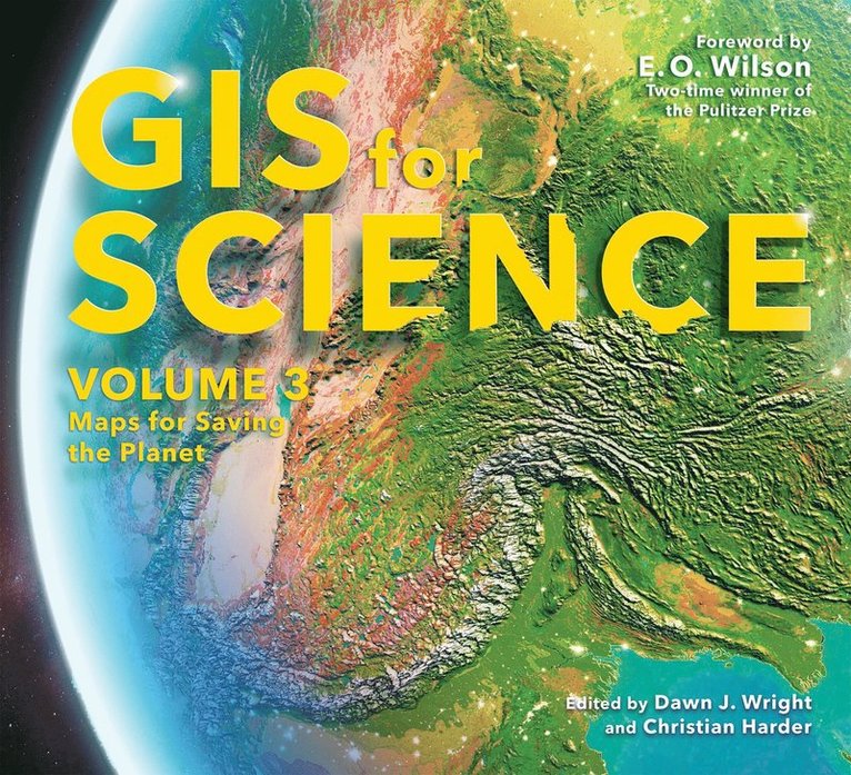
    GIS for Science, Volume 3

    Maps for Saving the Planet

    AvDawn J. Wright,Christian Harder

    Häftad, Engelska, 2022

    Del i serien GIS for Science

    491 kr

    Beställningsvara. Skickas inom 5-8 vardagar. Fri frakt över 249 kr.

    Beskrivning

    GIS for Science, Volume 3: Maps for Saving the Planet, highlights real-world examples of scientists creating maps about saving life on Earth and preserving biodiversity.   With Earth and the natural world at risk from various forces, geographic information system (GIS) mapping is essential for driving scientifically conscious decision-making about how to protect life on Earth. In volume 3 of GIS for Science, explore a collection of maps from scientists working to save the planet through documenting and protecting its biodiversity.  In this volume, learn how GIS and data mapping are used in tandem with global satellite observationforestrymarine policyartificial intelligenceconservation biology, andenvironmental educationto help preserve and chronicle life on Earth. This volume also spotlights important global action initiatives incorporating conservation, including Half-Earth, 30 x 30, AI for Earth, the Blue Nature Alliance, and the Sustainable Development Solutions Network. The stories presented in this third volume are ideal for the professional scientist and conservationist and anyone interested in the intersection of technology and the conservation of nature. The book’s contributors include scientists who are applying geographic data gathered from the full spectrum of remote sensing and on-site technologies. The maps and data are brought to life using ArcGIS® software and other spatial data science tools that support research, collaboration, spatial analysis, and science communication across many locations and within diverse communities. The stories shared in this book and its companion website present inspirational ideas so that GIS users and scientists can work toward preserving biodiversity and saving planet Earth before time runs out.

    Produktinformation

    • Utgivningsdatum:2022-01-06
    • Mått:279 x 254 x 17 mm
    • Vikt:1 008 g
    • Format:Häftad
    • Språk:Engelska
    • Serie:GIS for Science
    • Antal sidor:206
    • Förlag:ESRI Press
    • Medarbetare:E.O. Wilson
    • ISBN:9781589486713

    Utforska kategorier

    • Miljövetenskap och miljöpolitik inom Naturvetenskap och teknik
    • Geografi inom Naturvetenskap och teknik
    • Miljöteknik inom Naturvetenskap och teknik

    Mer om författaren

    Esri Chief Scientist Dawn J. Wright is a professor of geography and oceanography at Oregon State University. In 2007, the Carnegie Foundation for the Advancement of Teaching and the Council for the Advancement and Support of Education named her US Professor of the Year for the State of Oregon. She is also a fellow of the American Association for the Advancement of Science and a new fellow of Stanford University's Aldo Leopold Leadership Program in science communication. Her research interests include geographic information science; ocean informatics and cyberinfrastructure; benthic terrain and habitat characterization; and the processing and interpretation of high-resolution bathymetry, video, and underwater photographic images. Wright received a PhD in physical geography and marine geology from the University of California, Santa Barbara; an MS in oceanography from Texas A&M University; and a BS with honors from Wheaton College in Illinois. She is also certified by the GIS Certification Institute as a GIS professional (GISP). She coauthored several books for Esri Press, including Ocean Solutions, Earth Solutions, second edition (2016).Christian Harder is a technology writer and information designer at Esri. He is the author or coauthor of numerous books on GIS, including Understand GIS, The ArcGIS Book (Esri Press, 2017) and The ArcGIS Imagery Book (Esri Press, 2016).Pulitzer Prize winner

    Innehållsförteckning

    • INTRODUCTIONGIS for Science: A Framework and a ProcessIntroduction by the EditorsForewordPART 1: How Earth WorksEarth’s CoastlinesPreventing Species ExtinctionsMapping Half-EarthPART 2: How Earth LooksFrom Plots to PixelsBlueprint for a Better FutureConserving the Last Ocean FrontiersPART 3: How We Look at EarthAI for Geospatial AnalysisMapping Extreme Events from SpaceThe Science of Ocean AcousticsPART 4: Training Future Generations of ScientistsSpatial Thinking Effects on the Human BrainFueling Curiosity to Foster a Healthy PlanetTeaching Spatial Data Science and Deep LearningPART 5: Technology ShowcaseDrone Data Automation with Site Scan for ArcGISMapping BiodiversityModeling Global StreamflowClimate Data for the GIS CommunityVisualizing Vessel TrafficRevealing Sunken Ships with GeoAIThe Art of Frequency and PredominanceUnderstanding the Patterns of COVID-19Monitoring Global Snow CoverPeople for the PeopleAnalyzing Global Water Quality over TimeGrowing Degree Day ModelsInteractive Suitability ModelingInside Submarine Volcanic EruptionsSpatiotemporal Machine Learning