
Collins Maps – författare
Visar alla böcker från författaren . Handla med fri frakt och snabb leverans.
88 produkter
88 produkter
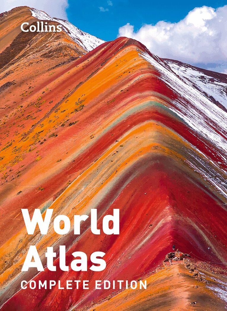
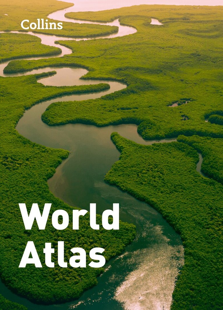
Inbunden, Engelska, 2024
421 kr
Skickas
This atlas presents a complete view of the world, bringing it to life through innovative maps, stunning images and detailed content.This fully-updated, comprehensive world atlas includes: Highly detailed regional and world-wide mappingWide range of topical issues covered including natural disasters, population, climate and the environmentKey country statistics allow comparisons of their state of development and an understanding of today’s worldThousands of facts and statistics including world and continental ranking tablesMapping updates include: Mont Blanc height updated to 4,806m/ 15,763ftMariana Trench depth updated 10,924m/ 35,839ftMore than 2000 place names updated, including major updates in Ukraine, Kazakhstan and New ZealandRoad and rail updates, including the under-construction Fehmarn Belt Fixed Link between Germany and DenmarkNew flags for Honduras and KyrgyzstanCurrency change for Croatia (now Euro) and Zimbabwe (Zimbabwe Gold)
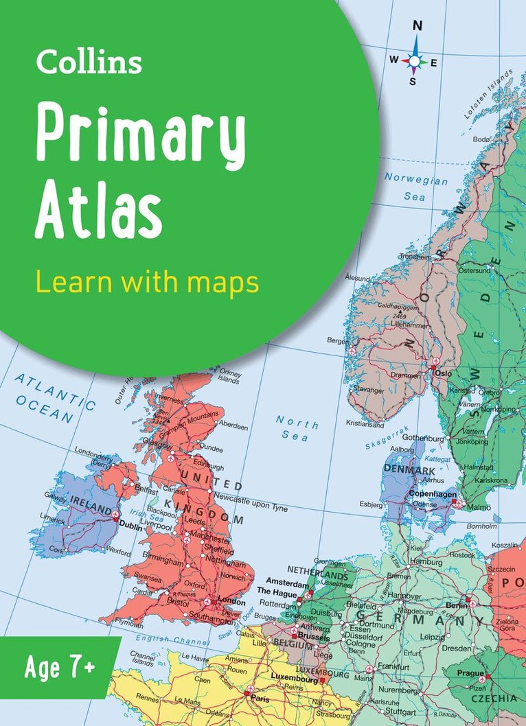
Häftad, Engelska, 2025, 6-9 år
106 kr
Skickas
The must-have atlas for children aged 7-11Collins Primary Atlas is a great introduction to mapping of the UK, Europe and all major regions of the world. It supports the Key Stage 2 curriculum and is suitable for children aged 7-11 years.This new, fully up-to-date edition includes information on map reading skills, the meaning of scale and measuring distances, and is ideal for classroom use or home learning.Reference maps:• Informative, politically coloured and easy-to-read• National capitals and major cities are clearly labelled• Maps are supported with national flags and basic national statisticsContinental maps:• Linked to regional mapping• Supported by a selection of aerial and terrestrial photographs• Relief maps show layer colouring and highlight major physical featuresThis atlas is also available in a eBook format. The next atlas in the series is the Collins School Atlas, suitable for ages 11+ and KS3.

Engelska, 2022
55 kr
Skickas
Explore the National Parks with this handy pocket map.Handy little full colour map and guide of New Forest National Park. Detailed mapping and visitor information to the National Park along with a selection of photographs.This small map with additional text and photographs gives a great overview of the New Forest National Park, and is the perfect companion for exploring this beautiful area of Southern England. Clear, detailed mappingKey park, tourist and travel informationIdeal for planning visits to the National ParkIndex to help locate and plan your trip
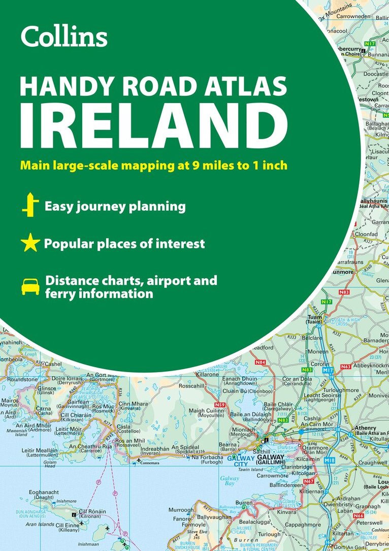
Häftad, Engelska, 2025
91 kr
Skickas
Discover new places with handy road atlases from Collins. Explore Ireland with this handy format route-planning atlas in full colour, complete with information on places of tourist interest including famous film locations. There are also fully indexed town centre plans of Belfast, Cork, Dublin, Galway, Limerick and Derry/Londonderry.This atlas, at A5 size, contains mapping of the whole of Ireland at 9 miles to 1 inch (1:570,240). The mapping is beautifully designed with colour classified roads and subtle layered height tinting.The atlas is ideal for residents, visitors and tourists alike.Key features of the atlas include:• All Ireland route planning maps• Town centre plans• Places of interest including TV and film locations from productions such as Game of Thrones, Star Wars and Harry Potter• Blue Flag and Green Coast beaches map• List of tourist information centres• Full index to place names and places of interest• Information on airports, ferries and radio stations• Mileage chart
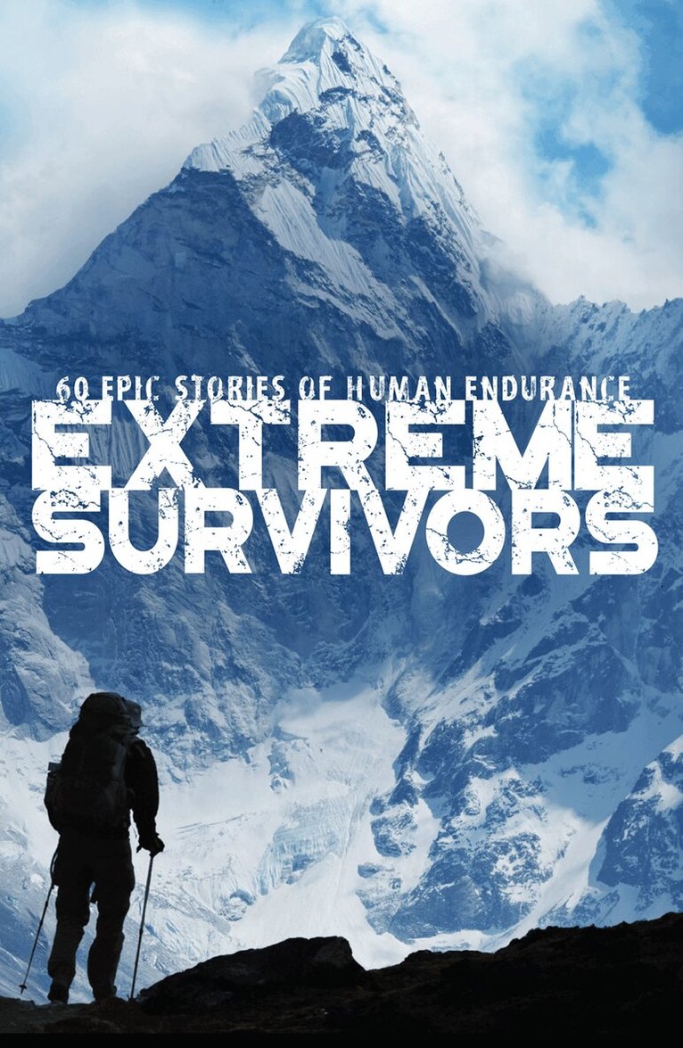
E-bok
Engelska, 201197 kr
Läs direkt efter köp
Extreme Survivors tells the illustrated story of 60 of the most daring escapes, famous shipwrecks, and ultimate survival stories. These are astonishing stories of human endurance and endeavour.The statistics, descriptions, archive photographs and illustrative maps will give the reader a full understanding of how Joe Simpson crawled to safety in the South American Andean mountains, how Anthony Farrar-Hockley evaded capture after the Battle of Imjin River in the Korean War and how Shackleton’s men survived the incredible journey by boat to South Georgia.Sixty of the world's greatest survival stories. Here is a selection of them:Survival Stories• The Miracle of Stairway B, and how 16 people managed to escape death in the Twin Towers on 9/11.• The infamous story of the Montevideo rugby union team’s plane crash in the Andes, and their subsequent admission of cannibalism – 2012 is the 40th anniversary of the crash.Prison Escapes• Mary Queen of Scots and her escape from a remote Scottish castle.• Three men pull off what is possibly the only successful escape from Alcatraz.• Henri Charrière’s (Papillon) five escape attempts from the Devil’s Island penal colony.Wartime Escapes• The story of Dith Pran, the Cambodian journalist who escaped the genocide of Pol Pot.• How the German soldier Cornelius Rost escaped from a labour camp in Siberia and trekked for 3 years to Iran.Shipwrecks• Ernest Shackleton’s incredible journey to South Georgia to save every man on an expedition.• The story of 18 year old William Shotton and how he navigated his ship after most of the crew perished from a mystery disease in 1893.Hostage Situations• Naheeda Bi’s ten years in captivity after her notorious tribal kidnapping in Pakistan.• The dramatic rescue of Íngrid Betancourt by Colombian security forces after six years as a hostage.
E-bok
Engelska, 201455 kr
Läs direkt efter köp
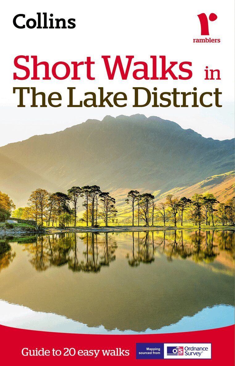
Recommended for colour tablets only. This ebook is not suitable for reading on black and white eink devices. All content downloaded to device, making maps and text available at all times.The Lake District contains some of the most spectacular landscapes in Britain with superb walking areas.This guide, produced in co-operation with the Ramblers and featuring Ordnance Survey mapping, is the perfect way to really appreciate the landscapes of the Lake District.INCLUDES:• 20 easy to follow walks which can be completed in 3 hours and under.• Each walk has a detailed 1:25 000 Ordnance Survey map with the route clearly marked plus a detailed description of the route.• The walks have been chosen with issues like parking and refreshments in mind to make life easy for families.• Packed with colour photographs of scenes you will see along the walk.The perfect guide for afternoon walks near to Keswick, Windermere, Coniston, Grasmere and Ambleside.
E-bok
Engelska, 201454 kr
Läs direkt efter köp
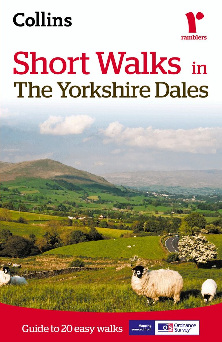
Recommended for colour tablets only. This ebook is not suitable for reading on black and white eink devices. All content downloaded to device, making maps and text available at all times.The Yorkshire Dales with its picturesque dales, ancient farmhouses and villages offer some superb country walking.This guide, produced in co-operation with the Ramblers and featuring Ordnance Survey mapping, is the perfect way to really appreciate the beautiful Yorkshire Dales.INCLUDES:• 20 easy to follow walks which can be completed in 3 hours and under.• Each walk has a detailed 1:25 000 Ordnance Survey map with the route clearly marked plus a detailed description of the route.• The walks have been chosen with issues like parking and refreshments in mind to make life easy for families.• Packed with colour photographs of scenes you will see along the walk.The perfect guide for afternoon walks near to Sedburgh, Hawes, Settle, Ingleton, Skipton and Harrogate.
E-bok
Engelska, 201455 kr
Läs direkt efter köp
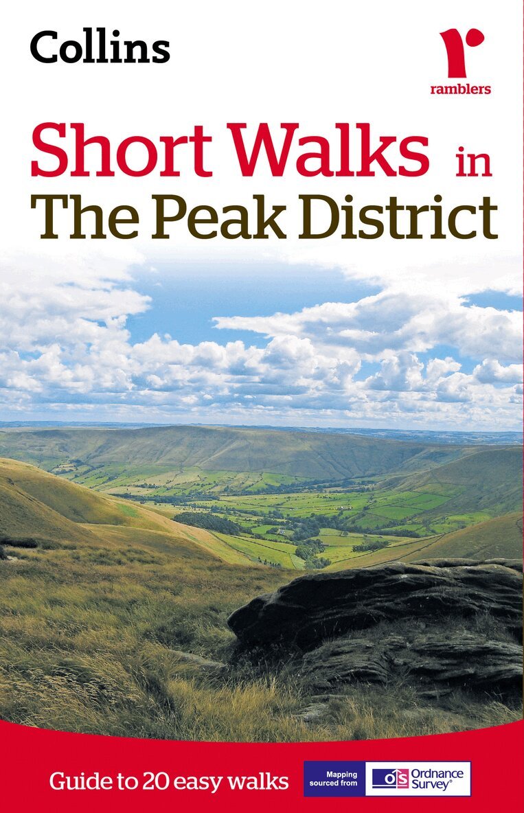
Recommended for colour tablets only. This ebook is not suitable for reading on black and white eink devices. All content downloaded to device, making maps and text available at all times.The Peak District, with its gentle limestone White Peak and the wilder more dramatic gritstone Dark Peak, offer some superb walking areas.This guide, produced in co-operation with the Ramblers and featuring Ordnance Survey mapping, is the perfect way to really appreciate the stunning scenery of the Peak District.INCLUDES:• 20 easy to follow walks which can be completed in 3 hours and under.• Each walk has a detailed 1:25 000 Ordnance Survey map with the route clearly marked plus a detailed description of the route.• The walks have been chosen with issues like parking and refreshments in mind to make life easy for families.• Packed with colour photographs of scenes you will see along the walk.The perfect guide for afternoon walks near to Chesterfield, Sheffield, Matlock, Buxton and Macclesfield.
E-bok
Engelska, 201555 kr
Läs direkt efter köp
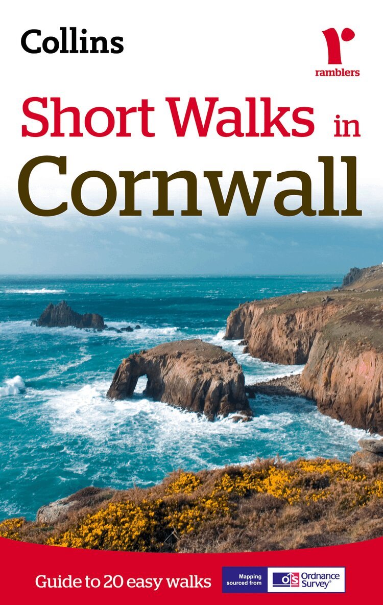
Discover Cornwall like never before with Ramblers Short Walks in Cornwall.This practical e-guidebook contains 20 short walks in Cornwall, all of which are 5 miles or under, and are ideal for families and individuals young and old looking for ideas for an afternoon stroll.Cornwall forms the tip of the southwest peninsula of Great Britain and is home to a fascinating varied landscape, featuring both areas of moorland and coastland. The 20 walks in Ramblers Short Walks will cover each aspect; there is no better way to experience these landscapes.Produced in co-operation with the Ramblers and featuring Ordnance Survey mapping, Ramblers Short Walks in Cornwall is the most reliable and trustworthy walking companion.When you walk with Ramblers Short Walks in Cornwall you’ll enjoy:• 20 easy to follow walks which can be completed in 3 hours and under.• Each walk has a detailed Ordnance Survey map with the route clearly marked plus a detailed description of the route.• The walks have been chosen with consideration for parking and refreshments to ensure they are suitable for families.• Interesting facts about all the things you'll see along the route.• Essential information on walking and the general area covered by the guide.See walk locations and a read preview by Looking Inside.Enhanced ExperienceEnhance your walk with this eBook edition, which has many digital features including:•All content downloaded to device so maps and directions are available at all times.•Never lose your page: click on a walk in the contents to be taken to its page.•Bookmark your favourite walks so you never forget them.
E-bok
Engelska, 201586 kr
Läs direkt efter köp
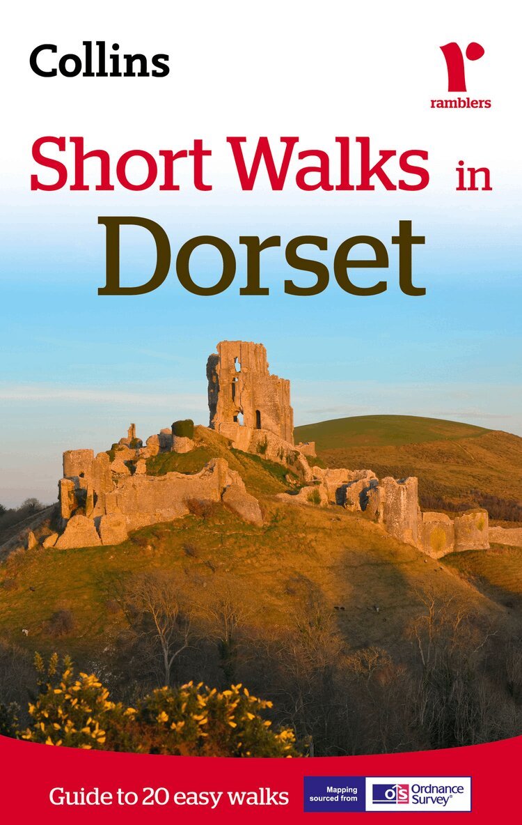
Discover Dorset like never before with Ramblers Short Walks in Dorset.This practical e-guidebook contains 20 short walks in Dorset, all of which are 5 miles or under, and are ideal for families and individuals young and old looking for an afternoon stroll.The southern English county of Dorset contains stunning coastal scenery and beautiful rural countryside waiting to be explored. The area is famous for the Jurassic Coast World Heritage Site, which features landforms such as the sublime Lulworth Cove, the impressive shingles of Chesil Beach, and the great natural arch of Durdle Door.This guide, produced in co-operation with the Ramblers and featuring Ordnance Survey mapping, is the perfect way to get out and enjoy the stunning scenery.This compact little guide contains walks, all of which are 5 miles or under, which are ideal for an afternoon stroll.INCLUDES:• 20 easy to follow walks which can be completed in 3 hours and under.• Each walk has a detailed Ordnance Survey map with the route clearly marked plus a detailed description of the route.• The walks have been chosen with issues like parking and refreshments in mind to make life easy for families.• There are interesting facts about the things you'll see along the route.• All the books include general information on walking and also the general area covered by the guide.• Packed with colour photographs of scenes you will see along the walk.
Häftad, Engelska, 2022
187 kr
Skickas
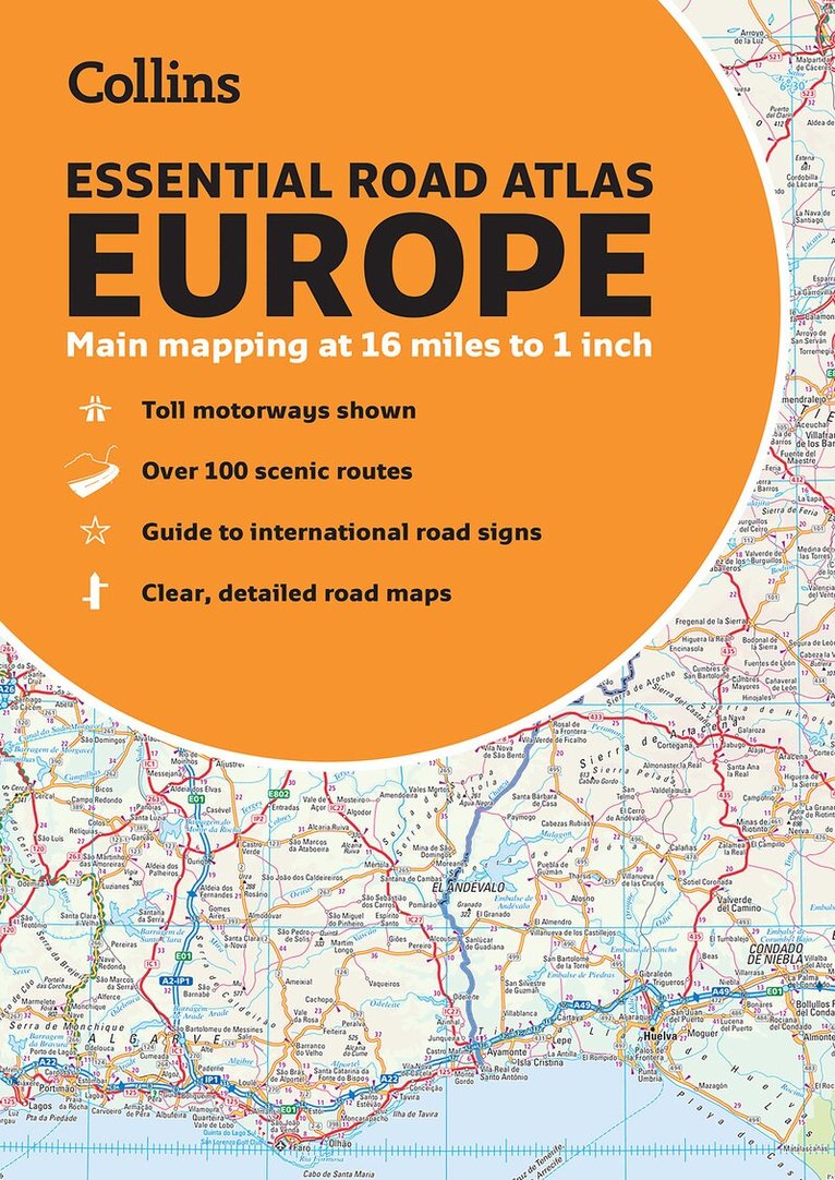
Discover new places with handy road atlases from Collins.Up-to-date A4 paperback road atlas of Europe. Contains clear, large-scale, detailed road mapping, perfect for touring the Mediterranean, Iberian peninsula, Scandinavia and all European tourist destinations.Scale of main maps 1:1,000,000 (1 cm to 10 km / 1 inch to 16 miles).Main featuresClear, easy to follow road maps at a scale of 1:1,000,000. Euroroutes and motorways are easily distinguished on the mapping. The maps also show international road classifications, road distances in kilometres and relief is shown by attractive layer tints. Route planning mapsOver 100 scenic routes shownToll motorways shownGuide to international road signs, driving advice and useful internet linksRoute maps of 64 major citiesStreet plans of 16 major citiesLocator diagrams on each page to help you navigateMore detailed road maps extending from Amsterdam to Munich, making route following easier through this densely populated areaArea of coverageThe mapping extends from the North Cape (Norway) to Gibraltar and from Ireland to east of Moscow. Also includes Iceland and Cyprus.
Engelska, 2021
60 kr
Skickas inom 3-6 vardagar
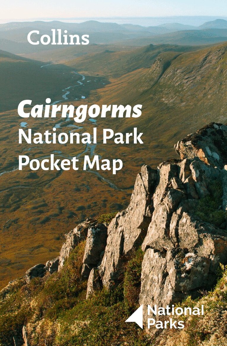
Handy little full colour map and guide of Cairngorms National Park. Detailed mapping and visitor information to the National Park along with a selection of photographs. Map at a scale of 1:91,000 (1.45 miles to 1 inch or 0.91 km to 1 cm).This small map with additional text and photographs gives a great overview of the Cairngorms National Park, and is the perfect companion for exploring this beautiful area of the Scottish Highlands. Clear, detailed mappingKey park, tourist and travel informationIdeal for planning visits to the National ParkIndex to help locate and plan your trip
Engelska, 2021
152 kr
Skickas inom 3-6 vardagar
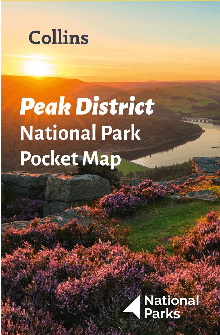
Handy little full-colour map and guide of Peak District National Park. Detailed mapping and visitor information to the National Park along with a selection of photographs. Map at a scale of 1:120 000 (1cm to 1.20km, 1.9 miles to 1 inch).This small map with additional text and photographs gives a great overview of the Peak District National Park, and is the perfect companion for exploring this beautiful area of England. Clear, detailed mappingKey park, tourist and travel informationIdeal for planning visits to the National ParkIndex to help locate and plan your tripInformation on the Pennine Way, Stanage-North Lees, caving activities and other places of interestDiscover more about the walking routes at this National Park with the Peak District Park Rangers Favourite Walks (ISBN: 9780008439125).
Engelska, 2022
55 kr
Skickas
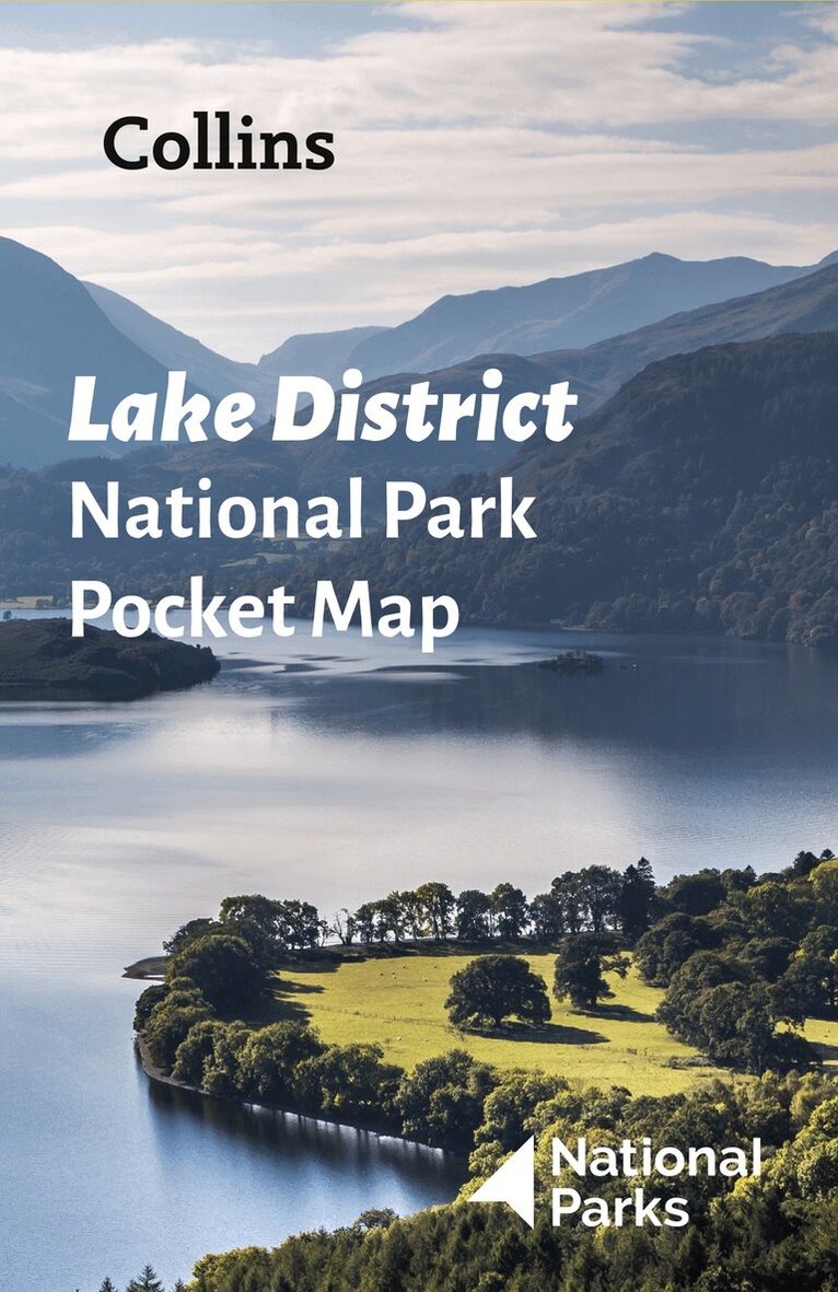
Explore the National Parks with this handy pocket map.Handy little full colour map and guide of Lake District National Park. Detailed mapping and visitor information to the National Park along with a selection of photographs.This small map with additional text and photographs gives a great overview of the Lake District National Park, and is the perfect companion for exploring this beautiful area of Northern England. Clear, detailed mappingKey park, tourist and travel informationIdeal for planning visits to the National ParkIndex to help locate and plan your tripThis and the Lake District Park Rangers Favourite Walks (ISBN: 9780008439149) are the perfect companions for exploring this superb walking area of Northwest England.
Engelska, 2022
55 kr
Skickas
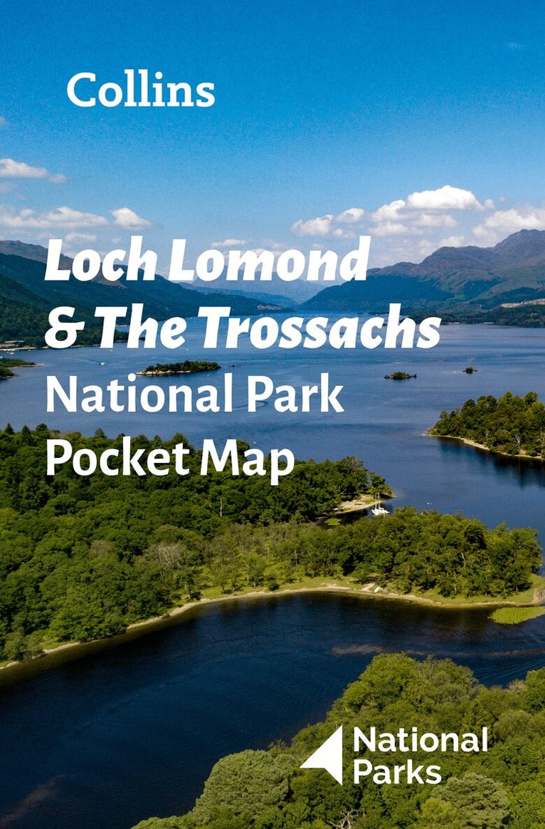
Explore the National Parks with this handy pocket map.Handy little full colour map and guide of Loch Lomond National Park. Detailed mapping and visitor information to the National Park along with a selection of photographs.This small map with additional text and photographs gives a great overview of the Loch Lomond National Park, and is the perfect companion for exploring this beautiful area of Scotland. Clear, detailed mappingKey park, tourist and travel informationIdeal for planning visits to the National ParkIndex to help locate and plan your trip
Engelska, 2022
55 kr
Skickas
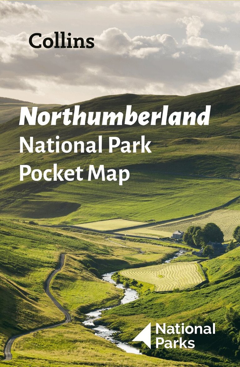
Explore the National Parks with this handy pocket map.Handy little full colour map and guide of Northumberland National Park. Detailed mapping and visitor information to the National Park along with a selection of photographs.This small map with additional text and photographs gives a great overview of the Northumberland National Park, and is the perfect companion for exploring this beautiful area of Northern England. Clear, detailed mappingKey park, tourist and travel informationIdeal for planning visits to the National ParkIndex to help locate and plan your trip
Inbunden, Engelska, 2022
293 kr
Skickas
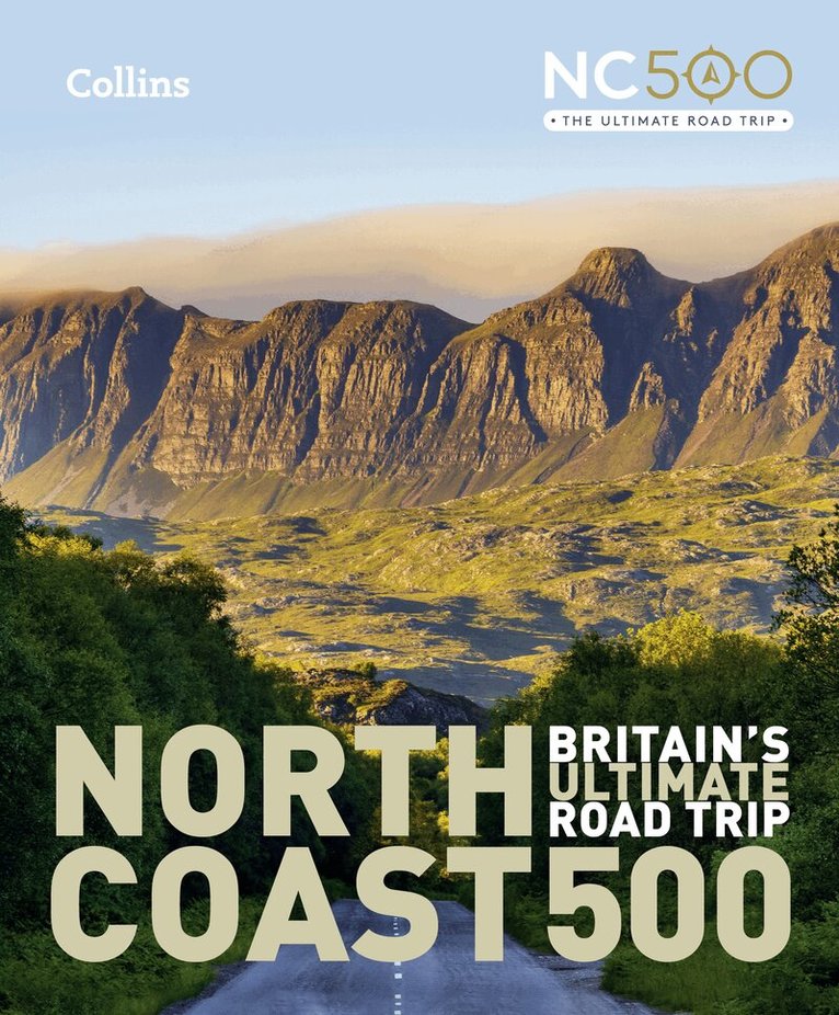
Highly illustrated, full colour book showcasing what is unique about the North Coast 500. Striking images and descriptive text of the best places to visit are shown along with a simple route map showing locations.100 of the best places to stop on route including;• Beaches and bays; Sandwood Bay to Red Point Beach• Engineering and architecture; Caledonian Canal to Noss Head Lighthouse• Historic sites; Culloden battlefield to Dunrobin Castle• Off the beaten track; Cape Wrath to Traligill Caves• Urban areas: Ullapool to John o’ Groats• Wildlife and nature: Dunnet Head to SuilvenA book to help plan your trip around the dramatic North Scotland. An indication of how long to spend at each place is given along with full description and photograph.
152 kr
Skickas inom 3-6 vardagar
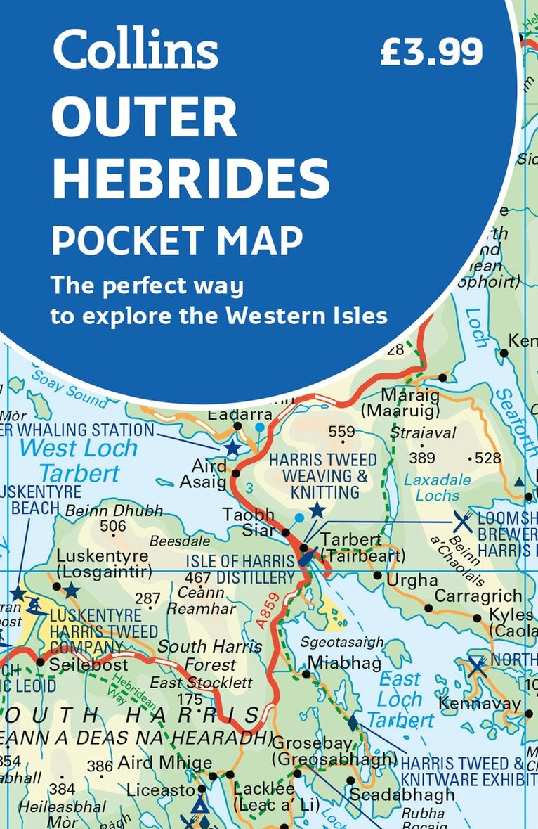
Explore new places with handy pocket maps from Collins.Handy little full-colour map of the Western Isles of Scotland. Detailed mapping and tourist information for the islands of Lewis, Harris, Uist, Benbecula, Barra and St Kilda. Excellent value and very detailed for its size.Famed for its stunning coastline, wildlife and traditional food and drink, the Outer Hebrides have a distinct identity. Discover these unique islands with this handy pocket map.Main features of this map include: Clear mapping at a scale of 3.2 miles to 1 inchTourist attractions located and describedSights, places to stay, cafe/restaurant, things to do are all highlighted on the mapTransport links map showing how to get to and depart the islandsIndex to places of interest and place namesEssential for those planning a trip around the Western Isles.
Häftad, Engelska, 2024
150 kr
Skickas inom 5-8 vardagar
Fully revised and updated for 2024, this curriculum-supportive world atlas is the perfect tool for students aged 14-16 years (Key Stage 4, GCSE 9-1).Featuring up-to-date reference and thematic mapping, country-by-country statistics, and a fully comprehensive index. Colour coded for ease of useIncludes thematic maps and accompanying graphs and tablesCovers tourism, telecommunications, environmental and socio-economic topicsLists relevant web addresses on each thematic page so students can explore topics more deeplyHigh quality satellite imagery supports data on the maps and is used to illustrate key environmental issuesUp-to-date demographic and socio-economic statistics can be used to support geographical, tourist, mathematical, economic or IT projectsNow with a FREE online geographical dictionary!
Inbunden, Engelska, 2025
284 kr
Skickas
A new, fully updated edition of this popular atlas in the Collins world atlas range. Designed in the distinctive Collins style, it is the ideal reference atlas for school, home and business use.Explore our planet: Highly detailed, updated regional and world-wide mappingWide range of topical issues covered including natural disasters, population, climate and the environmentKey country statistics allow comparisons of their state of development and an understanding of today’s worldThousands of facts and statistics including world and continental ranking tablesDiscover more than 56,000 placesMapping updates include: Mont Blanc height updated to 4,806m/ 15,763ftMariana Trench depth updated 10,924m/ 35,839ftMore than 2000 place names updated, including major updates in Ukraine, Kazakhstan and New ZealandRoad and rail updates, including the under-construction Fehmarn Belt Fixed Link between Germany and DenmarkNew flags for Honduras and KyrgyzstanCurrency change for Croatia (now Euro) and Zimbabwe (Zimbabwe Gold)
Häftad, Engelska, 2025
188 kr
Skickas
A new fully updated reference atlas in the exciting Collins world atlas range. Great value and contains all the world maps you need in a budget atlas, for family, study and business use.Explore our planet;• Clear maps giving balanced worldwide coverage• Key statistics and flags for every country of the world• World time zones maps• Discover more than 36,000 placesMapping updates include: Mont Blanc height updated to 4,806m/ 15,763ftMariana Trench depth updated 10,924m/ 35,839ftMore than 2000 place names updated, including major updates in Ukraine, Kazakhstan and New ZealandRoad and rail updates, including the under-construction Fehmarn Belt Fixed Link between Germany and DenmarkNew flags for Honduras and KyrgyzstanCurrency change for Croatia (now Euro) and Zimbabwe (Zimbabwe Gold)
Häftad, Engelska, 2024
96 kr
Skickas
A new, fully updated edition of this bestselling atlas of the world. Great value and contains all the world maps you need in a budget atlas, for family, study and business use.Explore our planet; Clear maps giving balanced worldwide coverageKey statistics and flags for every country of the worldWorld time zones mapsDiscover more than 10,000 placesMapping updates include: Extensive updates to place names in Ukraine and KazakhstanNew flags for Honduras and KyrgyzstanCurrency change for Croatia (now Euro) and Zimbabwe (Zimbabwe Gold)Mt Blanc height changed (4806 m)
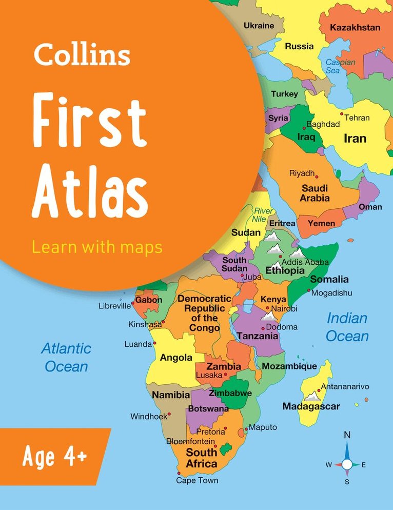
Häftad, Engelska, 2026, 3-6 år
82 kr
Skickas
The must-have atlas for children aged 4-7Collins First Atlas is a fun, vibrant and clear starter atlas for children aged 4-7 years, providing the perfect foundation to basic geography skills.The atlas begins by introducing pupils to photographs and mapping of a local area, then gradually leads them through maps of regional, national, continental and global areas. Short, informative sentences introduce pupils to basic geographical and atlas vocabularyMaps are clearly labelled to highlight certain countries and featuresMapping concepts are presented in a way that supports learning development, as concepts become more complexIdeal for classroom use or home learningFully up-to-date and now with flags of the world and simple glossarySuitable for EYFS and KS1This atlas is also available in a Kindle format. The next atlas in this series is the Collins Primary Atlas, suitable for ages 7+ and KS2.
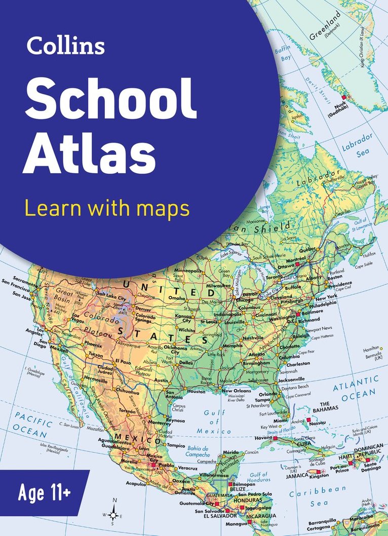
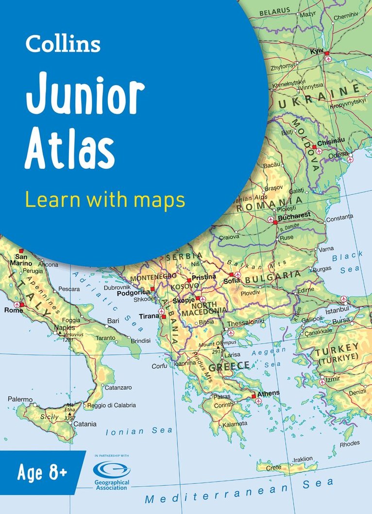
Häftad, Engelska, 2025, 9-12 år
129 kr
Skickas
The must-have atlas for pupils aged 11-14Fully updated for 2025, this world atlas is designed to support Key Stage 3 students aged 11-14 years in developing their geographical and mapping skills. The content follows requirements of the National Curriculum and has been reviewed by educational experts.A clear, easy-to-read ‘Introducing Atlas Maps’ section explains key information and encourages development of map, atlas and data handling skills. Comprehensive reference maps include facts, photos, map keys and engaging descriptive text. An extended ‘World’ section covers all the global issues required by the National Curriculum, such as population, climate change and environmental issues.·Fully updated for the 2024-2025 school term·Clearly explains key information such as latitude and longitude, scale, projections, distance, symbols, satellite images and GIS·Includes focus country studies and covers global issues required by the National Curriculum·Map coverage of the United Kingdom and Ireland, Europe, Asia, Africa, North America, South America, Oceania and Antarctica·Ideal for classroom use or home learning·Suitable for ages 11-14 (KS3 and S1-S2)This book is also available in eBook format. The next book in the series is the Collins Student Atlas which is aimed at learners aged 15+.
Häftad, Engelska, 2025
189 kr
Skickas inom 5-8 vardagar
Explore Britain with easy-to-read mapping from Collins.This A4, spiral-bound road atlas provides clear and detailed road mapping for England, Wales and Southern Scotland at a scale of 3.2 miles to 1 inch (1:200,000). For Northern Scotland the mapping is at a scale of 4.2 miles to 1 inch (1:266,000), with land height shown by different layers of colouring. Main features: Route planning section including maps at a scale of 22 miles to 1 inch, motorway services information, and a handy distance calculator chartMore than 20 urban approach maps at a larger scale which clearly show the best routes through and into built-up areas64 street maps focused on town centres showing places of interest, car park locations and one-way streets. All the street maps are fully indexedOver 30 categories of places of interest including castles, theme parks, sports venues, universities, mountain bike trails and surfing beachesThe top 1000 most visited places of interest are indexed with full postcodes to aid integration with sat-nav systemsUpdated Park & Ride locations, new rail stations and extensions to tram lines in Blackpool and EdinburghThis is the ideal purchase for drivers, navigators and route planners who want the very best road atlas of Britain in an A4 format.
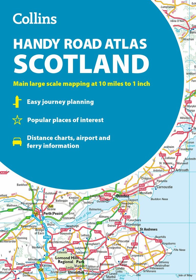
Häftad, Engelska, 2025
91 kr
Skickas
Discover new places with handy road atlases from Collins. Your ideal companion for navigating around Scotland. It has extremely clear, route planning maps of Scotland, detailed city plans of the major cities and towns and fits neatly into your glovebox, briefcase or bag.Main featuresClear, attractive route planning maps of the whole of Scotland supported by comprehensive, fully indexed city centre street maps of Aberdeen, Dundee, Edinburgh, Glasgow, Inverness and Perth.Scale of main maps: 1:625,000 (9.9 miles to 1 inch).Also includes• Places of tourist interest are highlighted• Attractive layer colouring showing land height• Road network fully classified and colour coded• Detailed street mapping of Edinburgh, including the Royal Mile with all its attractions clearly marked, Leith and Holyrood Park• Detailed street mapping of Glasgow, including the West End, city centre and M74 extension• Detailed street mapping of Aberdeen, including the bypass• Street maps, with indexes, of Dundee, Inverness and Perth city centres• Handy distance calculator chart highlighting distances between the major towns• Administrative areas map showing council areas• Transport connections section listing all the airports and details of all vehicle ferries into and within ScotlandArea of coverageCovers the whole of Scotland and part of northern England, extending down to Kendal and Scarborough in the south.
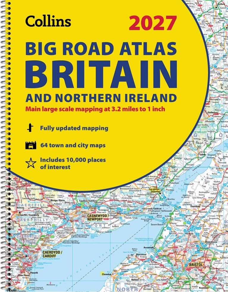
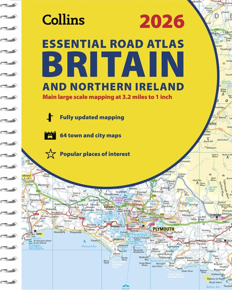
Häftad, Engelska, 2026
189 kr
Skickas inom 5-8 vardagar
Explore Britain with easy-to-read mapping from Collins.The ultimate 3.2 miles to 1 inch scale large-format, spiral-bound road atlas of Britain, featuring Collins’ popular and well-established road mapping, and designed for exceptional clarity and ease of use.The atlas has a wide range of urban area maps at even larger scale and 64 detailed town centre street plans.This fully updated road atlas covers the whole of Britain with each scale of mapping colour-coded for ease of use. The smallest scale maps are great for long-distance route planning and the street plans help you locate your final destination. Main features: Easy to use, clear road maps at a scale of 3.2 miles to 1 inch of England, Wales and Southern Scotland. Northern Scotland is shown at 5 miles to 1 inchRoute-planning section including maps at a scale of 15.8 miles to 1 inch, motorway services information and a handy distance calculator22 urban area approach maps at 1 mile to 1 inch which clearly show the best routes through and into urban areas64 street maps focused on town centres showing places of interest, car park locations and one-way streetsUpdated Park & Ride locations, new rail stations and extensions to tram lines in Blackpool and EdinburghOver 30 categories of places of interest including castles, theme parks, sports venues and surfing beachesFull postcodes for the top 1000 places of interest – ideal for use alongside sat-nav systemsNow includes dual Welsh / English names for Welsh locations, for example, Caerdydd / Cardiff
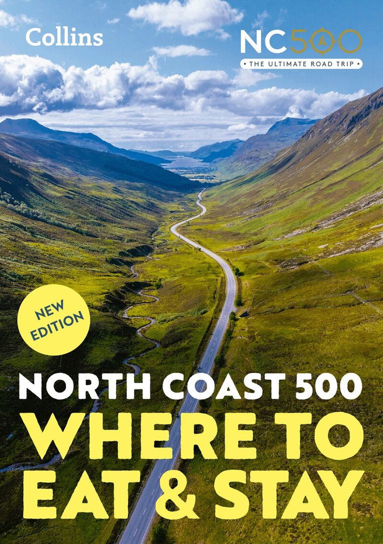
Häftad, Engelska, 2026
171 kr
Skickas
Published in partnership with © North Coast 500 Ltd, this is the ultimate guide for the trip of a lifetime. Elemental, enchanting and inspiring, the NC500 is Scotland’s most celebrated touring route, a stunning 500-mile loop around Northern Scotland.From rugged coastlines to charming villages, discover the best places to enjoy the local Scottish cuisine and famous hospitality along this iconic route. Researched and written by expert travel bloggers Campbell Kerr and Gemma Spence, this is your essential companion for planning the journey of a lifetime. This unique guide makes sure that at every stage and stop of the way, you will find the most creative chefs, the best hotels, the cosiest pubs, the best local foods and the most acclaimed destinations.In this guide you’ll find:• Overview maps of the NC500 route, thoughtfully broken down into seven regions for easy navigation.• Beautiful full-colour photos showcasing the breathtaking lanscapes along the route.• The what3words geocode system used to pinpoint exact locations of recommended places to eat and stay.• A clear guide to pricing at each of the venues to help you budget effectively.• Detailed information on dietary options, wheelchair access, pet friendly spots, electric vehicle charging points, WiFi, and venues offering exclusive NC500 member perks.This is the ultimate guide to dining and accommodation along Scotland’s most popular touring route, designed to enhance your travel experience and make every moment memorable.
Häftad, Engelska, 2026, 6-9 år
119 kr
Skickas
The must-have Atlas for Year 6Fully revised and updated, this is an ideal world reference atlas for young primary school geographers aged 8-11 years (Key Stage 2). Published in association with the Geographical Association, it enables children to learn about the world today and understand how maps and atlases work. The atlas is organised into sections covering the UK, Europe, the world and continents with more detailed larger scale maps of countries and regions popular for focus studies.It includes topics such as climate, population, migration, trade and environmental issues.Topographical based mapping helps the young geographer understand the processes which take place during the formation of the earth’s landscapes.The reference mapping is designed for maximum clarity and accessibility, and is supported by photographs and data boxes, with detailed map keys and scale information on each map.Specially selected topic maps give additional information linking to knowledge and understanding of distant places.Tables of key world country data include an Ecological Footprint figure for each country.Fully-updated in line with proposed curriculum changes.
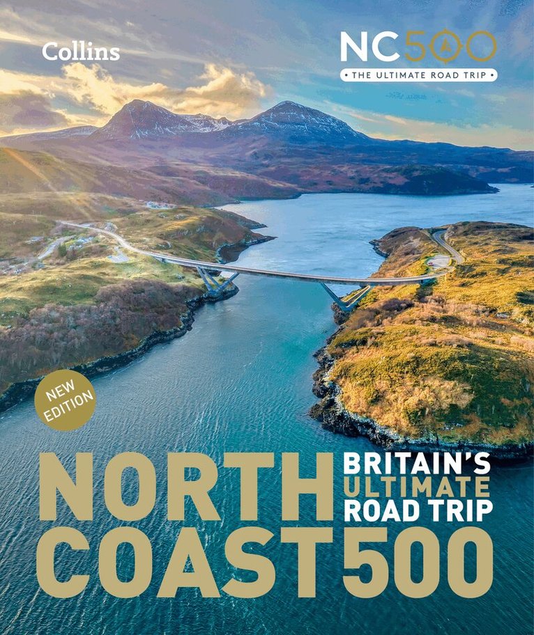
Inbunden, Engelska, 2026
283 kr
Kommande
Uncover the breathtaking beauty and hidden gems of Scotland's iconic North Coast 500 in partnership with © North Coast 500 Ltd Majestic, enchanting, and inspiring, the NC500 is Scotland’s most popular touring route, a 500-mile loop around the stunning landscapes of Northern Scotland.The NC500: Britain’s Ultimate Road Trip stands as the definitive guide to this iconic journey, highlighting the must-see locations and hidden gems along the way. This fully updated and revised edition features new locations and captivating photography, ensuring that travellers can experience the rich beauty and diverse attractions of this remarkable route. Whether you're seeking dramatic coastlines, historic villages, or awe-inspiring natural wonders, this guide will help you navigate the best that the NC500 has to offer including:• Beaches and bays; Sandwood Bay to Red Point Beach• Engineering and architecture; Caledonian Canal to Noss Head Lighthouse• Historic sites; Culloden battlefield to Dunrobin Castle• Off the beaten track; Cape Wrath to Traligill Caves• Urban areas: Ullapool to John o’ Groats• Wildlife and nature: Dunnet Head to Suilven